STS059-154-161
| NASA Photo ID | STS059-154-161 |
| Focal Length | 250mm |
| Date taken | 1994.04.11 |
| Time taken | 21:19:37 GMT |
Cloud masks available for this image:
Spacecraft nadir point: 37.8° N, 117.6° W
Photo center point: 37.0° N, 118.5° W
Photo center point by machine learning:
Photo center point: 37.0° N, 118.5° W
Photo center point by machine learning:
Nadir to Photo Center: Southwest
Spacecraft Altitude: 119 nautical miles (220km)
Country or Geographic Name: | USA-CALIFORNIA |
Features: | KINAS R, SIERRA NEVADA, V. |
| Features Found Using Machine Learning: | |
Cloud Cover Percentage: | 5 (1-10)% |
Sun Elevation Angle: | 55° |
Sun Azimuth: | 220° |
Camera: | Linhof |
Focal Length: | 250mm |
Camera Tilt: | Near Vertical |
Format: | 5046: Kodak, natural color positive, Lumiere 100/5046, ASA 100, standard base |
Film Exposure: | Normal |
| Additional Information | |
| Width | Height | Annotated | Cropped | Purpose | Links |
|---|---|---|---|---|---|
| 5088 pixels | 3968 pixels | No | No | Earth From Space collection | Download Image |
| 640 pixels | 499 pixels | No | No | Earth From Space collection | Download Image |
| 640 pixels | 480 pixels | No | No | ISD 1 | Download Image |
Download Packaged File
Download a Google Earth KML for this Image
View photo footprint information
Download a GeoTIFF for this photo
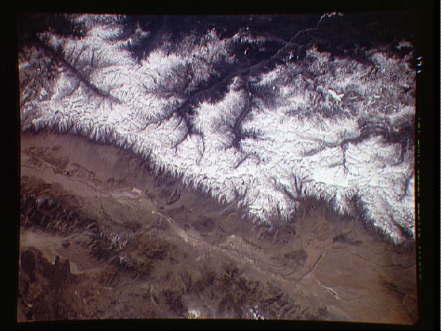
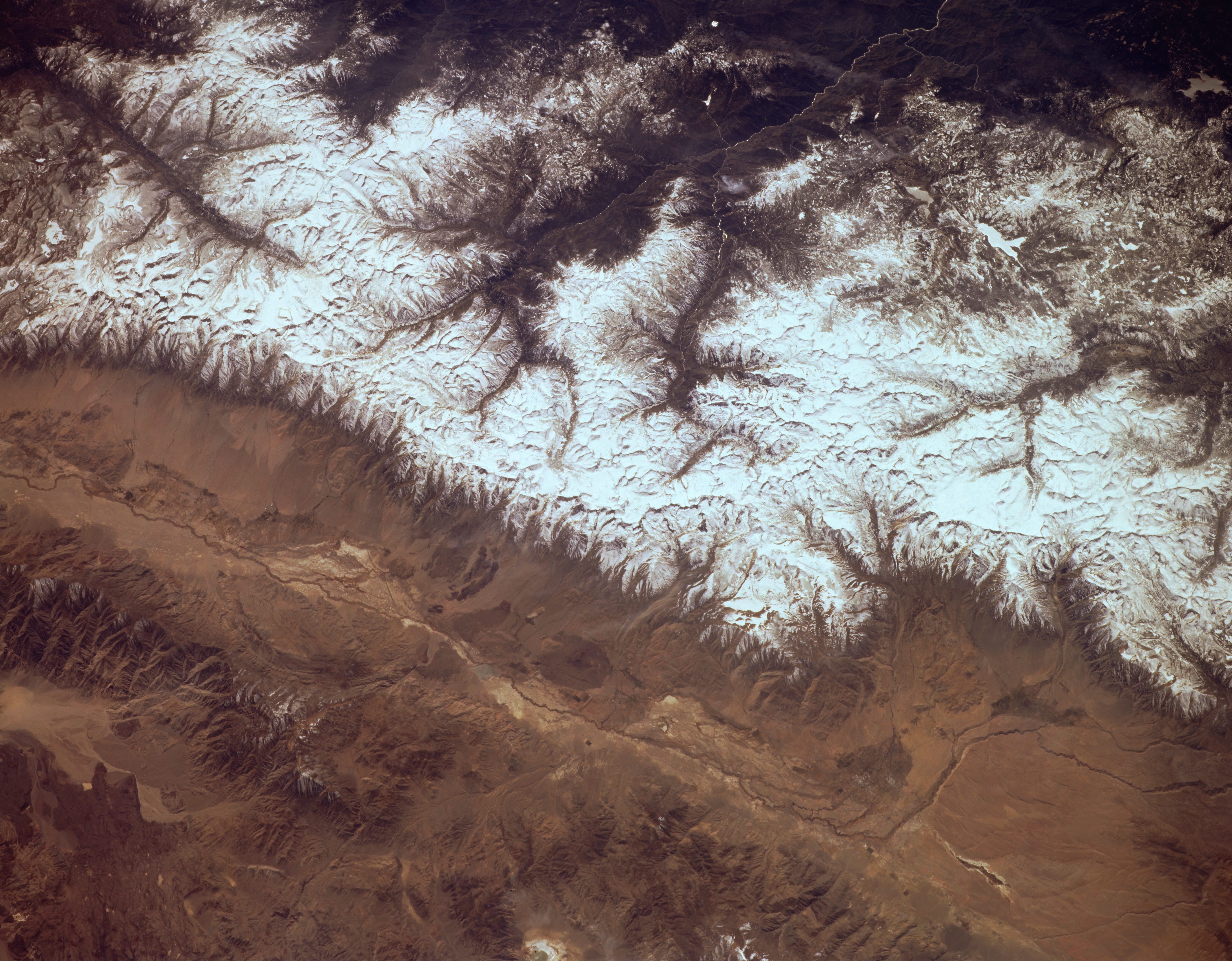
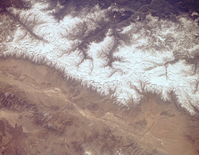
Image Caption: STS059-154-161 Kings River, Owens River, and Sierra Nevada Mountains, California, U.S.A. April 1994
The snow-covered Sierra Nevada Mountains are featured in this low-oblique, south-looking photograph. Two major national parks are visible--Kings Canyon National Park near the center and Sequoia National Park to the south from which the Kern River Canyon extends southward. The three branches of Kings River in Kings Canyon National Park join to form the main branch of the Kings River, which flows west toward the San Joaquin Valley. Between the upper Kern River and the southern fork of the Kings River is Mount Whitney [14 494 feet (4421 meters)], the highest peak in the Sierra Nevadas and the second highest peak in the United States. Apparent north to south along the bottom third of the photograph are the Owens River Valley and to its east the Inyo Mountains.
The snow-covered Sierra Nevada Mountains are featured in this low-oblique, south-looking photograph. Two major national parks are visible--Kings Canyon National Park near the center and Sequoia National Park to the south from which the Kern River Canyon extends southward. The three branches of Kings River in Kings Canyon National Park join to form the main branch of the Kings River, which flows west toward the San Joaquin Valley. Between the upper Kern River and the southern fork of the Kings River is Mount Whitney [14 494 feet (4421 meters)], the highest peak in the Sierra Nevadas and the second highest peak in the United States. Apparent north to south along the bottom third of the photograph are the Owens River Valley and to its east the Inyo Mountains.
