STS059-154-160
| NASA Photo ID | STS059-154-160 |
| Focal Length | 250mm |
| Date taken | 1994.04.11 |
| Time taken | 21:19:27 GMT |
Cloud masks available for this image:
Spacecraft nadir point: 38.3° N, 118.2° W
Photo center point: 37.5° N, 119.0° W
Photo center point by machine learning:
Photo center point: 37.5° N, 119.0° W
Photo center point by machine learning:
Nadir to Photo Center: Southwest
Spacecraft Altitude: 119 nautical miles (220km)
Country or Geographic Name: | USA-CALIFORNIA |
Features: | MONO L, SIERRA NEVADA, RIV |
| Features Found Using Machine Learning: | |
Cloud Cover Percentage: | 5 (1-10)% |
Sun Elevation Angle: | 55° |
Sun Azimuth: | 219° |
Camera: | Linhof |
Focal Length: | 250mm |
Camera Tilt: | 30 degrees |
Format: | 5046: Kodak, natural color positive, Lumiere 100/5046, ASA 100, standard base |
Film Exposure: | Normal |
| Additional Information | |
| Width | Height | Annotated | Cropped | Purpose | Links |
|---|---|---|---|---|---|
| 5088 pixels | 3936 pixels | No | No | Earth From Space collection | Download Image |
| 640 pixels | 495 pixels | No | No | Earth From Space collection | Download Image |
| 640 pixels | 480 pixels | No | No | ISD 1 | Download Image |
Download Packaged File
Download a Google Earth KML for this Image
View photo footprint information
Download a GeoTIFF for this photo
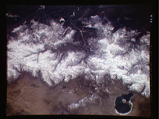
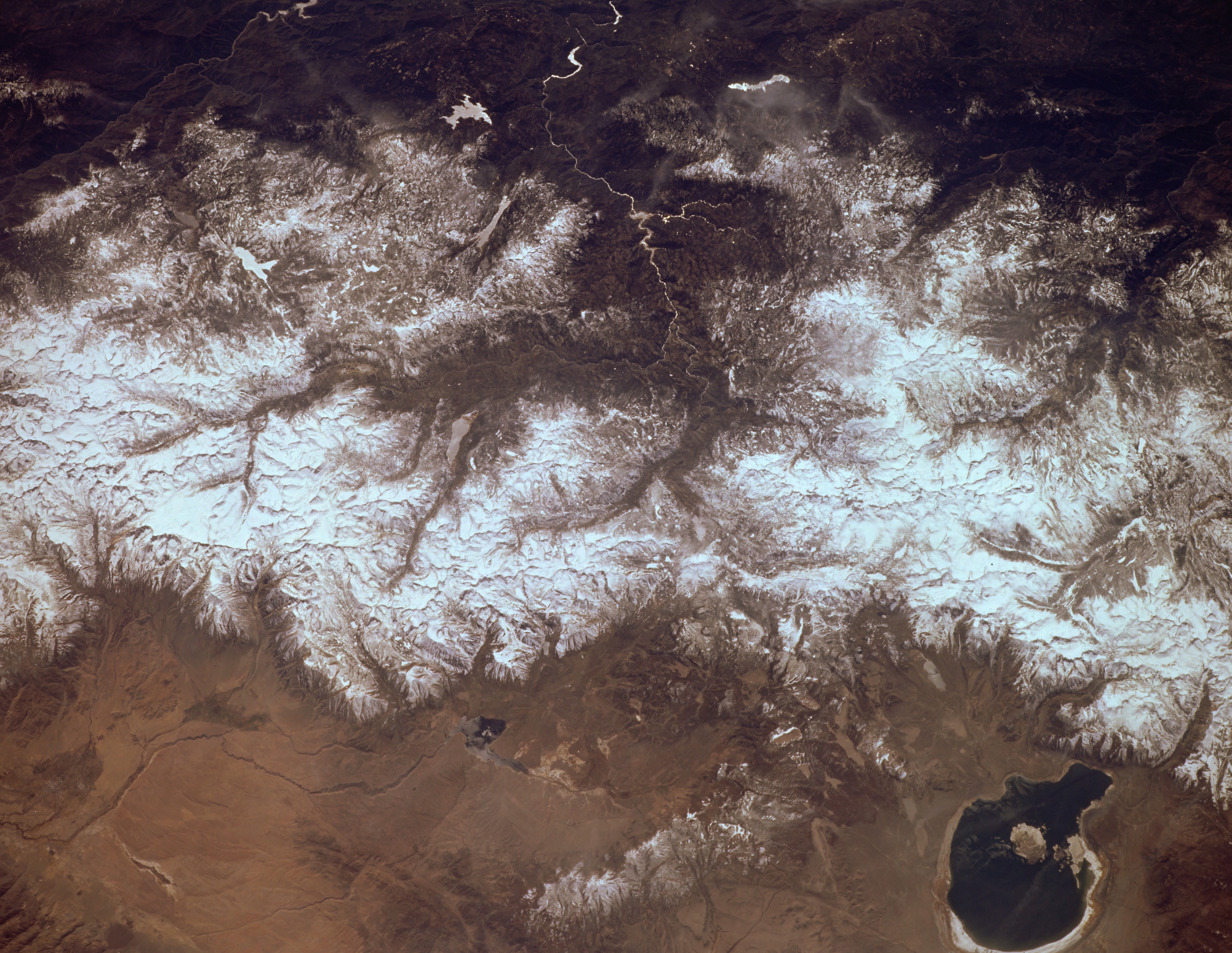
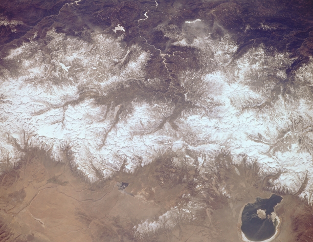
Image Caption: STS059-154-160 Sierra Nevada Mountains and Mono Lake, California, U.S.A. April 1994
The snow-covered central Sierra Nevada Mountains are featured in this low-oblique, west-looking photograph. Spring-fed, saline Mono Lake is visible near the lower right. Abundant snowmelt in the spring and early summer is important for filling rivers, lakes, and reservoirs that provide the state's drinking and agricultural water supplies. Runoffs east of the range provide irrigation for small agriculture tracts in the western portions of Nevada.
View is oriented with Mono Lake, California at the lower right; then the view is westward across the Sierra Nevada into the San Joaquin River drainage. A tine network of ski trails can be seen on the Mono Lake side of the Sierras, on a line between Mono Lake and the snow-free San Joaquin headwaters. The ski trails mark Mammoth Mountain, where Space Radar Laboratory (SRL) investigators are studying microwave measurements of the water content of snowpacks.
