STS058-99-83
| NASA Photo ID | STS058-99-83 |
| Focal Length | 250mm |
| Date taken | 1993.10.27 |
| Time taken | 01:44:16 GMT |
Resolutions offered for this image:
4072 x 4072 pixels 639 x 639 pixels 5700 x 5900 pixels 500 x 518 pixels 640 x 480 pixels
4072 x 4072 pixels 639 x 639 pixels 5700 x 5900 pixels 500 x 518 pixels 640 x 480 pixels

Cloud masks available for this image:
Spacecraft nadir point: 34.4° N, 134.1° E
Photo center point: 34.0° N, 133.5° E
Photo center point by machine learning:
Photo center point: 34.0° N, 133.5° E
Photo center point by machine learning:
Nadir to Photo Center: Southwest
Spacecraft Altitude: 143 nautical miles (265km)
Camera: | Hasselblad |
Focal Length: | 250mm |
Camera Tilt: | 17 degrees |
Format: | 5017: Kodak, natural color positive, Ektachrome, X Professional, ASA 64, standard base |
Film Exposure: | Normal |
| Additional Information | |
| Width | Height | Annotated | Cropped | Purpose | Links |
|---|---|---|---|---|---|
| 4072 pixels | 4072 pixels | No | No | Earth From Space collection | Download Image |
| 639 pixels | 639 pixels | No | No | Earth From Space collection | Download Image |
| 5700 pixels | 5900 pixels | No | No | Download Image | |
| 500 pixels | 518 pixels | No | No | Download Image | |
| 640 pixels | 480 pixels | No | No | Download Image |
Download Packaged File
Download a Google Earth KML for this Image
View photo footprint information
Download a GeoTIFF for this photo
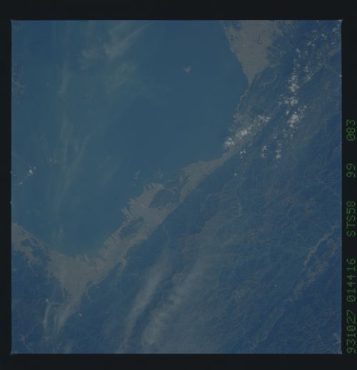
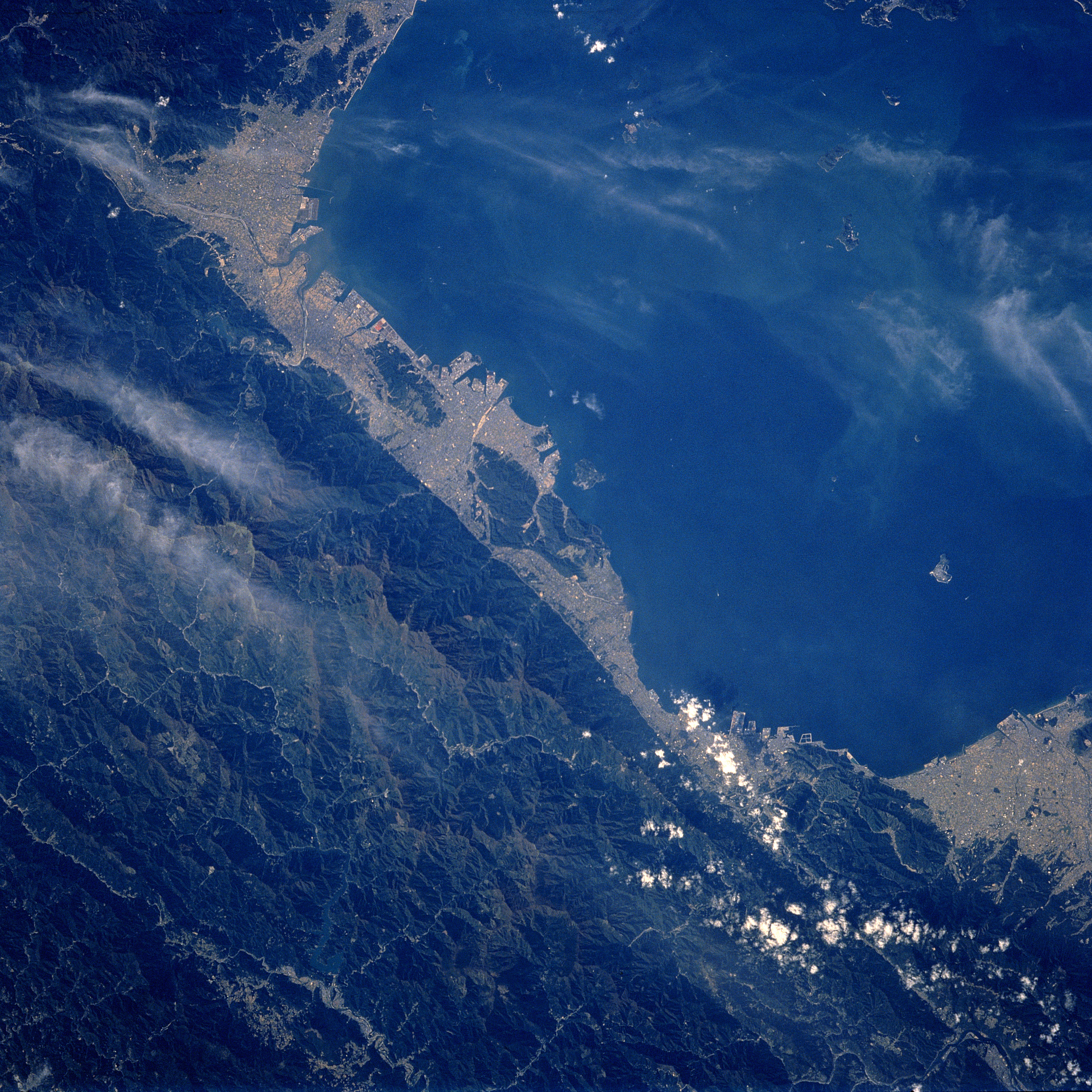
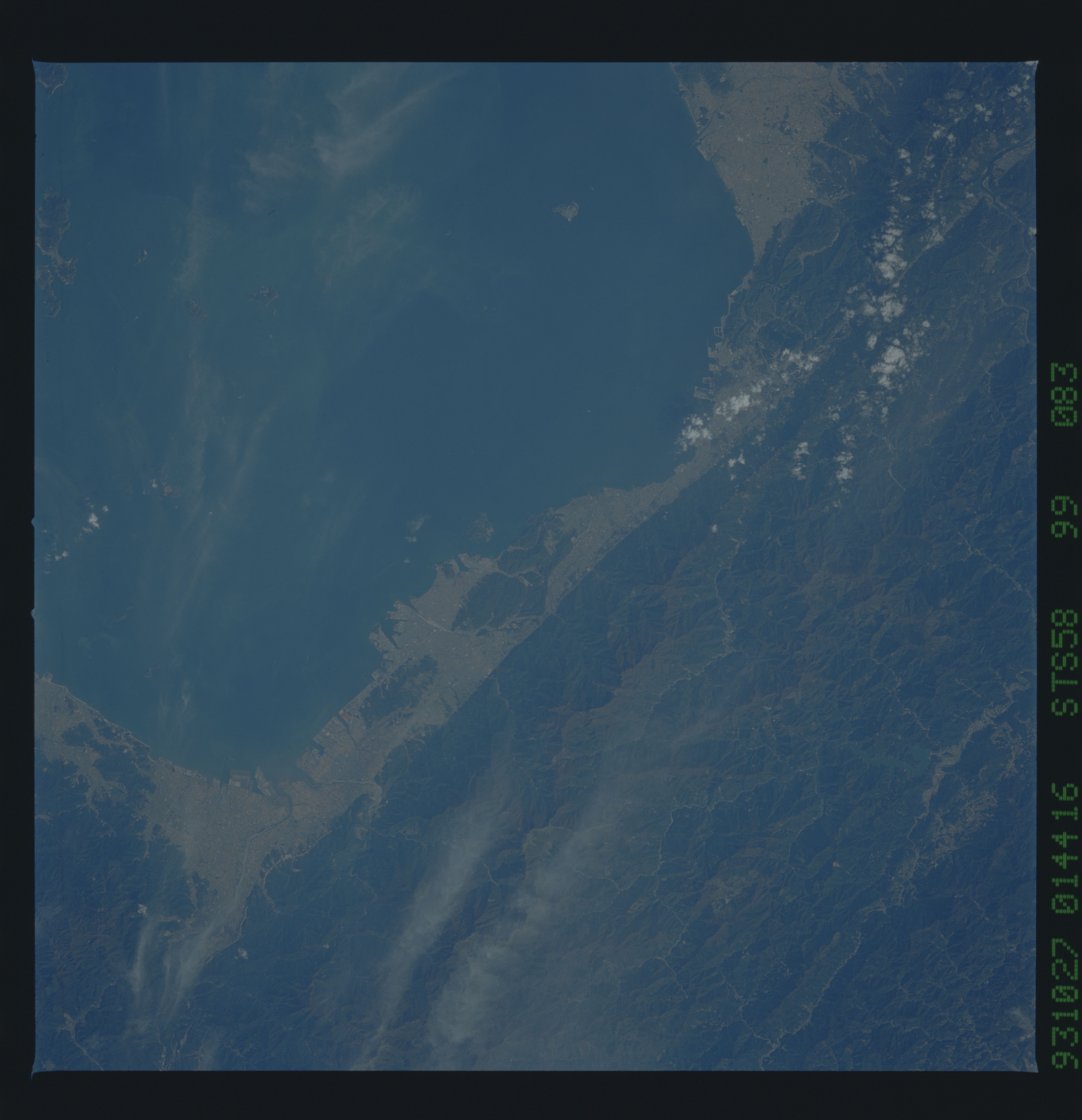
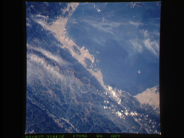
Image Caption: STS058-099-083 Shikoku Island, Japan October 1993
The most dramatic feature of this northwest-looking view of the Inland Sea is the diagonal line (abrupt color change) that shows the location of the westward extension of the Kii Fault as it continues along the northern coast of Shikoku Island. The dark-looking landscape south of the fault is the heavily forested steep sloped mountains that characterize almost 80 percent of Japan. By contrast, the lighter-colored terrain north of the fault includes a few urban areas as well as intensively cultivated fields where a variety of farm crops are produced on the limited coastal plains along the periphery of the Inland Sea.
The most dramatic feature of this northwest-looking view of the Inland Sea is the diagonal line (abrupt color change) that shows the location of the westward extension of the Kii Fault as it continues along the northern coast of Shikoku Island. The dark-looking landscape south of the fault is the heavily forested steep sloped mountains that characterize almost 80 percent of Japan. By contrast, the lighter-colored terrain north of the fault includes a few urban areas as well as intensively cultivated fields where a variety of farm crops are produced on the limited coastal plains along the periphery of the Inland Sea.
