STS058-89-32
| NASA Photo ID | STS058-89-32 |
| Focal Length | 250mm |
| Date taken | 1993.10.21 |
| Time taken | 19:46:57 GMT |
Resolutions offered for this image:
3904 x 3904 pixels 639 x 639 pixels 5700 x 5900 pixels 500 x 518 pixels 640 x 480 pixels
3904 x 3904 pixels 639 x 639 pixels 5700 x 5900 pixels 500 x 518 pixels 640 x 480 pixels


Cloud masks available for this image:
Spacecraft nadir point: 37.2° N, 108.2° W
Photo center point: 39.0° N, 106.5° W
Photo center point by machine learning:
Photo center point: 39.0° N, 106.5° W
Photo center point by machine learning:
Nadir to Photo Center: Northeast
Spacecraft Altitude: 156 nautical miles (289km)
Country or Geographic Name: | USA-COLORADO |
Features: | LEADVILLE AREA |
| Features Found Using Machine Learning: | |
Cloud Cover Percentage: | 0 (no clouds present) |
Sun Elevation Angle: | 41° |
Sun Azimuth: | 196° |
Camera: | Hasselblad |
Focal Length: | 250mm |
Camera Tilt: | 44 degrees |
Format: | 5017: Kodak, natural color positive, Ektachrome, X Professional, ASA 64, standard base |
Film Exposure: | Normal |
| Additional Information | |
| Width | Height | Annotated | Cropped | Purpose | Links |
|---|---|---|---|---|---|
| 3904 pixels | 3904 pixels | No | No | Earth From Space collection | Download Image |
| 639 pixels | 639 pixels | No | No | Earth From Space collection | Download Image |
| 5700 pixels | 5900 pixels | No | No | Download Image | |
| 500 pixels | 518 pixels | No | No | Download Image | |
| 640 pixels | 480 pixels | No | No | Download Image |
Download Packaged File
Download a Google Earth KML for this Image
View photo footprint information
Download a GeoTIFF for this photo
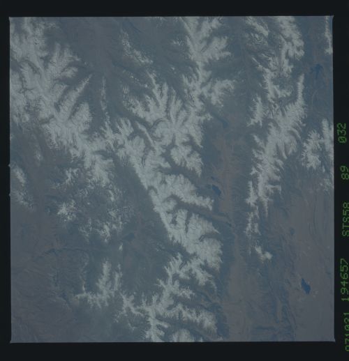
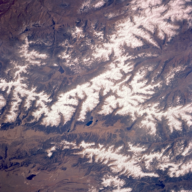
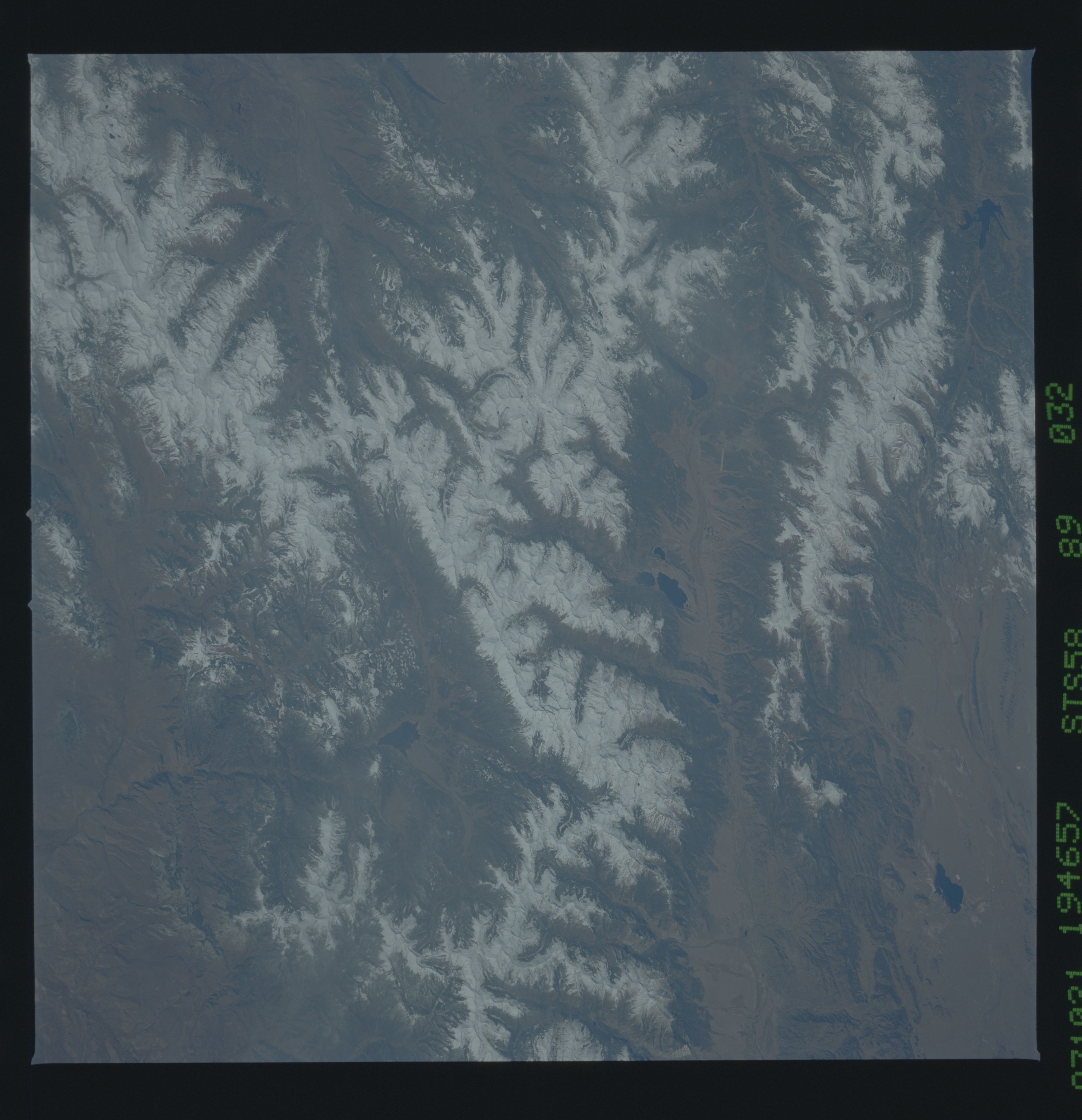
Image Caption: STS058-089-032 Sawatch Mountains, Colorado, U.S.A. October 1993
Snow-covered mountains and several large reservoirs are clearly visible in this low-oblique photograph of central Colorado. Dark Antero Reservoir (bottom of photograph) is part of the western edge of South Park, one of Colorado's large intermontane (elevated) valleys. Twin Lakes Reservoir (center of photograph) is part of the headwaters for the Arkansas River; however, to the north, the smaller, elongated reservoir is more accurately the headwater source for the Arkansas. The Arkansas River Valley separates the Mosquto Range to the east from the higher and more massive Sawatch Mountains to the west. Taylor River Valley and Taylor Park Reservoir, which form a tributary of the Gunnison River, are visible west of the Sawatch Mountains. To the north lies dark Dillon Reservoir.
Snow-covered mountains and several large reservoirs are clearly visible in this low-oblique photograph of central Colorado. Dark Antero Reservoir (bottom of photograph) is part of the western edge of South Park, one of Colorado's large intermontane (elevated) valleys. Twin Lakes Reservoir (center of photograph) is part of the headwaters for the Arkansas River; however, to the north, the smaller, elongated reservoir is more accurately the headwater source for the Arkansas. The Arkansas River Valley separates the Mosquto Range to the east from the higher and more massive Sawatch Mountains to the west. Taylor River Valley and Taylor Park Reservoir, which form a tributary of the Gunnison River, are visible west of the Sawatch Mountains. To the north lies dark Dillon Reservoir.
