STS058-88-76
| NASA Photo ID | STS058-88-76 |
| Focal Length | 250mm |
| Date taken | 1993.10.22 |
| Time taken | 16:45:28 GMT |
Resolutions offered for this image:
821 x 916 pixels 3904 x 3904 pixels 639 x 639 pixels 5700 x 5900 pixels 500 x 518 pixels 640 x 480 pixels
821 x 916 pixels 3904 x 3904 pixels 639 x 639 pixels 5700 x 5900 pixels 500 x 518 pixels 640 x 480 pixels
Cloud masks available for this image:
Spacecraft nadir point: 38.8° N, 81.3° W
Photo center point: 40.0° N, 83.0° W
Photo center point by machine learning:
Photo center point: 40.0° N, 83.0° W
Photo center point by machine learning:
Nadir to Photo Center: Northwest
Spacecraft Altitude: 155 nautical miles (287km)
Country or Geographic Name: | USA-OHIO |
Features: | COLUMBUS |
| Features Found Using Machine Learning: | |
Cloud Cover Percentage: | 0 (no clouds present) |
Sun Elevation Angle: | 40° |
Sun Azimuth: | 172° |
Camera: | Hasselblad |
Focal Length: | 250mm |
Camera Tilt: | 39 degrees |
Format: | 5017: Kodak, natural color positive, Ektachrome, X Professional, ASA 64, standard base |
Film Exposure: | Normal |
| Additional Information | |
| Width | Height | Annotated | Cropped | Purpose | Links |
|---|---|---|---|---|---|
| 821 pixels | 916 pixels | No | No | Cities collection | Download Image |
| 3904 pixels | 3904 pixels | No | No | Earth From Space collection | Download Image |
| 639 pixels | 639 pixels | No | No | Earth From Space collection | Download Image |
| 5700 pixels | 5900 pixels | No | No | Download Image | |
| 500 pixels | 518 pixels | No | No | Download Image | |
| 640 pixels | 480 pixels | No | No | Download Image |
Download Packaged File
Download a Google Earth KML for this Image
View photo footprint information
Download a GeoTIFF for this photo
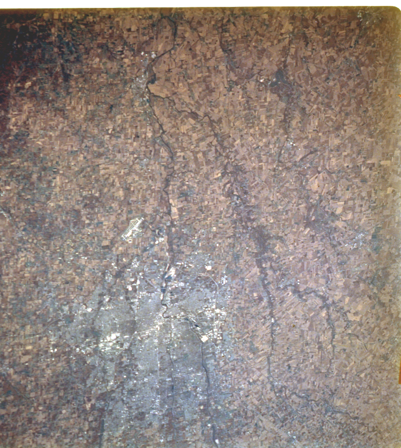
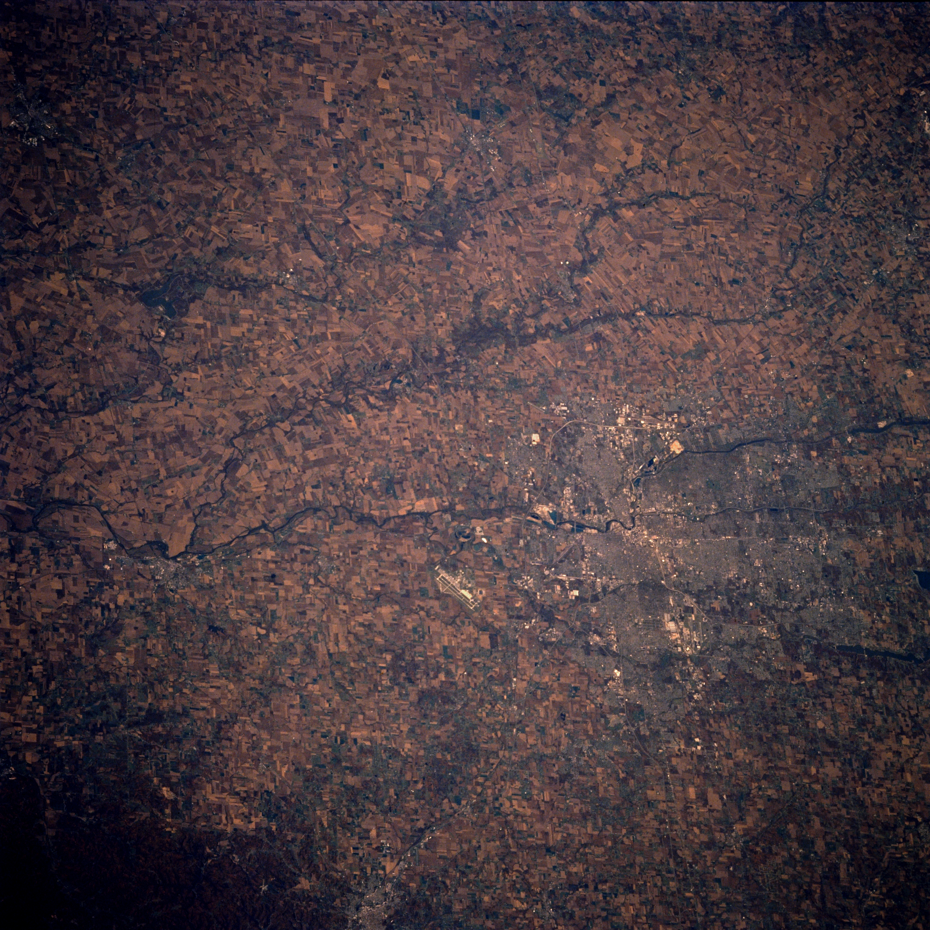
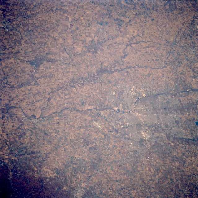
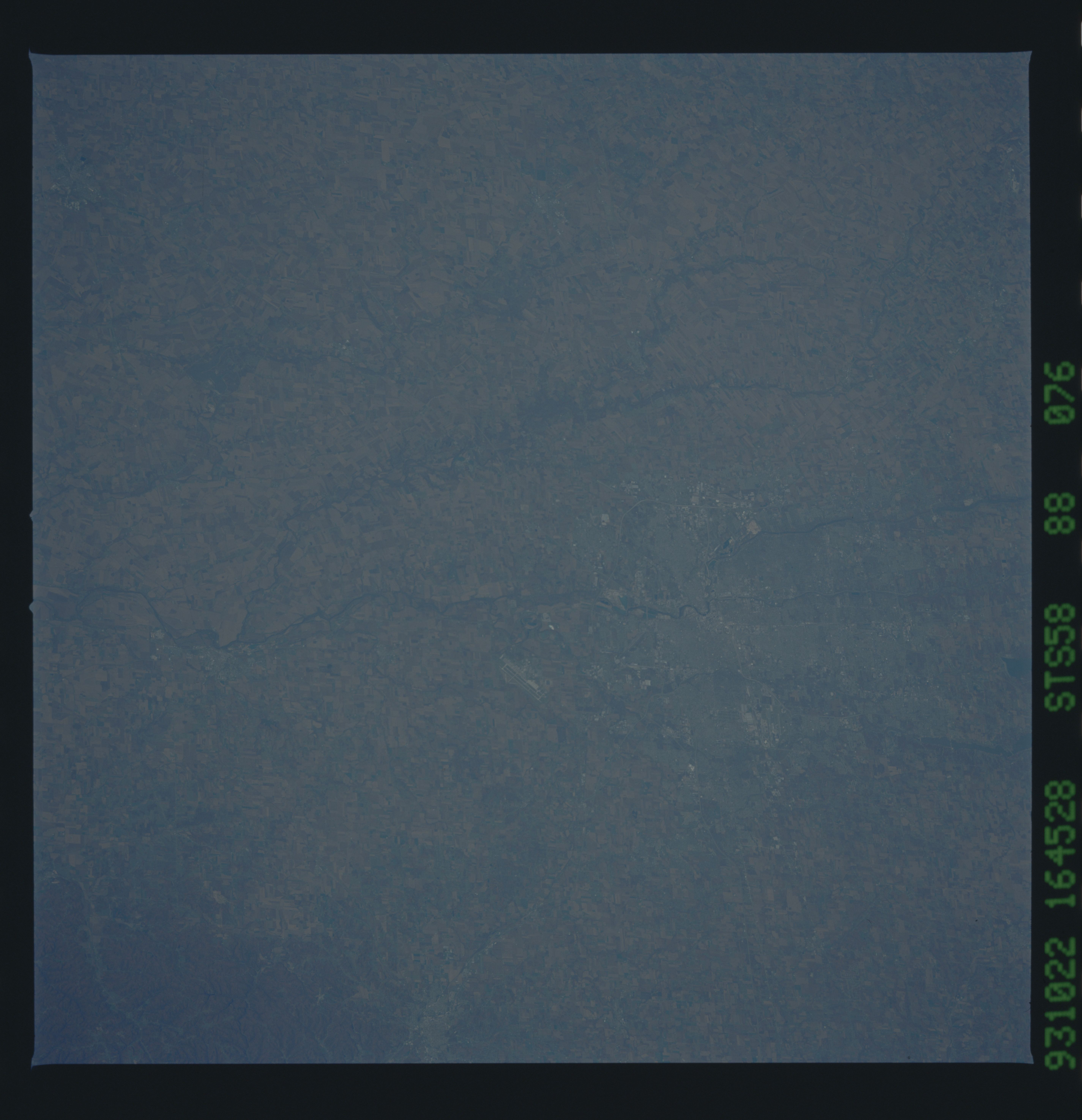
Image Caption: STS058-088-076 Columbus, Ohio, U.S.A. October 1993
Columbus, the capital of Ohio, is featured in this west-looking, low-oblique photograph. Situated on the Scioto River, Columbus is a major industrial and trade center in the rich farm region of central Ohio; the home of Ohio State University; and the headquarters of the American Rose Society, which has one of the largest rose gardens in the world. The runways of Rickenbacker Air National Guard Base in Lockbourne are visible south of the city, and Circleville is barely discernible farther south (near left center).
Columbus, the capital of Ohio, is featured in this west-looking, low-oblique photograph. Situated on the Scioto River, Columbus is a major industrial and trade center in the rich farm region of central Ohio; the home of Ohio State University; and the headquarters of the American Rose Society, which has one of the largest rose gardens in the world. The runways of Rickenbacker Air National Guard Base in Lockbourne are visible south of the city, and Circleville is barely discernible farther south (near left center).
