STS058-88-58
| NASA Photo ID | STS058-88-58 |
| Focal Length | 250mm |
| Date taken | 1993.10.22 |
| Time taken | 16:43:29 GMT |
Resolutions offered for this image:
3904 x 3904 pixels 639 x 639 pixels 5700 x 5900 pixels 500 x 518 pixels 640 x 480 pixels 3331 x 3369 pixels
3904 x 3904 pixels 639 x 639 pixels 5700 x 5900 pixels 500 x 518 pixels 640 x 480 pixels 3331 x 3369 pixels

Cloud masks available for this image:
Spacecraft nadir point: 39.1° N, 90.9° W
Photo center point: 39.0° N, 91.0° W
Photo center point by machine learning:
Photo center point: 39.0° N, 91.0° W
Photo center point by machine learning:
Nadir to Photo Center: Southwest
Spacecraft Altitude: 155 nautical miles (287km)
Country or Geographic Name: | USA-MISSOURI |
Features: | MISSOURI RIVER |
| Features Found Using Machine Learning: | |
Cloud Cover Percentage: | 0 (no clouds present) |
Sun Elevation Angle: | 38° |
Sun Azimuth: | 160° |
Camera: | Hasselblad |
Focal Length: | 250mm |
Camera Tilt: | 3 degrees |
Format: | 5017: Kodak, natural color positive, Ektachrome, X Professional, ASA 64, standard base |
Film Exposure: | Normal |
| Additional Information | |
| Width | Height | Annotated | Cropped | Purpose | Links |
|---|---|---|---|---|---|
| 3904 pixels | 3904 pixels | No | No | Earth From Space collection | Download Image |
| 639 pixels | 639 pixels | No | No | Earth From Space collection | Download Image |
| 5700 pixels | 5900 pixels | No | No | Download Image | |
| 500 pixels | 518 pixels | No | No | Download Image | |
| 640 pixels | 480 pixels | No | No | Download Image | |
| 3331 pixels | 3369 pixels | Download Image |
Download Packaged File
Download a Google Earth KML for this Image
View photo footprint information
Download a GeoTIFF for this photo
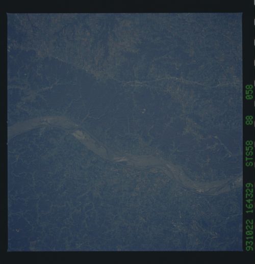
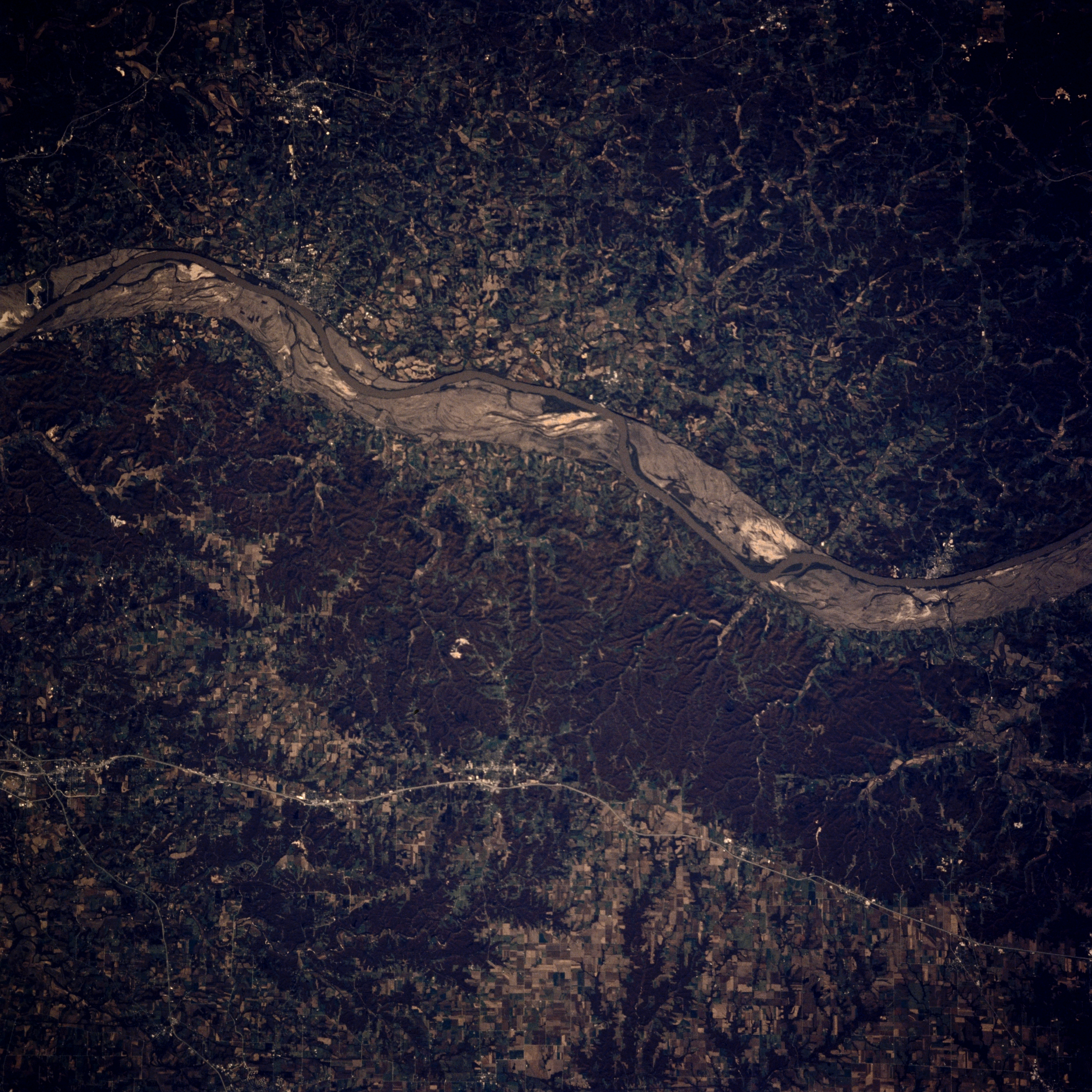
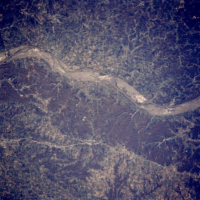
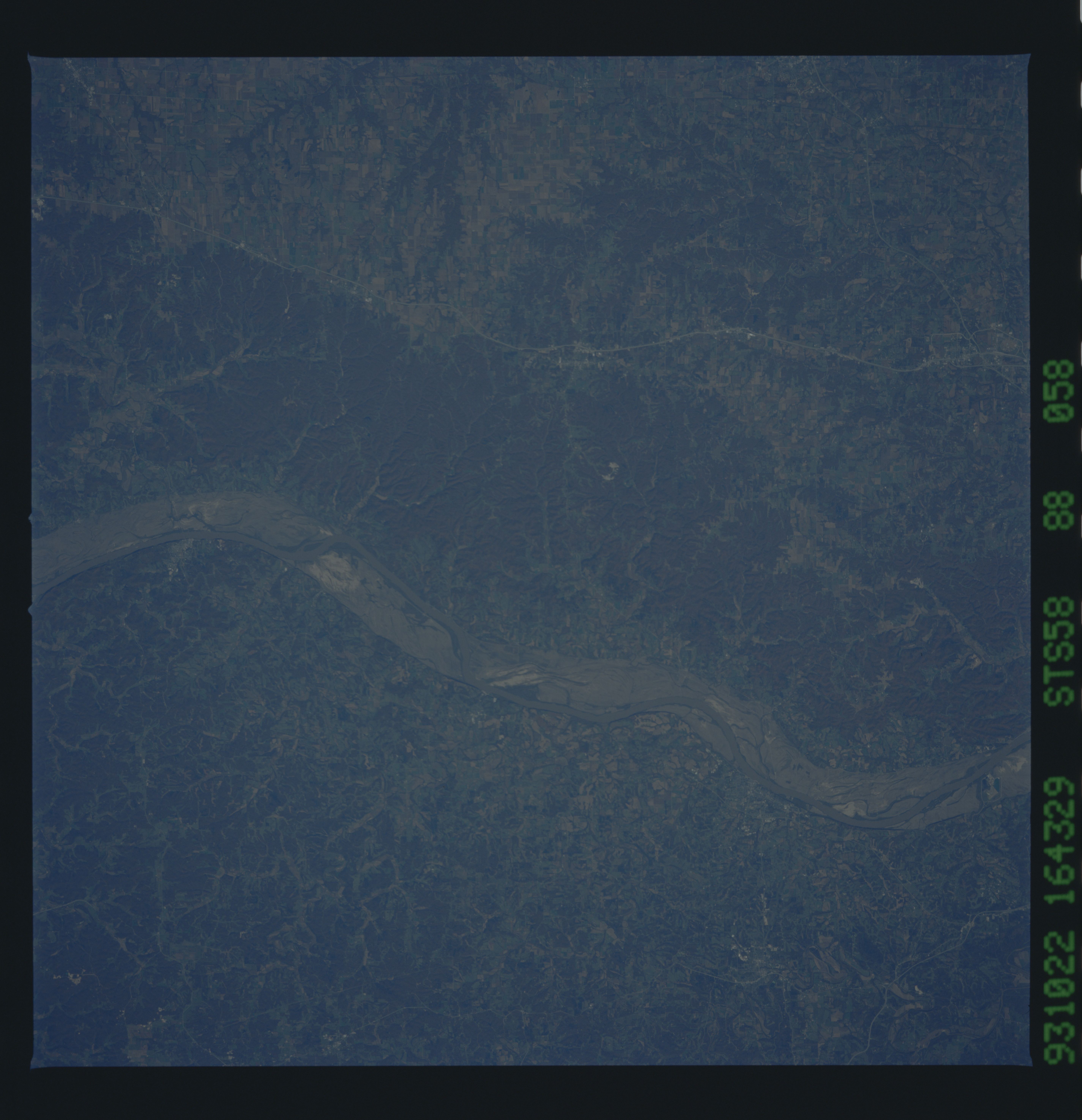
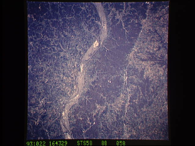
Image Caption: STS058-088-058 Missouri River and Washington, Missouri, U.S.A. October 1993
The scoured floodplain of the Missouri River is apparent in this near-vertical photograph. Before the floods of the spring and early summer of 1993, the floodplain was dotted with agricultural field patterns. Washington (barely discernible) is situated on the south bank of the Missouri River (upper left) whose bluffs sometimes exceed 250 feet (76 meters). East-west-oriented Interstate Highway 70 (bottom of photograph) is visible. This photograph was taken at the height of the fall foliage, which accounts for the reddish forested areas.
The scoured floodplain of the Missouri River is apparent in this near-vertical photograph. Before the floods of the spring and early summer of 1993, the floodplain was dotted with agricultural field patterns. Washington (barely discernible) is situated on the south bank of the Missouri River (upper left) whose bluffs sometimes exceed 250 feet (76 meters). East-west-oriented Interstate Highway 70 (bottom of photograph) is visible. This photograph was taken at the height of the fall foliage, which accounts for the reddish forested areas.
