STS058-88-54
| NASA Photo ID | STS058-88-54 |
| Focal Length | 250mm |
| Date taken | 1993.10.22 |
| Time taken | 16:43:17 GMT |
Resolutions offered for this image:
3904 x 3869 pixels 639 x 634 pixels 5700 x 5900 pixels 500 x 518 pixels 640 x 480 pixels
3904 x 3869 pixels 639 x 634 pixels 5700 x 5900 pixels 500 x 518 pixels 640 x 480 pixels

Cloud masks available for this image:
Spacecraft nadir point: 39.1° N, 91.9° W
Photo center point: 39.0° N, 92.5° W
Photo center point by machine learning:
Photo center point: 39.0° N, 92.5° W
Photo center point by machine learning:
Nadir to Photo Center: West
Spacecraft Altitude: 155 nautical miles (287km)
Country or Geographic Name: | USA-MISSOURI |
Features: | MISSOURI RIVER, COLOMBIA |
| Features Found Using Machine Learning: | |
Cloud Cover Percentage: | 0 (no clouds present) |
Sun Elevation Angle: | 37° |
Sun Azimuth: | 159° |
Camera: | Hasselblad |
Focal Length: | 250mm |
Camera Tilt: | 13 degrees |
Format: | 5017: Kodak, natural color positive, Ektachrome, X Professional, ASA 64, standard base |
Film Exposure: | Normal |
| Additional Information | |
| Width | Height | Annotated | Cropped | Purpose | Links |
|---|---|---|---|---|---|
| 3904 pixels | 3869 pixels | No | No | Earth From Space collection | Download Image |
| 639 pixels | 634 pixels | No | No | Earth From Space collection | Download Image |
| 5700 pixels | 5900 pixels | No | No | Download Image | |
| 500 pixels | 518 pixels | No | No | Download Image | |
| 640 pixels | 480 pixels | No | No | Download Image |
Download Packaged File
Download a Google Earth KML for this Image
View photo footprint information
Download a GeoTIFF for this photo
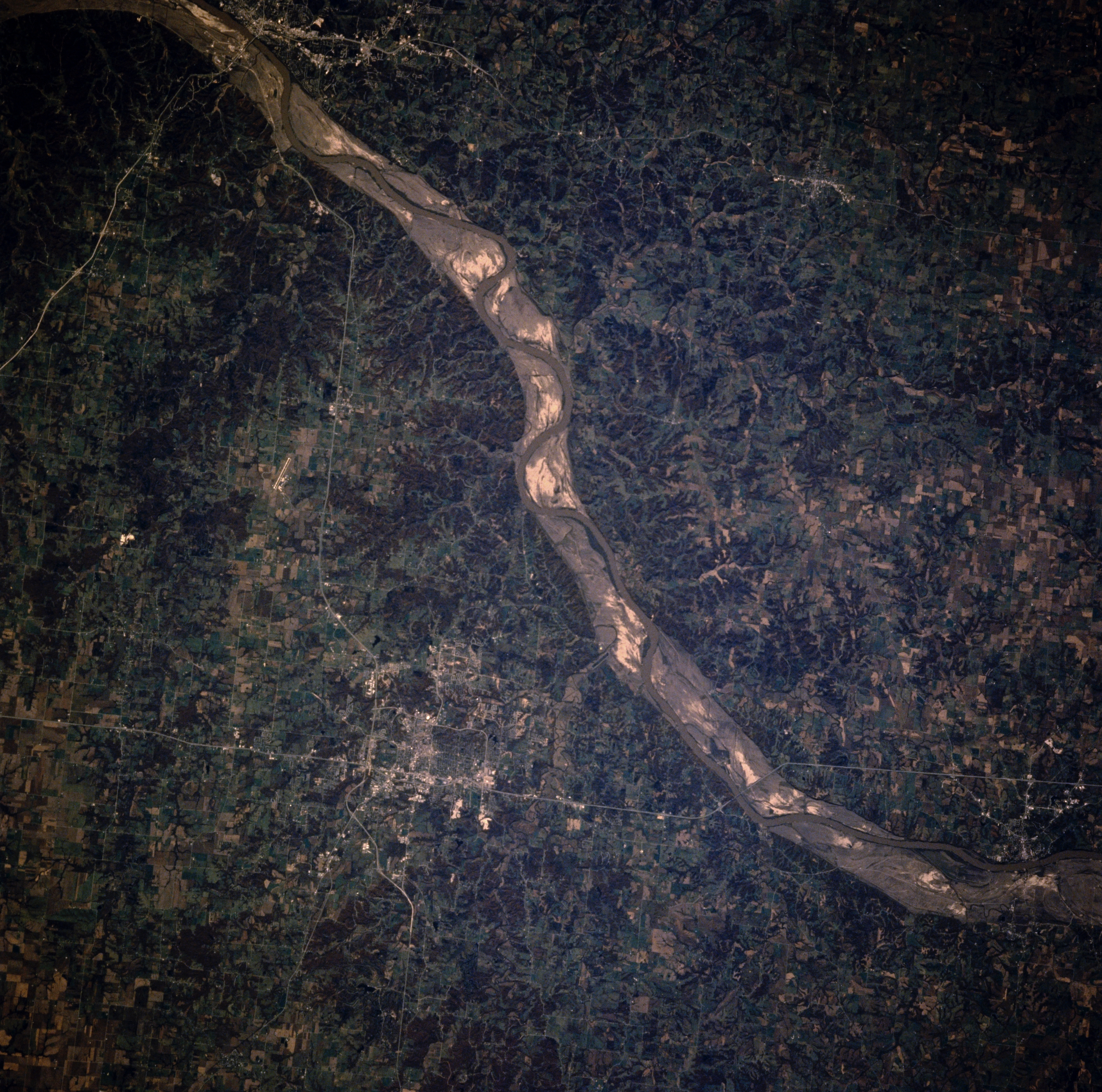
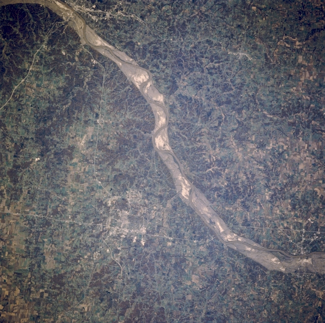
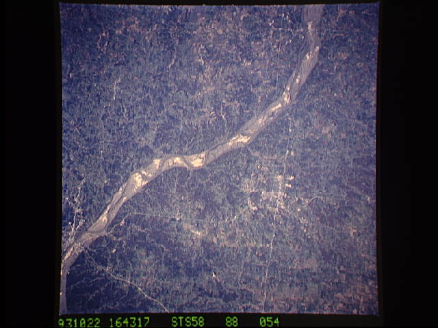
Image Caption: STS058-088-054 Missouri River and Columbia, Missouri, U.S.A. October 1993
Visible in this near-vertical photograph is a portion of the generally southeast-trending Missouri River and its scoured sand and gravel floodplain between Boonville (lower right) and Jefferson City (upper left). The once rich agricultural fields of the floodplain have disappeared because of the floods of the spring and early summer of 1993. Bluffs on either side of the floodplain can exceed 250 feet (76 meters). East of the river is Columbia (below center), a trade center in a farm and coal mining region. Columbia is the home of the University of Missouri and has a well known medical center. Interstate Highway 70 skirts the northern portions of the city.
Visible in this near-vertical photograph is a portion of the generally southeast-trending Missouri River and its scoured sand and gravel floodplain between Boonville (lower right) and Jefferson City (upper left). The once rich agricultural fields of the floodplain have disappeared because of the floods of the spring and early summer of 1993. Bluffs on either side of the floodplain can exceed 250 feet (76 meters). East of the river is Columbia (below center), a trade center in a farm and coal mining region. Columbia is the home of the University of Missouri and has a well known medical center. Interstate Highway 70 skirts the northern portions of the city.
