STS058-88-17
| NASA Photo ID | STS058-88-17 |
| Focal Length | 250mm |
| Date taken | 1993.10.22 |
| Time taken | 15:26:51 GMT |
Resolutions offered for this image:
4000 x 4008 pixels 638 x 639 pixels 5700 x 5900 pixels 500 x 518 pixels 640 x 480 pixels 2978 x 3000 pixels 635 x 640 pixels
4000 x 4008 pixels 638 x 639 pixels 5700 x 5900 pixels 500 x 518 pixels 640 x 480 pixels 2978 x 3000 pixels 635 x 640 pixels


Cloud masks available for this image:
Spacecraft nadir point: 22.3° N, 10.8° W
Photo center point: 21.0° N, 11.5° W
Photo center point by machine learning:
Photo center point: 21.0° N, 11.5° W
Photo center point by machine learning:
Nadir to Photo Center: Southwest
Spacecraft Altitude: 154 nautical miles (285km)
Country or Geographic Name: | MAURITANIA |
Features: | RICHAT STRUCTURE |
| Features Found Using Machine Learning: | |
Cloud Cover Percentage: | 0 (no clouds present) |
Sun Elevation Angle: | 35° |
Sun Azimuth: | 237° |
Camera: | Hasselblad |
Focal Length: | 250mm |
Camera Tilt: | 30 degrees |
Format: | 5017: Kodak, natural color positive, Ektachrome, X Professional, ASA 64, standard base |
Film Exposure: | Under Exposed |
| Additional Information | |
| Width | Height | Annotated | Cropped | Purpose | Links |
|---|---|---|---|---|---|
| 4000 pixels | 4008 pixels | No | No | Earth From Space collection | Download Image |
| 638 pixels | 639 pixels | No | No | Earth From Space collection | Download Image |
| 5700 pixels | 5900 pixels | No | No | Download Image | |
| 500 pixels | 518 pixels | No | No | Download Image | |
| 640 pixels | 480 pixels | No | No | Download Image | |
| 2978 pixels | 3000 pixels | No | No | Download Image | |
| 635 pixels | 640 pixels | No | No | Download Image |
Download Packaged File
Download a Google Earth KML for this Image
View photo footprint information
Download a GeoTIFF for this photo
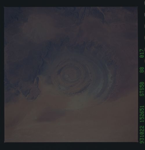
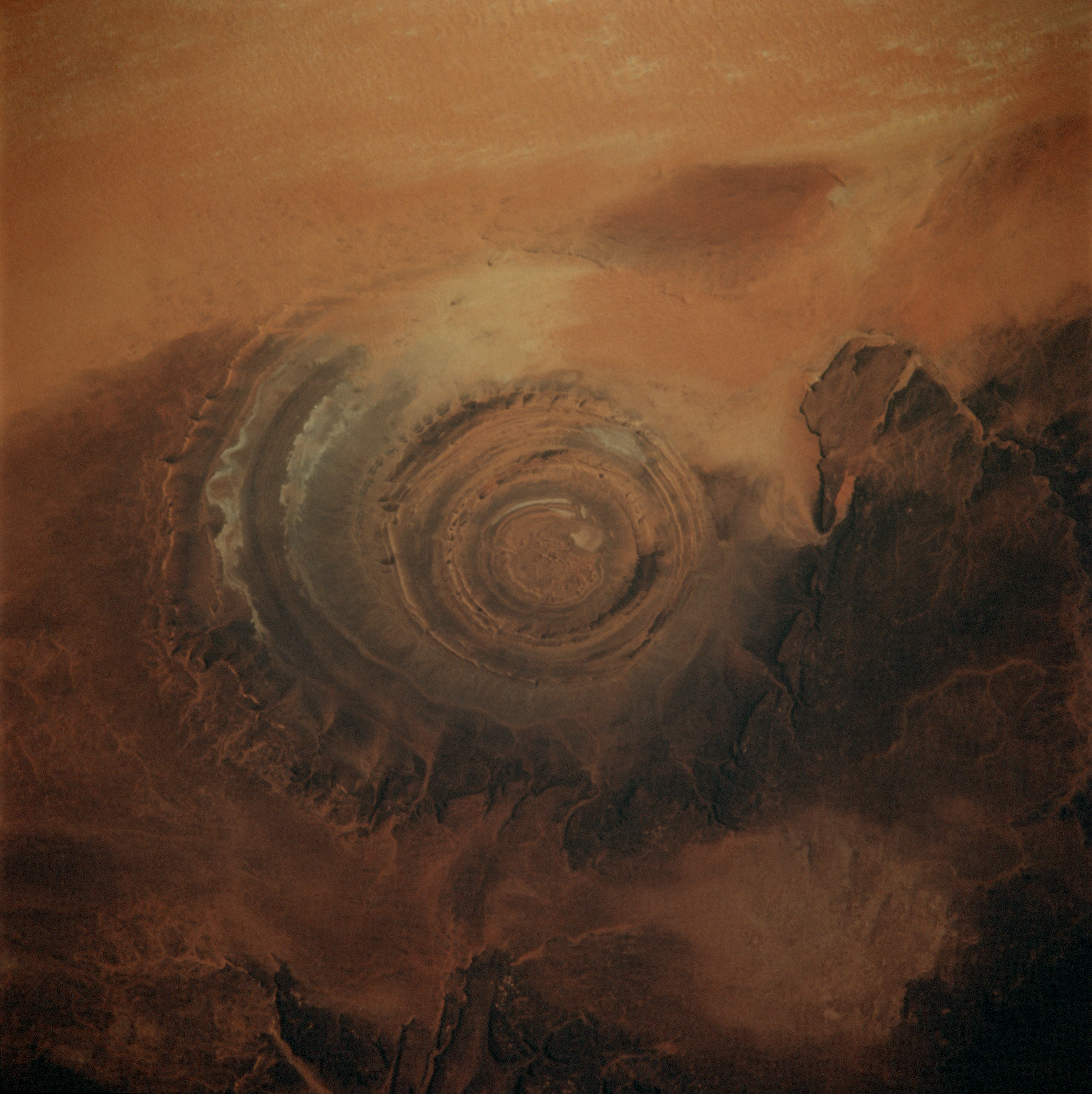
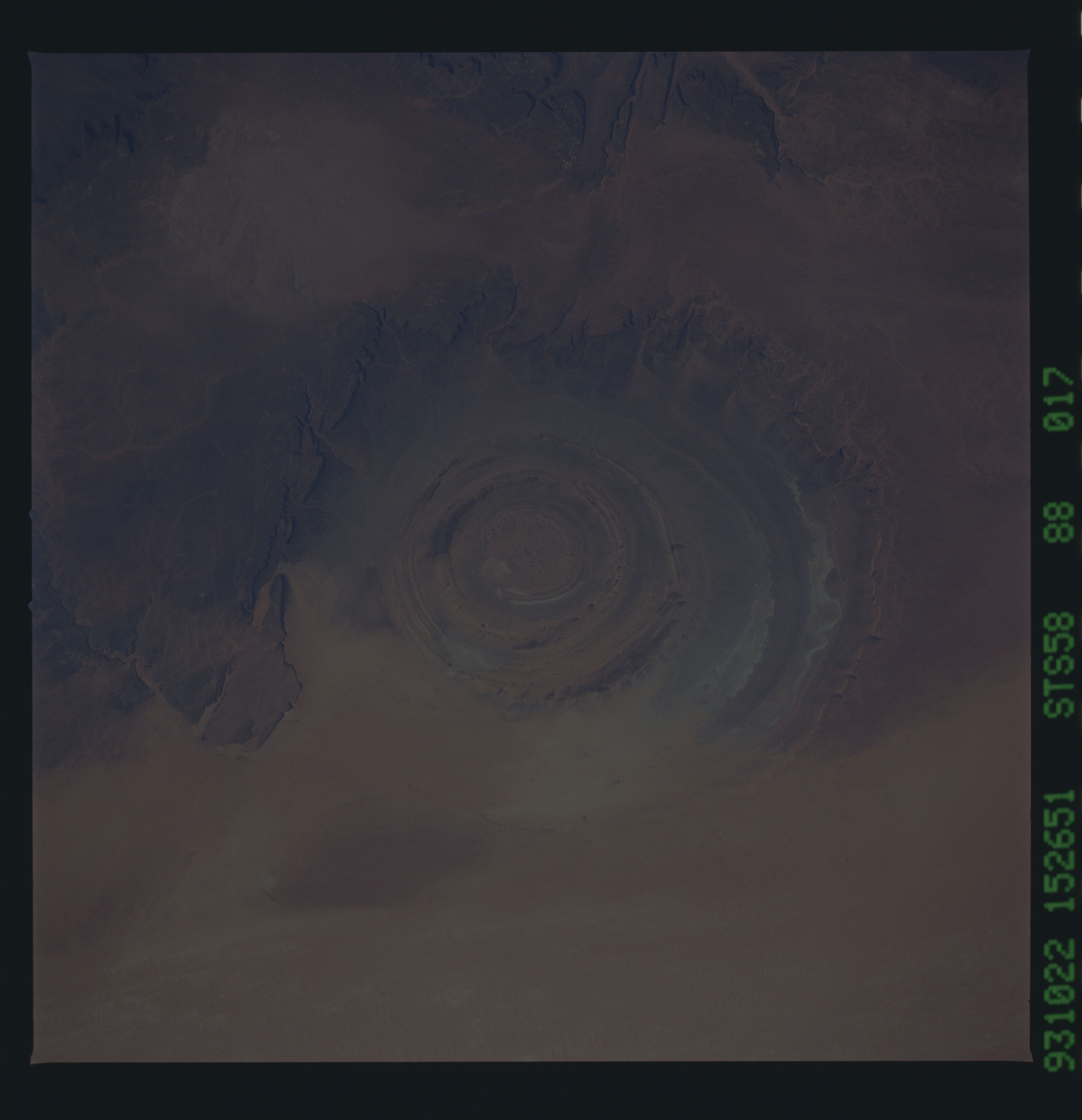
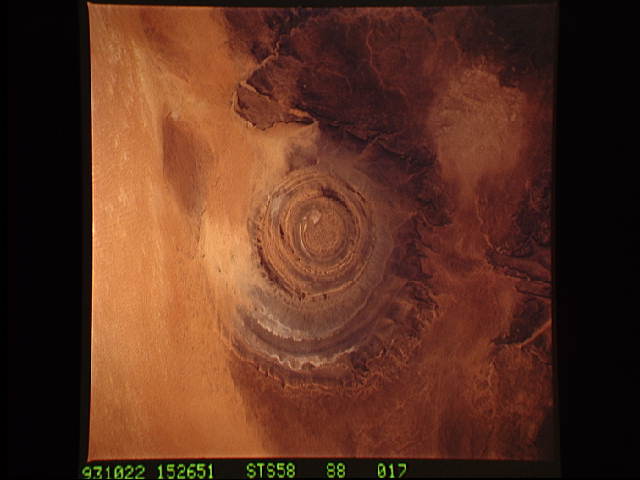
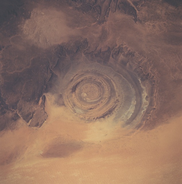
Image Caption: STS058-88-17 Richat Structure, Mauritania October 1993
The Richat Structure, sometimes referred to as the Bull's Eye, can be seen in northwest-looking view. Contrary to a commonly believed notion, the structure was not made by the impact of a meteorite. The 24 mile (39km) wide structure was made by the erosion of layers of rock (limestone, sandstone, and shale) that domed upward. Geologists have not found any evidence of meteorite impact, surface volcanic activity, or salt. The best guess is that the structure was caused by deep injection of pre-volcanic melted rock (magma) that never quite ascended to Earth's surface. The depression or pit in which the domed rock rings sit is 328 feet (100 meters) deep from the surrounding plateau area (darker colored rock). The rock layers themselves are thought by many scientists to be several hundred million years old, and their variable resistance to erosion has produced a series of concentric ridges in the structure stepping down from the outside in. The structure is surrounded by fields of sand which is visible encroaching into the southern part of the structure. Small dry lakes or playas (whitish-gray color) are discernible to the east of the center part of the structure.
The Richat Structure, sometimes referred to as the Bull's Eye, can be seen in northwest-looking view. Contrary to a commonly believed notion, the structure was not made by the impact of a meteorite. The 24 mile (39km) wide structure was made by the erosion of layers of rock (limestone, sandstone, and shale) that domed upward. Geologists have not found any evidence of meteorite impact, surface volcanic activity, or salt. The best guess is that the structure was caused by deep injection of pre-volcanic melted rock (magma) that never quite ascended to Earth's surface. The depression or pit in which the domed rock rings sit is 328 feet (100 meters) deep from the surrounding plateau area (darker colored rock). The rock layers themselves are thought by many scientists to be several hundred million years old, and their variable resistance to erosion has produced a series of concentric ridges in the structure stepping down from the outside in. The structure is surrounded by fields of sand which is visible encroaching into the southern part of the structure. Small dry lakes or playas (whitish-gray color) are discernible to the east of the center part of the structure.
