STS058-82-58
| NASA Photo ID | STS058-82-58 |
| Focal Length | 100mm |
| Date taken | 1993.10.30 |
| Time taken | 16:32:42 GMT |
Resolutions offered for this image:
3904 x 3904 pixels 639 x 639 pixels 5700 x 5900 pixels 500 x 518 pixels 640 x 480 pixels
3904 x 3904 pixels 639 x 639 pixels 5700 x 5900 pixels 500 x 518 pixels 640 x 480 pixels
Cloud masks available for this image:
Spacecraft nadir point: 35.2° N, 118.9° W
Photo center point: 36.5° N, 118.0° W
Photo center point by machine learning:
Photo center point: 36.5° N, 118.0° W
Photo center point by machine learning:
Nadir to Photo Center: Northeast
Spacecraft Altitude: 143 nautical miles (265km)
Camera: | Hasselblad |
Focal Length: | 100mm |
Camera Tilt: | 34 degrees |
Format: | 5017: Kodak, natural color positive, Ektachrome, X Professional, ASA 64, standard base |
Film Exposure: | Normal |
| Additional Information | |
| Width | Height | Annotated | Cropped | Purpose | Links |
|---|---|---|---|---|---|
| 3904 pixels | 3904 pixels | No | No | Earth From Space collection | Download Image |
| 639 pixels | 639 pixels | No | No | Earth From Space collection | Download Image |
| 5700 pixels | 5900 pixels | No | No | Download Image | |
| 500 pixels | 518 pixels | No | No | Download Image | |
| 640 pixels | 480 pixels | No | No | Download Image |
Download Packaged File
Download a Google Earth KML for this Image
View photo footprint information
Download a GeoTIFF for this photo
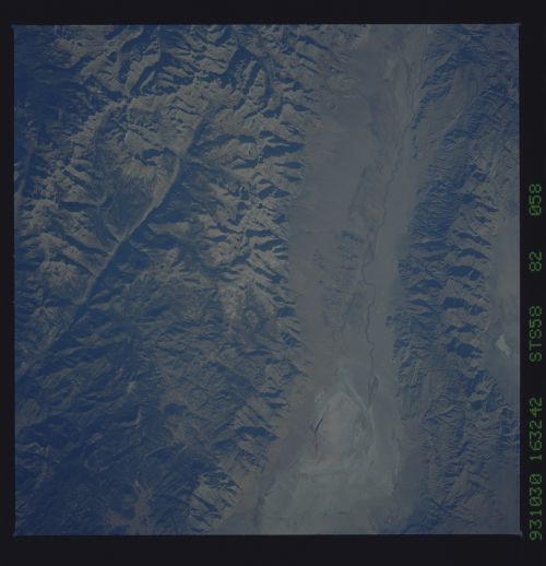
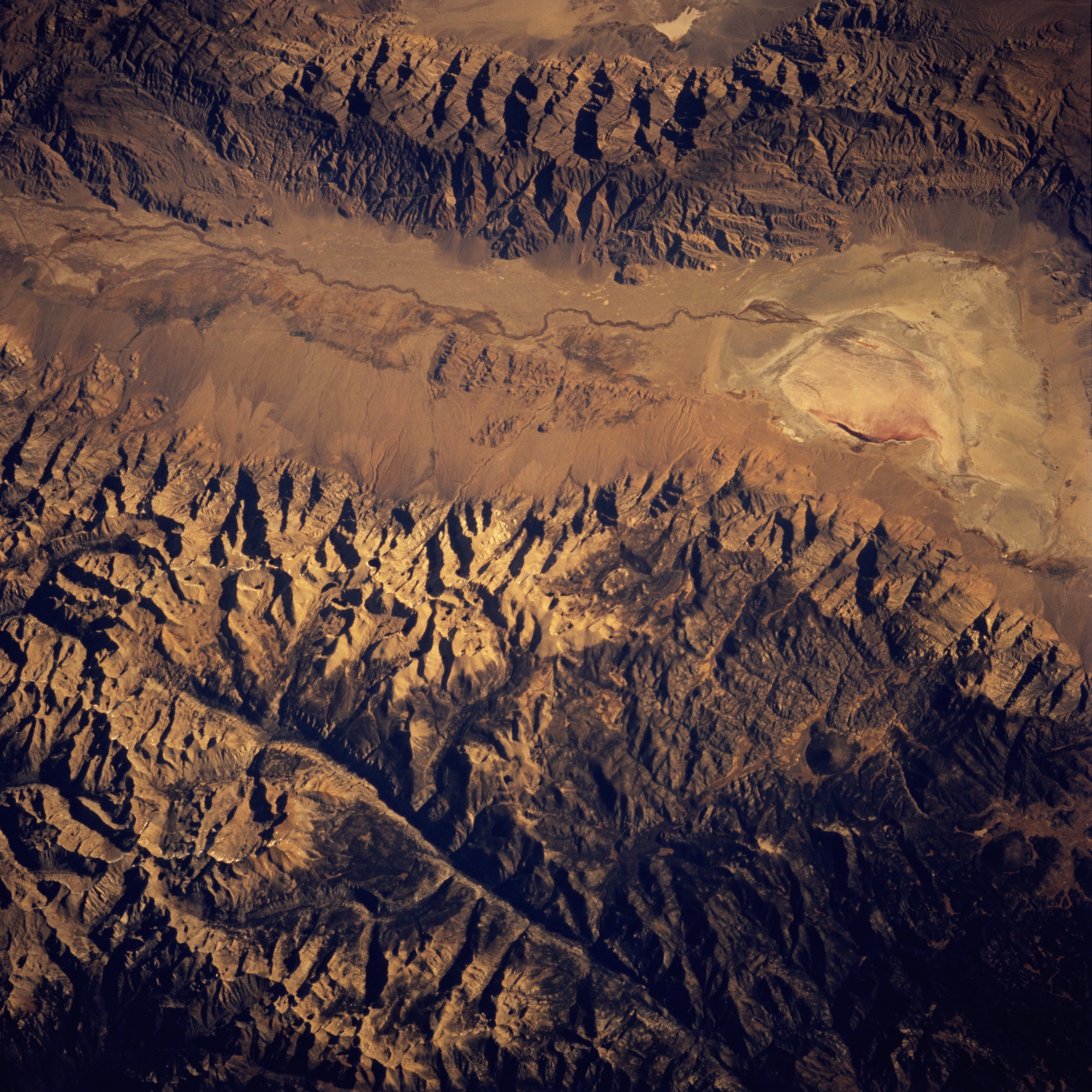
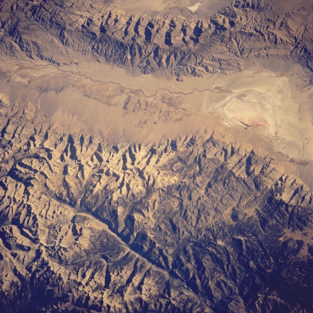
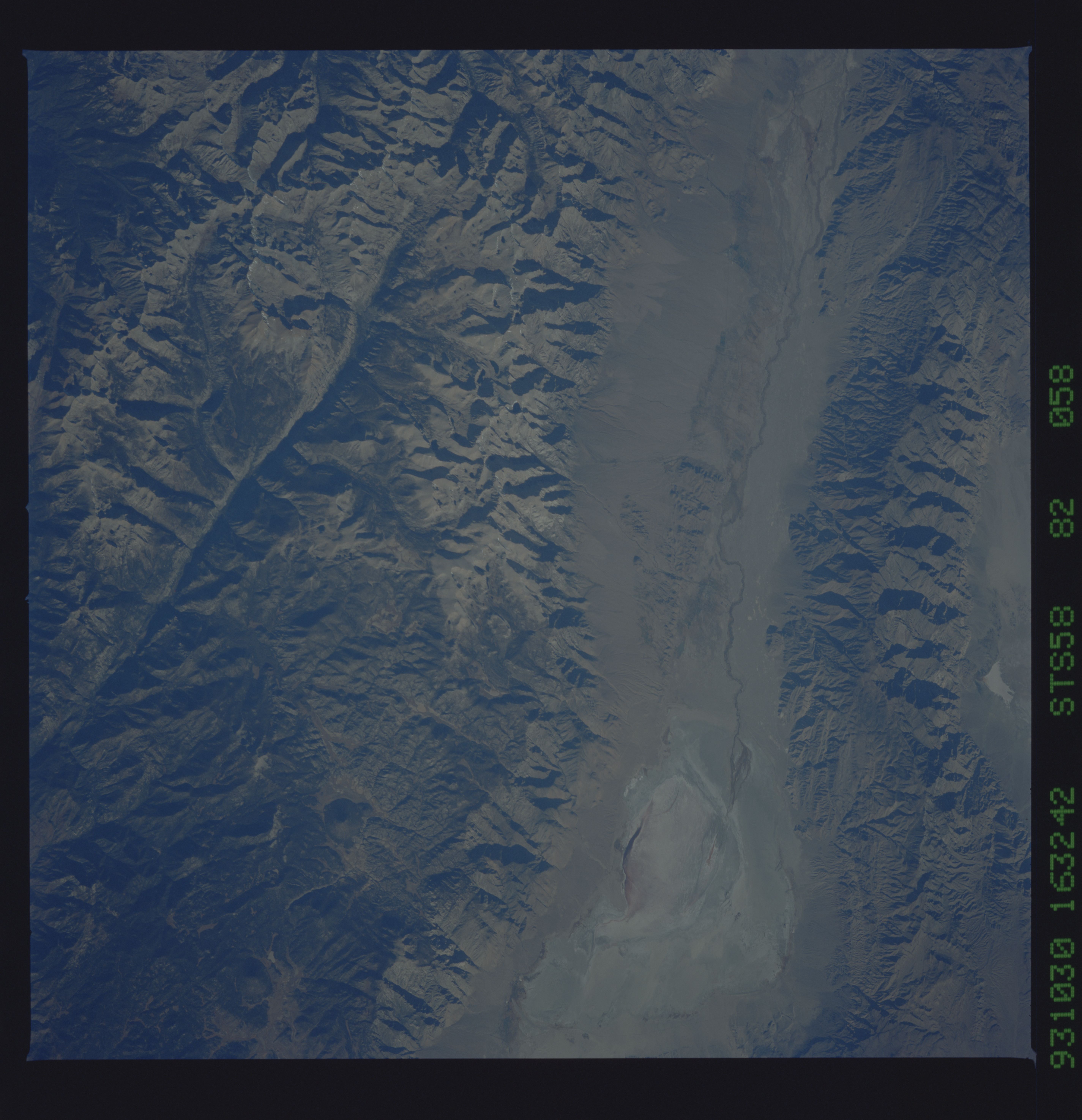
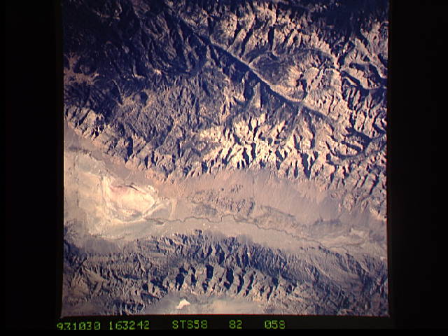
Image Caption: STS058-082-058 Owens Valley, California, U.S.A. October 1993
The main channel of the south-flowing Owens River is discernible as a narrow, meandering line in this near-vertical photograph that shows a 50-mile (80-kilometer) section of the Owens Valley. The Owens River enters oval, lighter Owens Lake, a source of potable water for the city of Los Angeles since the early 1900s. This fault valley is flanked by the Sierra Nevada Mountains on the west and the smaller Inyo Mountains on the east. The darker, linear, north-south-trending feature near the western edge of the photograph is part of the Kern River Valley, another fault valley. Mount Whitney, the highest peak in the 48 contiguous states at 14 495 feet (4415 meters), is located between these two valleys.
The main channel of the south-flowing Owens River is discernible as a narrow, meandering line in this near-vertical photograph that shows a 50-mile (80-kilometer) section of the Owens Valley. The Owens River enters oval, lighter Owens Lake, a source of potable water for the city of Los Angeles since the early 1900s. This fault valley is flanked by the Sierra Nevada Mountains on the west and the smaller Inyo Mountains on the east. The darker, linear, north-south-trending feature near the western edge of the photograph is part of the Kern River Valley, another fault valley. Mount Whitney, the highest peak in the 48 contiguous states at 14 495 feet (4415 meters), is located between these two valleys.
