STS058-81-8
| NASA Photo ID | STS058-81-8 |
| Focal Length | 100mm |
| Date taken | 1993.10.24 |
| Time taken | 13:39:25 GMT |
Resolutions offered for this image:
3869 x 3904 pixels 634 x 639 pixels 5700 x 5900 pixels 500 x 518 pixels 640 x 480 pixels
3869 x 3904 pixels 634 x 639 pixels 5700 x 5900 pixels 500 x 518 pixels 640 x 480 pixels
Cloud masks available for this image:
Spacecraft nadir point: 37.4° N, 78.3° W
Photo center point: 39.0° N, 77.0° W
Photo center point by machine learning:
Photo center point: 39.0° N, 77.0° W
Photo center point by machine learning:
Nadir to Photo Center: Northeast
Spacecraft Altitude: 146 nautical miles (270km)
Country or Geographic Name: | USA-MARYLAND |
Features: | WASHINGTON, D. C. |
| Features Found Using Machine Learning: | |
Cloud Cover Percentage: | 0 (no clouds present) |
Sun Elevation Angle: | 22° |
Sun Azimuth: | 126° |
Camera: | Hasselblad |
Focal Length: | 100mm |
Camera Tilt: | 40 degrees |
Format: | 5017: Kodak, natural color positive, Ektachrome, X Professional, ASA 64, standard base |
Film Exposure: | Under Exposed |
| Additional Information | |
| Width | Height | Annotated | Cropped | Purpose | Links |
|---|---|---|---|---|---|
| 3869 pixels | 3904 pixels | No | No | Earth From Space collection | Download Image |
| 634 pixels | 639 pixels | No | No | Earth From Space collection | Download Image |
| 5700 pixels | 5900 pixels | No | No | Download Image | |
| 500 pixels | 518 pixels | No | No | Download Image | |
| 640 pixels | 480 pixels | No | No | Download Image |
Download Packaged File
Download a Google Earth KML for this Image
View photo footprint information
Download a GeoTIFF for this photo
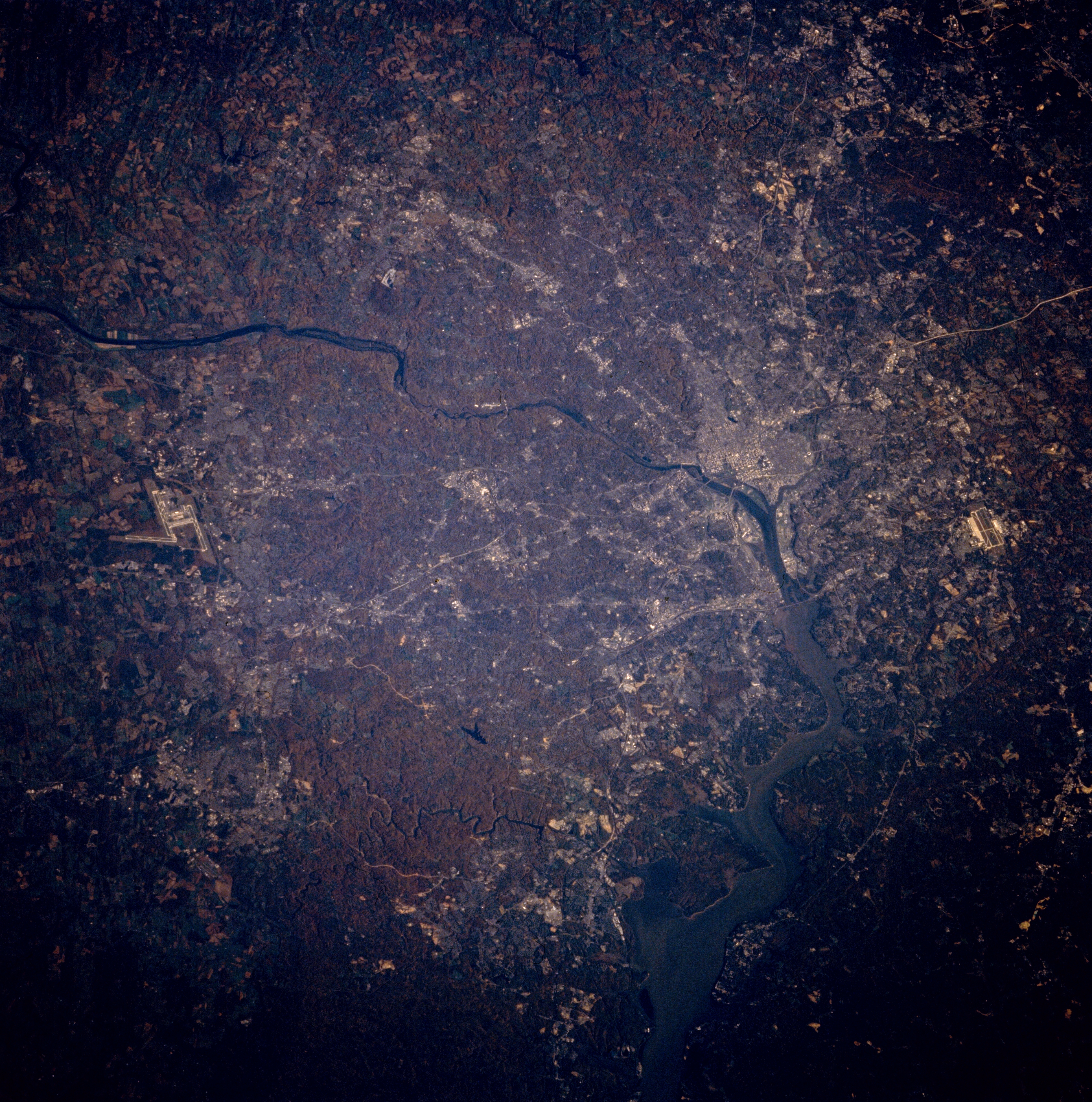
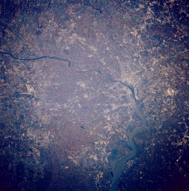
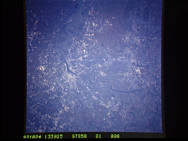
Image Caption: STS058-081-008 Washington, D. C., Potomac River, Virginia, U.S.A. October 1993
The Potomac River can be seen entering the scene from the northwest midway between the left center and upper left, going through Washington, D.C., and exiting the scene to the south near the center bottom, of this mostly north-looking low-oblique view. The Potomac passes over the Great Falls (not discernible) just to the northwest of Washington, D.C., and enters a tidal estuary just to the south of the city. The city of Washington, D.C., visible to the right of the center of the image, is the capital of the United States. The runways of Dulles International Airport can be seen near the left center of the image. The north-south runways of Andrews Air Force Base are visible near the right center of the image.
The Potomac River can be seen entering the scene from the northwest midway between the left center and upper left, going through Washington, D.C., and exiting the scene to the south near the center bottom, of this mostly north-looking low-oblique view. The Potomac passes over the Great Falls (not discernible) just to the northwest of Washington, D.C., and enters a tidal estuary just to the south of the city. The city of Washington, D.C., visible to the right of the center of the image, is the capital of the United States. The runways of Dulles International Airport can be seen near the left center of the image. The north-south runways of Andrews Air Force Base are visible near the right center of the image.
