STS058-74-R
| NASA Photo ID | STS058-74-R |
| Focal Length | 100mm |
| Date taken | 1993.__.__ |
| Time taken | GMT |

Cloud masks available for this image:
Spacecraft nadir point:
Photo center point: 36.0° N, 115.0° W
Photo center point by machine learning:
Photo center point: 36.0° N, 115.0° W
Photo center point by machine learning:
Nadir to Photo Center:
Spacecraft Altitude: nautical miles (0km)
Country or Geographic Name: | USA-ARIZONA |
Features: | PAN-GRAND CANYON, W COAST |
| Features Found Using Machine Learning: | |
Cloud Cover Percentage: | 10 (1-10)% |
Sun Elevation Angle: | ° |
Sun Azimuth: | ° |
Camera: | Hasselblad |
Focal Length: | 100mm |
Camera Tilt: | High Oblique |
Format: | 5017: Kodak, natural color positive, Ektachrome, X Professional, ASA 64, standard base |
Film Exposure: | Normal |
| Additional Information | |
| Width | Height | Annotated | Cropped | Purpose | Links |
|---|---|---|---|---|---|
| 5700 pixels | 5900 pixels | No | No | Download Image | |
| 500 pixels | 518 pixels | No | No | Download Image | |
| 640 pixels | 480 pixels | No | No | Download Image |
Download Packaged File
Download a Google Earth KML for this Image
View photo footprint information
Download a GeoTIFF for this photo
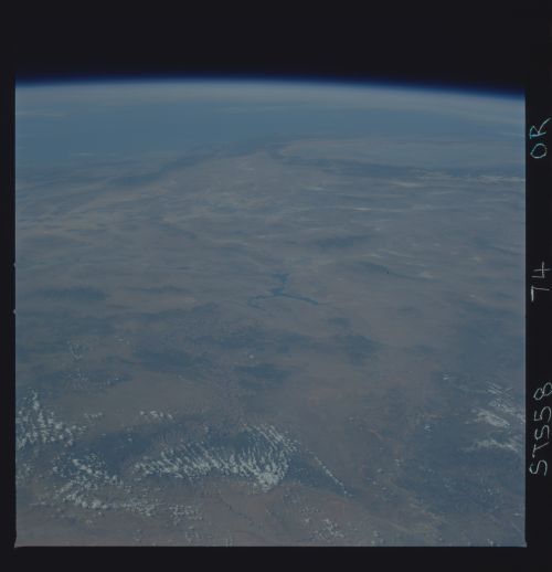
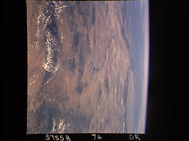
Image Caption: From the Grand Canyon to the Pacific
A broad view westward along the Colorado River from just below Glen Canyon Dam (out of picture), through the entire Grand Canyon to Lake Mead and Las Vegas and westward to include southern Nevada and much of California. The Salton Sea, Los Angeles Basin, and Great Valley rim the Pacific Coast in the distance.
A broad view westward along the Colorado River from just below Glen Canyon Dam (out of picture), through the entire Grand Canyon to Lake Mead and Las Vegas and westward to include southern Nevada and much of California. The Salton Sea, Los Angeles Basin, and Great Valley rim the Pacific Coast in the distance.
