STS058-73-83
| NASA Photo ID | STS058-73-83 |
| Focal Length | 250mm |
| Date taken | 1993.10.19 |
| Time taken | 18:05:00 GMT |
Resolutions offered for this image:
3872 x 3872 pixels 639 x 639 pixels 5700 x 5900 pixels 500 x 518 pixels 640 x 480 pixels
3872 x 3872 pixels 639 x 639 pixels 5700 x 5900 pixels 500 x 518 pixels 640 x 480 pixels
Cloud masks available for this image:
Spacecraft nadir point: 36.2° N, 113.7° W
Photo center point: 36.5° N, 118.0° W
Photo center point by machine learning:
Photo center point: 36.5° N, 118.0° W
Photo center point by machine learning:
Nadir to Photo Center: West
Spacecraft Altitude: 156 nautical miles (289km)
Country or Geographic Name: | USA-CALIFORNIA |
Features: | SIERRA NEV. MTS, OWENS L. |
| Features Found Using Machine Learning: | |
Cloud Cover Percentage: | 0 (no clouds present) |
Sun Elevation Angle: | 40° |
Sun Azimuth: | 155° |
Camera: | Hasselblad |
Focal Length: | 250mm |
Camera Tilt: | Low Oblique |
Format: | 5017: Kodak, natural color positive, Ektachrome, X Professional, ASA 64, standard base |
Film Exposure: | Normal |
| Additional Information | |
| Width | Height | Annotated | Cropped | Purpose | Links |
|---|---|---|---|---|---|
| 3872 pixels | 3872 pixels | No | No | Earth From Space collection | Download Image |
| 639 pixels | 639 pixels | No | No | Earth From Space collection | Download Image |
| 5700 pixels | 5900 pixels | No | No | Download Image | |
| 500 pixels | 518 pixels | No | No | Download Image | |
| 640 pixels | 480 pixels | No | No | Download Image |
Download Packaged File
Download a Google Earth KML for this Image
View photo footprint information
Download a GeoTIFF for this photo
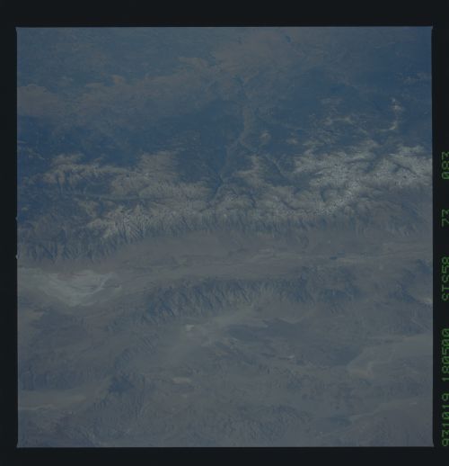
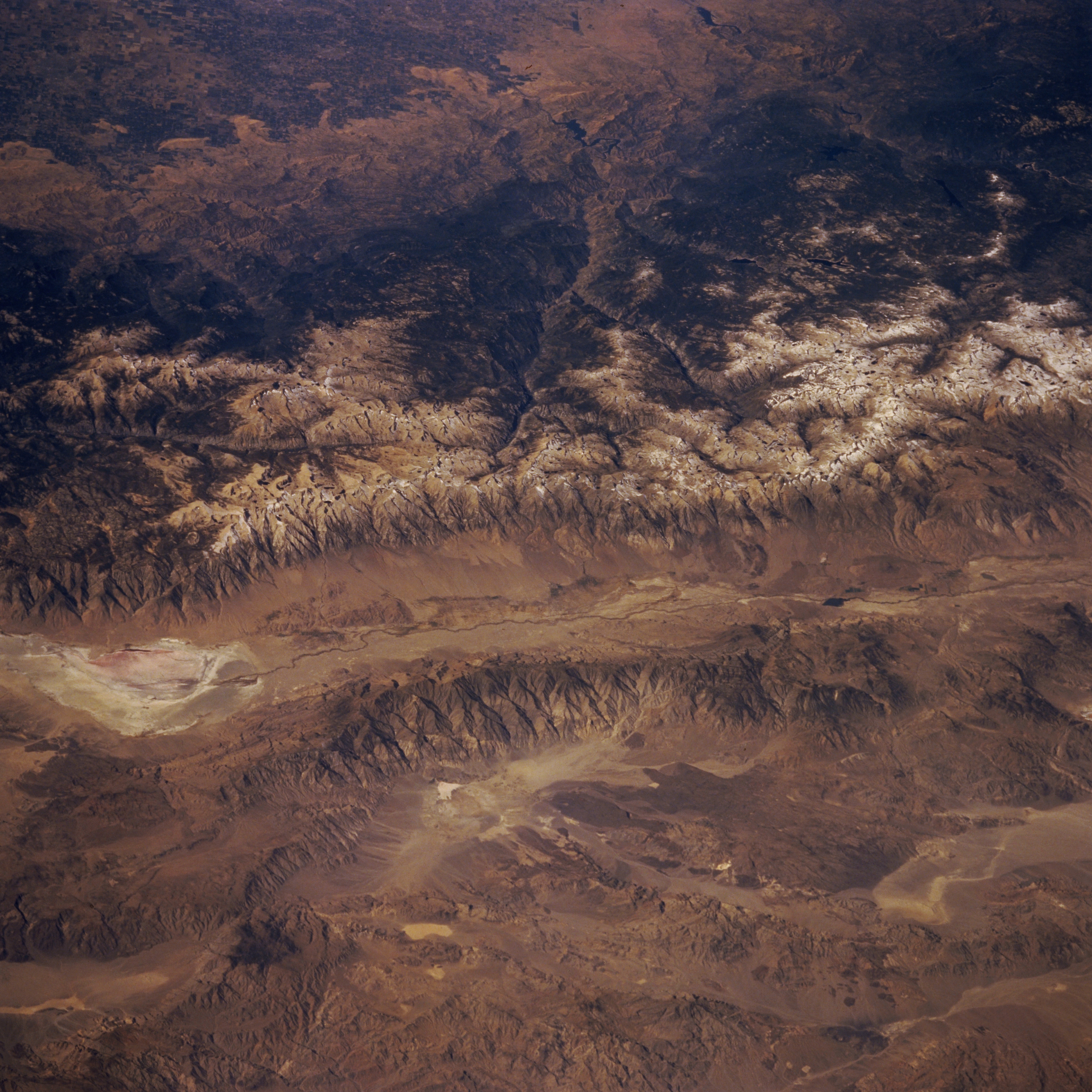
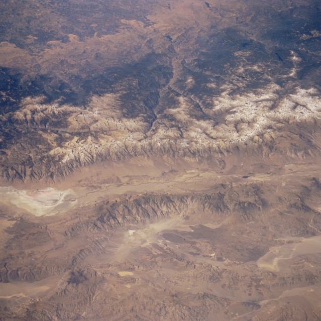
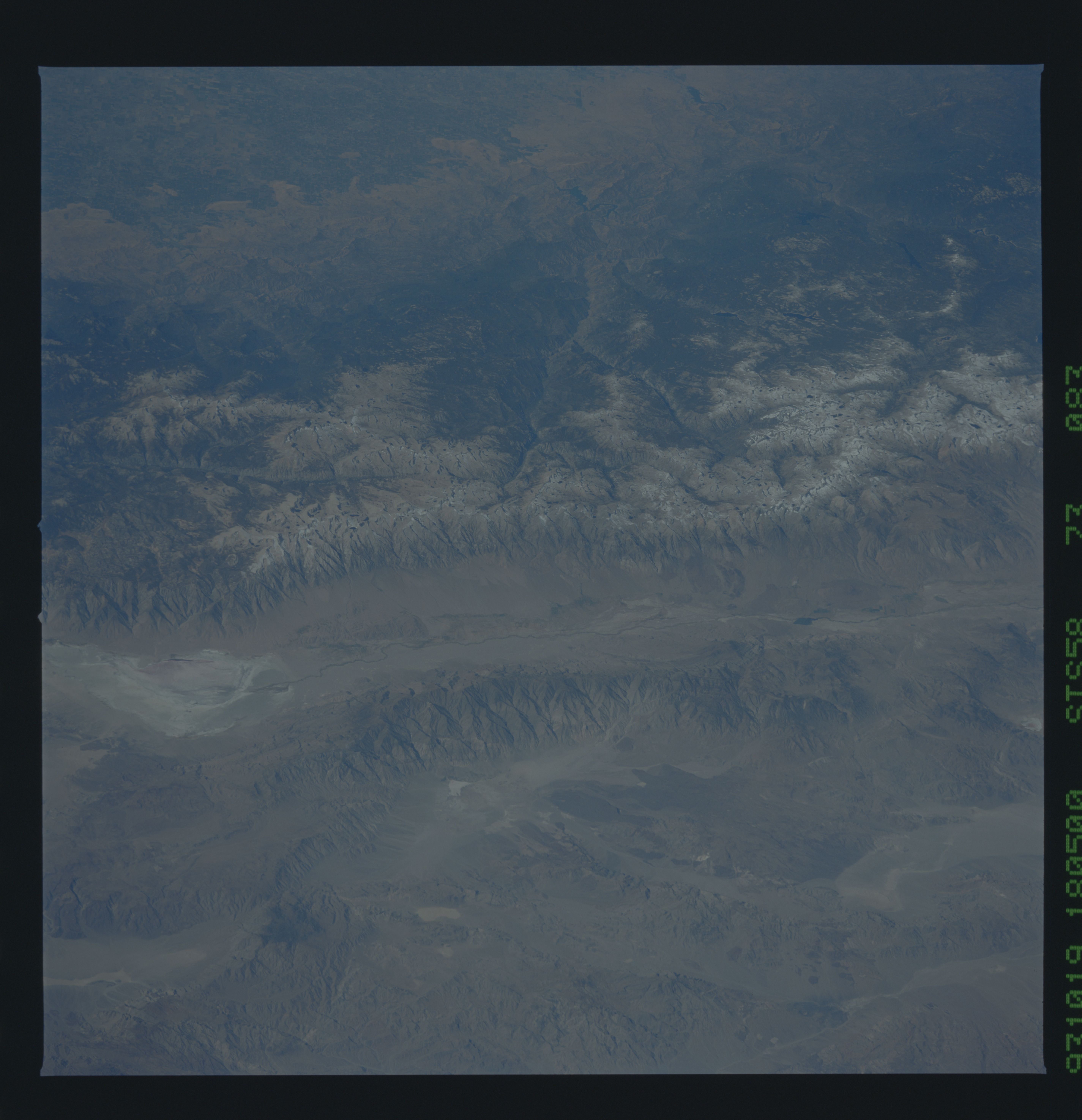
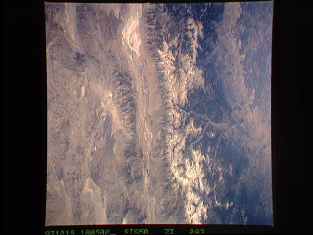
Image Caption: STS058-073-083 Sierra Nevada Mountains and Owens Lake, California, U.S.A. October 1993
The massive Sierra Nevada Mountains and the east-facing slopes of the smaller and lower Inyo Mountains show similar erosional patterns. These surfaces, coupled with the deep, faulted river valleys throughout this section of the Sierra Nevada Mountains, give this photograph a three-dimensional quality. The Owens River Valley fault extends north-south. Owens Lake, now almost dry, is the highly reflective, roughly oval feature to the south. Landscape elevations vary from approximately 4000 feet (1220 meters) above sea level in the Owens Valley to more than 13 500 feet (4115 meters) in the Sierra Nevada Mountains. Mount Whitney, at 14 495 feet (4415 meters), is visible immediately northwest of Owens Lake in the higher, snow-covered Sierra Nevada Mountains.
The massive Sierra Nevada Mountains and the east-facing slopes of the smaller and lower Inyo Mountains show similar erosional patterns. These surfaces, coupled with the deep, faulted river valleys throughout this section of the Sierra Nevada Mountains, give this photograph a three-dimensional quality. The Owens River Valley fault extends north-south. Owens Lake, now almost dry, is the highly reflective, roughly oval feature to the south. Landscape elevations vary from approximately 4000 feet (1220 meters) above sea level in the Owens Valley to more than 13 500 feet (4115 meters) in the Sierra Nevada Mountains. Mount Whitney, at 14 495 feet (4415 meters), is visible immediately northwest of Owens Lake in the higher, snow-covered Sierra Nevada Mountains.
