STS058-110-36
| NASA Photo ID | STS058-110-36 |
| Focal Length | 250mm |
| Date taken | 1993.10.22 |
| Time taken | 00:07:55 GMT |
Resolutions offered for this image:
4048 x 4048 pixels 639 x 639 pixels 5700 x 5900 pixels 500 x 518 pixels 640 x 480 pixels
4048 x 4048 pixels 639 x 639 pixels 5700 x 5900 pixels 500 x 518 pixels 640 x 480 pixels

Cloud masks available for this image:
Spacecraft nadir point: 36.4° N, 139.0° E
Photo center point: 35.5° N, 138.5° E
Photo center point by machine learning:
Photo center point: 35.5° N, 138.5° E
Photo center point by machine learning:
Nadir to Photo Center: Southwest
Spacecraft Altitude: 150 nautical miles (278km)
Country or Geographic Name: | JAPAN |
Features: | MT. FUJI VOLCANO |
| Features Found Using Machine Learning: | |
Cloud Cover Percentage: | 10 (1-10)% |
Sun Elevation Angle: | 32° |
Sun Azimuth: | 138° |
Camera: | Hasselblad |
Focal Length: | 250mm |
Camera Tilt: | 22 degrees |
Format: | 2443: Kodak Aerochrome 2443, color IR, thin base, EA-5 process thru June 1999, E-6 process afterward |
Film Exposure: | Normal |
| Additional Information | |
| Width | Height | Annotated | Cropped | Purpose | Links |
|---|---|---|---|---|---|
| 4048 pixels | 4048 pixels | No | No | Earth From Space collection | Download Image |
| 639 pixels | 639 pixels | No | No | Earth From Space collection | Download Image |
| 5700 pixels | 5900 pixels | No | No | Download Image | |
| 500 pixels | 518 pixels | No | No | Download Image | |
| 640 pixels | 480 pixels | No | No | Download Image |
Download Packaged File
Download a Google Earth KML for this Image
View photo footprint information
Download a GeoTIFF for this photo
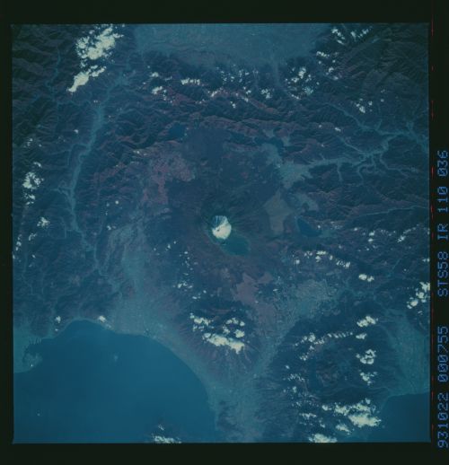
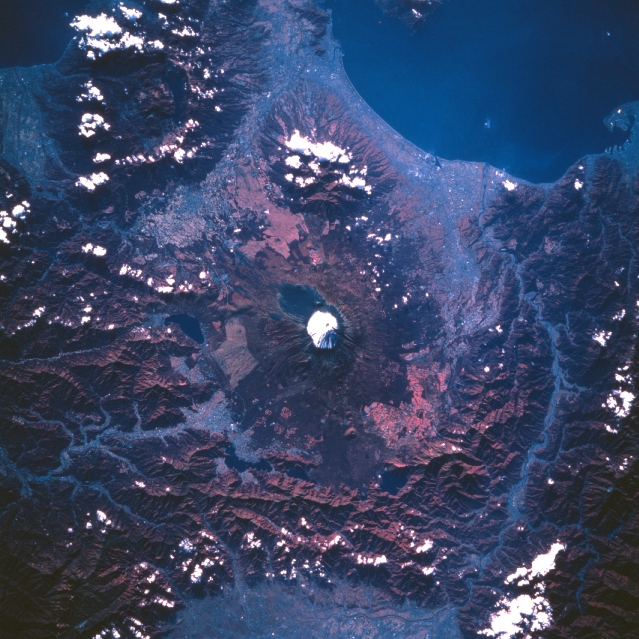
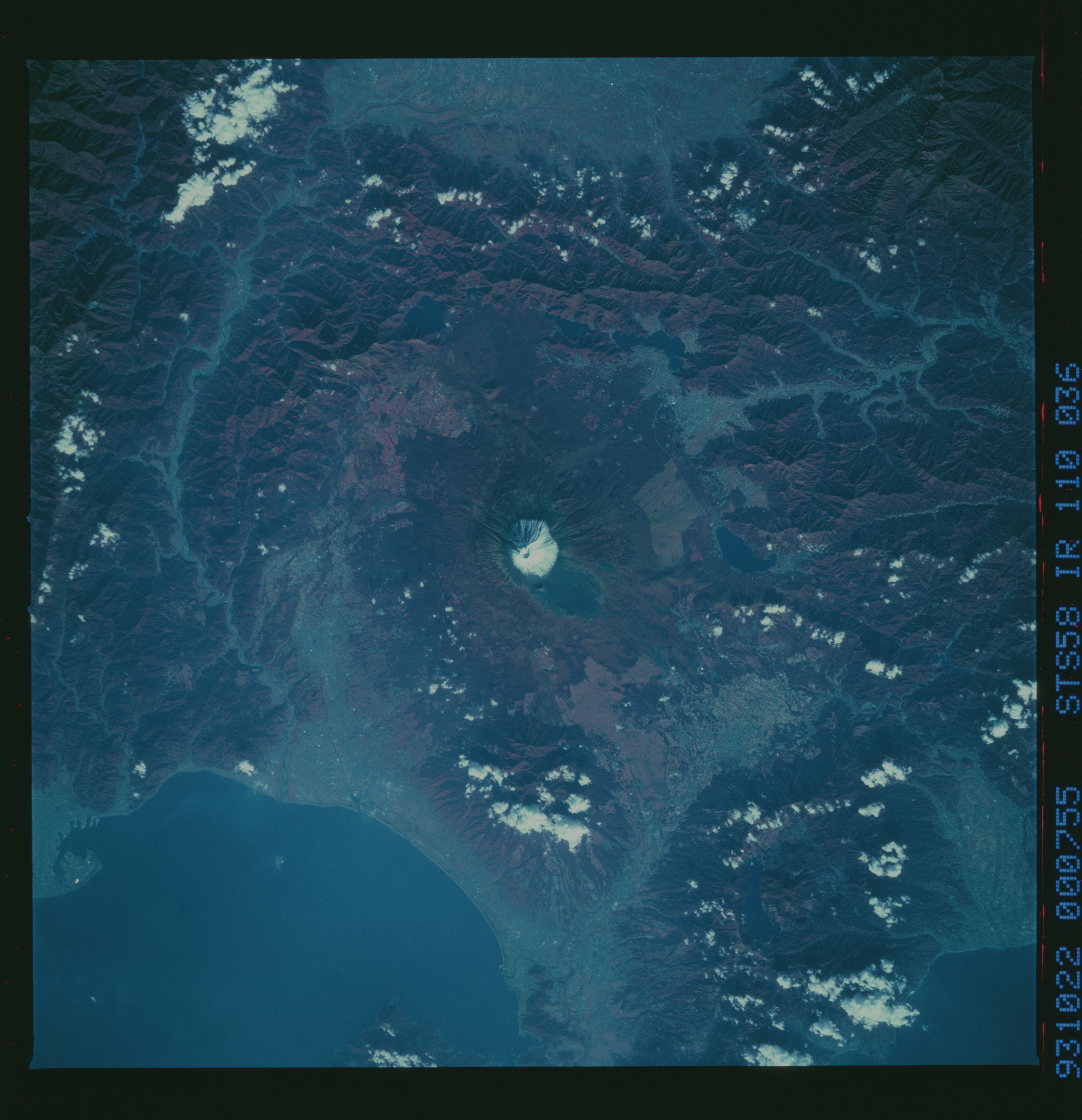
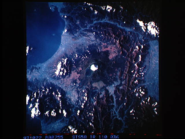
Image Caption: STS058-110-036 Mount Fuji Area, Honshu, Japan October 1993
Located approximately 60 miles (95 km) southwest of Tokyo, Mt. Fuji (snow capped peak, center of image) is Japan's most sacred mountain. Mt. Fuji, an almost symmetrical stratovolcano, is Japan's tallest mountain at 12388 feet (3776 meters) above sea level. Although scattered clouds obscure some of the mountainous terrain in the region, the color infrared image (green vegetation is shown as shades of red) helps to identify the forested, steep sloped mountains. The different shades of red indicate the extent of green vegetation from the forested mountains (deep reds) to the cultivated fields (pinkish colors) in the valleys and along the coast of Suruga Bay (upper right). The Fuji River Valley is visible (linear, light colored feature) as it passes through a mountainous area near the western side of the volcano (right side of image). The pink area at the bottom (center) of the image is part of the Kofu Valley. The angular-looking, lighter-colored landscape on the flanks of Fuji Volcano is the result of clear cutting logging operations.
Located approximately 60 miles (95 km) southwest of Tokyo, Mt. Fuji (snow capped peak, center of image) is Japan's most sacred mountain. Mt. Fuji, an almost symmetrical stratovolcano, is Japan's tallest mountain at 12388 feet (3776 meters) above sea level. Although scattered clouds obscure some of the mountainous terrain in the region, the color infrared image (green vegetation is shown as shades of red) helps to identify the forested, steep sloped mountains. The different shades of red indicate the extent of green vegetation from the forested mountains (deep reds) to the cultivated fields (pinkish colors) in the valleys and along the coast of Suruga Bay (upper right). The Fuji River Valley is visible (linear, light colored feature) as it passes through a mountainous area near the western side of the volcano (right side of image). The pink area at the bottom (center) of the image is part of the Kofu Valley. The angular-looking, lighter-colored landscape on the flanks of Fuji Volcano is the result of clear cutting logging operations.
