STS058-104-74

| NASA Photo ID | STS058-104-74 |
| Focal Length | 250mm |
| Date taken | 1993.10.27 |
| Time taken | 16:56:52 GMT |

Cloud masks available for this image:
Spacecraft nadir point: 3.7° N, 46.3° W
Photo center point: 1.0° N, 50.0° W
Photo center point by machine learning:
Photo center point: 1.0° N, 50.0° W
Photo center point by machine learning:
Nadir to Photo Center: Southwest
Spacecraft Altitude: 150 nautical miles (278km)
Country or Geographic Name: | BRAZIL |
Features: | PAN-AMAZON R. MOUTH, TAIL |
| Features Found Using Machine Learning: | |
Cloud Cover Percentage: | 75 (51-75)% |
Sun Elevation Angle: | 54° |
Sun Azimuth: | 242° |
Camera: | Hasselblad |
Focal Length: | 250mm |
Camera Tilt: | High Oblique |
Format: | 5017: Kodak, natural color positive, Ektachrome, X Professional, ASA 64, standard base |
Film Exposure: | Normal |
| Additional Information | |
| Width | Height | Annotated | Cropped | Purpose | Links |
|---|---|---|---|---|---|
| 5700 pixels | 5900 pixels | No | No | Download Image | |
| 500 pixels | 518 pixels | No | No | Download Image | |
| 640 pixels | 480 pixels | No | No | Download Image |
Download Packaged File
Download a Google Earth KML for this Image
View photo footprint information
Download a GeoTIFF for this photo
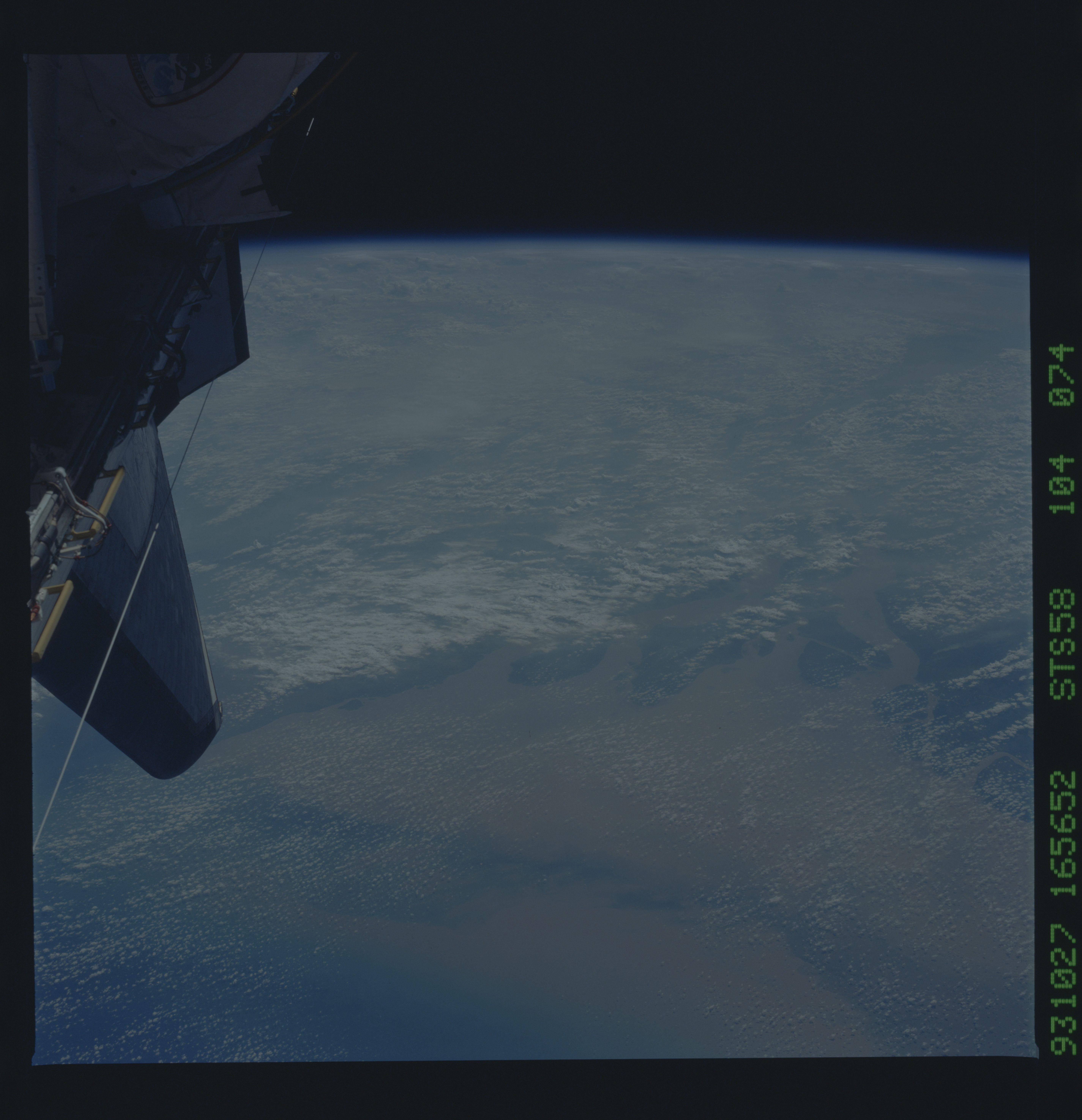
Image Caption: Near nadir view of sediment from the Amazon river delta
Coastal and river discharge areas around the world are being
studied for a number of reasons by the National Oceanic and
Atmospheric Administration (NOAA), the National Science
Foundation (NSF), Navy research and development offices (e.g., ONR),
and various international organizations. The South American
coast and river outflows, primarily from the Amazon and the Orinoco,
are being studied to determine (1) the degree to which
biological productivity has been enhanced in areas receiving river
discharge, (2) the impact on water quality (especially demand for
dissolved oxygen) of this nutrient-enhanced productivity, (3) the fate of carbon fixed in highly productive coastal areas of the
outflow region and the subsequent impact of this enhanced
productivity on living resources. These three items being studied are part of larger research efforts to model hypoxia and study carbon
flux in the shelf waters. This photo shows the distribution of
sediment from the Amazon river. The dark line through the sediment
plume appears to be caused by the current. Why the current
only covers that small swath remains to be determined.
