STS057-80-92
| NASA Photo ID | STS057-80-92 |
| Focal Length | 100mm |
| Date taken | 1993.06.26 |
| Time taken | 19:54:22 GMT |

Cloud masks available for this image:
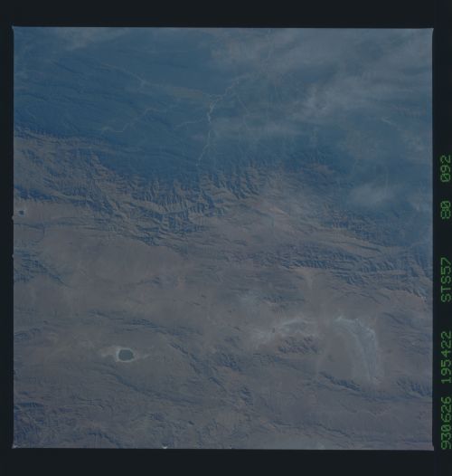
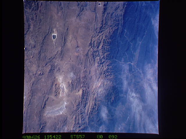
Spacecraft nadir point: 22.4° S, 67.3° W
Photo center point: 23.0° S, 65.5° W
Photo center point by machine learning:
Photo center point: 23.0° S, 65.5° W
Photo center point by machine learning:
Nadir to Photo Center: East
Spacecraft Altitude: 258 nautical miles (478km)
Country or Geographic Name: | ARGENTINA |
Features: | CORDILLERA CENTRAL |
| Features Found Using Machine Learning: | |
Cloud Cover Percentage: | 5 (1-10)% |
Sun Elevation Angle: | 23° |
Sun Azimuth: | 310° |
Camera: | Hasselblad |
Focal Length: | 100mm |
Camera Tilt: | 24 degrees |
Format: | 5017: Kodak, natural color positive, Ektachrome, X Professional, ASA 64, standard base |
Film Exposure: | Normal |
| Additional Information | |
| Width | Height | Annotated | Cropped | Purpose | Links |
|---|---|---|---|---|---|
| 5700 pixels | 6000 pixels | No | No | Download Image | |
| 500 pixels | 526 pixels | No | No | Download Image | |
| 640 pixels | 480 pixels | No | No | Download Image |
Download Packaged File
Download a Google Earth KML for this Image
View photo footprint information
Download a GeoTIFF for this photo
Image Caption: STS-57 Earth observation taken aboard Endeavour, Orbiter Vehicle (OV) 105, is of Rio Bermejo Development area in northwest Argentina. Astronaut photographs of agricultural development in the area of the Rio Bermejo in northwestern Argentina (called "Rio Teuco" in the lowlands of Argentina) support scientific studies of one of the 600 global environmental sites monitored by the Space Shuttle Earth Observations Project. Photographs of the Rio Bermejo headwaters and the hardwood forests of the East Andes began with STS-7 in June 1983. The 10-year record of this site leads NASA researchers to estimate that the area of former Andean closed-canopy forest now converted to ranching and agriculture in these river valleys has doubled over the past decade. Also evident in this photograph are secondary impacts from this regional forest conversion, including increased soil erosion, increased stream turbity, secondary stream anastomosing, and stream widening.
