STS057-72-52
| NASA Photo ID | STS057-72-52 |
| Focal Length | 100mm |
| Date taken | 1993.06.22 |
| Time taken | 12:27:20 GMT |
Cloud masks available for this image:
Spacecraft nadir point: 27.0° N, 81.4° W
Photo center point: 28.5° N, 80.5° W
Photo center point by machine learning:
Photo center point: 28.5° N, 80.5° W
Photo center point by machine learning:
Nadir to Photo Center: Northeast
Spacecraft Altitude: 221 nautical miles (409km)
Country or Geographic Name: | USA-FLORIDA |
Features: | CAPE CANAVERAL, COAST |
| Features Found Using Machine Learning: | |
Cloud Cover Percentage: | 25 (11-25)% |
Sun Elevation Angle: | 23° |
Sun Azimuth: | 74° |
Camera: | Hasselblad |
Focal Length: | 100mm |
Camera Tilt: | 25 degrees |
Format: | 5017: Kodak, natural color positive, Ektachrome, X Professional, ASA 64, standard base |
Film Exposure: | Normal |
| Additional Information | |
| Width | Height | Annotated | Cropped | Purpose | Links |
|---|---|---|---|---|---|
| 5700 pixels | 6000 pixels | No | No | Download Image | |
| 500 pixels | 526 pixels | No | No | Download Image | |
| 640 pixels | 480 pixels | No | No | Download Image |
Download Packaged File
Download a Google Earth KML for this Image
View photo footprint information
Download a GeoTIFF for this photo
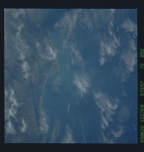
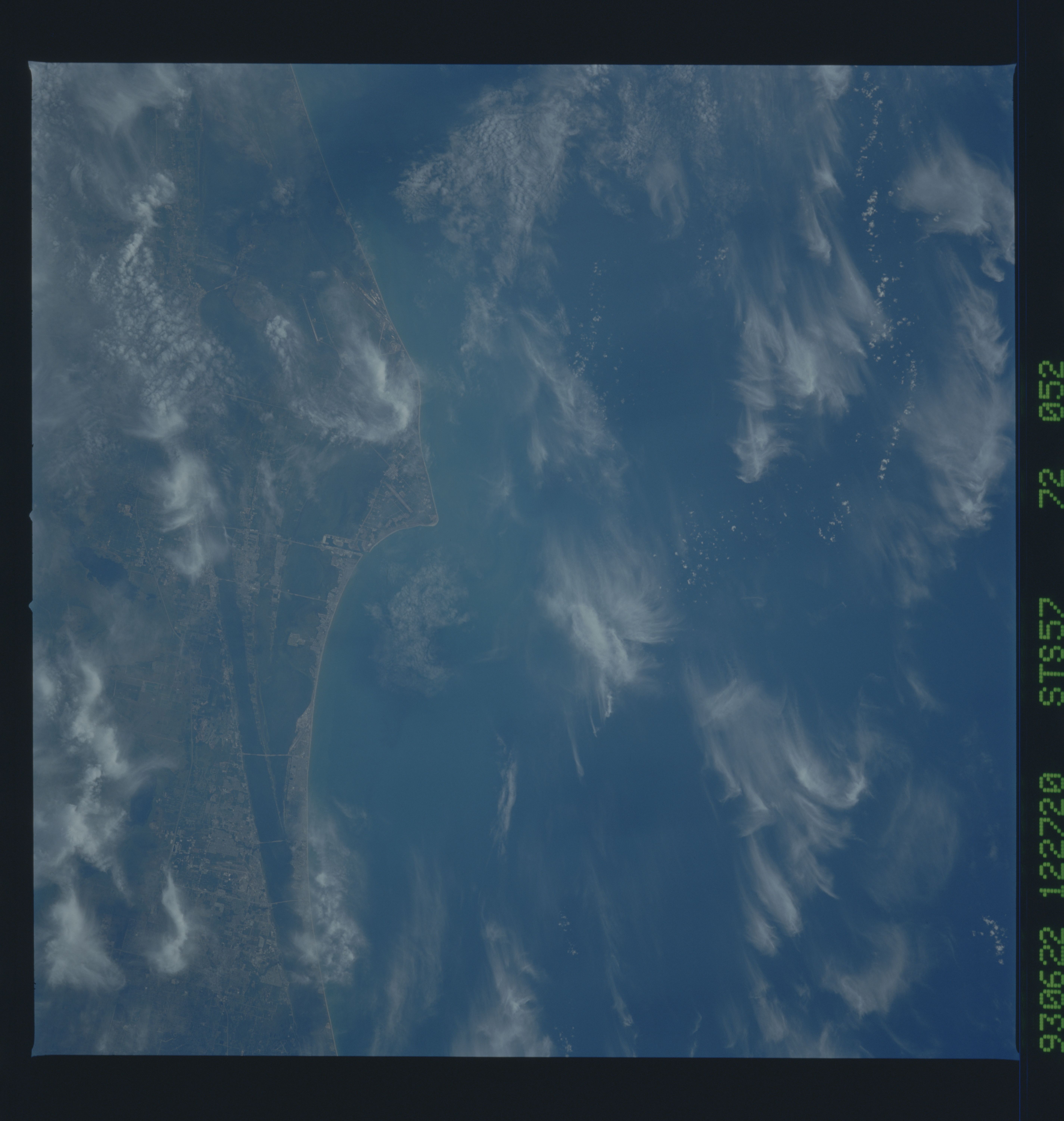
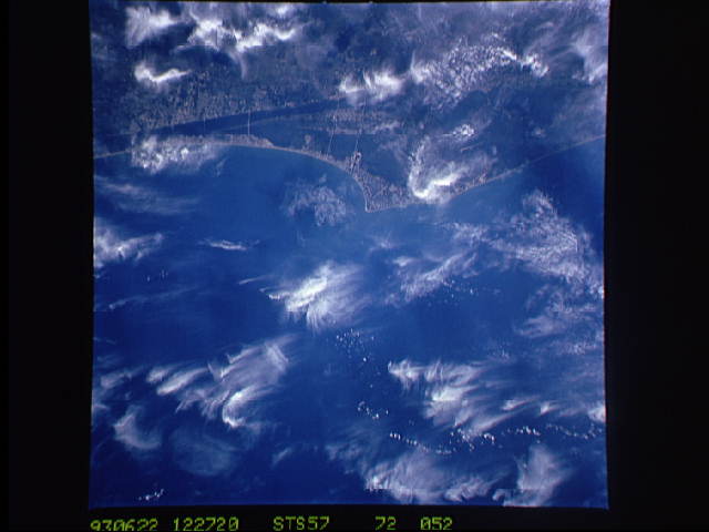
Image Caption: STS-57 Earth observation taken aboard Endeavour, Orbiter Vehicle (OV) 105, is of the Kennedy Space Center (KSC) in Florida. Even though it contains a large number of wispy cirrus clouds, this photograph of KSC and environs clearly reveals many significant features. Mosquito Lagoon, an elongated body of water, can be seen just to the north of the KSC site. The Indian River and the much shorter Banana River are seen. The Florida mainland is connected to the narrow barrier island by many causeways and bridges. The ocean front communities of Cape Canaveral, Cocoa Beach and Melbourne Beach extend southward from KSC. Within the space center, launch pads, shuttle servicing facilities and the administration building are clearly visible. The shuttle landing facility (SLF) is seen immediately northwest of the main KSC complex.
