STS057-106-56
| NASA Photo ID | STS057-106-56 |
| Focal Length | 250mm |
| Date taken | 1993.06.30 |
| Time taken | 16:49:06 GMT |
Resolutions offered for this image:
4037 x 4085 pixels 632 x 640 pixels 5700 x 6000 pixels 500 x 526 pixels 640 x 480 pixels
4037 x 4085 pixels 632 x 640 pixels 5700 x 6000 pixels 500 x 526 pixels 640 x 480 pixels

Cloud masks available for this image:
Spacecraft nadir point: 11.9° S, 78.3° W
Photo center point: 11.0° S, 76.0° W
Photo center point by machine learning:
Photo center point: 11.0° S, 76.0° W
Photo center point by machine learning:
Nadir to Photo Center: East
Spacecraft Altitude: 239 nautical miles (443km)
Country or Geographic Name: | PERU |
Features: | JUNIN LAKE |
| Features Found Using Machine Learning: | |
Cloud Cover Percentage: | 5 (1-10)% |
Sun Elevation Angle: | 54° |
Sun Azimuth: | 11° |
Camera: | Hasselblad |
Focal Length: | 250mm |
Camera Tilt: | 32 degrees |
Format: | 2443: Kodak Aerochrome 2443, color IR, thin base, EA-5 process thru June 1999, E-6 process afterward |
Film Exposure: | Normal |
| Additional Information | |
| Width | Height | Annotated | Cropped | Purpose | Links |
|---|---|---|---|---|---|
| 4037 pixels | 4085 pixels | No | No | Earth From Space collection | Download Image |
| 632 pixels | 640 pixels | No | No | Earth From Space collection | Download Image |
| 5700 pixels | 6000 pixels | No | No | Download Image | |
| 500 pixels | 526 pixels | No | No | Download Image | |
| 640 pixels | 480 pixels | No | No | Download Image |
Download Packaged File
Download a Google Earth KML for this Image
View photo footprint information
Download a GeoTIFF for this photo
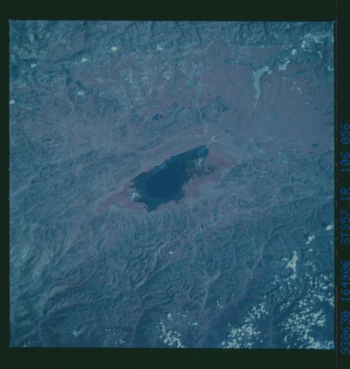
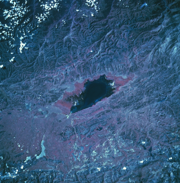
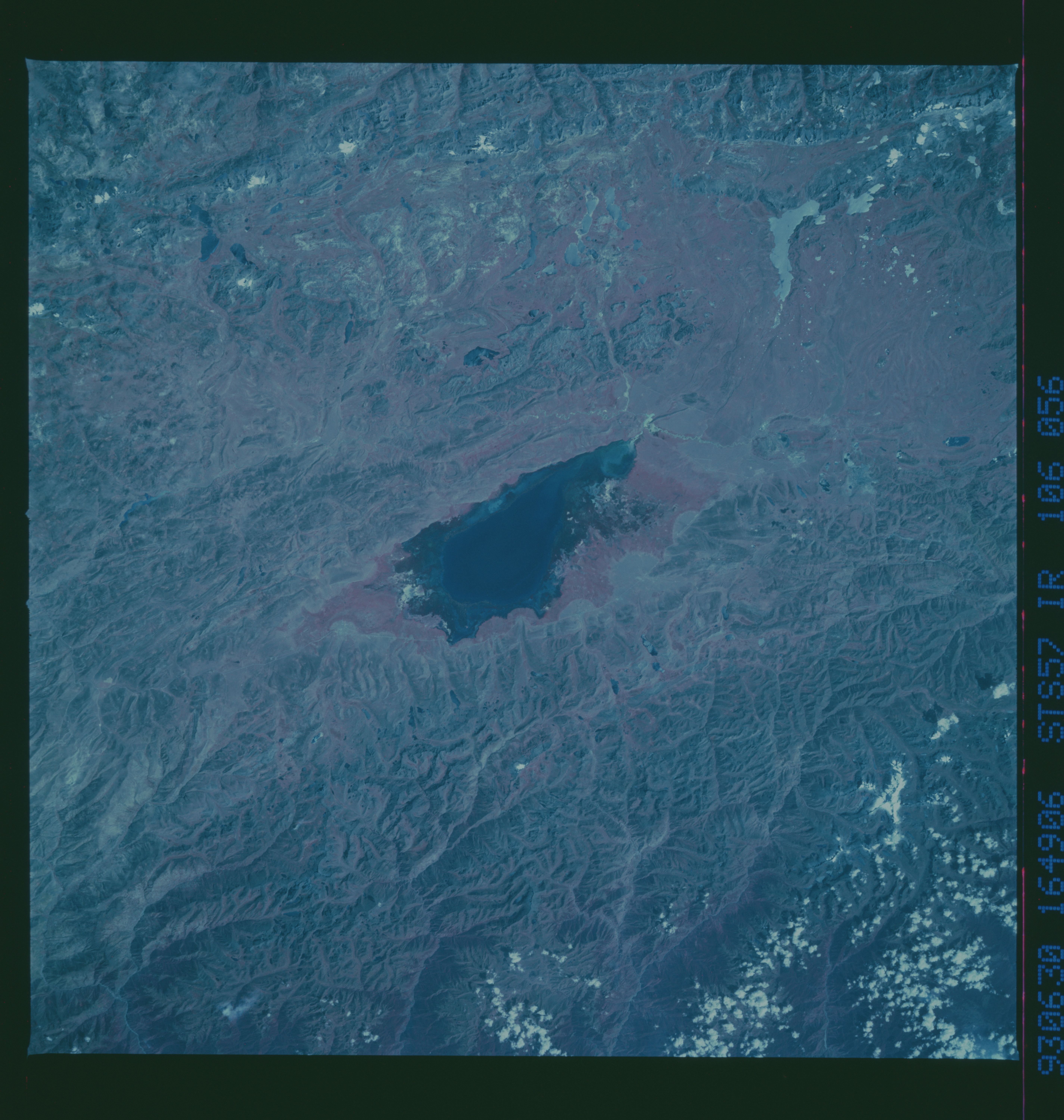
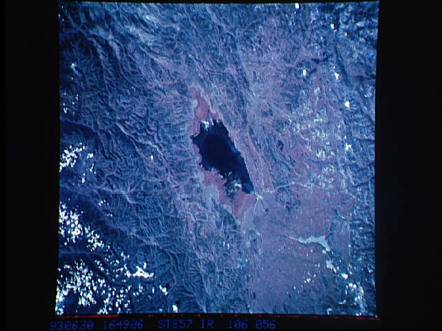
Image Caption: STS057-106-056 Lake Junin, Andes Mountains, Peru June 1993
The dark feature in the center of the color infrared image is Lake Junin. Located at approximately 13393 feet (4082 meters) above sea level, Lake Junin is about 90 miles (145 kilometers) northeast of Lima in the Andes Mountains. Numerous erosional stream channels and deep canyons are visible at the top (northeast) of the image. The rivers drain eastward and eventually flow into the Amazon Basin of eastern Peru. Notice that there is a redder border that encircles three-quarters of the lake (except the southwest coast). This is an indication that healthy green vegetation (green, chlorophyll-bearing vegetation is portrayed as reddish hues in color infrared images) can be mapped around most of the periphery of the lake. The lake measures roughly 25 miles (40 kilometers) in length and approximately 9 miles (15 kilometers) in width. Some of the mountainous terrain immediately southwest of the lake shows an intensively folded, northwest- aligned landscape.
The dark feature in the center of the color infrared image is Lake Junin. Located at approximately 13393 feet (4082 meters) above sea level, Lake Junin is about 90 miles (145 kilometers) northeast of Lima in the Andes Mountains. Numerous erosional stream channels and deep canyons are visible at the top (northeast) of the image. The rivers drain eastward and eventually flow into the Amazon Basin of eastern Peru. Notice that there is a redder border that encircles three-quarters of the lake (except the southwest coast). This is an indication that healthy green vegetation (green, chlorophyll-bearing vegetation is portrayed as reddish hues in color infrared images) can be mapped around most of the periphery of the lake. The lake measures roughly 25 miles (40 kilometers) in length and approximately 9 miles (15 kilometers) in width. Some of the mountainous terrain immediately southwest of the lake shows an intensively folded, northwest- aligned landscape.
