STS057-104-63
| NASA Photo ID | STS057-104-63 |
| Focal Length | 250mm |
| Date taken | 1993.06.28 |
| Time taken | 10:31:23 GMT |
Resolutions offered for this image:
5303 x 5303 pixels 640 x 640 pixels 5700 x 6000 pixels 500 x 526 pixels 640 x 480 pixels
5303 x 5303 pixels 640 x 640 pixels 5700 x 6000 pixels 500 x 526 pixels 640 x 480 pixels

Cloud masks available for this image:
Spacecraft nadir point: 8.7° S, 27.6° E
Photo center point: 9.5° S, 28.5° E
Photo center point by machine learning:
Photo center point: 9.5° S, 28.5° E
Photo center point by machine learning:
Nadir to Photo Center: Southeast
Spacecraft Altitude: 246 nautical miles (456km)
Country or Geographic Name: | ZAMBIA |
Features: | LAKE MWERU SOUTH END |
| Features Found Using Machine Learning: | |
Cloud Cover Percentage: | 0 (no clouds present) |
Sun Elevation Angle: | 58° |
Sun Azimuth: | 352° |
Camera: | Hasselblad |
Focal Length: | 250mm |
Camera Tilt: | 16 degrees |
Format: | 2443: Kodak Aerochrome 2443, color IR, thin base, EA-5 process thru June 1999, E-6 process afterward |
Film Exposure: | Normal |
| Additional Information | |
| Width | Height | Annotated | Cropped | Purpose | Links |
|---|---|---|---|---|---|
| 5303 pixels | 5303 pixels | No | No | Earth From Space collection | Download Image |
| 640 pixels | 640 pixels | No | No | Earth From Space collection | Download Image |
| 5700 pixels | 6000 pixels | No | No | Download Image | |
| 500 pixels | 526 pixels | No | No | Download Image | |
| 640 pixels | 480 pixels | No | No | Download Image |
Download Packaged File
Download a Google Earth KML for this Image
View photo footprint information
Download a GeoTIFF for this photo
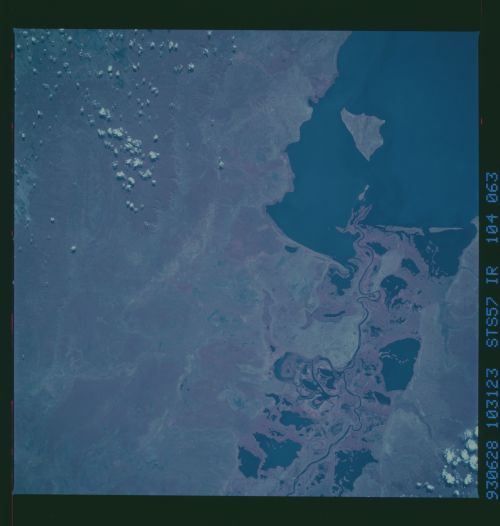
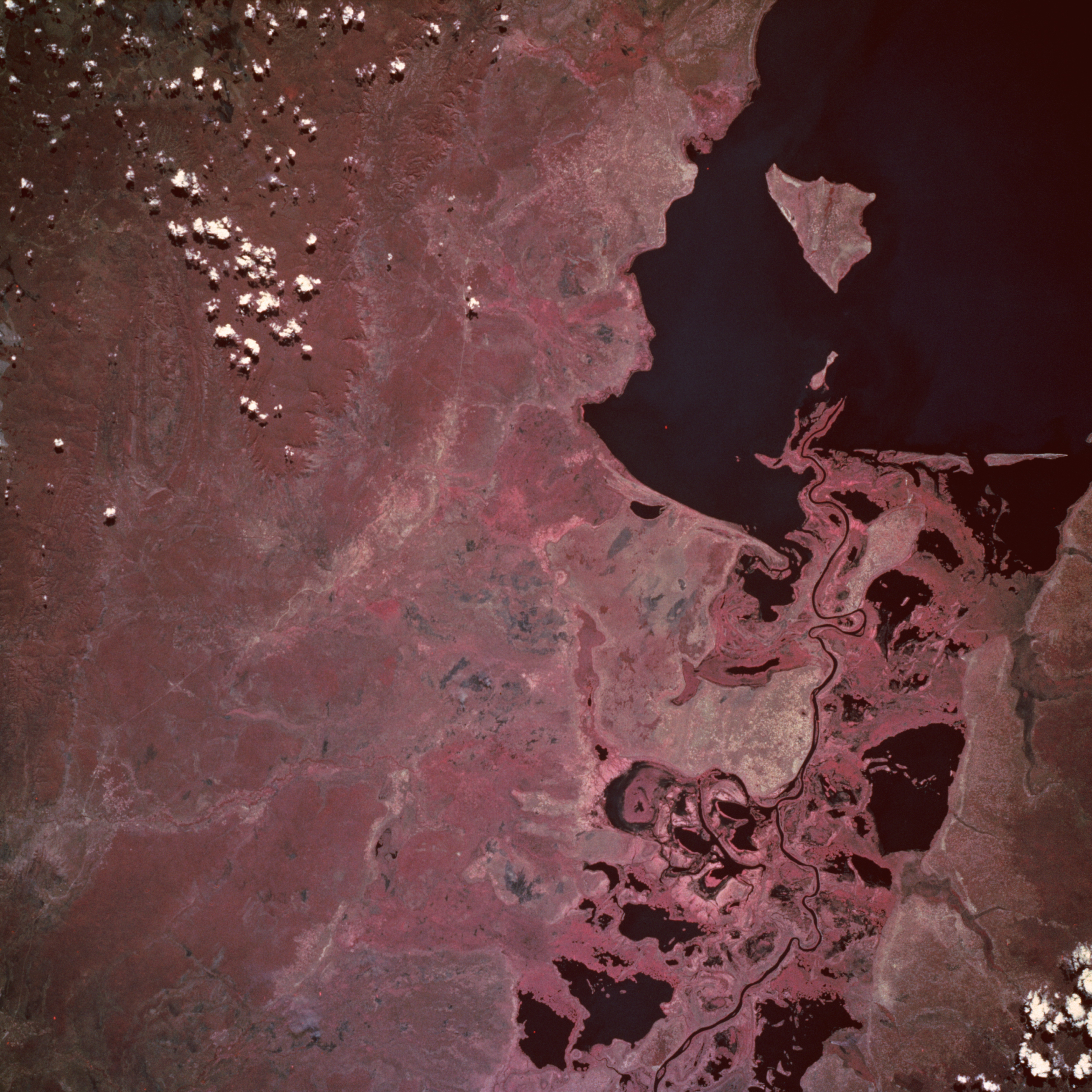
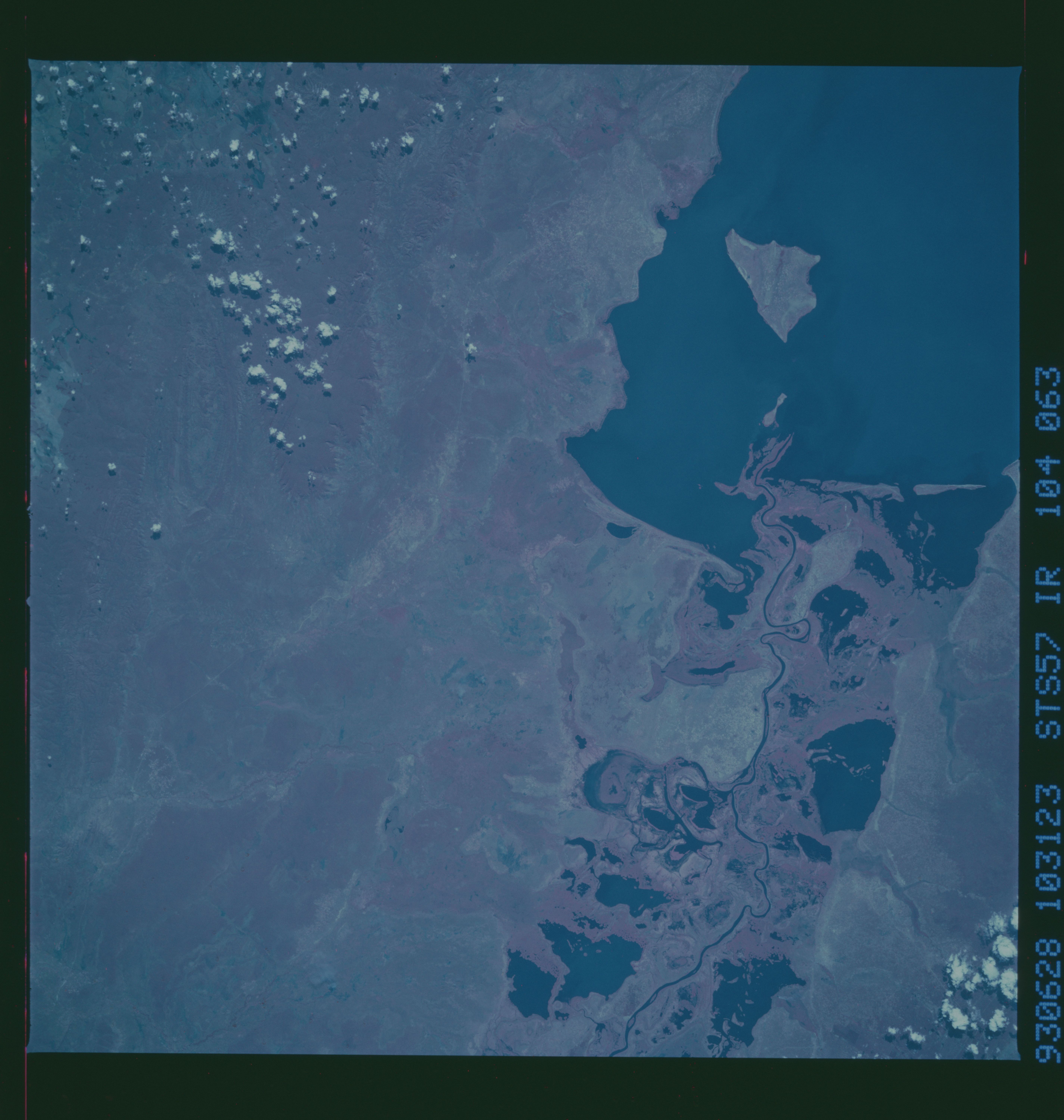
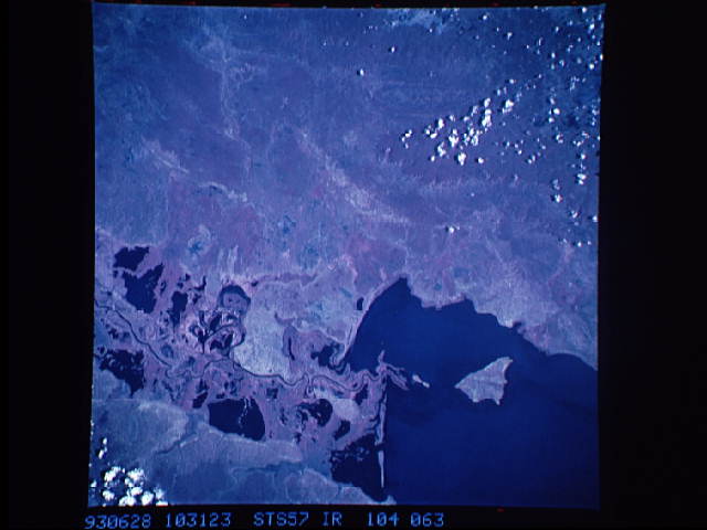
Image Caption: STS057-104-063 Lake Mweru, Zaire and Zambia June 1993
The southern end of Lake Mweru, a large freshwater lake with a maximum depth of at least 80 feet (25 meters), is visible in this near-vertical, color infrared photograph. The lake forms part of the border between Zaire to the west and Zambia to the east. The lake, noted for its large fisheries, is part of the Bangweulu wetland system and the Luapula River, which flows northward through the lake and is a headstream of the Zaire (Congo) River. The Luapula River's main channel, south of the lake, meanders through the swampy floodplain where many open bodies of water are identified as dark features within the heavily vegetated marshland. The roughly triangular lake island near the southern end of Lake Mweru belongs to Zambia. Visible west of the lake is the northern portion of the Kundelungu Mountains, a range of low mountains and escarpments, through which a roadway winds between some of the more elevated landforms. The reddish pink color on color infrared film designates green vegetation and indicates areas with dense foliage south and west of the lake.
The southern end of Lake Mweru, a large freshwater lake with a maximum depth of at least 80 feet (25 meters), is visible in this near-vertical, color infrared photograph. The lake forms part of the border between Zaire to the west and Zambia to the east. The lake, noted for its large fisheries, is part of the Bangweulu wetland system and the Luapula River, which flows northward through the lake and is a headstream of the Zaire (Congo) River. The Luapula River's main channel, south of the lake, meanders through the swampy floodplain where many open bodies of water are identified as dark features within the heavily vegetated marshland. The roughly triangular lake island near the southern end of Lake Mweru belongs to Zambia. Visible west of the lake is the northern portion of the Kundelungu Mountains, a range of low mountains and escarpments, through which a roadway winds between some of the more elevated landforms. The reddish pink color on color infrared film designates green vegetation and indicates areas with dense foliage south and west of the lake.
