STS057-104-62
| NASA Photo ID | STS057-104-62 |
| Focal Length | 250mm |
| Date taken | 1993.06.28 |
| Time taken | 10:31:13 GMT |
Resolutions offered for this image:
5303 x 5303 pixels 640 x 640 pixels 5700 x 6000 pixels 500 x 526 pixels 640 x 480 pixels
5303 x 5303 pixels 640 x 640 pixels 5700 x 6000 pixels 500 x 526 pixels 640 x 480 pixels
Cloud masks available for this image:
Spacecraft nadir point: 8.4° S, 27.1° E
Photo center point: 8.0° S, 27.0° E
Photo center point by machine learning:
Photo center point: 8.0° S, 27.0° E
Photo center point by machine learning:
Nadir to Photo Center: North
Spacecraft Altitude: 246 nautical miles (456km)
Country or Geographic Name: | DEM. REP. OF CONGO |
Features: | LAKE KABAMBA |
| Features Found Using Machine Learning: | |
Cloud Cover Percentage: | 0 (no clouds present) |
Sun Elevation Angle: | 58° |
Sun Azimuth: | 353° |
Camera: | Hasselblad |
Focal Length: | 250mm |
Camera Tilt: | 6 degrees |
Format: | 2443: Kodak Aerochrome 2443, color IR, thin base, EA-5 process thru June 1999, E-6 process afterward |
Film Exposure: | Normal |
| Additional Information | |
| Width | Height | Annotated | Cropped | Purpose | Links |
|---|---|---|---|---|---|
| 5303 pixels | 5303 pixels | No | No | Earth From Space collection | Download Image |
| 640 pixels | 640 pixels | No | No | Earth From Space collection | Download Image |
| 5700 pixels | 6000 pixels | No | No | Download Image | |
| 500 pixels | 526 pixels | No | No | Download Image | |
| 640 pixels | 480 pixels | No | No | Download Image |
Download Packaged File
Download a Google Earth KML for this Image
View photo footprint information
Download a GeoTIFF for this photo
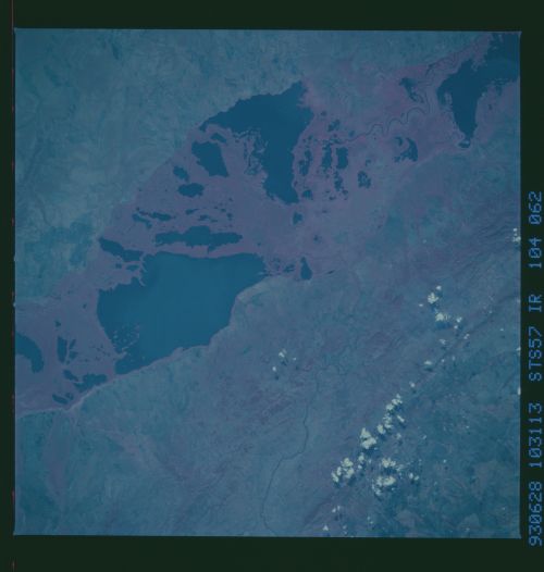
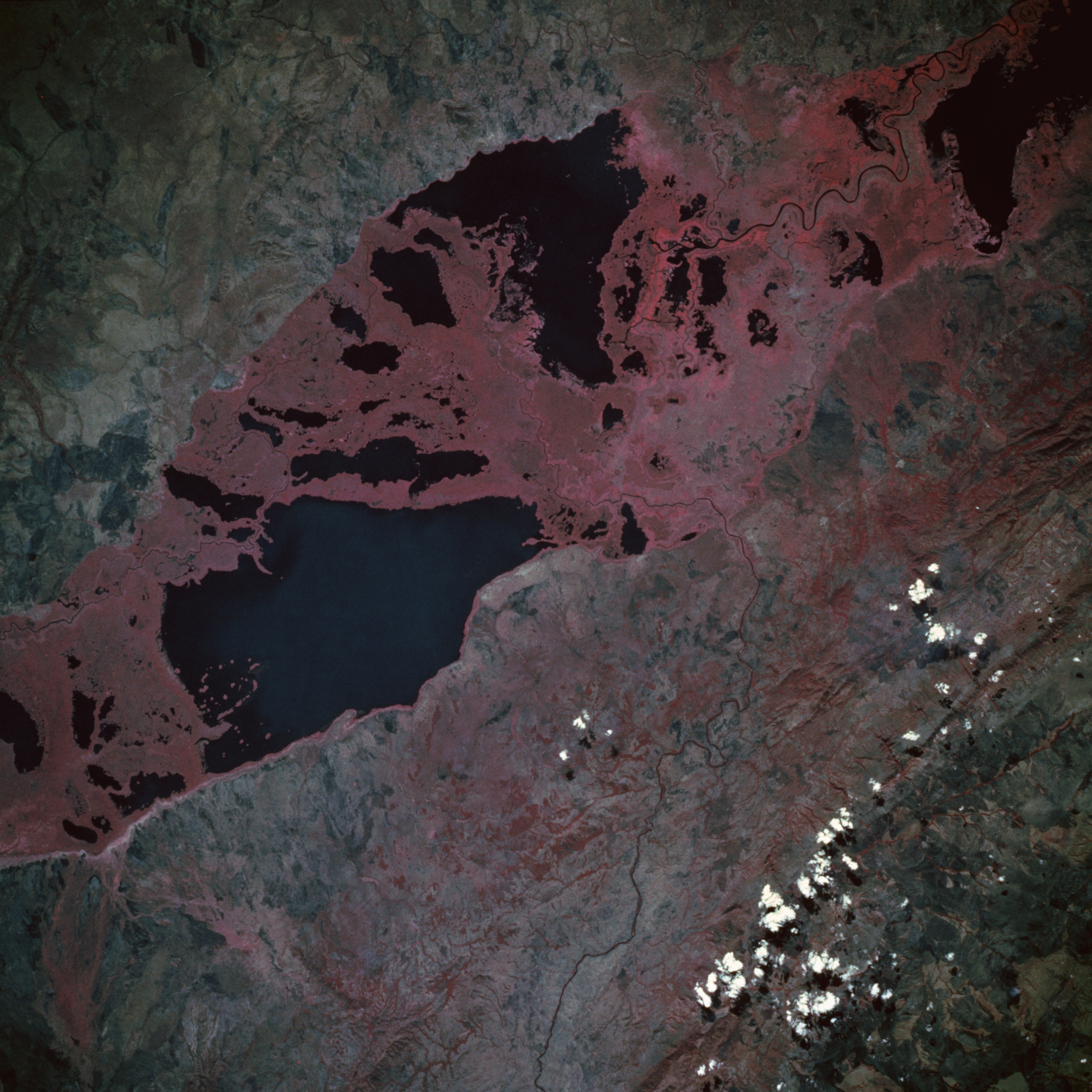
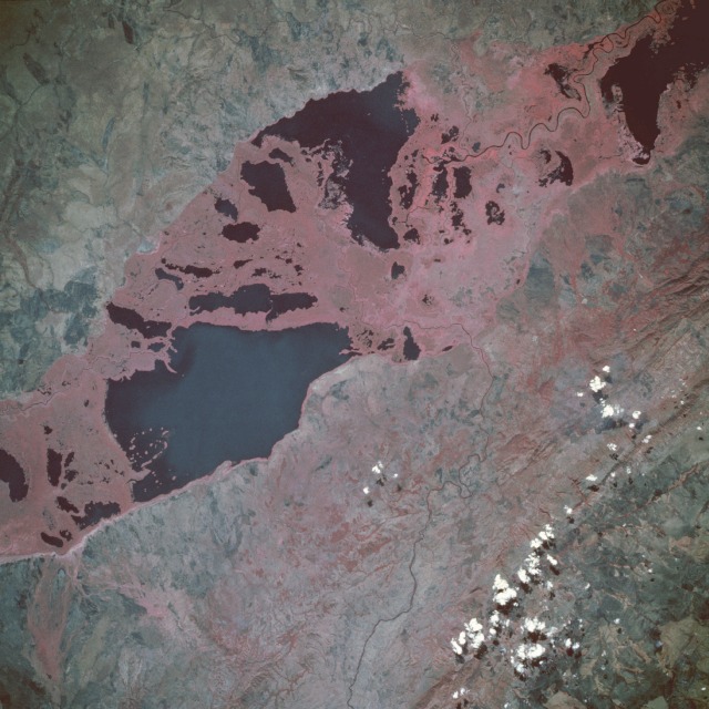
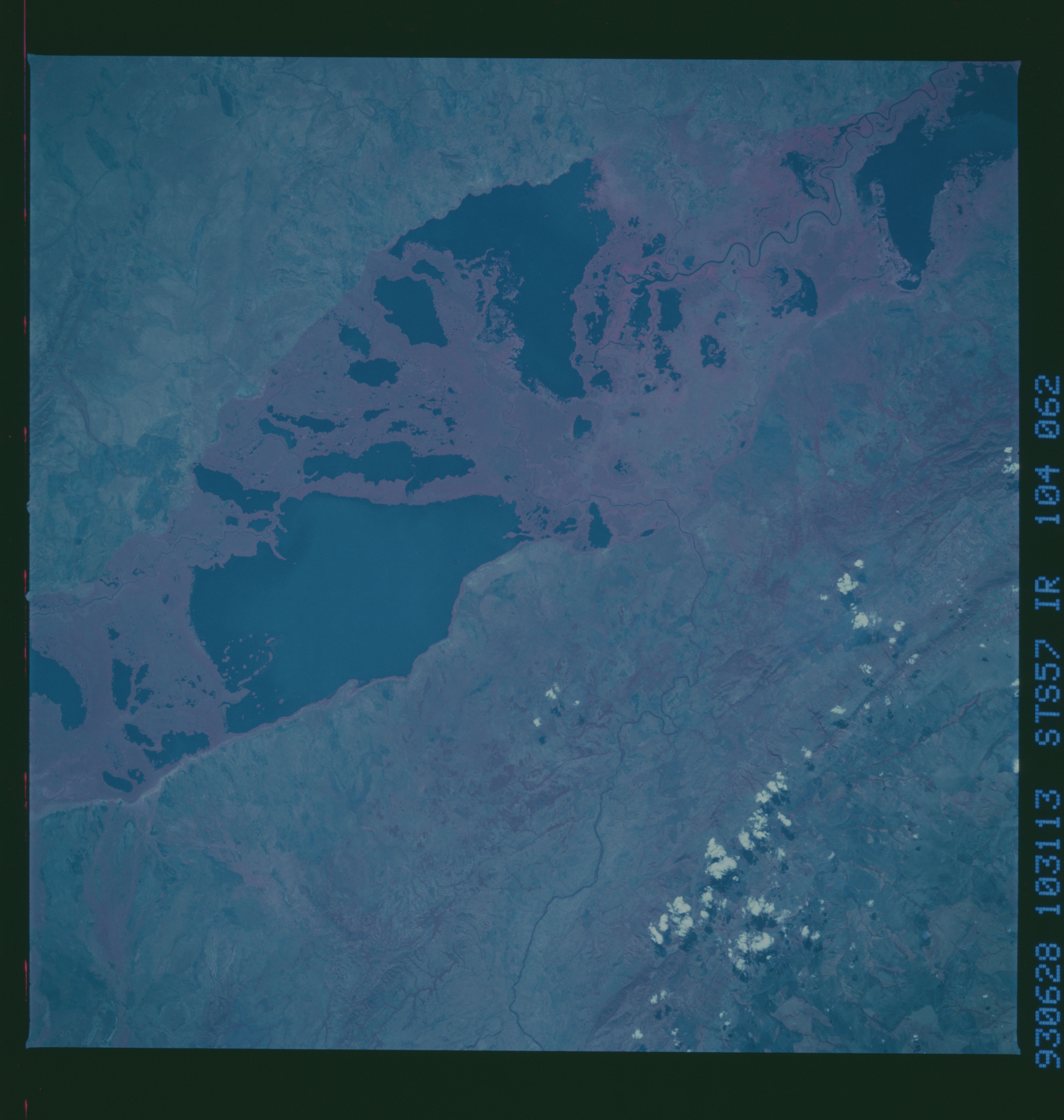
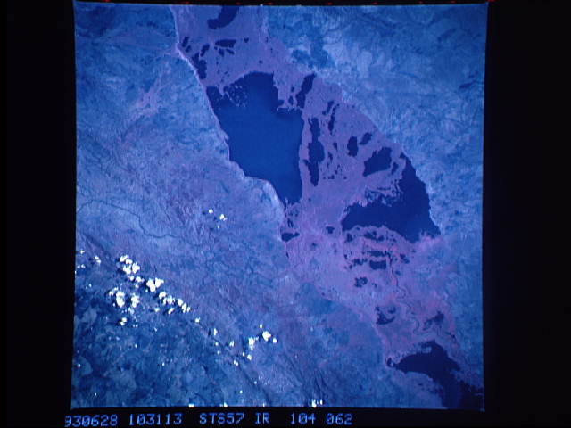
Image Caption: STS057-104-062 Lake Upemba, Zaire June 1993
This striking photograph shows a series of dark freshwater lakes strung together in a general northeast-southwest alignment in southern Zaire. The brilliant red of the color infrared film indicates a vibrant growth of lush vegetation throughout the area, especially in the marshlands separating the lakes. The largest area of open water is Lake Upemba, bordered on the east and southeast by Upemba National Park; specific open water channels are visible within the densely vegetated swampland between the rivers. Water moves through the complex maze of rivers, freshwater marshes, and broad floodplains generally toward the north into the Lualaba River, which eventually becomes the Zaire (Congo) River. The Lufira River winds its way between two northeast-southwest-trending, low mountain ranges as it flows northward into the floodplain. (Refer to STS-057-104-063 for a photograph of Lake Mweru, located due east of Lake Upemba on the Zaire-Zambia border.)
This striking photograph shows a series of dark freshwater lakes strung together in a general northeast-southwest alignment in southern Zaire. The brilliant red of the color infrared film indicates a vibrant growth of lush vegetation throughout the area, especially in the marshlands separating the lakes. The largest area of open water is Lake Upemba, bordered on the east and southeast by Upemba National Park; specific open water channels are visible within the densely vegetated swampland between the rivers. Water moves through the complex maze of rivers, freshwater marshes, and broad floodplains generally toward the north into the Lualaba River, which eventually becomes the Zaire (Congo) River. The Lufira River winds its way between two northeast-southwest-trending, low mountain ranges as it flows northward into the floodplain. (Refer to STS-057-104-063 for a photograph of Lake Mweru, located due east of Lake Upemba on the Zaire-Zambia border.)
