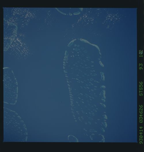
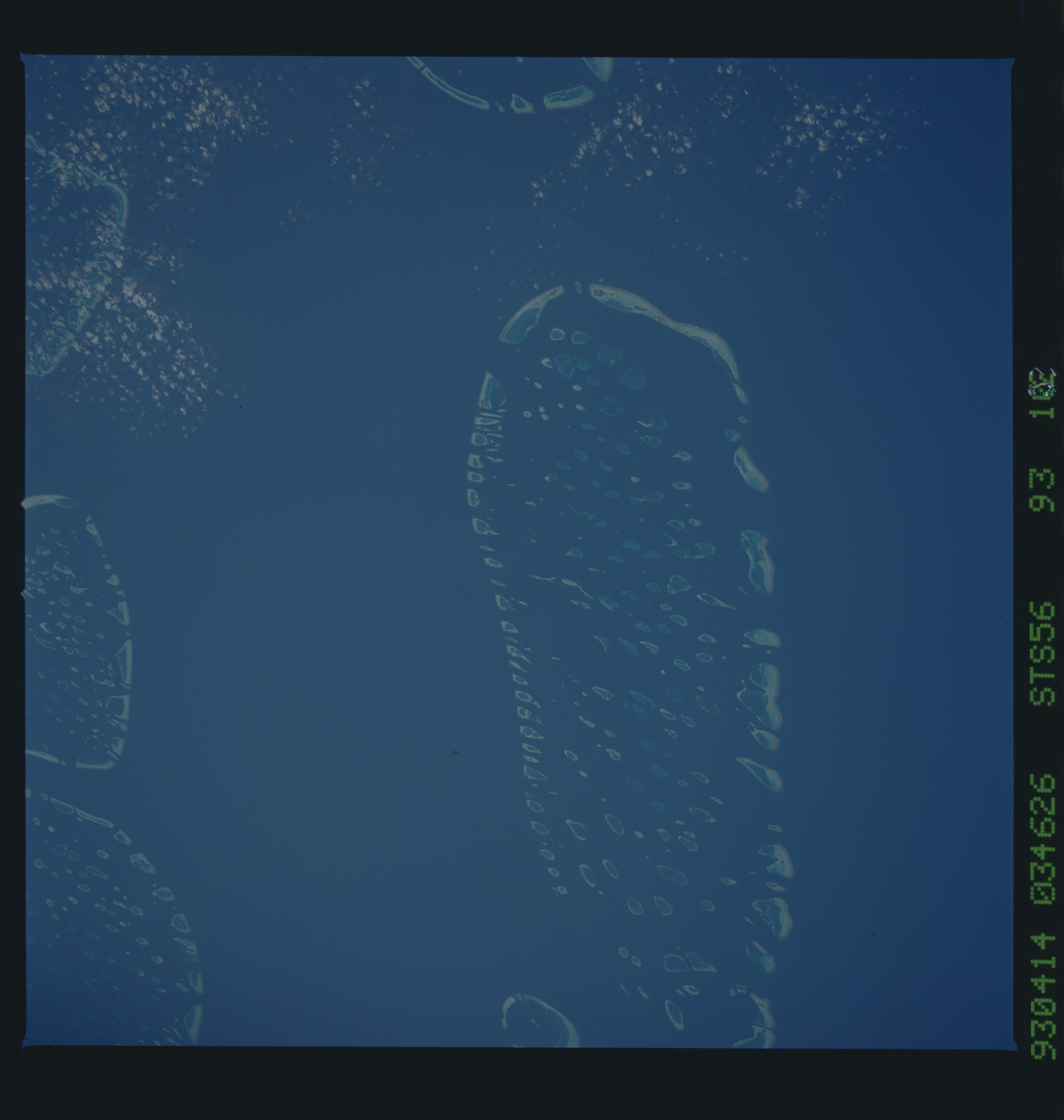
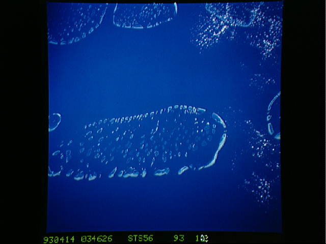
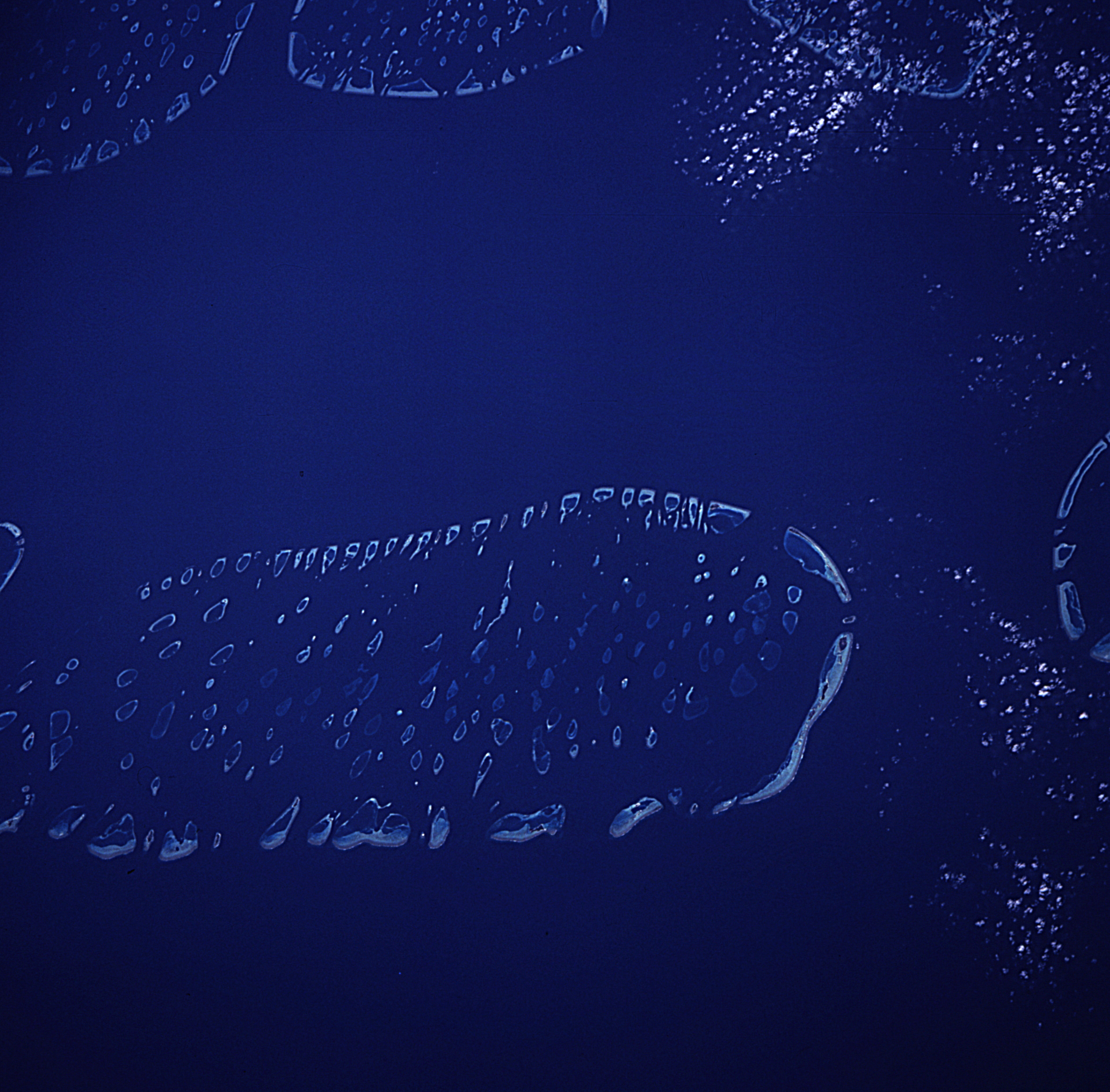
STS056-93-102
| NASA Photo ID | STS056-93-102 |
| Focal Length | 250mm |
| Date taken | 1993.04.14 |
| Time taken | 03:46:26 GMT |
Resolutions offered for this image:
5700 x 6000 pixels 500 x 526 pixels 640 x 480 pixels 5052 x 4970 pixels 5162 x 5124 pixels 2664 x 2487 pixels
5700 x 6000 pixels 500 x 526 pixels 640 x 480 pixels 5052 x 4970 pixels 5162 x 5124 pixels 2664 x 2487 pixels

Cloud masks available for this image:
Spacecraft nadir point: 1.9° N, 71.3° E
Photo center point: 3.5° N, 73.0° E
Photo center point by machine learning:
Photo center point: 3.5° N, 73.0° E
Photo center point by machine learning:
Nadir to Photo Center: Northeast
Spacecraft Altitude: 160 nautical miles (296km)
Country or Geographic Name: | MALDIVES |
Features: | ARI ATOLL |
| Features Found Using Machine Learning: | |
Cloud Cover Percentage: | 5 (1-10)% |
Sun Elevation Angle: | 38° |
Sun Azimuth: | 79° |
Camera: | Hasselblad |
Focal Length: | 250mm |
Camera Tilt: | 41 degrees |
Format: | 5017: Kodak, natural color positive, Ektachrome, X Professional, ASA 64, standard base |
Film Exposure: | Normal |
| Additional Information | |
| Width | Height | Annotated | Cropped | Purpose | Links |
|---|---|---|---|---|---|
| 5700 pixels | 6000 pixels | No | No | Download Image | |
| 500 pixels | 526 pixels | No | No | Download Image | |
| 640 pixels | 480 pixels | No | No | Download Image | |
| 5052 pixels | 4970 pixels | Reef RS | Download Image | ||
| 5162 pixels | 5124 pixels | Yes | Reef RS | Download Image | |
| 2664 pixels | 2487 pixels | No | No | ReefBase 2 | Download Image |
Download Packaged File
Download a Google Earth KML for this Image
View photo footprint information
Download a GeoTIFF for this photo
Image Caption: none
