STS056-90-79

| NASA Photo ID | STS056-90-79 |
| Focal Length | 100mm |
| Date taken | 1993.04.__ |
| Time taken | GMT |
Resolutions offered for this image:
5303 x 5303 pixels 640 x 640 pixels 5700 x 6000 pixels 500 x 526 pixels 640 x 480 pixels
5303 x 5303 pixels 640 x 640 pixels 5700 x 6000 pixels 500 x 526 pixels 640 x 480 pixels
Cloud masks available for this image:
Spacecraft nadir point:
Photo center point: 7.0° N, 0.0° E
Photo center point by machine learning:
Photo center point: 7.0° N, 0.0° E
Photo center point by machine learning:
Nadir to Photo Center:
Spacecraft Altitude: nautical miles (0km)
Country or Geographic Name: | GHANA |
Features: | VOLTA RES., SUNGLINT |
| Features Found Using Machine Learning: | |
Cloud Cover Percentage: | 10 (1-10)% |
Sun Elevation Angle: | ° |
Sun Azimuth: | ° |
Camera: | Hasselblad |
Focal Length: | 100mm |
Camera Tilt: | Low Oblique |
Format: | 5017: Kodak, natural color positive, Ektachrome, X Professional, ASA 64, standard base |
Film Exposure: | Normal |
| Additional Information | |
| Width | Height | Annotated | Cropped | Purpose | Links |
|---|---|---|---|---|---|
| 5303 pixels | 5303 pixels | No | No | Earth From Space collection | Download Image |
| 640 pixels | 640 pixels | No | No | Earth From Space collection | Download Image |
| 5700 pixels | 6000 pixels | No | No | Download Image | |
| 500 pixels | 526 pixels | No | No | Download Image | |
| 640 pixels | 480 pixels | No | No | Download Image |
Download Packaged File
Download a Google Earth KML for this Image
View photo footprint information
Download a GeoTIFF for this photo
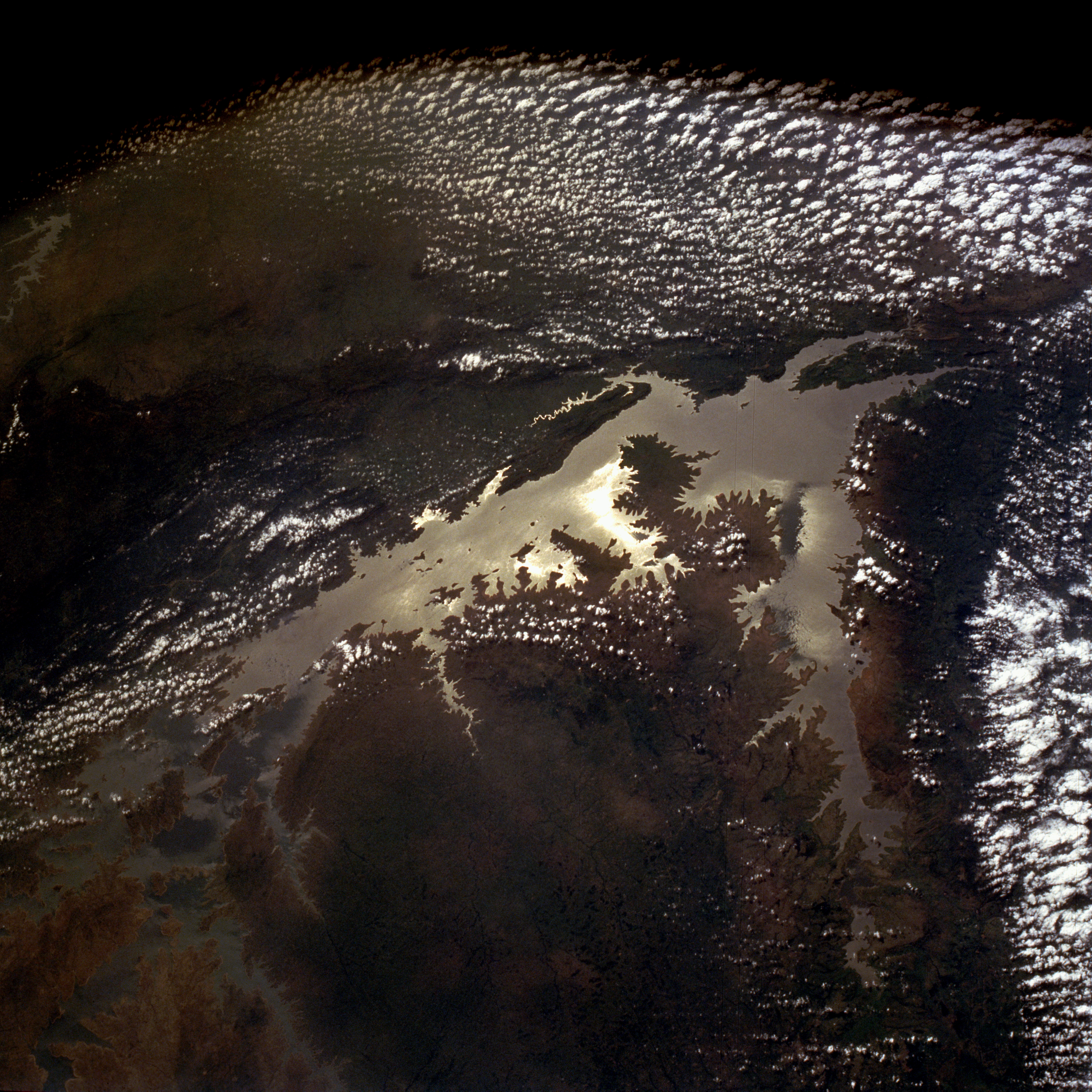
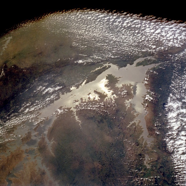
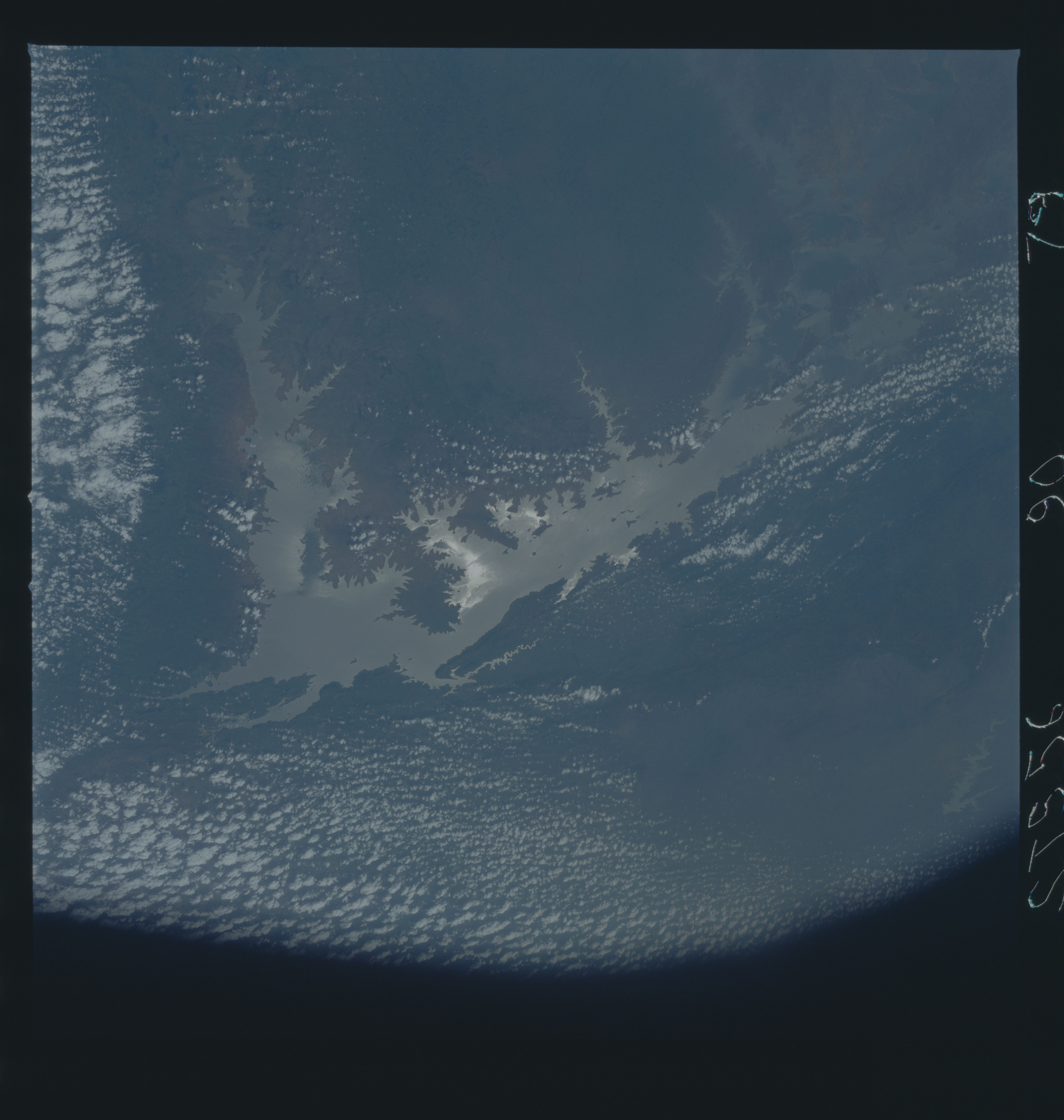
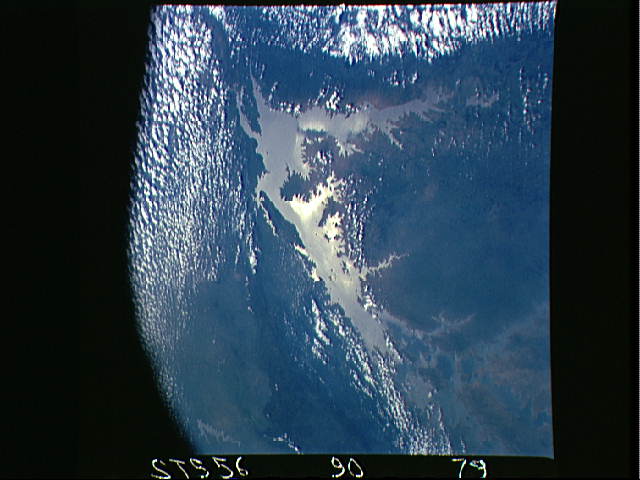
Image Caption: STS056-090-079 Lake Volta, Ghana April 1993
This low-oblique, southeast-looking photograph of Lake Volta (Volta Reservoir) provides a rare opportunity to see almost the entire reservoir with very few obscuring clouds. Lake Volta, one of the world's largest manmade lakes, occupies a large area of southern Ghana--approximately 3275 square miles (8480 square kilometers) 280 miles (450 kilometers) upstream of the Akosombo Dam. Water impounded in this reservoir is used to irrigate crops, regulate the flow of water in Volta River, and generate hydroelectric power that supports an aluminum industry in Ghana. The Sun reflecting off the surface of the water (sunglint) helps identify and map the land-water boundaries.
This low-oblique, southeast-looking photograph of Lake Volta (Volta Reservoir) provides a rare opportunity to see almost the entire reservoir with very few obscuring clouds. Lake Volta, one of the world's largest manmade lakes, occupies a large area of southern Ghana--approximately 3275 square miles (8480 square kilometers) 280 miles (450 kilometers) upstream of the Akosombo Dam. Water impounded in this reservoir is used to irrigate crops, regulate the flow of water in Volta River, and generate hydroelectric power that supports an aluminum industry in Ghana. The Sun reflecting off the surface of the water (sunglint) helps identify and map the land-water boundaries.
