STS056-86-15
| NASA Photo ID | STS056-86-15 |
| Focal Length | 250mm |
| Date taken | 1993.04.12 |
| Time taken | 06:39:52 GMT |
Resolutions offered for this image:
5013 x 5013 pixels 640 x 640 pixels 5700 x 6000 pixels 500 x 526 pixels 640 x 480 pixels 5013 x 5013 pixels
5013 x 5013 pixels 640 x 640 pixels 5700 x 6000 pixels 500 x 526 pixels 640 x 480 pixels 5013 x 5013 pixels

Cloud masks available for this image:
Spacecraft nadir point: 12.3° S, 47.8° E
Photo center point: 12.5° S, 49.9° E
Photo center point by machine learning:
Photo center point: 12.5° S, 49.9° E
Photo center point by machine learning:
Nadir to Photo Center: East
Spacecraft Altitude: 161 nautical miles (298km)
Country or Geographic Name: | MADAGASCAR |
Features: | CAPE AMBRE, DIEGO SUAREZ |
| Features Found Using Machine Learning: | |
Cloud Cover Percentage: | 5 (1-10)% |
Sun Elevation Angle: | 51° |
Sun Azimuth: | 58° |
Camera: | Hasselblad |
Focal Length: | 250mm |
Camera Tilt: | 38 degrees |
Format: | 5017: Kodak, natural color positive, Ektachrome, X Professional, ASA 64, standard base |
Film Exposure: | Normal |
| Additional Information | |
| Width | Height | Annotated | Cropped | Purpose | Links |
|---|---|---|---|---|---|
| 5013 pixels | 5013 pixels | No | No | Earth From Space collection | Download Image |
| 640 pixels | 640 pixels | No | No | Earth From Space collection | Download Image |
| 5700 pixels | 6000 pixels | No | No | Download Image | |
| 500 pixels | 526 pixels | No | No | Download Image | |
| 640 pixels | 480 pixels | No | No | Download Image | |
| 5013 pixels | 5013 pixels | ReefBase pilot | Download Image |
Download Packaged File
Download a Google Earth KML for this Image
View photo footprint information
Download a GeoTIFF for this photo
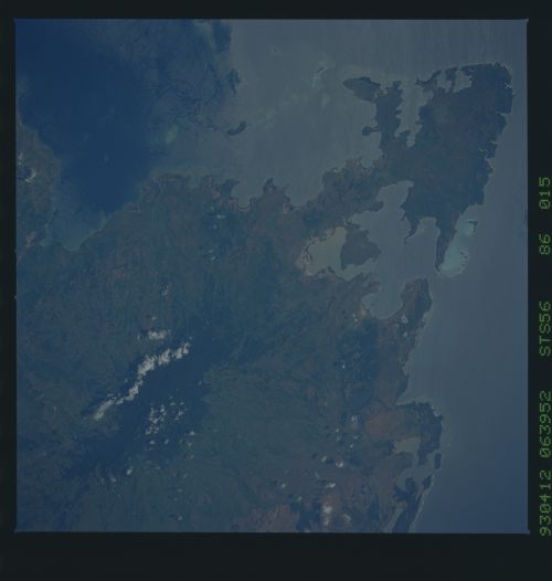
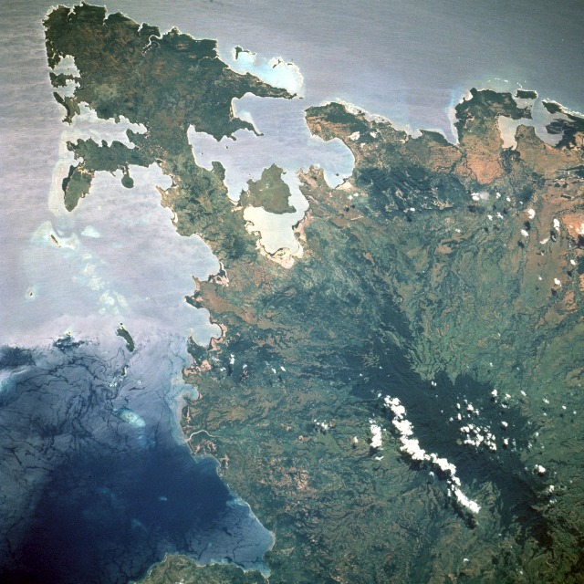
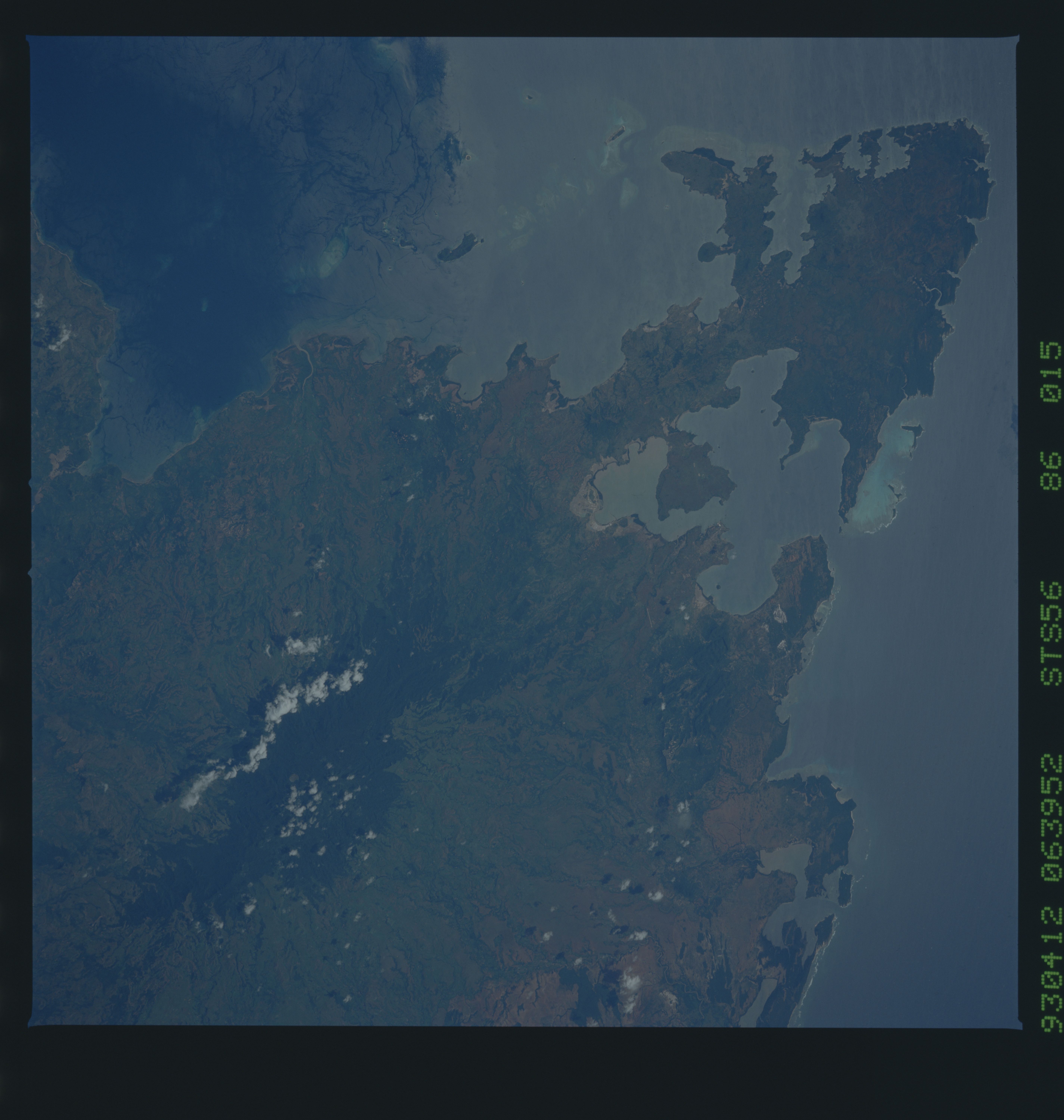
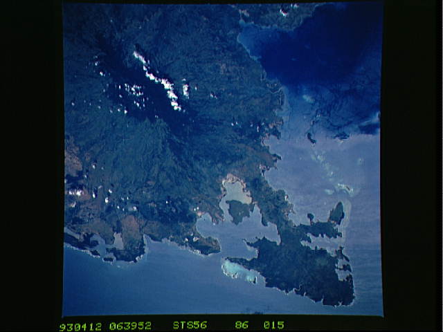
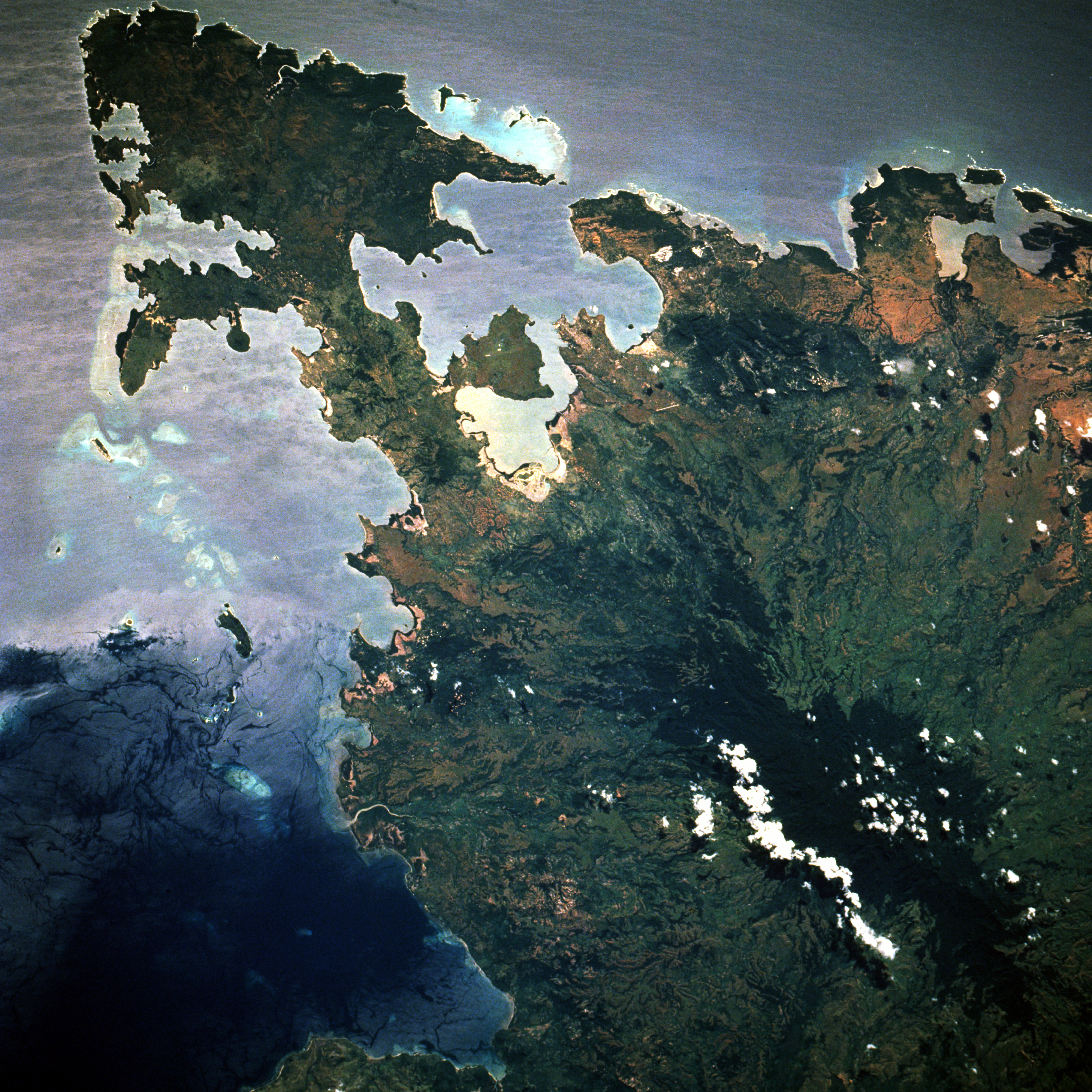
Image Caption: STS056-086-015 Cape d'Ambre, Madagascar April 1993
Cape d'Ambre, the northernmost point of land on Madagascar (the world's fourth largest island), is easily identified by its arrowhead shape. Diégo-Suarez Bay, the large natural bay along the northeast coast, is considered one of the finest natural harbors in the world. The bay, protected by a narrow inlet that provides shelter from strong Indian Ocean winds is believed to be the result of a submerging coastline or drowned river valley that formed many peninsulas around the bay. The very dark southern area is a small vegetated mountain range with elevations that exceed 4000 feet (1220 meters) above sea level. The area, known as the Ankarana Plateau, is composed of limestone rocks. With an average annual rainfall of 70 inches (180 centimeters), the underlying rocks are susceptible to erosion, thereby producing caves and underground streams--a karst topography. The rugged relief and the dense vegetation have helped protect the region from human intrusion.
Cape d'Ambre, the northernmost point of land on Madagascar (the world's fourth largest island), is easily identified by its arrowhead shape. Diégo-Suarez Bay, the large natural bay along the northeast coast, is considered one of the finest natural harbors in the world. The bay, protected by a narrow inlet that provides shelter from strong Indian Ocean winds is believed to be the result of a submerging coastline or drowned river valley that formed many peninsulas around the bay. The very dark southern area is a small vegetated mountain range with elevations that exceed 4000 feet (1220 meters) above sea level. The area, known as the Ankarana Plateau, is composed of limestone rocks. With an average annual rainfall of 70 inches (180 centimeters), the underlying rocks are susceptible to erosion, thereby producing caves and underground streams--a karst topography. The rugged relief and the dense vegetation have helped protect the region from human intrusion.
