STS056-81-21
| NASA Photo ID | STS056-81-21 |
| Focal Length | 100mm |
| Date taken | 1993.04.__ |
| Time taken | GMT |
Resolutions offered for this image:
3862 x 3886 pixels 636 x 640 pixels 5700 x 6000 pixels 500 x 526 pixels 640 x 480 pixels
3862 x 3886 pixels 636 x 640 pixels 5700 x 6000 pixels 500 x 526 pixels 640 x 480 pixels


Cloud masks available for this image:
Spacecraft nadir point:
Photo center point: 21.0° N, 156.5° W
Photo center point by machine learning:
Photo center point: 21.0° N, 156.5° W
Photo center point by machine learning:
Nadir to Photo Center:
Spacecraft Altitude: nautical miles (0km)
Country or Geographic Name: | USA-HAWAII |
Features: | MAUI I., MOLOKAI ISLAND |
| Features Found Using Machine Learning: | |
Cloud Cover Percentage: | 5 (1-10)% |
Sun Elevation Angle: | ° |
Sun Azimuth: | ° |
Camera: | Hasselblad |
Focal Length: | 100mm |
Camera Tilt: | Low Oblique |
Format: | 5017: Kodak, natural color positive, Ektachrome, X Professional, ASA 64, standard base |
Film Exposure: | Normal |
| Additional Information | |
| Width | Height | Annotated | Cropped | Purpose | Links |
|---|---|---|---|---|---|
| 3862 pixels | 3886 pixels | No | No | Earth From Space collection | Download Image |
| 636 pixels | 640 pixels | No | No | Earth From Space collection | Download Image |
| 5700 pixels | 6000 pixels | No | No | Download Image | |
| 500 pixels | 526 pixels | No | No | Download Image | |
| 640 pixels | 480 pixels | No | No | Download Image |
Download Packaged File
Download a Google Earth KML for this Image
View photo footprint information
Download a GeoTIFF for this photo
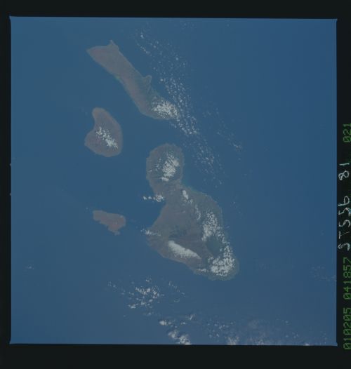
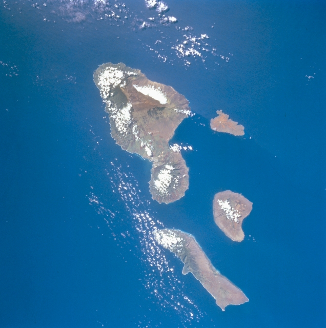
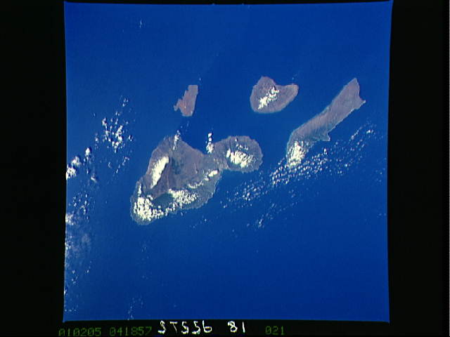
Image Caption: STS056-081-021 Maui, Molokai, Lanai, and Kahoolawe, Hawaii, U.S.A. April 1993
While the physiographic details for each island are not discernible in this synoptic view of Maui, Molokai, Lanai, and Kahoolawe, the impact of higher volcanic mountains on rainfall patterns and amounts is apparent. Darker, more heavily vegetated landscapes appear on the windward-facing slopes. The predominate cloud cover pattern is on the northeast-facing, windward slopes for three of the islands. Kahoolawe appears to be in the rain shadow of Maui, and the mountainous relief of Kahoolawe is not sufficient to produce a dramatic orographic effect.
While the physiographic details for each island are not discernible in this synoptic view of Maui, Molokai, Lanai, and Kahoolawe, the impact of higher volcanic mountains on rainfall patterns and amounts is apparent. Darker, more heavily vegetated landscapes appear on the windward-facing slopes. The predominate cloud cover pattern is on the northeast-facing, windward slopes for three of the islands. Kahoolawe appears to be in the rain shadow of Maui, and the mountainous relief of Kahoolawe is not sufficient to produce a dramatic orographic effect.
