STS056-80-92
| NASA Photo ID | STS056-80-92 |
| Focal Length | 100mm |
| Date taken | 1993.04.10 |
| Time taken | 13:41:50 GMT |
Resolutions offered for this image:
3880 x 3904 pixels 636 x 639 pixels 5700 x 6000 pixels 500 x 526 pixels 640 x 480 pixels
3880 x 3904 pixels 636 x 639 pixels 5700 x 6000 pixels 500 x 526 pixels 640 x 480 pixels

Cloud masks available for this image:
Spacecraft nadir point: 41.5° N, 91.0° W
Photo center point: 43.0° N, 91.0° W
Photo center point by machine learning:
Photo center point: 43.0° N, 91.0° W
Photo center point by machine learning:
Nadir to Photo Center: North
Spacecraft Altitude: 163 nautical miles (302km)
Country or Geographic Name: | USA-WISCONSIN |
Features: | MISSISSIPPI, WISCONSIN R. |
| Features Found Using Machine Learning: | |
Cloud Cover Percentage: | 5 (1-10)% |
Sun Elevation Angle: | 23° |
Sun Azimuth: | 100° |
Camera: | Hasselblad |
Focal Length: | 100mm |
Camera Tilt: | 29 degrees |
Format: | 5017: Kodak, natural color positive, Ektachrome, X Professional, ASA 64, standard base |
Film Exposure: | Normal |
| Additional Information | |
| Width | Height | Annotated | Cropped | Purpose | Links |
|---|---|---|---|---|---|
| 3880 pixels | 3904 pixels | No | No | Earth From Space collection | Download Image |
| 636 pixels | 639 pixels | No | No | Earth From Space collection | Download Image |
| 5700 pixels | 6000 pixels | No | No | Download Image | |
| 500 pixels | 526 pixels | No | No | Download Image | |
| 640 pixels | 480 pixels | No | No | Download Image |
Download Packaged File
Download a Google Earth KML for this Image
View photo footprint information
Download a GeoTIFF for this photo
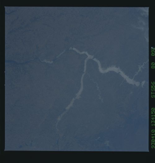
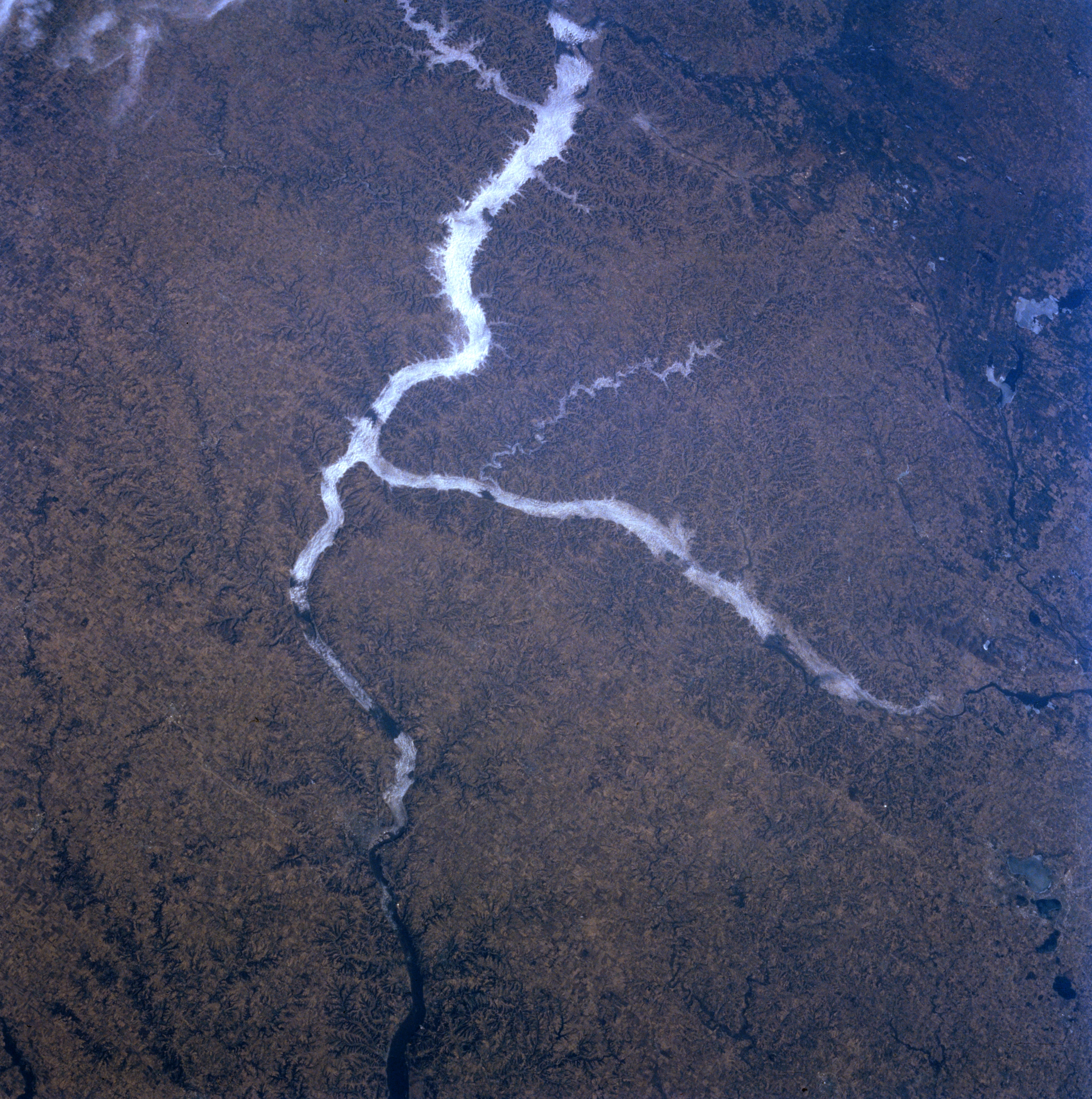
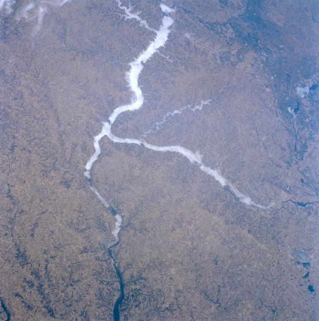
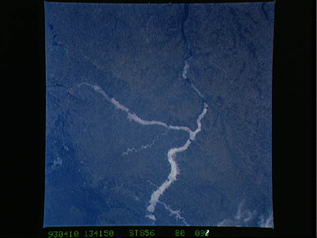
Image Caption: STS056-080-092 Mississippi and Wisconsin Rivers; Driftless Area, Wisconsin, U.S.A. April 1993
The Driftless Area of southwestern Wisconsin, northeastern Iowa, and southeastern Minnesota is discernible in this northwest-looking, low-oblique photograph. Also referred to as the Western Upland, it is generally an agricultural region with residual, well-drained soil--a dissected (eroded) upland. The continental glacier that covered most of the surrounding regions did not touch the Driftless Area, which abounds in hilly, rugged terrain; caves; and sinkholes. Apparent are the Mississippi River Valley as far as south of Dubuque, Iowa (barely discernible near bottom center), and the Wisconsin River, which flows westward to the Mississippi River. Fog is discernible in the valleys of the Mississippi and Wisconsin Rivers and in the smaller Kickapoo River Valley (near center).
The Driftless Area of southwestern Wisconsin, northeastern Iowa, and southeastern Minnesota is discernible in this northwest-looking, low-oblique photograph. Also referred to as the Western Upland, it is generally an agricultural region with residual, well-drained soil--a dissected (eroded) upland. The continental glacier that covered most of the surrounding regions did not touch the Driftless Area, which abounds in hilly, rugged terrain; caves; and sinkholes. Apparent are the Mississippi River Valley as far as south of Dubuque, Iowa (barely discernible near bottom center), and the Wisconsin River, which flows westward to the Mississippi River. Fog is discernible in the valleys of the Mississippi and Wisconsin Rivers and in the smaller Kickapoo River Valley (near center).
