STS056-79-25
| NASA Photo ID | STS056-79-25 |
| Focal Length | 100mm |
| Date taken | 1993.04.10 |
| Time taken | 04:41:00 GMT |
Resolutions offered for this image:
6888 x 6888 pixels 639 x 639 pixels 5700 x 6000 pixels 500 x 526 pixels 640 x 480 pixels 648 x 629 pixels
6888 x 6888 pixels 639 x 639 pixels 5700 x 6000 pixels 500 x 526 pixels 640 x 480 pixels 648 x 629 pixels

Cloud masks available for this image:
Spacecraft nadir point: 37.6° N, 51.3° E
Photo center point: 36.5° N, 51.5° E
Photo center point by machine learning:
Photo center point: 36.5° N, 51.5° E
Photo center point by machine learning:
Nadir to Photo Center: South
Spacecraft Altitude: 163 nautical miles (302km)
Country or Geographic Name: | IRAN |
Features: | ELBURZ MTS., CASPIAN COAST |
| Features Found Using Machine Learning: | |
Cloud Cover Percentage: | 10 (1-10)% |
Sun Elevation Angle: | 29° |
Sun Azimuth: | 103° |
Camera: | Hasselblad |
Focal Length: | 100mm |
Camera Tilt: | 22 degrees |
Format: | 5017: Kodak, natural color positive, Ektachrome, X Professional, ASA 64, standard base |
Film Exposure: | Normal |
| Additional Information | |
| Width | Height | Annotated | Cropped | Purpose | Links |
|---|---|---|---|---|---|
| 6888 pixels | 6888 pixels | No | No | Earth From Space collection | Download Image |
| 639 pixels | 639 pixels | No | No | Earth From Space collection | Download Image |
| 5700 pixels | 6000 pixels | No | No | Download Image | |
| 500 pixels | 526 pixels | No | No | Download Image | |
| 640 pixels | 480 pixels | No | No | Download Image | |
| 648 pixels | 629 pixels | No | No | Download Image |
Download Packaged File
Download a Google Earth KML for this Image
View photo footprint information
Download a GeoTIFF for this photo
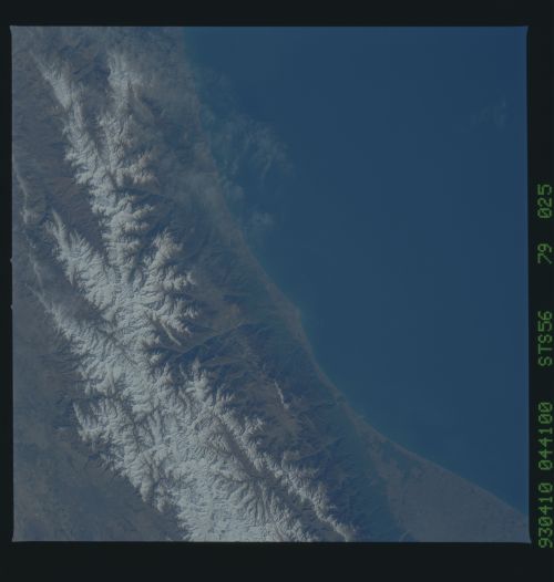
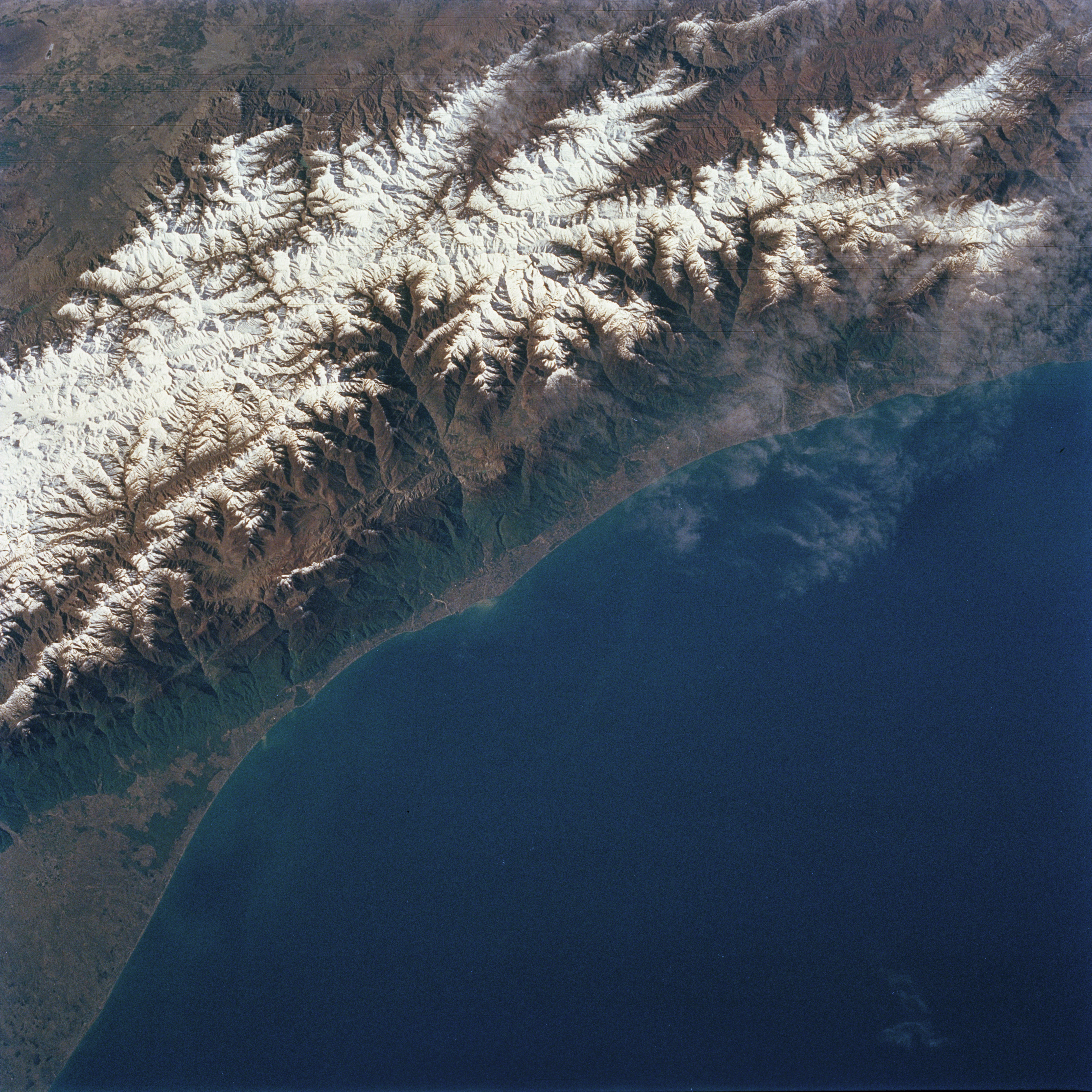
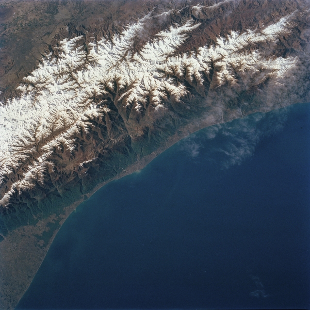
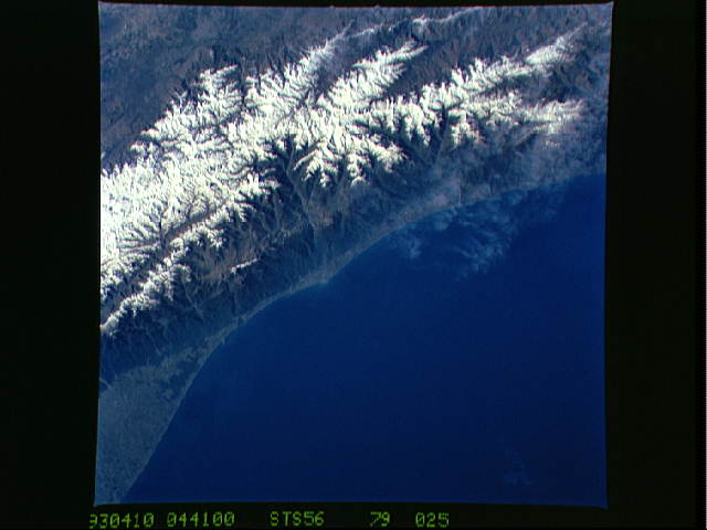
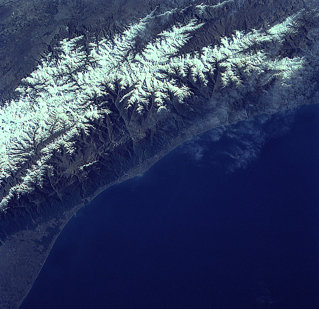
Image Caption: STS056-079-025 Elburz Mountains, Iran April 1993
The western half of the Elburz Mountains, located in northern Iran along the south shore of the Caspian Sea, is visible in this southwest view. These snow-capped mountains are the northern limit of the Iranian Plateau. While the average elevation of the Elburz is 9000 feet (2743 meters), many of the higher peaks exceed 13000 feet (3962 meters) above sea level. Many of the higher elevations have permanent snowfields on them throughout the year. The mountains are a major climate barrier between the arid Iranian Plateau (south) and the moist (receives significant amounts of rain and snow) north facing slopes. Dense forests are visible on the north-facing slope that lead down to the narrow coastal plain. The Chalus River and several of its tributary streams has eroded a sizeable area of the mountain, thereby creating an impressive-looking, deep gorge (north-south aligned feature, slightly left of center).
The western half of the Elburz Mountains, located in northern Iran along the south shore of the Caspian Sea, is visible in this southwest view. These snow-capped mountains are the northern limit of the Iranian Plateau. While the average elevation of the Elburz is 9000 feet (2743 meters), many of the higher peaks exceed 13000 feet (3962 meters) above sea level. Many of the higher elevations have permanent snowfields on them throughout the year. The mountains are a major climate barrier between the arid Iranian Plateau (south) and the moist (receives significant amounts of rain and snow) north facing slopes. Dense forests are visible on the north-facing slope that lead down to the narrow coastal plain. The Chalus River and several of its tributary streams has eroded a sizeable area of the mountain, thereby creating an impressive-looking, deep gorge (north-south aligned feature, slightly left of center).
