STS056-77-61
| NASA Photo ID | STS056-77-61 |
| Focal Length | 100mm |
| Date taken | 1993.04.10 |
| Time taken | 15:17:29 GMT |
Resolutions offered for this image:
3904 x 3904 pixels 639 x 639 pixels 5700 x 6000 pixels 500 x 526 pixels 640 x 480 pixels
3904 x 3904 pixels 639 x 639 pixels 5700 x 6000 pixels 500 x 526 pixels 640 x 480 pixels

Cloud masks available for this image:
Spacecraft nadir point: 25.6° N, 98.5° W
Photo center point: 26.5° N, 97.5° W
Photo center point by machine learning:
Photo center point: 26.5° N, 97.5° W
Photo center point by machine learning:
Nadir to Photo Center: Northeast
Spacecraft Altitude: 161 nautical miles (298km)
Country or Geographic Name: | USA-TEXAS |
Features: | BROWNSVILLE, LAGUNA MADRE |
| Features Found Using Machine Learning: | |
Cloud Cover Percentage: | 0 (no clouds present) |
Sun Elevation Angle: | 40° |
Sun Azimuth: | 101° |
Camera: | Hasselblad |
Focal Length: | 100mm |
Camera Tilt: | 27 degrees |
Format: | 5017: Kodak, natural color positive, Ektachrome, X Professional, ASA 64, standard base |
Film Exposure: | Normal |
| Additional Information | |
| Width | Height | Annotated | Cropped | Purpose | Links |
|---|---|---|---|---|---|
| 3904 pixels | 3904 pixels | No | No | Earth From Space collection | Download Image |
| 639 pixels | 639 pixels | No | No | Earth From Space collection | Download Image |
| 5700 pixels | 6000 pixels | No | No | Download Image | |
| 500 pixels | 526 pixels | No | No | Download Image | |
| 640 pixels | 480 pixels | No | No | Download Image |
Download Packaged File
Download a Google Earth KML for this Image
View photo footprint information
Download a GeoTIFF for this photo
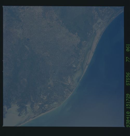
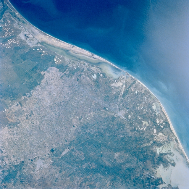
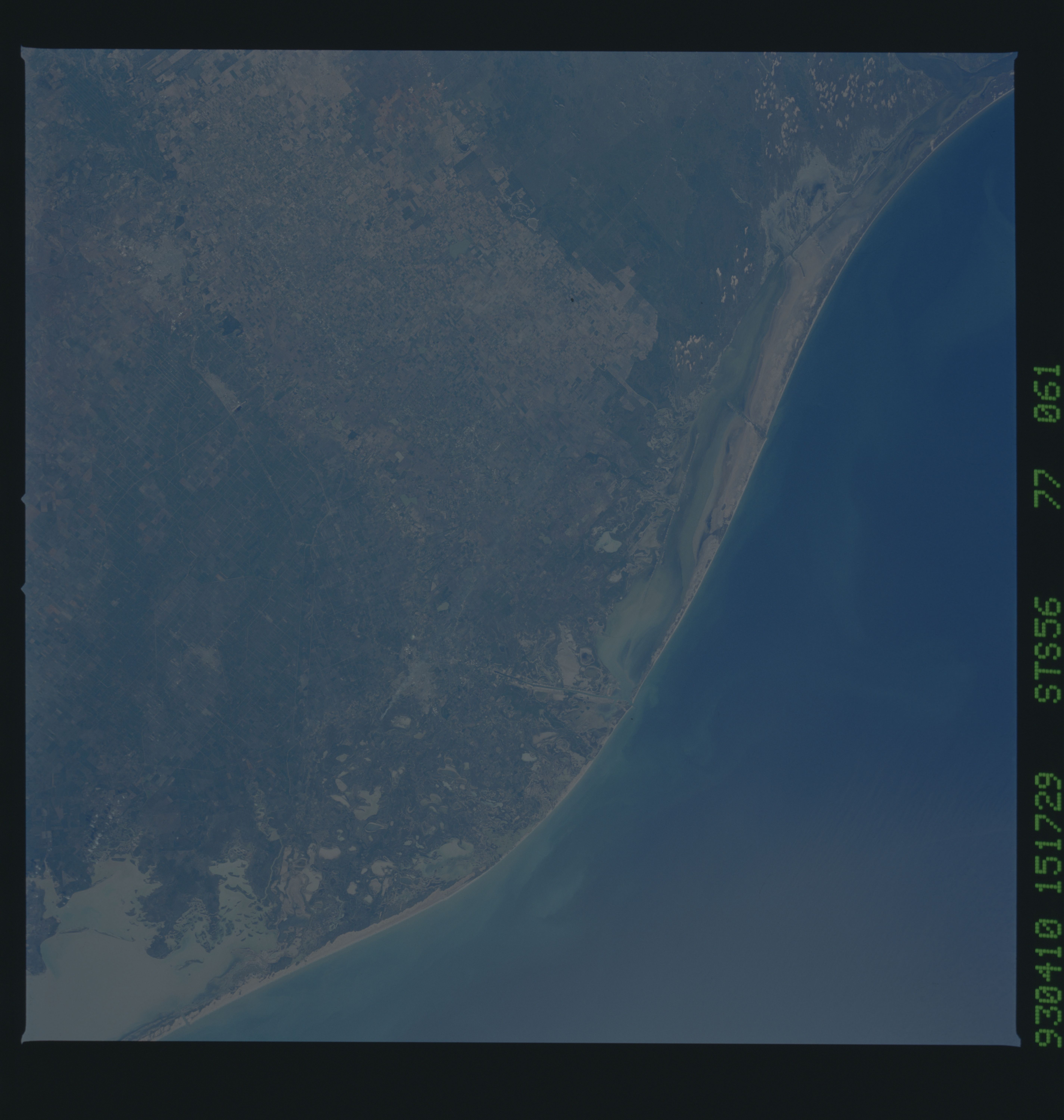
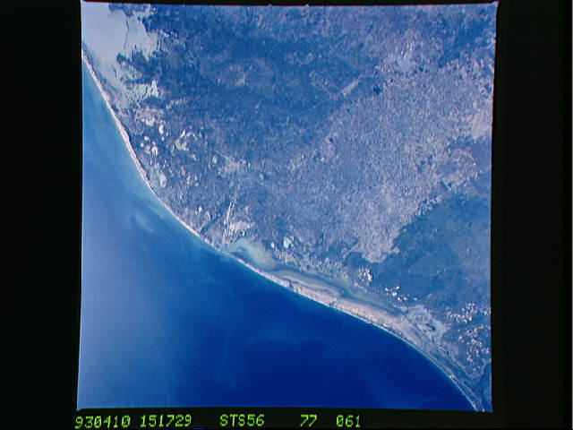
Image Caption: STS056-077-061 Rio Grande Delta, Texas, U.S.A. April 1993
The flat floodplain of the Rio Grande and a large part of its delta are visible in this synoptic photograph of the southern tip of Texas. The diverse coastal area includes tidal flats; sand dunes; floodplain deposits; and Laguna Madre, whose shallowness allows small waves to keep the sand in suspension, thereby producing a sandy-looking water. The Intracoastal Waterway between Padre Island and the mainland requires constant dredging to keep it and other channels open for ship traffic. The northern part of Mexico's highly reflective Laguna Madre is visible (lower right corner). The speckled landscape (upper left edge) shows nonvegetated sand dunes; darker areas denote sandy soils where vegetative cover provides some stability for the shifting sands; and the lighter inland areas show the greatest concentration of agricultural activity, primarily north of the United States-Mexico border.
The flat floodplain of the Rio Grande and a large part of its delta are visible in this synoptic photograph of the southern tip of Texas. The diverse coastal area includes tidal flats; sand dunes; floodplain deposits; and Laguna Madre, whose shallowness allows small waves to keep the sand in suspension, thereby producing a sandy-looking water. The Intracoastal Waterway between Padre Island and the mainland requires constant dredging to keep it and other channels open for ship traffic. The northern part of Mexico's highly reflective Laguna Madre is visible (lower right corner). The speckled landscape (upper left edge) shows nonvegetated sand dunes; darker areas denote sandy soils where vegetative cover provides some stability for the shifting sands; and the lighter inland areas show the greatest concentration of agricultural activity, primarily north of the United States-Mexico border.
