STS056-76-10
| NASA Photo ID | STS056-76-10 |
| Focal Length | 250mm |
| Date taken | 1993.04.10 |
| Time taken | 13:44:31 GMT |
Resolutions offered for this image:
3904 x 3904 pixels 639 x 639 pixels 5700 x 6000 pixels 500 x 526 pixels 640 x 480 pixels
3904 x 3904 pixels 639 x 639 pixels 5700 x 6000 pixels 500 x 526 pixels 640 x 480 pixels
Cloud masks available for this image:
Spacecraft nadir point: 33.6° N, 82.2° W
Photo center point: 33.5° N, 82.0° W
Photo center point by machine learning:
Photo center point: 33.5° N, 82.0° W
Photo center point by machine learning:
Nadir to Photo Center: Southeast
Spacecraft Altitude: 162 nautical miles (300km)
Country or Geographic Name: | USA-GEORGIA |
Features: | AUGUSTA, SAVANNAH R. |
| Features Found Using Machine Learning: | |
Cloud Cover Percentage: | 0 (no clouds present) |
Sun Elevation Angle: | 32° |
Sun Azimuth: | 102° |
Camera: | Hasselblad |
Focal Length: | 250mm |
Camera Tilt: | 5 degrees |
Format: | 5017: Kodak, natural color positive, Ektachrome, X Professional, ASA 64, standard base |
Film Exposure: | Normal |
| Additional Information | |
| Width | Height | Annotated | Cropped | Purpose | Links |
|---|---|---|---|---|---|
| 3904 pixels | 3904 pixels | No | No | Earth From Space collection | Download Image |
| 639 pixels | 639 pixels | No | No | Earth From Space collection | Download Image |
| 5700 pixels | 6000 pixels | No | No | Download Image | |
| 500 pixels | 526 pixels | No | No | Download Image | |
| 640 pixels | 480 pixels | No | No | Download Image |
Download Packaged File
Download a Google Earth KML for this Image
View photo footprint information
Download a GeoTIFF for this photo
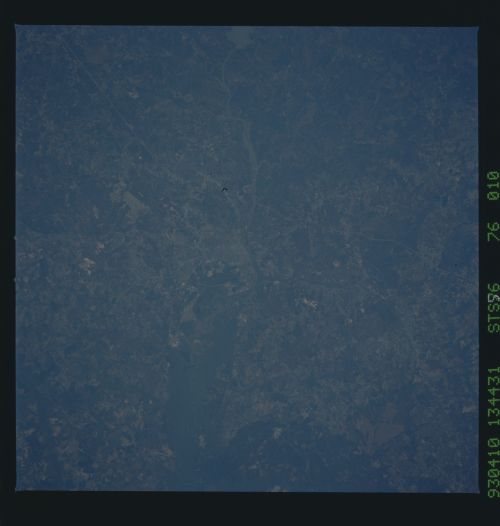
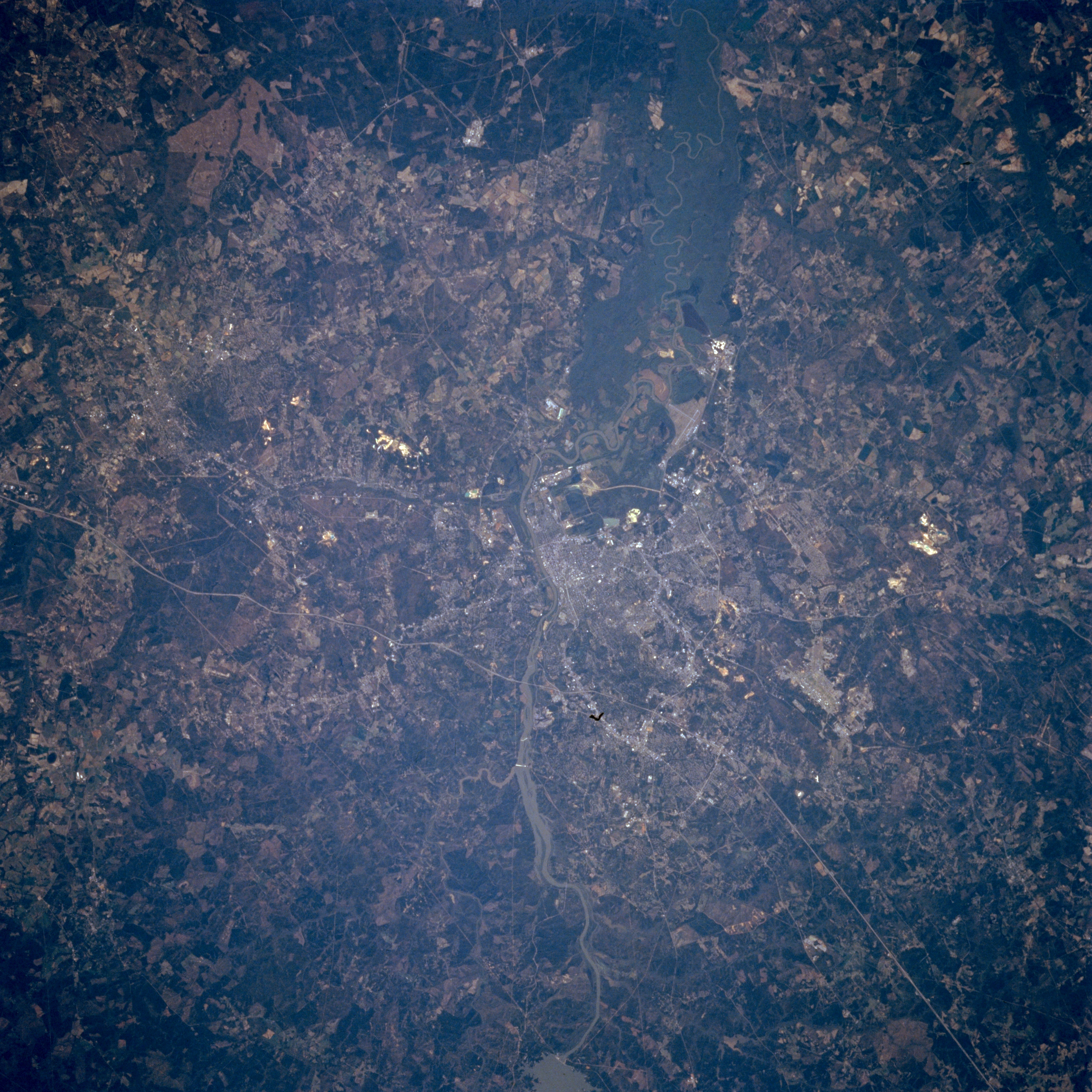
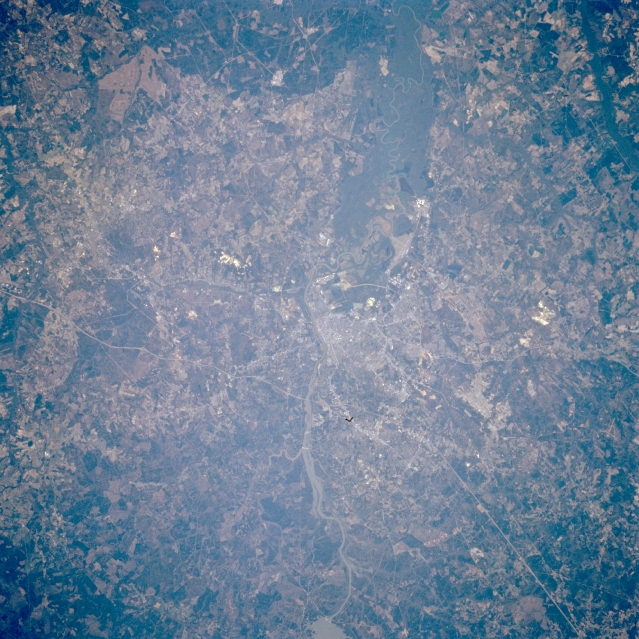
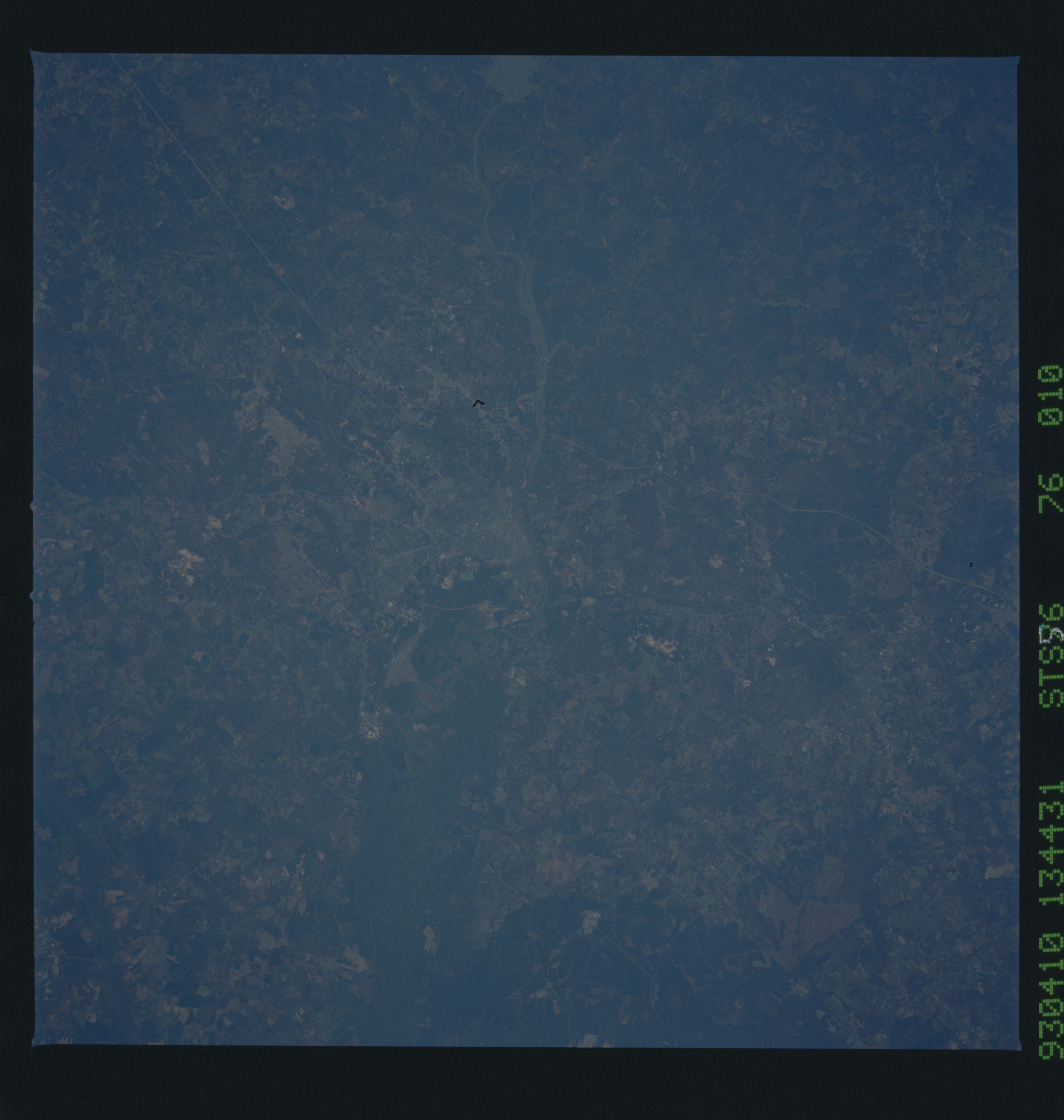
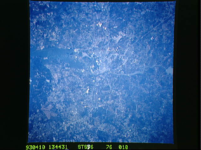
Image Caption: STS056-076-010 Augusta, Georgia, U.S.A. April 1993
The street grid pattern of Augusta, barely discernible in the center of the photograph, is obscured by widespread vegetation and foliage. Visible are a section of the southeast-flowing Savannah River and a segment of thin, linear Interstate Highway 20 north of Augusta, which connects Augusta with Atlanta to the west and with Columbia, South Carolina, to the northeast. The dark floodplain of the Savannah River widens dramatically south of Augusta. The concentration of dark, forested land (right side of photograph) is part of the extensive Savannah River Nuclear Power Generating Facility.
The street grid pattern of Augusta, barely discernible in the center of the photograph, is obscured by widespread vegetation and foliage. Visible are a section of the southeast-flowing Savannah River and a segment of thin, linear Interstate Highway 20 north of Augusta, which connects Augusta with Atlanta to the west and with Columbia, South Carolina, to the northeast. The dark floodplain of the Savannah River widens dramatically south of Augusta. The concentration of dark, forested land (right side of photograph) is part of the extensive Savannah River Nuclear Power Generating Facility.
