STS056-75-104
| NASA Photo ID | STS056-75-104 |
| Focal Length | 100mm |
| Date taken | 1993.04.10 |
| Time taken | 15:35:13 GMT |
Resolutions offered for this image:
402 x 443 pixels 5266 x 5266 pixels 639 x 639 pixels 5700 x 6000 pixels 500 x 526 pixels 640 x 480 pixels
402 x 443 pixels 5266 x 5266 pixels 639 x 639 pixels 5700 x 6000 pixels 500 x 526 pixels 640 x 480 pixels


Cloud masks available for this image:
Spacecraft nadir point: 32.4° S, 60.7° W
Photo center point: 32.5° S, 60.5° W
Photo center point by machine learning:
Photo center point: 32.5° S, 60.5° W
Photo center point by machine learning:
Nadir to Photo Center: Southeast
Spacecraft Altitude: 164 nautical miles (304km)
Country or Geographic Name: | ARGENTINA |
Features: | RIO PARANA, ROSARIO, AGR. |
| Features Found Using Machine Learning: | |
Cloud Cover Percentage: | 0 (no clouds present) |
Sun Elevation Angle: | 49° |
Sun Azimuth: | 11° |
Camera: | Hasselblad |
Focal Length: | 100mm |
Camera Tilt: | 5 degrees |
Format: | 5017: Kodak, natural color positive, Ektachrome, X Professional, ASA 64, standard base |
Film Exposure: | Normal |
| Additional Information | |
| Width | Height | Annotated | Cropped | Purpose | Links |
|---|---|---|---|---|---|
| 402 pixels | 443 pixels | No | No | Cities collection | Download Image |
| 5266 pixels | 5266 pixels | No | No | Earth From Space collection | Download Image |
| 639 pixels | 639 pixels | No | No | Earth From Space collection | Download Image |
| 5700 pixels | 6000 pixels | No | No | Download Image | |
| 500 pixels | 526 pixels | No | No | Download Image | |
| 640 pixels | 480 pixels | No | No | Download Image |
Download Packaged File
Download a Google Earth KML for this Image
View photo footprint information
Download a GeoTIFF for this photo
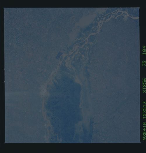
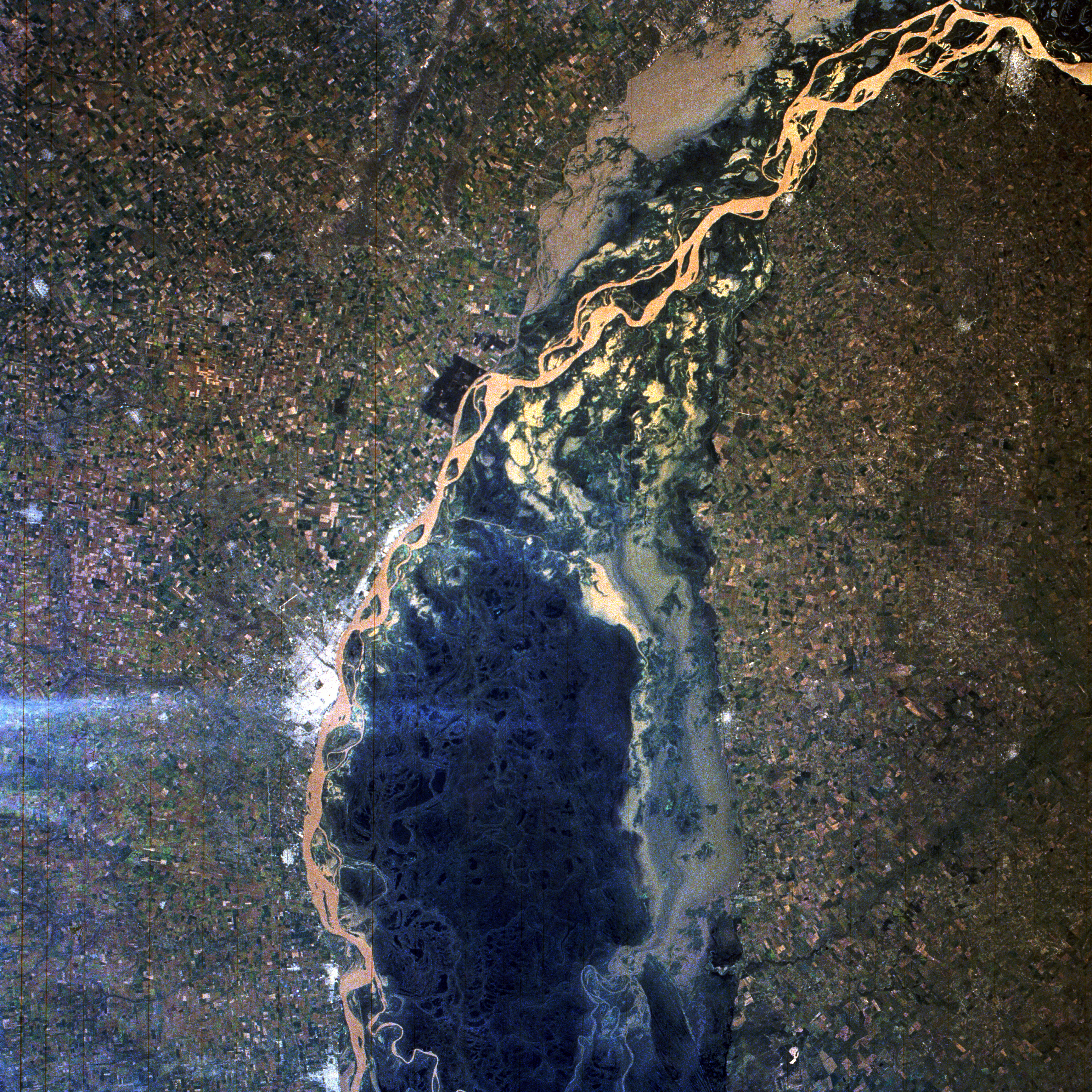
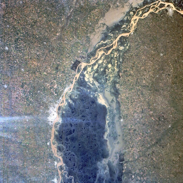
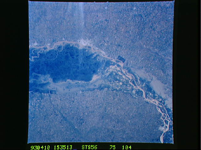
Image Caption: STS056-075-104 Paraná River, Argentina April 1993
The muddy, multibraided channels of the Paraná River are visible as the river flows south past the city of Rosario (population of more than 1 million). The floodplain, much of which appears to be covered by open, sediment-laden water, perhaps experienced some flooding in this section of the Paraná. The dark green area within the confines of the river's floodplain shows the densely vegetated, basically uninhabited swamplands that extend in a swath of unproductive land for 35 miles (60 kilometers) to the western end of the Rio de la Plata. The extensively cultivated field patterns on either side of the river are part of the highly productive agricultural Pampas region, many areas of which are poorly drained, reclaimed swamplands. Rosario, a commercial city approximately 180 miles (290 kilometers) northwest of Buenos Aires, the capital of Argentina, is noted for its transshipping and processing facilities for grains, hay, meat, wool, and sugar. Other smaller urban areas can be seen principally along the west bank of the river, except for Paraná, which lies along the east bank at the northern edge of the photograph. (Refer to STS-056-102-004 for the extensive delta area of the Paraná River near Buenos Aires.)
The muddy, multibraided channels of the Paraná River are visible as the river flows south past the city of Rosario (population of more than 1 million). The floodplain, much of which appears to be covered by open, sediment-laden water, perhaps experienced some flooding in this section of the Paraná. The dark green area within the confines of the river's floodplain shows the densely vegetated, basically uninhabited swamplands that extend in a swath of unproductive land for 35 miles (60 kilometers) to the western end of the Rio de la Plata. The extensively cultivated field patterns on either side of the river are part of the highly productive agricultural Pampas region, many areas of which are poorly drained, reclaimed swamplands. Rosario, a commercial city approximately 180 miles (290 kilometers) northwest of Buenos Aires, the capital of Argentina, is noted for its transshipping and processing facilities for grains, hay, meat, wool, and sugar. Other smaller urban areas can be seen principally along the west bank of the river, except for Paraná, which lies along the east bank at the northern edge of the photograph. (Refer to STS-056-102-004 for the extensive delta area of the Paraná River near Buenos Aires.)
