STS056-155-242
| NASA Photo ID | STS056-155-242 |
| Focal Length | 250mm |
| Date taken | 1993.04.16 |
| Time taken | 00:59:45 GMT |
Resolutions offered for this image:
640 x 480 pixels 4800 x 6014 pixels 909 x 1181 pixels 4800 x 6014 pixels 540 x 702 pixels
640 x 480 pixels 4800 x 6014 pixels 909 x 1181 pixels 4800 x 6014 pixels 540 x 702 pixels


Cloud masks available for this image:
Spacecraft nadir point: 5.5° S, 107.2° E
Photo center point: 5.5° S, 107.0° E
Photo center point by machine learning:
Photo center point: 5.5° S, 107.0° E
Photo center point by machine learning:
Nadir to Photo Center: West
Spacecraft Altitude: 160 nautical miles (296km)
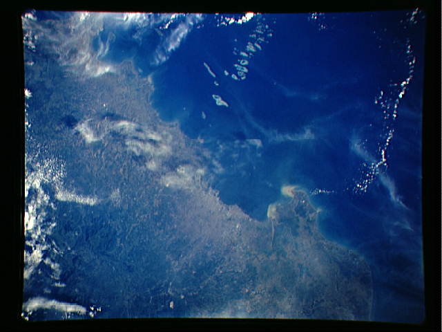
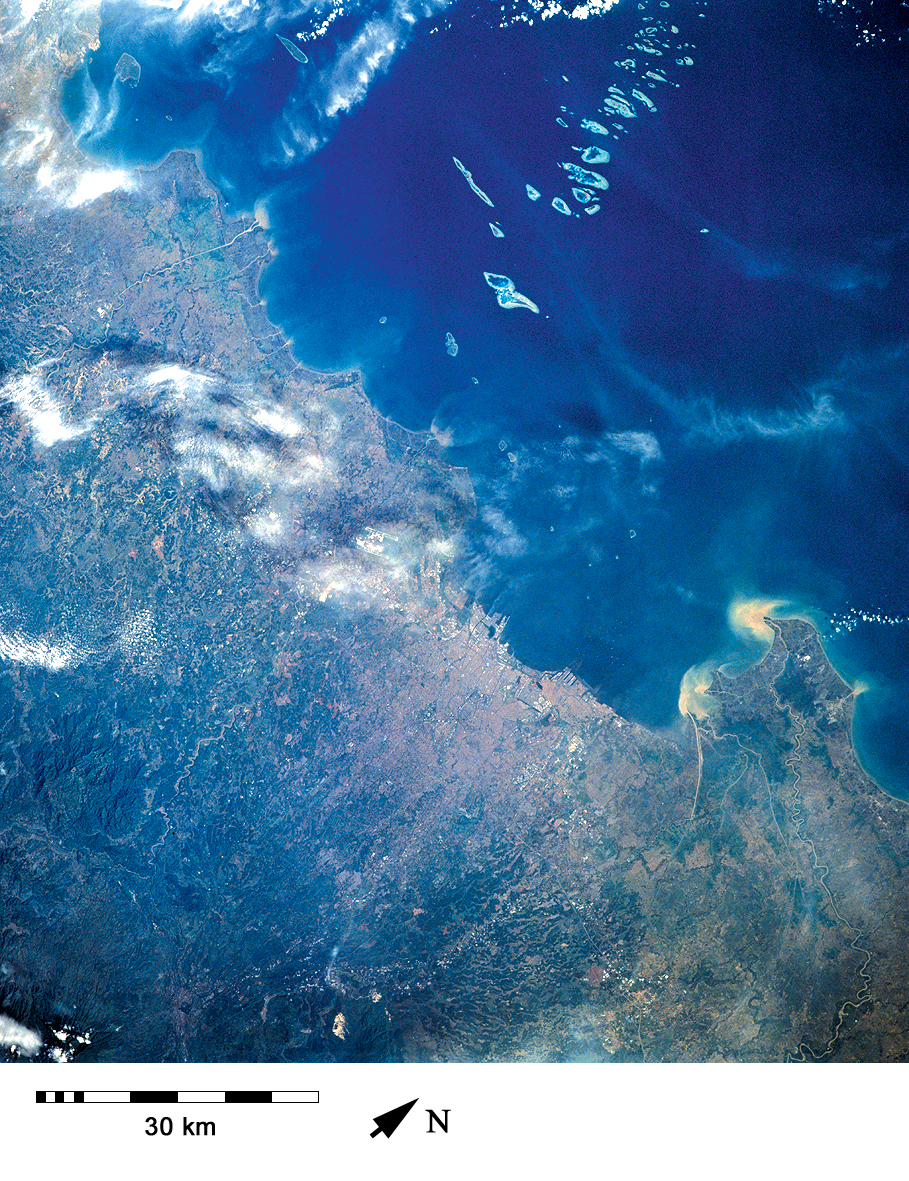
Country or Geographic Name: | INDONESIA-J |
Features: | DJAKARTA BAY AND CITY |
| Features Found Using Machine Learning: | |
Cloud Cover Percentage: | 10 (1-10)% |
Sun Elevation Angle: | 30° |
Sun Azimuth: | 75° |
Camera: | Linhof |
Focal Length: | 250mm |
Camera Tilt: | 4 degrees |
Format: | QX868: Kodak, natural color positive, Ektachrome QX868(5017 emulsion), ASA 64, thin base |
Film Exposure: | Normal |
| Additional Information | |
| Width | Height | Annotated | Cropped | Purpose | Links |
|---|---|---|---|---|---|
| 640 pixels | 480 pixels | No | No | ISD 1 | Download Image |
| 4800 pixels | 6014 pixels | No | No | Coral Reef Atlas Publication | Download Image |
| 909 pixels | 1181 pixels | Yes | Yes | Publisher Request | Download Image |
| 4800 pixels | 6014 pixels | No | No | Download Image | |
| 540 pixels | 702 pixels | Yes | Yes | Publisher Request | Download Image |
Download Packaged File
Download a Google Earth KML for this Image
View photo footprint information
Download a GeoTIFF for this photo
Image Caption: Jakarta produces considerable quantities of sedimentation and pollution. The impacts of these on coral cover and diversity decline with distance across the reefs of Kepulauan Seribu [STS056-155-242, 1993].
