STS056-154-74
| NASA Photo ID | STS056-154-74 |
| Focal Length | 90mm |
| Date taken | 1993.04.__ |
| Time taken | GMT |
Cloud masks available for this image:
Spacecraft nadir point:
Photo center point: 22.5° N, 58.0° E
Photo center point by machine learning:
Photo center point: 22.5° N, 58.0° E
Photo center point by machine learning:
Nadir to Photo Center:
Spacecraft Altitude: nautical miles (0km)
Country or Geographic Name: | OMAN |
Features: | OMAN MTS., WAHIBA SANDS |
| Features Found Using Machine Learning: | |
Cloud Cover Percentage: | 10 (1-10)% |
Sun Elevation Angle: | ° |
Sun Azimuth: | ° |
Camera: | Linhof |
Focal Length: | 90mm |
Camera Tilt: | Low Oblique |
Format: | QX868: Kodak, natural color positive, Ektachrome QX868(5017 emulsion), ASA 64, thin base |
Film Exposure: | Normal |
| Additional Information | |
| Width | Height | Annotated | Cropped | Purpose | Links |
|---|---|---|---|---|---|
| 4038 pixels | 5154 pixels | No | No | Earth From Space collection | Download Image |
| 501 pixels | 640 pixels | No | No | Earth From Space collection | Download Image |
| 640 pixels | 480 pixels | No | No | ISD 1 | Download Image |
Download Packaged File
Download a Google Earth KML for this Image
View photo footprint information
Download a GeoTIFF for this photo
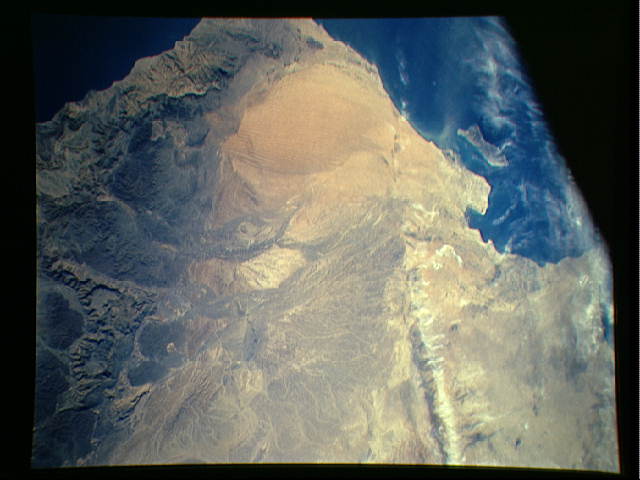
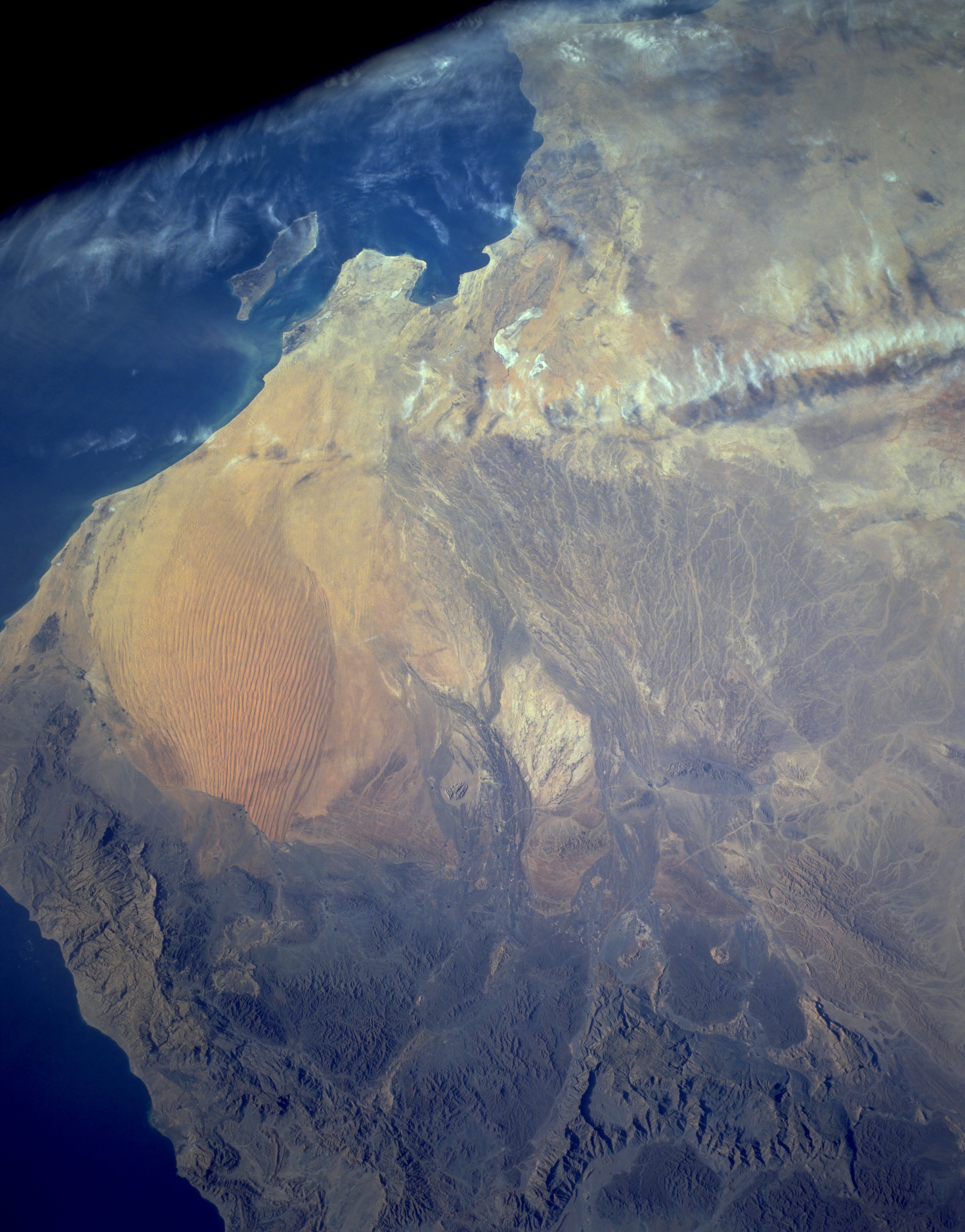
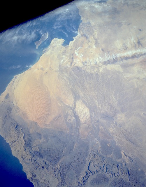
Image Caption: STS056-154-074 Wahibah Sands, Oman April 1993
Wahibah Sands in eastern Oman is a small coastal sand desert that borders the Arabian Sea. The desert demonstrates the results of erosion and deposits caused by running water and wind in this region where the climate has undergone considerable changes. Most sand dunes in Wahibah Sands are north-south oriented, longitudinal dunes. Meandering streams form an extensive pattern as they spread south from the rugged Eastern Hajar Mountains in the north. The Hajars, with major peaks exceeding 7000 feet (2100 meters) above sea level, were formed by the collision of the Arabian and Eurasian plates. Masirah Island is visible off the southeast coast of Oman.
Wahibah Sands in eastern Oman is a small coastal sand desert that borders the Arabian Sea. The desert demonstrates the results of erosion and deposits caused by running water and wind in this region where the climate has undergone considerable changes. Most sand dunes in Wahibah Sands are north-south oriented, longitudinal dunes. Meandering streams form an extensive pattern as they spread south from the rugged Eastern Hajar Mountains in the north. The Hajars, with major peaks exceeding 7000 feet (2100 meters) above sea level, were formed by the collision of the Arabian and Eurasian plates. Masirah Island is visible off the southeast coast of Oman.
