STS056-154-165
| NASA Photo ID | STS056-154-165 |
| Focal Length | 90mm |
| Date taken | 1993.04.__ |
| Time taken | GMT |

Cloud masks available for this image:
Spacecraft nadir point:
Photo center point: 34.0° S, 24.0° E
Photo center point by machine learning:
Photo center point: 34.0° S, 24.0° E
Photo center point by machine learning:
Nadir to Photo Center:
Spacecraft Altitude: nautical miles (0km)
Country or Geographic Name: | REPUBLIC SOUTH AFRICA |
Features: | DRAKENSBERG, C. SEAL |
| Features Found Using Machine Learning: | |
Cloud Cover Percentage: | 15 (11-25)% |
Sun Elevation Angle: | ° |
Sun Azimuth: | ° |
Camera: | Linhof |
Focal Length: | 90mm |
Camera Tilt: | Low Oblique |
Format: | QX868: Kodak, natural color positive, Ektachrome QX868(5017 emulsion), ASA 64, thin base |
Film Exposure: | Normal |
| Additional Information | |
| Width | Height | Annotated | Cropped | Purpose | Links |
|---|---|---|---|---|---|
| 5167 pixels | 4038 pixels | No | No | Earth From Space collection | Download Image |
| 639 pixels | 500 pixels | No | No | Earth From Space collection | Download Image |
| 640 pixels | 480 pixels | No | No | ISD 1 | Download Image |
Download Packaged File
Download a Google Earth KML for this Image
View photo footprint information
Download a GeoTIFF for this photo
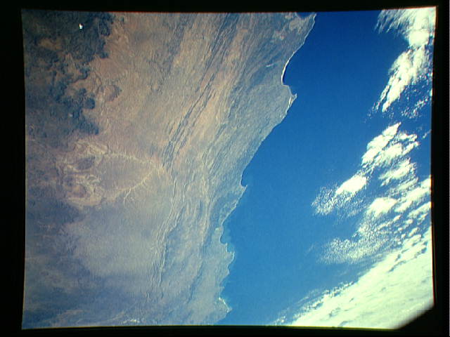
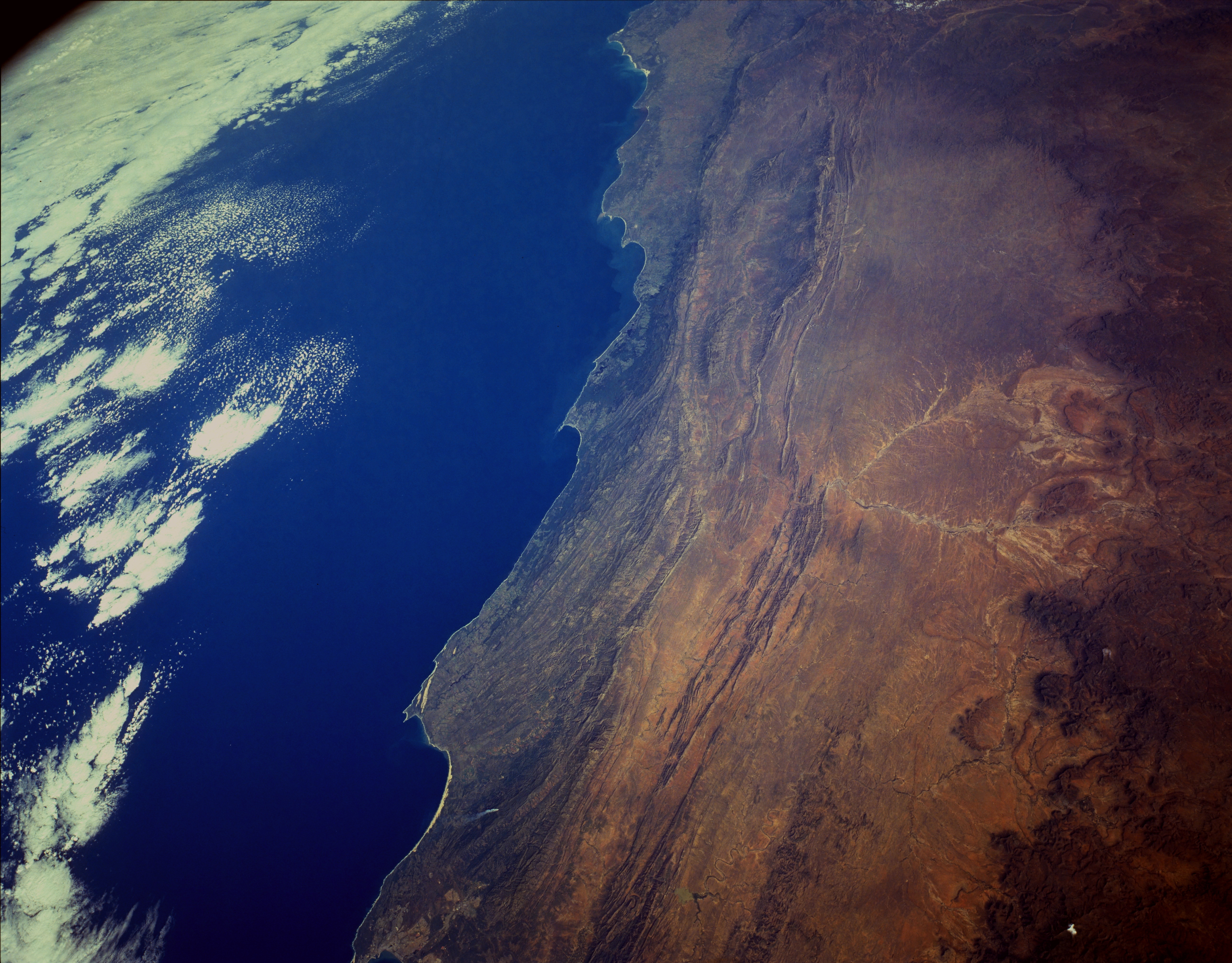
Image Caption: STS056-154-165 The Great Karoo Range and Cape Ranges, South Africa April 1993
This low-oblique, south-southwest-looking photograph reveals the complex landscape of South Africa. The topography of this region is a series of steppes. From the high central plateau (not visible in the photograph) to the Great Escarpment, at an altitude of 7000 feet (2135 meters), that appears along the north side of the photograph, the terrain descends into a vast semiarid plateau called the Great Karoo (orange area). This hot, arid plateau extends east-west 300 miles (500 kilometers) and averages 2000 to 4000 feet (600 to 1200 meters) above sea level. Descending further across smaller escarpments and plains, the steppes reach the mountains of the forested Cape Ranges (dark green) and, finally, the coast. Where irrigated, the Great Karoo is very fertile and supports extensive livestock grazing and the growing of citrus fruit and grains. The Great Karoo is covered mostly by succulent plants that survive the heat and aridity by conserving moisture or having life cycles geared to the occasional violent storms that pass over the region. Three pronounced capes lie along the coast--from east to west are Cape St. Francis, Cape Seal, and Cape St. Blaize located near the small port city of Mosselbaai.
This low-oblique, south-southwest-looking photograph reveals the complex landscape of South Africa. The topography of this region is a series of steppes. From the high central plateau (not visible in the photograph) to the Great Escarpment, at an altitude of 7000 feet (2135 meters), that appears along the north side of the photograph, the terrain descends into a vast semiarid plateau called the Great Karoo (orange area). This hot, arid plateau extends east-west 300 miles (500 kilometers) and averages 2000 to 4000 feet (600 to 1200 meters) above sea level. Descending further across smaller escarpments and plains, the steppes reach the mountains of the forested Cape Ranges (dark green) and, finally, the coast. Where irrigated, the Great Karoo is very fertile and supports extensive livestock grazing and the growing of citrus fruit and grains. The Great Karoo is covered mostly by succulent plants that survive the heat and aridity by conserving moisture or having life cycles geared to the occasional violent storms that pass over the region. Three pronounced capes lie along the coast--from east to west are Cape St. Francis, Cape Seal, and Cape St. Blaize located near the small port city of Mosselbaai.
