STS056-152-38
| NASA Photo ID | STS056-152-38 |
| Focal Length | 250mm |
| Date taken | 1993.04.__ |
| Time taken | GMT |
Resolutions offered for this image:
5214 x 4086 pixels 640 x 501 pixels 640 x 480 pixels 879 x 1129 pixels
5214 x 4086 pixels 640 x 501 pixels 640 x 480 pixels 879 x 1129 pixels

Cloud masks available for this image:
Spacecraft nadir point:
Photo center point: 36.0° N, 76.5° E
Photo center point by machine learning:
Photo center point: 36.0° N, 76.5° E
Photo center point by machine learning:
Nadir to Photo Center:
Spacecraft Altitude: nautical miles (0km)
Country or Geographic Name: | CHINA |
Features: | KARAKORAM RA, GLACIERS |
| Features Found Using Machine Learning: | |
Cloud Cover Percentage: | 0 (no clouds present) |
Sun Elevation Angle: | ° |
Sun Azimuth: | ° |
Camera: | Linhof |
Focal Length: | 250mm |
Camera Tilt: | Near Vertical |
Format: | QX868: Kodak, natural color positive, Ektachrome QX868(5017 emulsion), ASA 64, thin base |
Film Exposure: | Normal |
| Additional Information | |
| Width | Height | Annotated | Cropped | Purpose | Links |
|---|---|---|---|---|---|
| 5214 pixels | 4086 pixels | No | No | Earth From Space collection | Download Image |
| 640 pixels | 501 pixels | No | No | Earth From Space collection | Download Image |
| 640 pixels | 480 pixels | No | No | ISD 1 | Download Image |
| 879 pixels | 1129 pixels | No | No | Download Image |
Download Packaged File
Download a Google Earth KML for this Image
View photo footprint information
Download a GeoTIFF for this photo
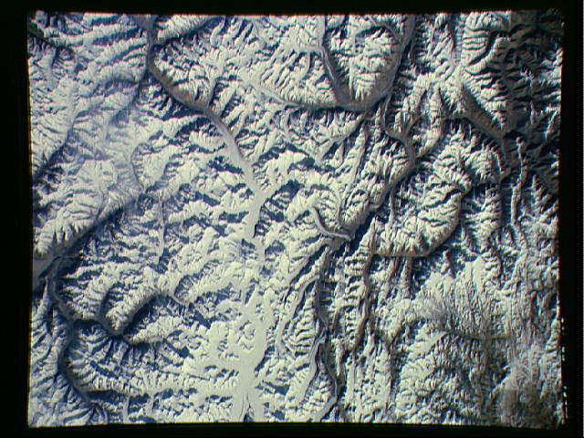
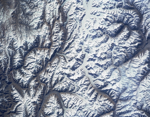
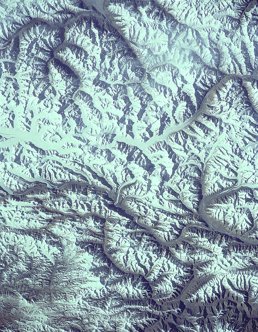
Image Caption: STS056-152-038 Karakorum Mountains (K2), China April 1993
K2 (Mount Goodwin-Austin), the world's second tallest mountain peak (28250 feet - 8611 meters above sea level), is discernible as a small concentration of white slightly left of center. Located on the Pakistan (south) and China (north) border, K2 was not successfully climbed until 1954. In addition to this isolated peak, several other peaks in this scene exceed 23000 feet (7010 meters) above sea level. Several sizable glaciers are visible (linear, whitish-looking features), mainly on the Pakistan side of the border. The glaciated river valleys (dark linear features) drain northward towards the interior in the top half of the image, while the glaciated valleys in the southern half of the image are tributaries of the Indus River Basin. STS56-152-033 has a small area along its southeastern corner that provides some overlap with this image (upper left).
K2 (Mount Goodwin-Austin), the world's second tallest mountain peak (28250 feet - 8611 meters above sea level), is discernible as a small concentration of white slightly left of center. Located on the Pakistan (south) and China (north) border, K2 was not successfully climbed until 1954. In addition to this isolated peak, several other peaks in this scene exceed 23000 feet (7010 meters) above sea level. Several sizable glaciers are visible (linear, whitish-looking features), mainly on the Pakistan side of the border. The glaciated river valleys (dark linear features) drain northward towards the interior in the top half of the image, while the glaciated valleys in the southern half of the image are tributaries of the Indus River Basin. STS56-152-033 has a small area along its southeastern corner that provides some overlap with this image (upper left).
