STS056-110-80
| NASA Photo ID | STS056-110-80 |
| Focal Length | 250mm |
| Date taken | 1993.04.11 |
| Time taken | 02:10:45 GMT |
Resolutions offered for this image:
3907 x 3968 pixels 630 x 639 pixels 5700 x 6000 pixels 500 x 526 pixels 640 x 480 pixels
3907 x 3968 pixels 630 x 639 pixels 5700 x 6000 pixels 500 x 526 pixels 640 x 480 pixels

Cloud masks available for this image:
Spacecraft nadir point: 40.6° S, 147.3° E
Photo center point: 41.0° S, 148.0° E
Photo center point by machine learning:
Photo center point: 41.0° S, 148.0° E
Photo center point by machine learning:
Nadir to Photo Center: Southeast
Spacecraft Altitude: 166 nautical miles (307km)
Country or Geographic Name: | AUSTRALIA-T |
Features: | EDDYSTONE POINT |
| Features Found Using Machine Learning: | |
Cloud Cover Percentage: | 5 (1-10)% |
Sun Elevation Angle: | 41° |
Sun Azimuth: | 0° |
Camera: | Hasselblad |
Focal Length: | 250mm |
Camera Tilt: | 16 degrees |
Format: | 2443: Kodak Aerochrome 2443, color IR, thin base, EA-5 process thru June 1999, E-6 process afterward |
Film Exposure: | Normal |
| Additional Information | |
| Width | Height | Annotated | Cropped | Purpose | Links |
|---|---|---|---|---|---|
| 3907 pixels | 3968 pixels | No | No | Earth From Space collection | Download Image |
| 630 pixels | 639 pixels | No | No | Earth From Space collection | Download Image |
| 5700 pixels | 6000 pixels | No | No | Download Image | |
| 500 pixels | 526 pixels | No | No | Download Image | |
| 640 pixels | 480 pixels | No | No | Download Image |
Download Packaged File
Download a Google Earth KML for this Image
View photo footprint information
Download a GeoTIFF for this photo
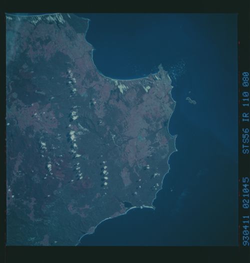
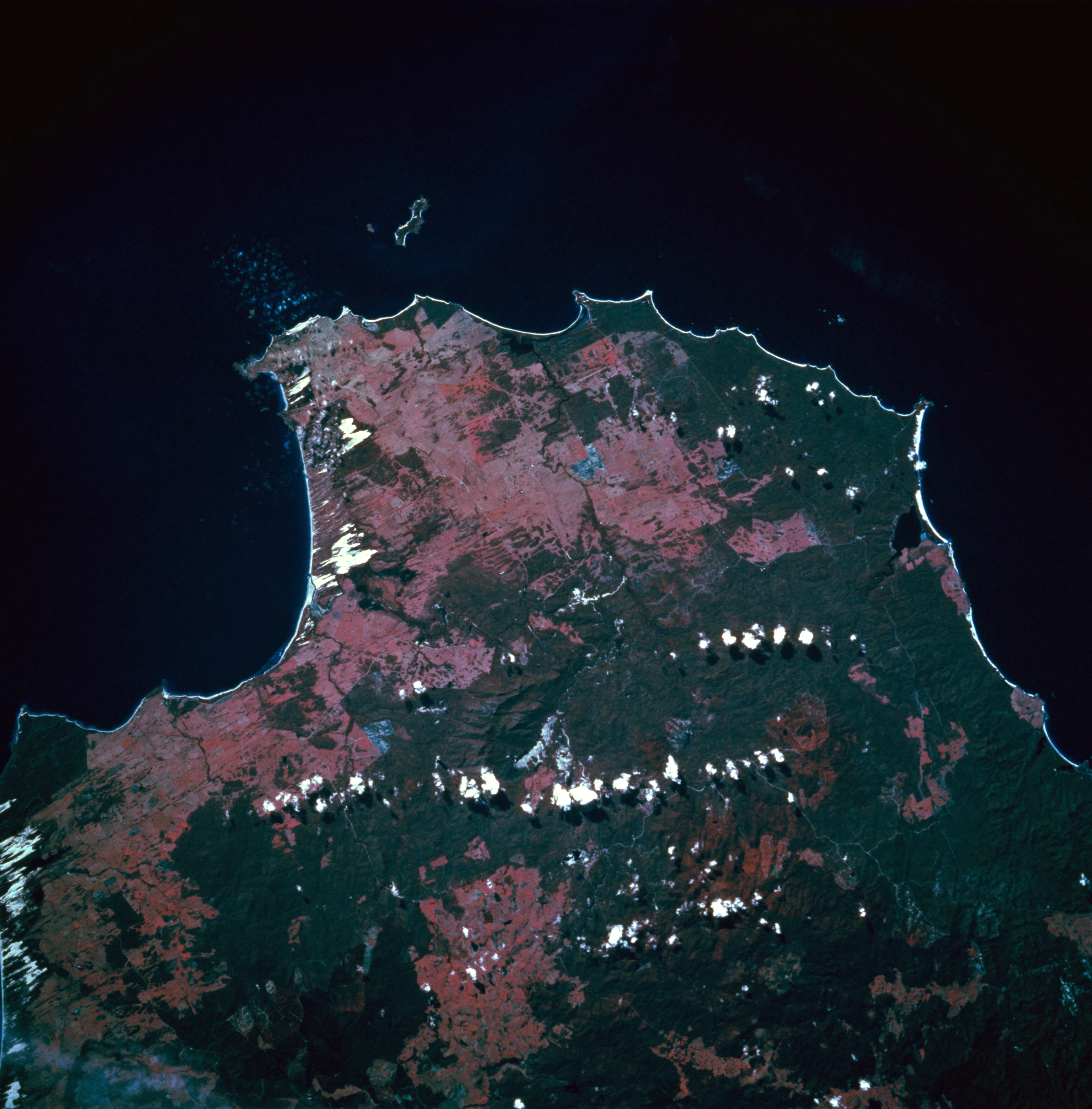
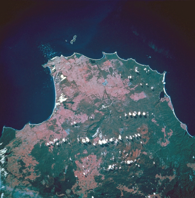
Image Caption: STS056-110-080 Eddystone Point, Tasmania, Australia April 1993
The northeastern tip of Tasmania is observed in this northeasterly view that extends from Waterhouse Point in the northwest to the Bay of Fires along the east coast. Key features in this color infrared image include Eddystone Point (small peninsula that juts eastward into the Tasman Sea) and Ringarooma Bay which is located on the north coast of Tasmania and faces the Banks Strait. The white-looking areas along the coastline are sandy beaches and dunes further inland. A few cumulus clouds have formed primarily over the densely vegetated, forested lands (darker, more uniform-looking patterns). The pinkish colored landscape are areas where the forests have been cut down. This color infrared image presents the green range land and some cultivated fields as a pink signature.
The northeastern tip of Tasmania is observed in this northeasterly view that extends from Waterhouse Point in the northwest to the Bay of Fires along the east coast. Key features in this color infrared image include Eddystone Point (small peninsula that juts eastward into the Tasman Sea) and Ringarooma Bay which is located on the north coast of Tasmania and faces the Banks Strait. The white-looking areas along the coastline are sandy beaches and dunes further inland. A few cumulus clouds have formed primarily over the densely vegetated, forested lands (darker, more uniform-looking patterns). The pinkish colored landscape are areas where the forests have been cut down. This color infrared image presents the green range land and some cultivated fields as a pink signature.
