STS056-109-80
| NASA Photo ID | STS056-109-80 |
| Focal Length | 250mm |
| Date taken | 1993.04.10 |
| Time taken | 15:34:27 GMT |
Resolutions offered for this image:
5230 x 5230 pixels 639 x 639 pixels 5700 x 6000 pixels 500 x 526 pixels 640 x 480 pixels
5230 x 5230 pixels 639 x 639 pixels 5700 x 6000 pixels 500 x 526 pixels 640 x 480 pixels
Cloud masks available for this image:
Spacecraft nadir point: 30.3° S, 62.5° W
Photo center point:
Photo center point by machine learning:
Photo center point:
Photo center point by machine learning:
Nadir to Photo Center:
Spacecraft Altitude: 164 nautical miles (304km)
Country or Geographic Name: | ARGENTINA |
Features: | SALT FLATS, AGRICULTURE, SMOKE |
| Features Found Using Machine Learning: | |
Cloud Cover Percentage: | 0 (no clouds present) |
Sun Elevation Angle: | 51° |
Sun Azimuth: | 14° |
Camera: | Hasselblad |
Focal Length: | 250mm |
Camera Tilt: | Low Oblique |
Format: | 2443: Kodak Aerochrome 2443, color IR, thin base, EA-5 process thru June 1999, E-6 process afterward |
Film Exposure: | Normal |
| Additional Information | |
| Width | Height | Annotated | Cropped | Purpose | Links |
|---|---|---|---|---|---|
| 5230 pixels | 5230 pixels | No | No | Earth From Space collection | Download Image |
| 639 pixels | 639 pixels | No | No | Earth From Space collection | Download Image |
| 5700 pixels | 6000 pixels | No | No | Download Image | |
| 500 pixels | 526 pixels | No | No | Download Image | |
| 640 pixels | 480 pixels | No | No | Download Image |
Download Packaged File
Download a Google Earth KML for this Image
View photo footprint information
Download a GeoTIFF for this photo
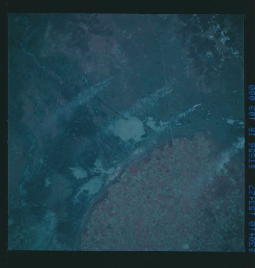
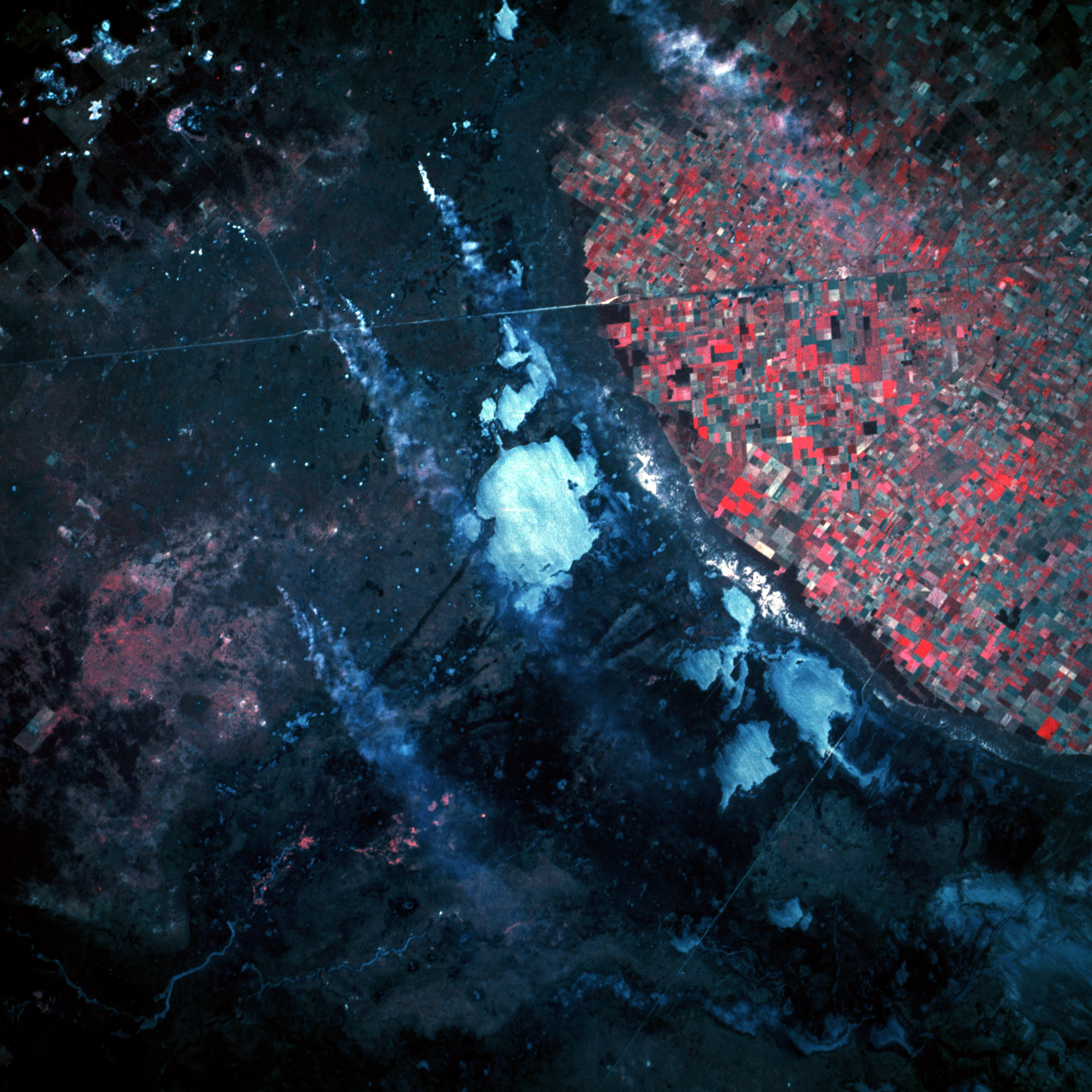
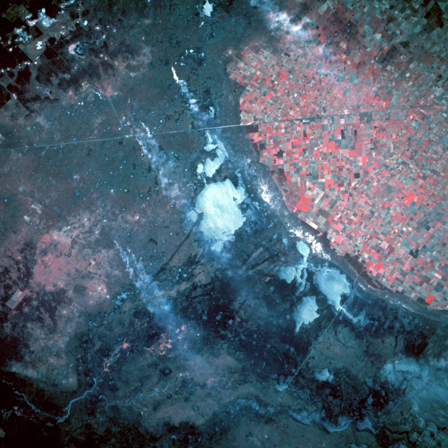
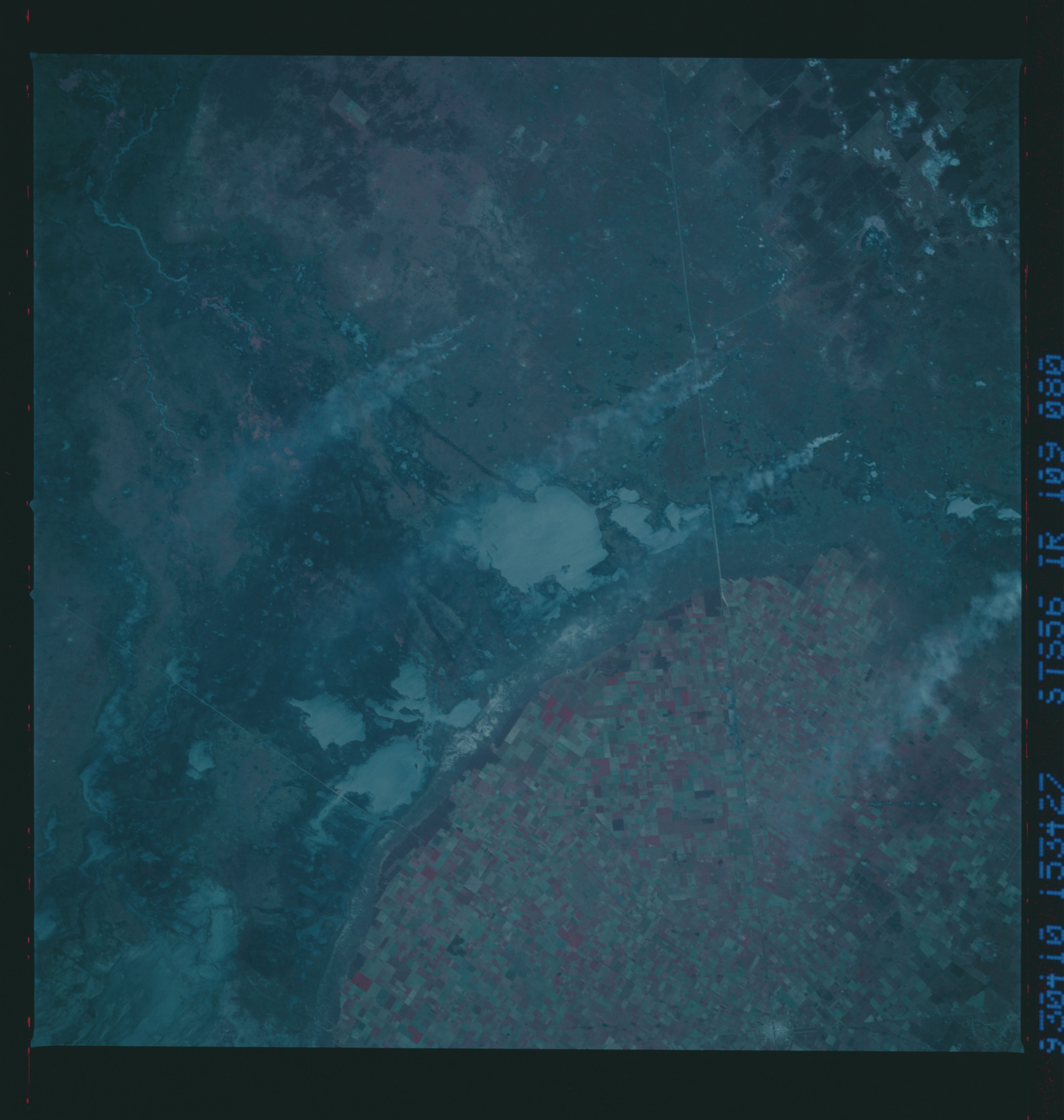
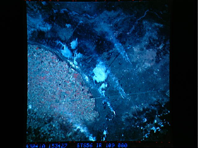
Image Caption: STS056-109-080 Agricultural Area, North-Central Argentina April 1993
The color infrared film accurately delineates the intensively productive cultivated farmland (red colors) from the unproductive, poorly drained land in this near-vertical photograph taken near the small rural town of Ceres in north-central Argentina. The hundreds of field patterns show a well-established agricultural infrastructure. The darker areas west and northwest of the cultivated fields are part of a large interior drainage system that crosses broad alluvial fans that stretch eastward with gradually decreasing slopes. The whitish areas are dry lakebeds (salt flats) where the evaporation rate of surface water has exceeded the water recharge rate. Several south-trending smoke plumes probably originate on small parcels of land that are being cleared for agricultural use. The thin northwest-southeast line is a combined railroad and highway right-of-way. This area is part of the Chaco region of Argentina, a great expanse of lowland plain with deciduous scrub woodland interspersed with patches of savanna and poorly drained soils.
STS-56 color infrared Earth observation taken aboard Discovery, Orbiter Vehicle (OV) 103, shows the agricultural frontier (rectangular field patterns) impinging on the natural grasslands (pampas) of northern Argentina. Note the sharp delineation between the upland agricultural areas (red and pink rectangles), and the lowland semi-arid grasslands or pampas (shown in violet and purple). In addition, several large smoke plumes associated with biomass burning are visible. These smoke plumes and their burn point sources are considered to be evident of extended agricultural preparations in the lowland pampas.
