STS056-109-33
| NASA Photo ID | STS056-109-33 |
| Focal Length | 250mm |
| Date taken | 1993.04.10 |
| Time taken | 15:17:08 GMT |
Resolutions offered for this image:
3904 x 3904 pixels 639 x 639 pixels 5700 x 6000 pixels 500 x 526 pixels 640 x 480 pixels
3904 x 3904 pixels 639 x 639 pixels 5700 x 6000 pixels 500 x 526 pixels 640 x 480 pixels

Cloud masks available for this image:
Spacecraft nadir point: 26.6° N, 99.2° W
Photo center point: 26.5° N, 97.5° W
Photo center point by machine learning:
Photo center point: 26.5° N, 97.5° W
Photo center point by machine learning:
Nadir to Photo Center: East
Spacecraft Altitude: 161 nautical miles (298km)
Country or Geographic Name: | USA-TEXAS |
Features: | LAGUNA MADRE |
| Features Found Using Machine Learning: | |
Cloud Cover Percentage: | 0 (no clouds present) |
Sun Elevation Angle: | 39° |
Sun Azimuth: | 101° |
Camera: | Hasselblad |
Focal Length: | 250mm |
Camera Tilt: | 32 degrees |
Format: | 2443: Kodak Aerochrome 2443, color IR, thin base, EA-5 process thru June 1999, E-6 process afterward |
Film Exposure: | Normal |
| Additional Information | |
| Width | Height | Annotated | Cropped | Purpose | Links |
|---|---|---|---|---|---|
| 3904 pixels | 3904 pixels | No | No | Earth From Space collection | Download Image |
| 639 pixels | 639 pixels | No | No | Earth From Space collection | Download Image |
| 5700 pixels | 6000 pixels | No | No | Download Image | |
| 500 pixels | 526 pixels | No | No | Download Image | |
| 640 pixels | 480 pixels | No | No | Download Image |
Download Packaged File
Download a Google Earth KML for this Image
View photo footprint information
Download a GeoTIFF for this photo
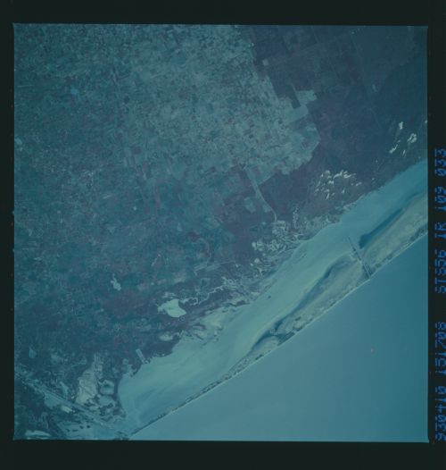
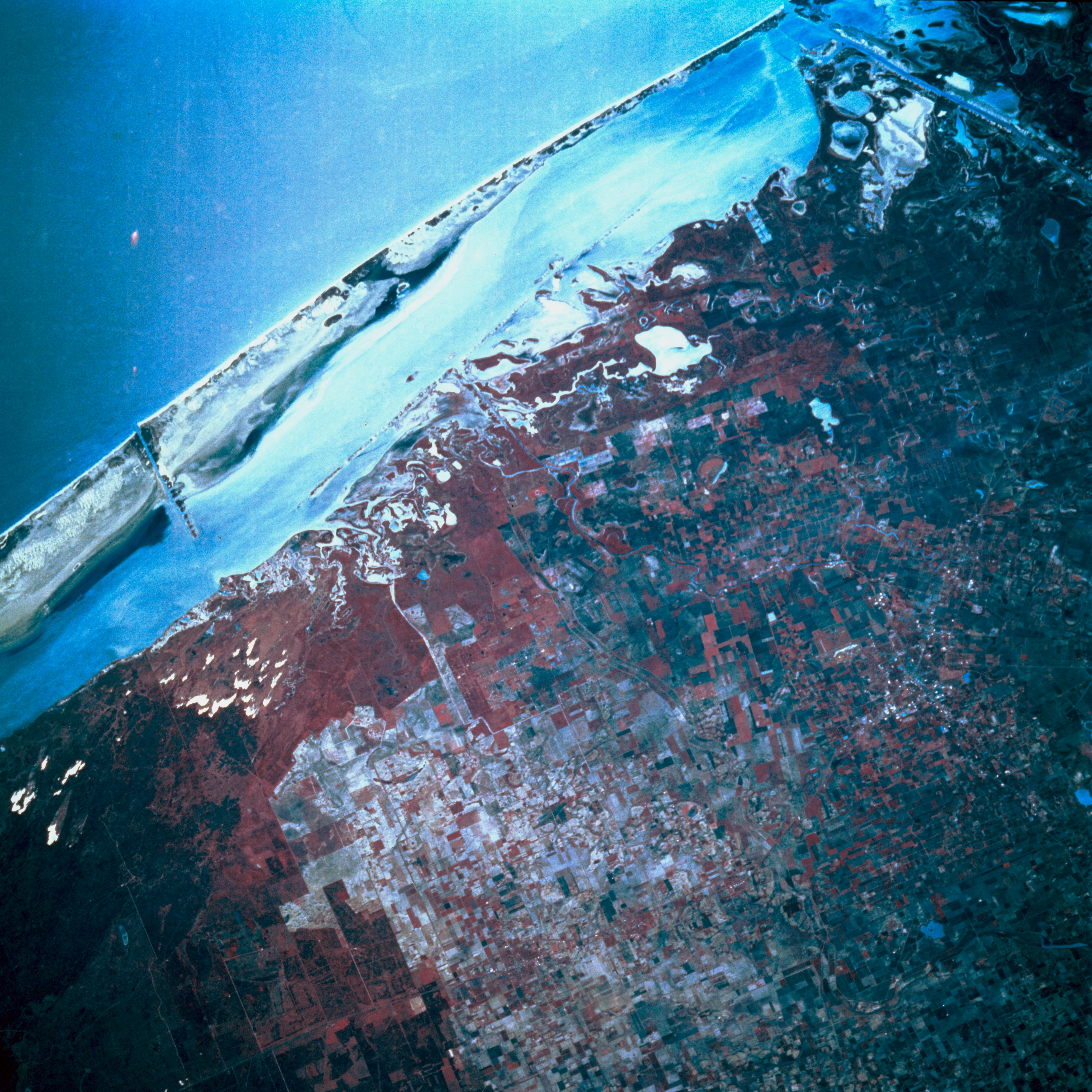
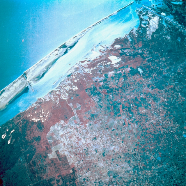
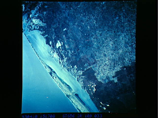
Image Caption: STS056-109-033 South Texas Coastal Plain, Texas, U.S.A. April 1993
Evident in this color infrared photograph is the flatness of the south Texas coastal plain with sand dunes, sandy soils covered by scrubby trees and grass (darker areas), tidal flats, and some lighter rectangular field patterns. Visible are the southern end of the Intracoastal Waterway, identified by linear deposits of dredged material near the shoreline of the mainland, and Laguna Madre, which separates Padre Island from the mainland of south Texas. Because of blowing sands, two other features--a dredged channel perpendicular to Padre Island (left edge) and a section of the dredged Brownsville Ship Channel (upper right corner)--require constant dredging to keep the channels open for shipping.
Evident in this color infrared photograph is the flatness of the south Texas coastal plain with sand dunes, sandy soils covered by scrubby trees and grass (darker areas), tidal flats, and some lighter rectangular field patterns. Visible are the southern end of the Intracoastal Waterway, identified by linear deposits of dredged material near the shoreline of the mainland, and Laguna Madre, which separates Padre Island from the mainland of south Texas. Because of blowing sands, two other features--a dredged channel perpendicular to Padre Island (left edge) and a section of the dredged Brownsville Ship Channel (upper right corner)--require constant dredging to keep the channels open for shipping.
