STS056-104-88
| NASA Photo ID | STS056-104-88 |
| Focal Length | 250mm |
| Date taken | 1993.04.11 |
| Time taken | 02:09:58 GMT |
Resolutions offered for this image:
3840 x 3904 pixels 629 x 639 pixels 5700 x 6000 pixels 500 x 526 pixels 640 x 480 pixels
3840 x 3904 pixels 629 x 639 pixels 5700 x 6000 pixels 500 x 526 pixels 640 x 480 pixels
Cloud masks available for this image:
Spacecraft nadir point: 38.4° S, 144.7° E
Photo center point: 40.0° S, 148.0° E
Photo center point by machine learning:
Photo center point: 40.0° S, 148.0° E
Photo center point by machine learning:
Nadir to Photo Center: East
Spacecraft Altitude: 165 nautical miles (306km)
Country or Geographic Name: | AUSTRALIA-T |
Features: | FLINDERS I., C. BARREN I. |
| Features Found Using Machine Learning: | |
Cloud Cover Percentage: | 5 (1-10)% |
Sun Elevation Angle: | 43° |
Sun Azimuth: | 4° |
Camera: | Hasselblad |
Focal Length: | 250mm |
Camera Tilt: | 53 degrees |
Format: | 5017: Kodak, natural color positive, Ektachrome, X Professional, ASA 64, standard base |
Film Exposure: | Normal |
| Additional Information | |
| Width | Height | Annotated | Cropped | Purpose | Links |
|---|---|---|---|---|---|
| 3840 pixels | 3904 pixels | No | No | Earth From Space collection | Download Image |
| 629 pixels | 639 pixels | No | No | Earth From Space collection | Download Image |
| 5700 pixels | 6000 pixels | No | No | Download Image | |
| 500 pixels | 526 pixels | No | No | Download Image | |
| 640 pixels | 480 pixels | No | No | Download Image |
Download Packaged File
Download a Google Earth KML for this Image
View photo footprint information
Download a GeoTIFF for this photo
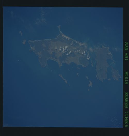
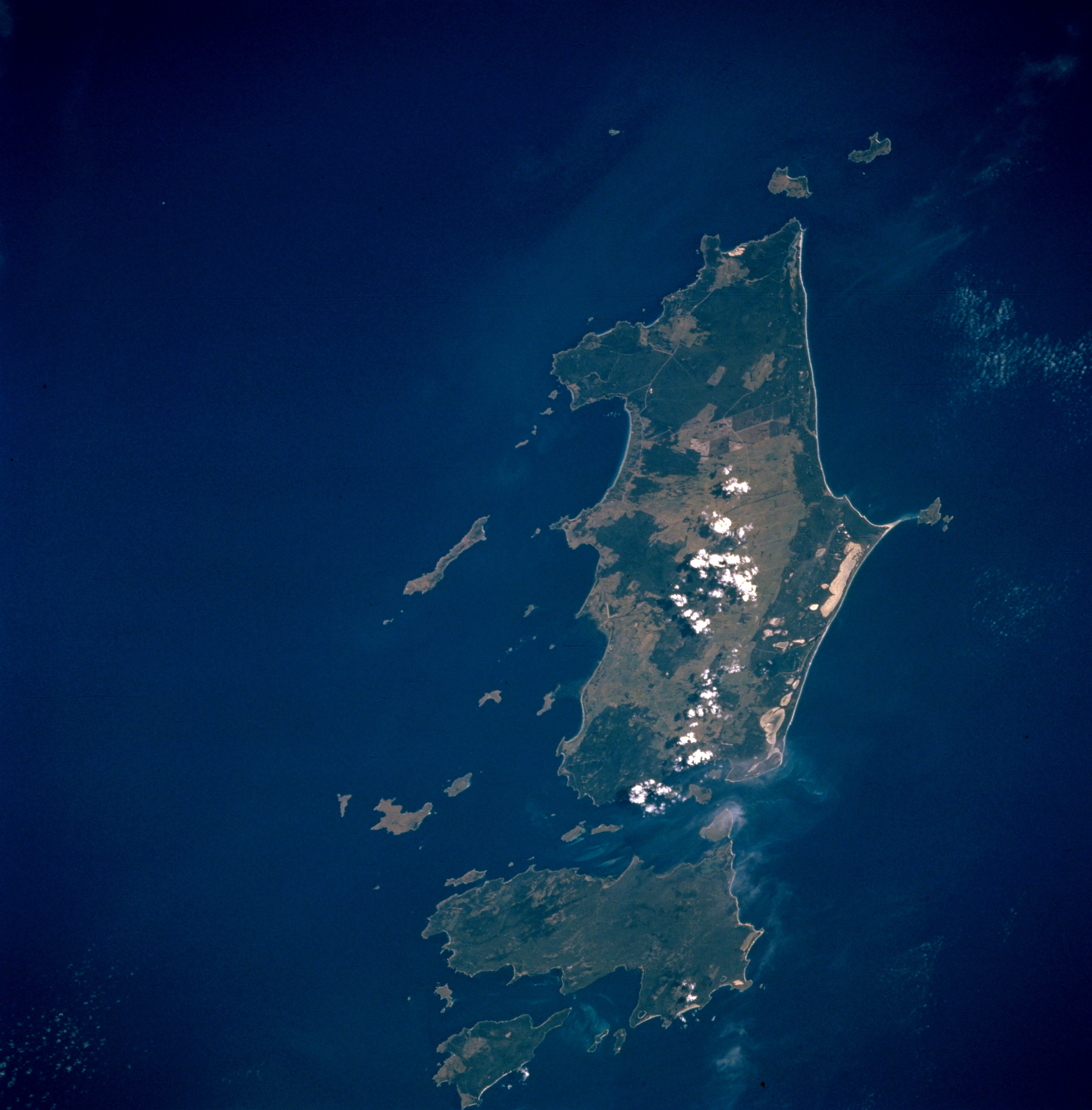
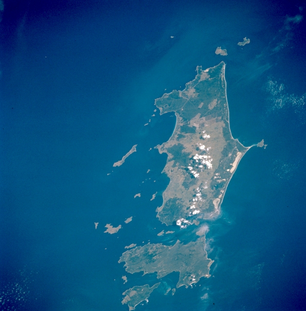
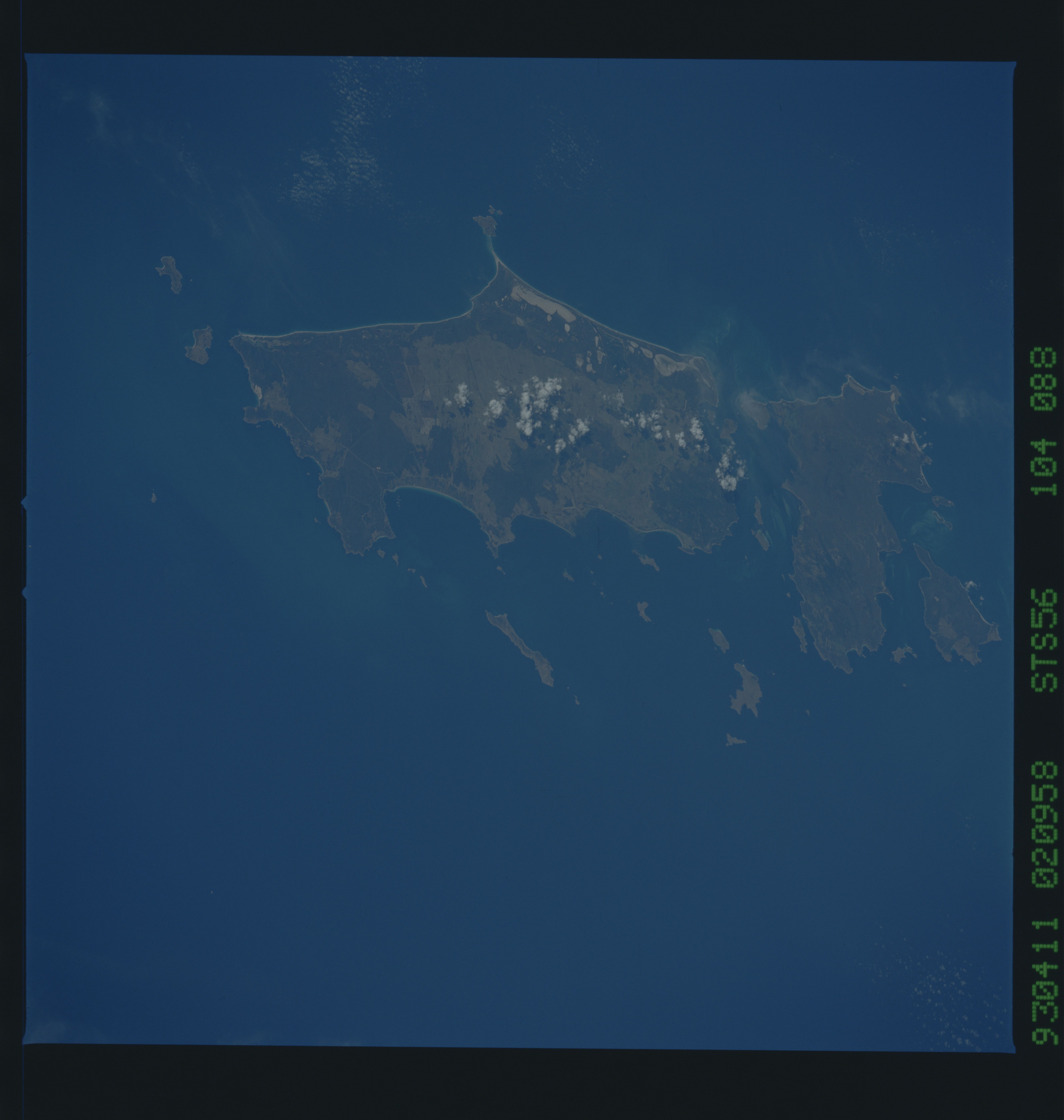
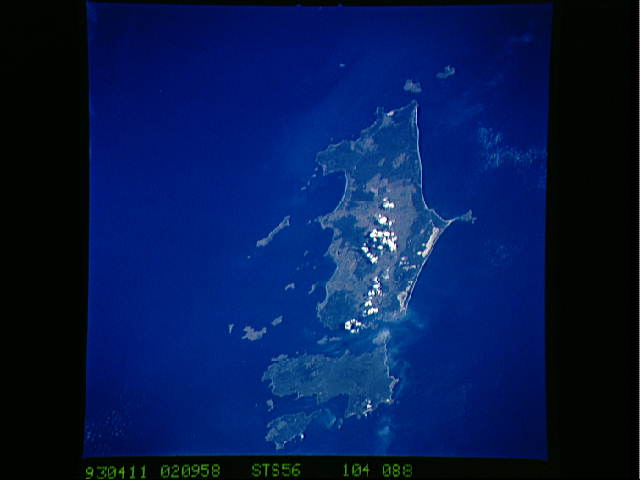
Image Caption: STS056-104-088 Flinders Island, Tasmania, Australia April 1993
Flinders Island, the largest of the three large islands (Cape Barren is second in size and then Clarke Island) in this view, is located off the northeast tip of Tasmania in the Furneaux Group of islands. Fishing, grazing, and tourism are the leading economic activities of Flinders Island. Geologically the low granite mountainous terrain on these islands, with elevations ranging from less than 1000 feet (305 meters) to slightly over 2500 feet (760 meters) above sea level, are a southern extension of the mountains in southeastern Australia (eastern Victoria). The highest peak (2550 feet--780 meters) on Flinders Island is located in Strzelecki National Park at the southwestern end of the island (dark, vegetated feature). Mountainous terrain can be identified on the picture as the area where the darker, greenish-looking forested areas occur. Many white, sandy beaches, especially on the east side of Flinders Island, are visible in this picture. The islands are also havens for a variety of sea birds.
Flinders Island, the largest of the three large islands (Cape Barren is second in size and then Clarke Island) in this view, is located off the northeast tip of Tasmania in the Furneaux Group of islands. Fishing, grazing, and tourism are the leading economic activities of Flinders Island. Geologically the low granite mountainous terrain on these islands, with elevations ranging from less than 1000 feet (305 meters) to slightly over 2500 feet (760 meters) above sea level, are a southern extension of the mountains in southeastern Australia (eastern Victoria). The highest peak (2550 feet--780 meters) on Flinders Island is located in Strzelecki National Park at the southwestern end of the island (dark, vegetated feature). Mountainous terrain can be identified on the picture as the area where the darker, greenish-looking forested areas occur. Many white, sandy beaches, especially on the east side of Flinders Island, are visible in this picture. The islands are also havens for a variety of sea birds.
