STS056-104-77
| NASA Photo ID | STS056-104-77 |
| Focal Length | 250mm |
| Date taken | 1993.04.11 |
| Time taken | 02:01:56 GMT |
Resolutions offered for this image:
5700 x 6000 pixels 500 x 526 pixels 640 x 480 pixels 2281 x 2233 pixels 2785 x 2787 pixels
5700 x 6000 pixels 500 x 526 pixels 640 x 480 pixels 2281 x 2233 pixels 2785 x 2787 pixels


Cloud masks available for this image:
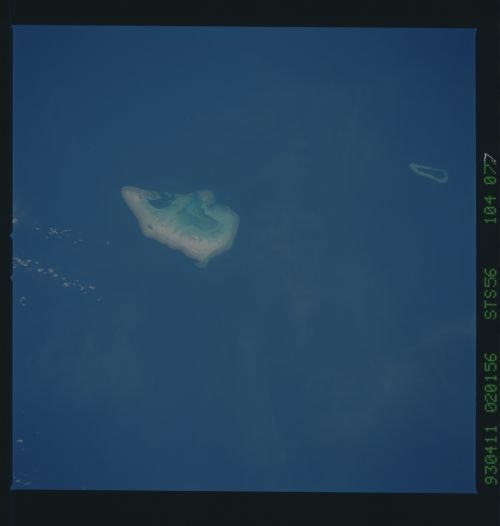
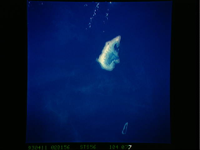
Spacecraft nadir point: 13.1° S, 124.6° E
Photo center point: 12.0° S, 123.0° E
Photo center point by machine learning:
Photo center point: 12.0° S, 123.0° E
Photo center point by machine learning:
Nadir to Photo Center: Northwest
Spacecraft Altitude: 161 nautical miles (298km)
Country or Geographic Name: | TIMOR SEA |
Features: | ASHMORE REEF |
| Features Found Using Machine Learning: | |
Cloud Cover Percentage: | 5 (1-10)% |
Sun Elevation Angle: | 57° |
Sun Azimuth: | 51° |
Camera: | Hasselblad |
Focal Length: | 250mm |
Camera Tilt: | 36 degrees |
Format: | 5017: Kodak, natural color positive, Ektachrome, X Professional, ASA 64, standard base |
Film Exposure: | Normal |
| Additional Information | |
| Width | Height | Annotated | Cropped | Purpose | Links |
|---|---|---|---|---|---|
| 5700 pixels | 6000 pixels | No | No | Download Image | |
| 500 pixels | 526 pixels | No | No | Download Image | |
| 640 pixels | 480 pixels | No | No | Download Image | |
| 2281 pixels | 2233 pixels | No | Yes | ReefBase 1 | Download Image |
| 2785 pixels | 2787 pixels | No | ReefBase 1 | Download Image |
Download Packaged File
Download a Google Earth KML for this Image
View photo footprint information
Download a GeoTIFF for this photo
Image Caption: none
