STS055-81-59
| NASA Photo ID | STS055-81-59 |
| Focal Length | 250mm |
| Date taken | 1993.04.27 |
| Time taken | 15:00:22 GMT |
Resolutions offered for this image:
3904 x 3850 pixels 639 x 631 pixels 5700 x 6000 pixels 500 x 526 pixels 640 x 480 pixels
3904 x 3850 pixels 639 x 631 pixels 5700 x 6000 pixels 500 x 526 pixels 640 x 480 pixels
Cloud masks available for this image:
Spacecraft nadir point: 28.5° N, 90.2° W
Photo center point: 31.5° N, 92.0° W
Photo center point by machine learning:
Photo center point: 31.5° N, 92.0° W
Photo center point by machine learning:
Nadir to Photo Center: Northwest
Spacecraft Altitude: 163 nautical miles (302km)
Country or Geographic Name: | USA-LOUISIANA |
Features: | RED R., ATCHAFALAYA FORK |
| Features Found Using Machine Learning: | |
Cloud Cover Percentage: | 0 (no clouds present) |
Sun Elevation Angle: | 46° |
Sun Azimuth: | 100° |
Camera: | Hasselblad |
Focal Length: | 250mm |
Camera Tilt: | Near Vertical |
Format: | 5017: Kodak, natural color positive, Ektachrome, X Professional, ASA 64, standard base |
Film Exposure: | Normal |
| Additional Information | |
| Width | Height | Annotated | Cropped | Purpose | Links |
|---|---|---|---|---|---|
| 3904 pixels | 3850 pixels | No | No | Earth From Space collection | Download Image |
| 639 pixels | 631 pixels | No | No | Earth From Space collection | Download Image |
| 5700 pixels | 6000 pixels | No | No | Download Image | |
| 500 pixels | 526 pixels | No | No | Download Image | |
| 640 pixels | 480 pixels | No | No | Download Image |
Download Packaged File
Download a Google Earth KML for this Image
View photo footprint information
Download a GeoTIFF for this photo
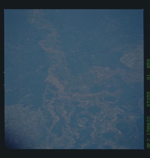
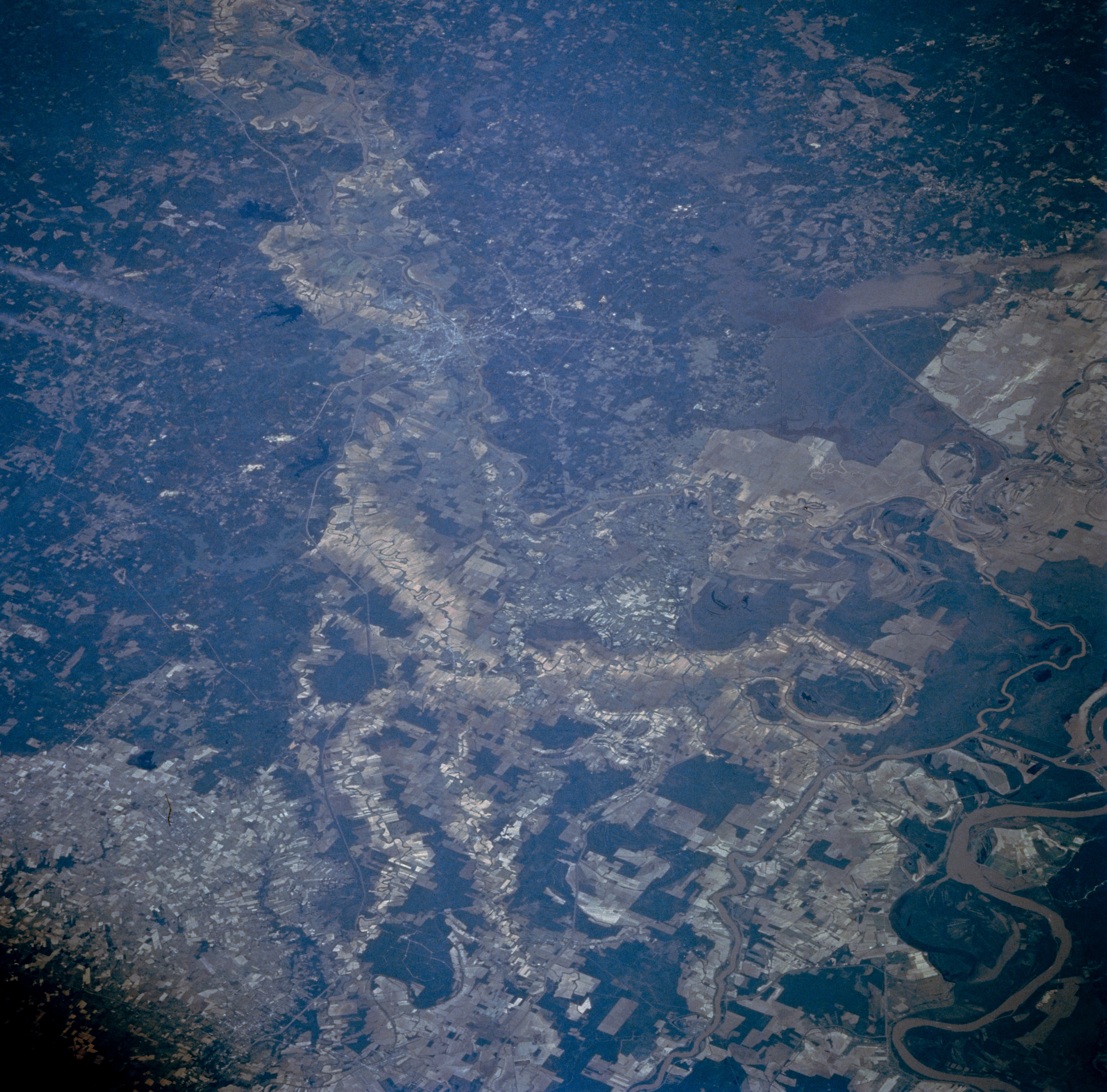
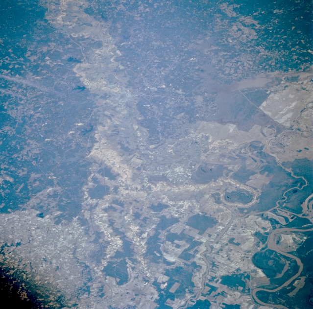
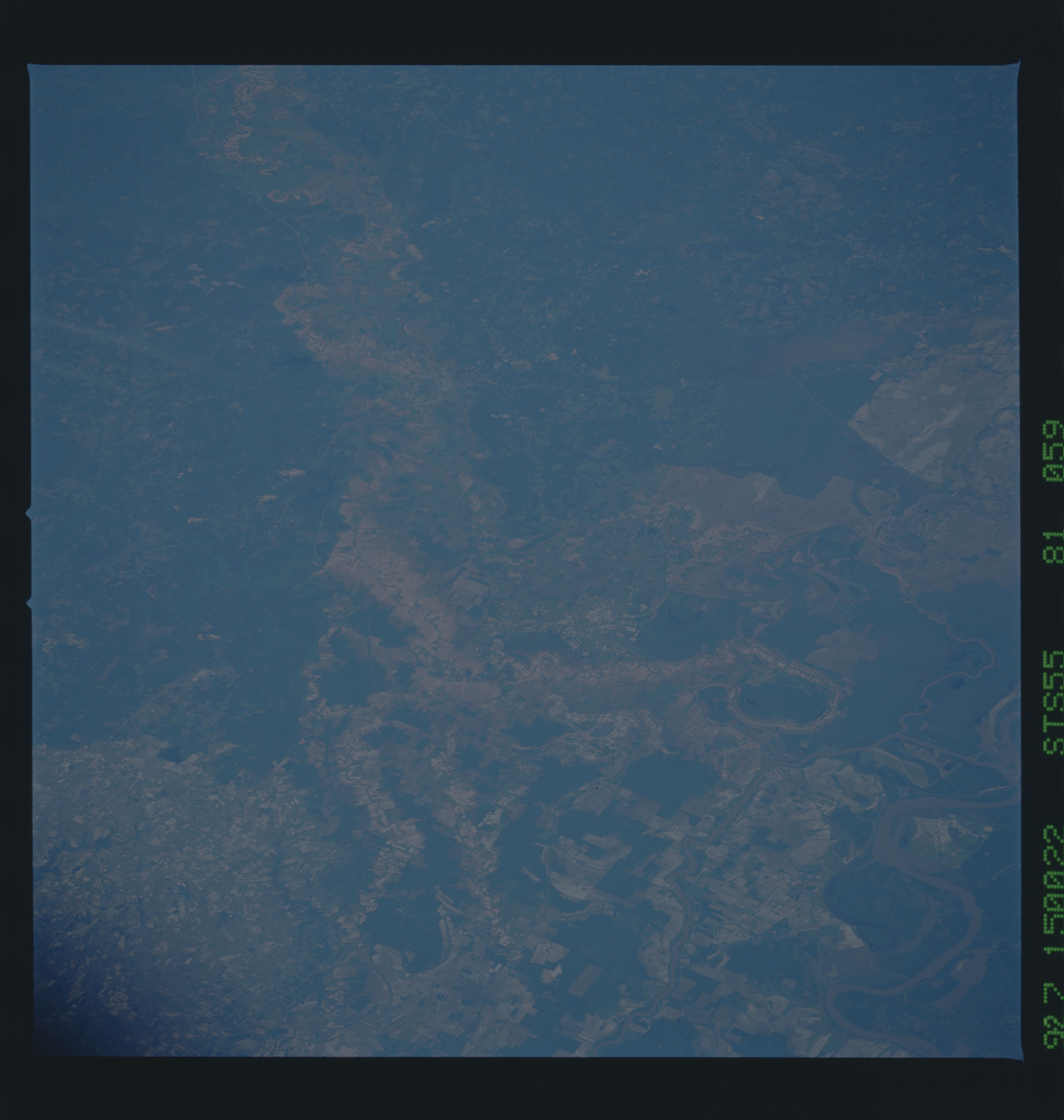
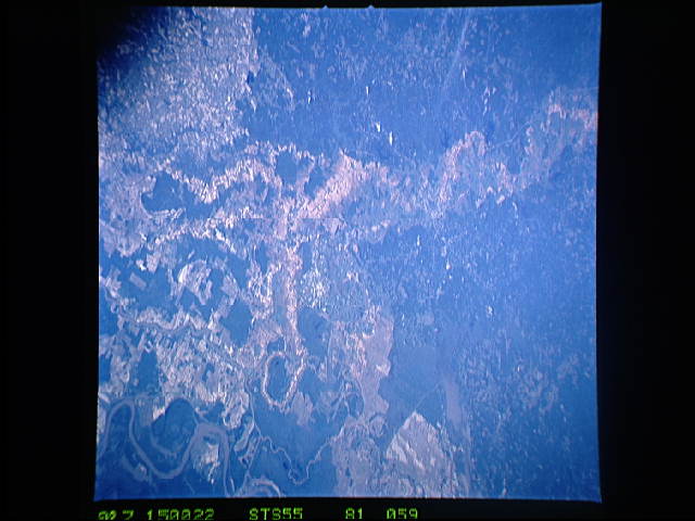
Image Caption: STS055-081-059 Red River Valley, Louisiana, U.S.A. May 1993
This northwest-looking photograph of central Louisiana accentuates the complicated merging of the Red River, Mississippi River, and Atchafalaya River between Alexandria and Baton Rouge. Alexandria is discernible along an east meander of the Red River, which has a broad, northwest-southeast-aligned floodplain. Visible are several large meanders of the Mississippi River (lower right corner) and the Atchafalaya River to the west, the main channel of which can be traced northward to the southern edge of the Dismal Swamp. Numerous interconnecting channels and streams crisscross the flat, swampy landscape. Cultivated field patterns are visible on the elevated terrain (lower left corner).
This northwest-looking photograph of central Louisiana accentuates the complicated merging of the Red River, Mississippi River, and Atchafalaya River between Alexandria and Baton Rouge. Alexandria is discernible along an east meander of the Red River, which has a broad, northwest-southeast-aligned floodplain. Visible are several large meanders of the Mississippi River (lower right corner) and the Atchafalaya River to the west, the main channel of which can be traced northward to the southern edge of the Dismal Swamp. Numerous interconnecting channels and streams crisscross the flat, swampy landscape. Cultivated field patterns are visible on the elevated terrain (lower left corner).
