STS055-77-69
| NASA Photo ID | STS055-77-69 |
| Focal Length | 100mm |
| Date taken | 1993.04.28 |
| Time taken | 06:09:46 GMT |
Resolutions offered for this image:
6864 x 6864 pixels 639 x 639 pixels 5700 x 6000 pixels 500 x 526 pixels 640 x 480 pixels 650 x 632 pixels 645 x 638 pixels
6864 x 6864 pixels 639 x 639 pixels 5700 x 6000 pixels 500 x 526 pixels 640 x 480 pixels 650 x 632 pixels 645 x 638 pixels

Cloud masks available for this image:
Spacecraft nadir point: 26.1° N, 63.9° E
Photo center point: 26.5° N, 65.5° E
Photo center point by machine learning:
Photo center point: 26.5° N, 65.5° E
Photo center point by machine learning:
Nadir to Photo Center: East
Spacecraft Altitude: 163 nautical miles (302km)
Country or Geographic Name: | PAKISTAN |
Features: | COASTLINE, MAKRAN RANGE |
| Features Found Using Machine Learning: | |
Cloud Cover Percentage: | 5 (1-10)% |
Sun Elevation Angle: | 65° |
Sun Azimuth: | 114° |
Camera: | Hasselblad |
Focal Length: | 100mm |
Camera Tilt: | 31 degrees |
Format: | 5017: Kodak, natural color positive, Ektachrome, X Professional, ASA 64, standard base |
Film Exposure: | Normal |
| Additional Information | |
| Width | Height | Annotated | Cropped | Purpose | Links |
|---|---|---|---|---|---|
| 6864 pixels | 6864 pixels | No | No | Earth From Space collection | Download Image |
| 639 pixels | 639 pixels | No | No | Earth From Space collection | Download Image |
| 5700 pixels | 6000 pixels | No | No | Download Image | |
| 500 pixels | 526 pixels | No | No | Download Image | |
| 640 pixels | 480 pixels | No | No | Download Image | |
| 650 pixels | 632 pixels | No | No | Download Image | |
| 645 pixels | 638 pixels | No | No | Download Image |
Download Packaged File
Download a Google Earth KML for this Image
View photo footprint information
Download a GeoTIFF for this photo
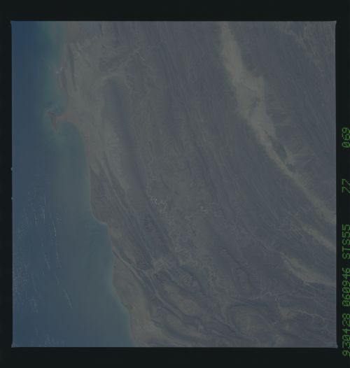
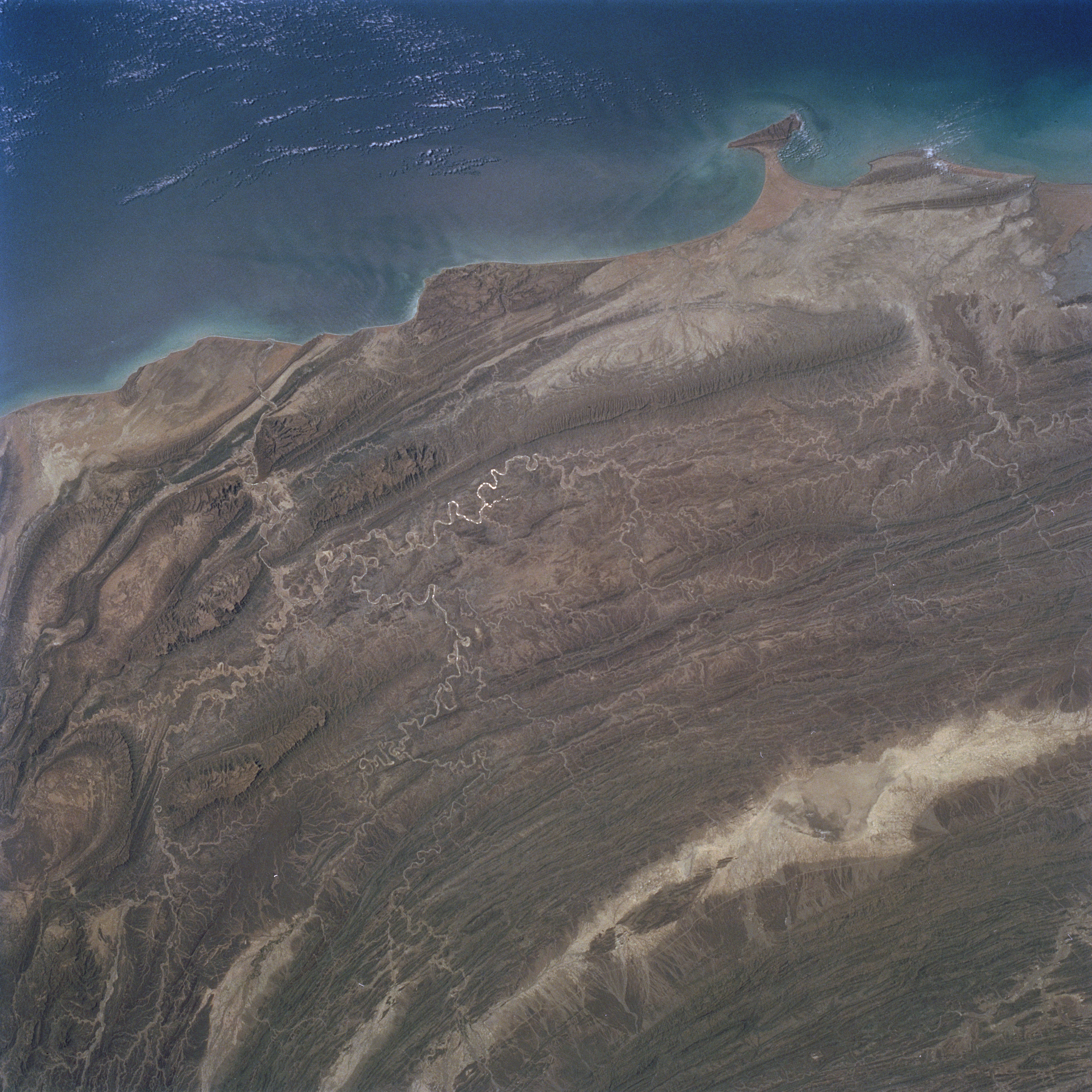
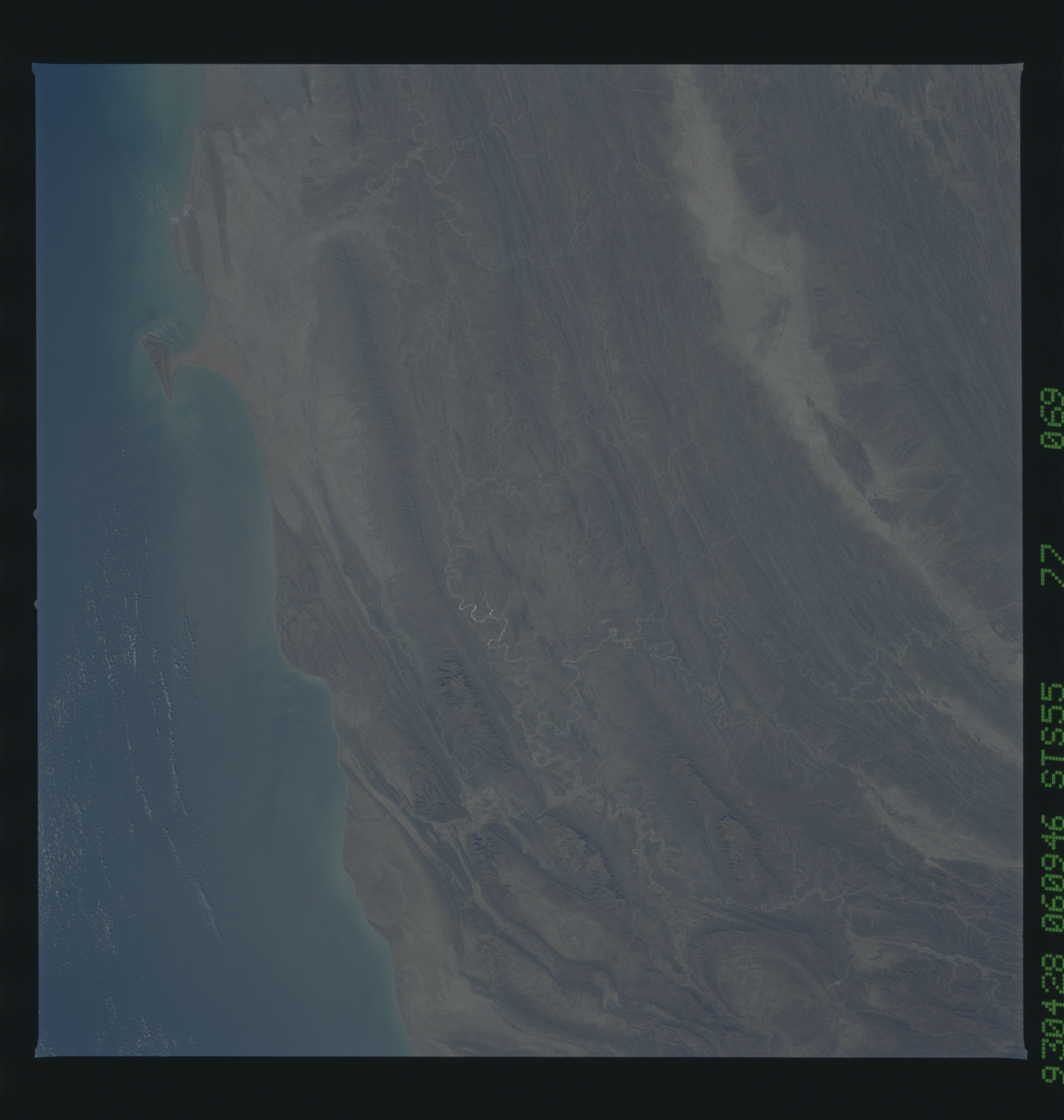
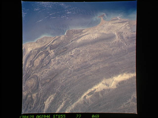
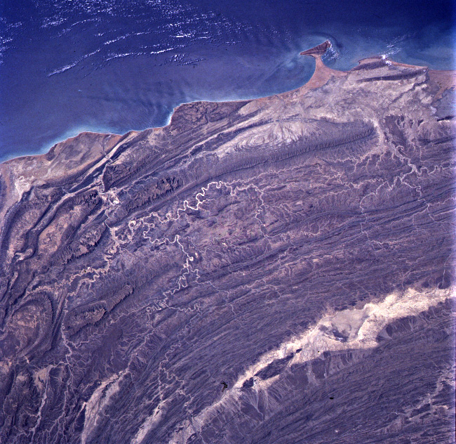
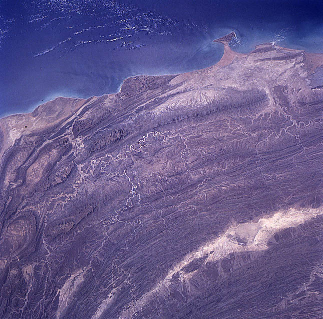
Image Caption: STS055-077-069 Makran Mountains, Pakistan May 1993
The impact of the Indian plate colliding with the Eurasian plate is captured in this synoptic image of the large-scale crustal deformation in southwest Pakistan adjacent to the Arabian Sea. This type of view shows the result of the tremendous tectonic forces that have shaped the rugged mountainous landscape of western Pakistan. Looking at the folding and bending of the Makran Coast Range and the Central Makran Coast Range with the intervening arid valleys, hills, and plateaus the result of plate tectonics on this part of the world is striking and dramatic. The ridgelines and peaks of the mountainous terrain range from 3000 feet (915 meters) to 4500 feet (1370 meters) above sea level. The structure-controlled drainage pattern (light-colored, meandering lines), especially of the Hingol River and its tributaries (lower left quadrant), parallels the multi folded mountains. In a few places the ephemeral streams have continually cut through the mountains as the uplifting and folding processes progressed to maintain drainage channels (southward) into the Arabian Sea. The elongated, highly reflective feature (bottom right) is a large dry lake (salt flat) that is located in an isolated valley.
The impact of the Indian plate colliding with the Eurasian plate is captured in this synoptic image of the large-scale crustal deformation in southwest Pakistan adjacent to the Arabian Sea. This type of view shows the result of the tremendous tectonic forces that have shaped the rugged mountainous landscape of western Pakistan. Looking at the folding and bending of the Makran Coast Range and the Central Makran Coast Range with the intervening arid valleys, hills, and plateaus the result of plate tectonics on this part of the world is striking and dramatic. The ridgelines and peaks of the mountainous terrain range from 3000 feet (915 meters) to 4500 feet (1370 meters) above sea level. The structure-controlled drainage pattern (light-colored, meandering lines), especially of the Hingol River and its tributaries (lower left quadrant), parallels the multi folded mountains. In a few places the ephemeral streams have continually cut through the mountains as the uplifting and folding processes progressed to maintain drainage channels (southward) into the Arabian Sea. The elongated, highly reflective feature (bottom right) is a large dry lake (salt flat) that is located in an isolated valley.
