STS055-152A-41
| NASA Photo ID | STS055-152A-41 |
| Focal Length | 250mm |
| Date taken | 1993.04.30 |
| Time taken | 13:48:42 GMT |


Cloud masks available for this image:
Spacecraft nadir point: 27.7° N, 81.2° W
Photo center point: 28.0° N, 82.5° W
Photo center point by machine learning:
Photo center point: 28.0° N, 82.5° W
Photo center point by machine learning:
Nadir to Photo Center: West
Spacecraft Altitude: 164 nautical miles (304km)
Country or Geographic Name: | USA-FLORIDA |
Features: | TAMPA BAY AREA |
| Features Found Using Machine Learning: | |
Cloud Cover Percentage: | 0 (no clouds present) |
Sun Elevation Angle: | 39° |
Sun Azimuth: | 93° |
Camera: | Linhof |
Focal Length: | 250mm |
Camera Tilt: | 26 degrees |
Format: | QX868: Kodak, natural color positive, Ektachrome QX868(5017 emulsion), ASA 64, thin base |
Film Exposure: | Normal |
| Additional Information | |
| Width | Height | Annotated | Cropped | Purpose | Links |
|---|---|---|---|---|---|
| 5152 pixels | 4064 pixels | No | No | Earth From Space collection | Download Image |
| 640 pixels | 504 pixels | No | No | Earth From Space collection | Download Image |
| 640 pixels | 480 pixels | No | No | ISD 1 | Download Image |
Download Packaged File
Download a Google Earth KML for this Image
View photo footprint information
Download a GeoTIFF for this photo
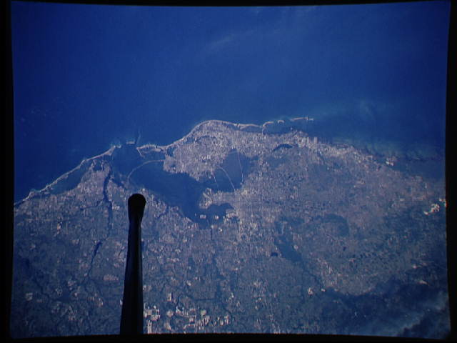
Image Caption: STS055-152A-041 Tampa Bay, Florida, U.S.A. May 1993
The blue Gulf of Mexico contrasts sharply with the reflective sandy beaches along this section of west-central Florida. Crossing Tampa Bay are bridges that provide key land links between the major urban areas of Bradenton, Clearwater, Saint Petersburg, and Tampa. The short Manatee River travels across the flat landscape and empties into southern Tampa Bay. The highly reflective features (bottom center) appear to be limestone quarries.
The blue Gulf of Mexico contrasts sharply with the reflective sandy beaches along this section of west-central Florida. Crossing Tampa Bay are bridges that provide key land links between the major urban areas of Bradenton, Clearwater, Saint Petersburg, and Tampa. The short Manatee River travels across the flat landscape and empties into southern Tampa Bay. The highly reflective features (bottom center) appear to be limestone quarries.
