STS054-86-1
| NASA Photo ID | STS054-86-1 |
| Focal Length | 250mm |
| Date taken | 1993.01.16 |
| Time taken | 18:01:24 GMT |
Resolutions offered for this image:
3904 x 3925 pixels 636 x 640 pixels 5700 x 6000 pixels 500 x 526 pixels 640 x 480 pixels 6820 x 6741 pixels 909 x 1122 pixels 6820 x 6741 pixels 5054 x 5177 pixels 540 x 667 pixels
3904 x 3925 pixels 636 x 640 pixels 5700 x 6000 pixels 500 x 526 pixels 640 x 480 pixels 6820 x 6741 pixels 909 x 1122 pixels 6820 x 6741 pixels 5054 x 5177 pixels 540 x 667 pixels


Cloud masks available for this image:
Spacecraft nadir point: 17.6° S, 39.7° W
Photo center point: 17.5° S, 39.0° W
Photo center point by machine learning:
Photo center point: 17.5° S, 39.0° W
Photo center point by machine learning:
Nadir to Photo Center: East
Spacecraft Altitude: 163 nautical miles (302km)
Country or Geographic Name: | BRAZIL |
Features: | POINT BALEIA, CARAVELAS |
| Features Found Using Machine Learning: | |
Cloud Cover Percentage: | 5 (1-10)% |
Sun Elevation Angle: | 44° |
Sun Azimuth: | 258° |
Camera: | Hasselblad |
Focal Length: | 250mm |
Camera Tilt: | 15 degrees |
Format: | 5017: Kodak, natural color positive, Ektachrome, X Professional, ASA 64, standard base |
Film Exposure: | Normal |
| Additional Information | |
| Width | Height | Annotated | Cropped | Purpose | Links |
|---|---|---|---|---|---|
| 3904 pixels | 3925 pixels | No | No | Earth From Space collection | Download Image |
| 636 pixels | 640 pixels | No | No | Earth From Space collection | Download Image |
| 5700 pixels | 6000 pixels | No | No | Download Image | |
| 500 pixels | 526 pixels | No | No | Download Image | |
| 640 pixels | 480 pixels | No | No | Download Image | |
| 6820 pixels | 6741 pixels | No | No | Coral Reef Atlas Publication | Download Image |
| 909 pixels | 1122 pixels | Yes | Yes | Publisher Request | Download Image |
| 6820 pixels | 6741 pixels | No | No | Download Image | |
| 5054 pixels | 5177 pixels | No | No | Download Image | |
| 540 pixels | 667 pixels | Yes | Yes | Publisher Request | Download Image |
Download Packaged File
Download a Google Earth KML for this Image
View photo footprint information
Download a GeoTIFF for this photo
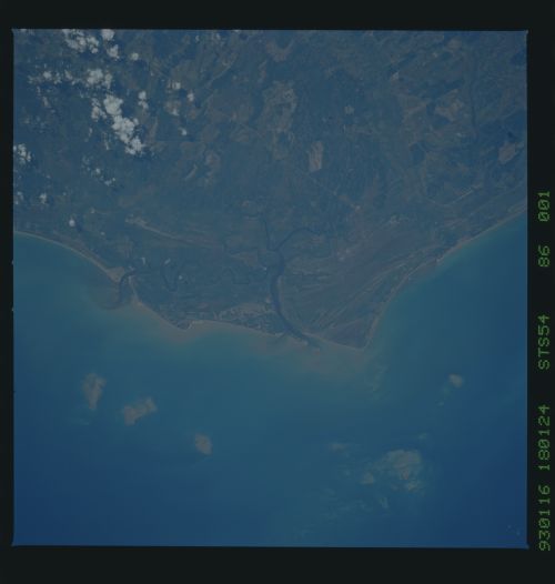
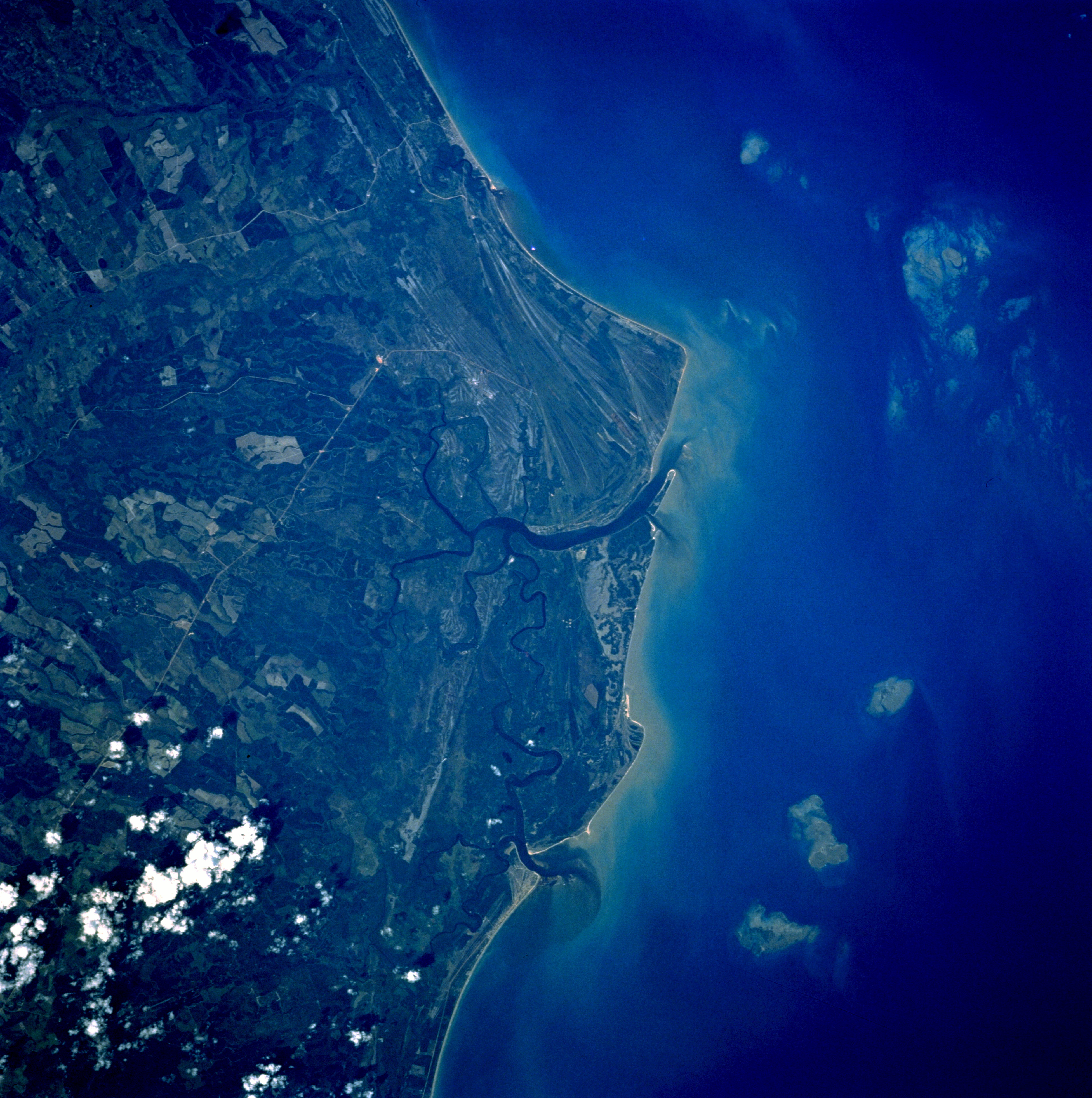
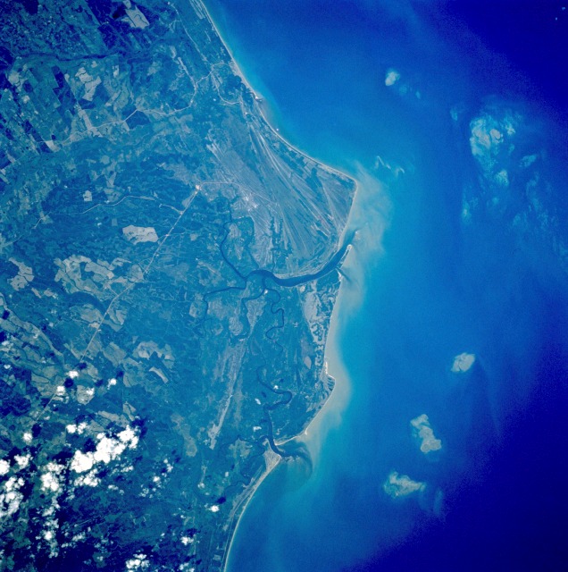
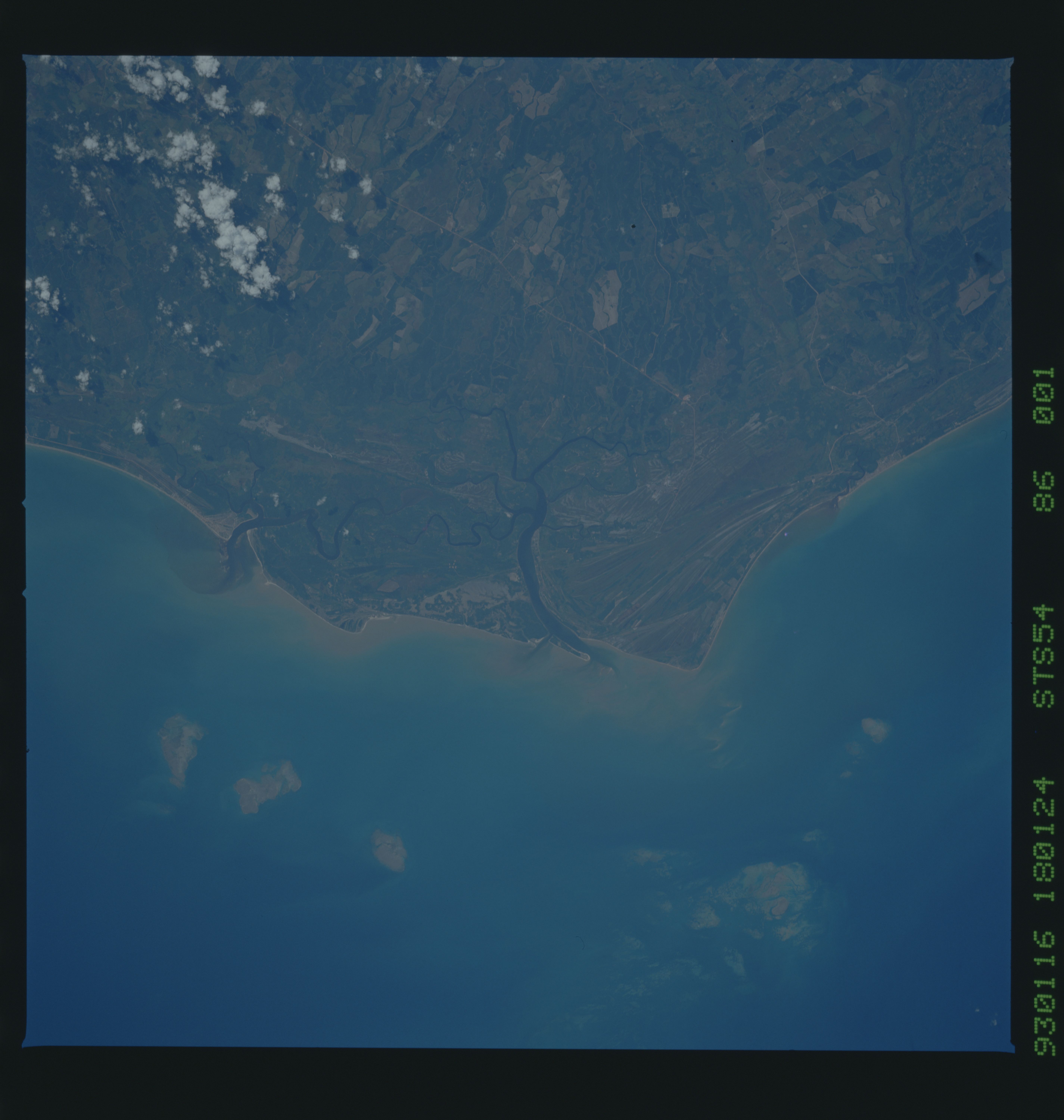
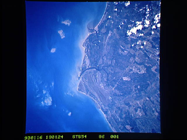
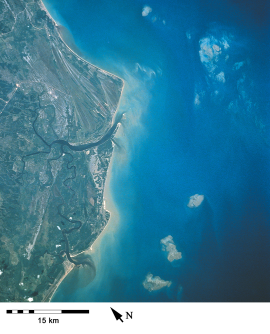
Image Caption: STS054-086-001 Caravelas, Bahia, Brazil January 1993
This rural Brazilian coastal area is designated as an Atlantic rain forest, where annual precipitation usually exceeds 80 inches (200 centimeters). The general greenness of the vegetated cover supports the classification of a humid equatorial climate with no specific dry season. Barely visible are intersecting runways of a local airport approximately 5 miles (8 kilometers) north of the small town of Caravelas, north of the larger river estuary near the center of the photograph. Eastward toward the coast are numerous ancient beach terraces (parallel, striated lines). Two highly reflective, linear features, which are probably improved highways, traverse the coastal plains and connect interior cities with this small port city. The lighter field patterns are possibly large sugarcane plantations. The vegetated floodplain of the Alcobaca River is barely visible near the northern edge of the photograph.
Cape Baleia (17.5N, 39.0W), on the north central coast of Brazil illustrates a good example of multiple coastal sand spits. Over a several thousand year time period, shifting regimes of wave and current patterns have piled up sand onto a series of beach ridges and tidal lagoons. Offshore, several prominent reefs and sandbanks can be seen paralleling the coast. The largest is the Recife da Pedra Grande (Big Rocks Reef).
