STS054-152-16
| NASA Photo ID | STS054-152-16 |
| Focal Length | 250mm |
| Date taken | 1993.01.__ |
| Time taken | GMT |

Cloud masks available for this image:
Spacecraft nadir point:
Photo center point: 17.5° S, 31.5° E
Photo center point by machine learning:
Photo center point: 17.5° S, 31.5° E
Photo center point by machine learning:
Nadir to Photo Center:
Spacecraft Altitude: nautical miles (0km)
Country or Geographic Name: | ZIMBABWE |
Features: | GREAT DIKE |
| Features Found Using Machine Learning: | |
Cloud Cover Percentage: | 5 (1-10)% |
Sun Elevation Angle: | ° |
Sun Azimuth: | ° |
Camera: | Linhof |
Focal Length: | 250mm |
Camera Tilt: | Low Oblique |
Format: | QX868: Kodak, natural color positive, Ektachrome QX868(5017 emulsion), ASA 64, thin base |
Film Exposure: | Normal |
| Additional Information | |
| Width | Height | Annotated | Cropped | Purpose | Links |
|---|---|---|---|---|---|
| 5668 pixels | 4478 pixels | No | No | Earth From Space collection | Download Image |
| 639 pixels | 505 pixels | No | No | Earth From Space collection | Download Image |
| 640 pixels | 480 pixels | No | No | ISD 1 | Download Image |
Download Packaged File
Download a Google Earth KML for this Image
View photo footprint information
Download a GeoTIFF for this photo
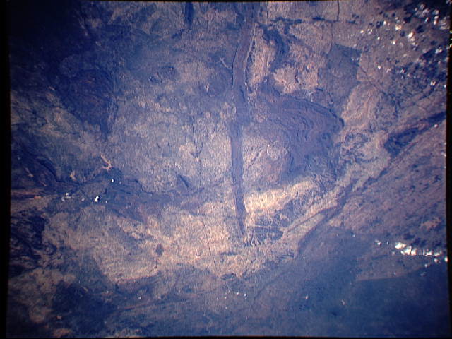
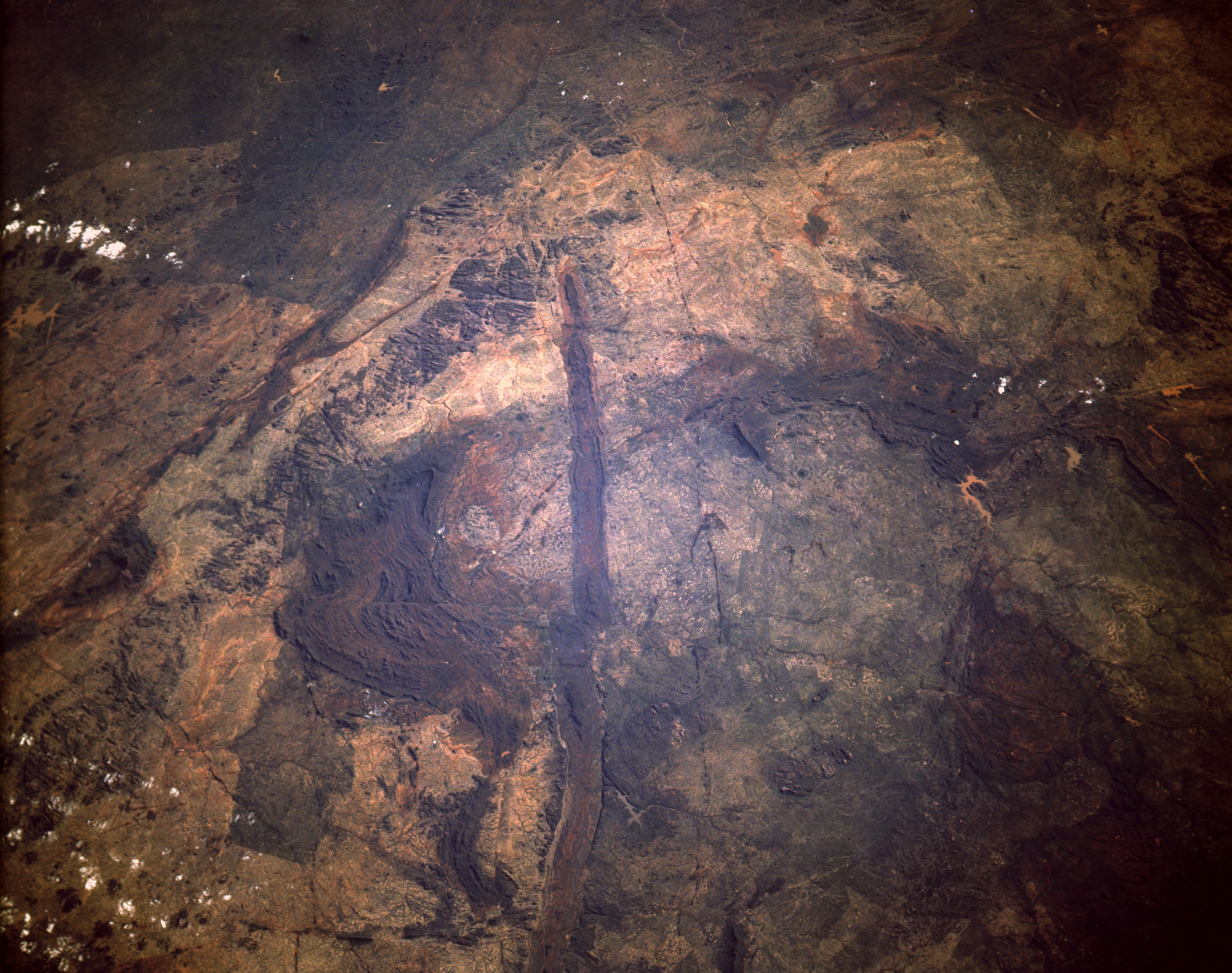
Image Caption: STS054-152-016 Great Dike, Zimbabwe January 1993
The Great Dike of Zimbabwe is a linear geological feature that is easily recognizable running 300 miles (483 kilometers) north-south through the midsection of Zimbabwe. This photograph shows only the southernmost extent of the Great Dike. The highly mineralized composition of the dike (igneous rock) makes this an important economic region for Zimbabwe. Copper, asbestos, chromium, gold, and platinum are some of the minerals that make up the strategic mineral reserves found throughout this region. Some of the lighter brown areas in this photograph are large areas of overgrazed "tribal trust lands" that are scattered throughout Zimbabwe. There is also visual evidence that east-west surface displacement (faulting) has occurred at several points along the Great Dike. Much narrower, paralleling mineralized veins observed east and west of the Great Dike exhibit the same horizontal displacements as the much broader dike.
The Great Dike of Zimbabwe (17.5S, 31.5E) bisects the entire length of Zimbabwae in southern Africa and is one of the prominent visual features easily recognized from low orbit. The volcanic rocks which make up the dike are about 1.2 billion years old and are rich in chromite and platinum which are mined from it. The straight line of the dike is offset in places by faults which are often occupied by streams flowing through the fractures.
