STS052-77-12
| NASA Photo ID | STS052-77-12 |
| Focal Length | 250mm |
| Date taken | 1992.10.30 |
| Time taken | 07:34:44 GMT |
Resolutions offered for this image:
5700 x 6000 pixels 500 x 526 pixels 640 x 480 pixels 1259 x 1263 pixels 963 x 960 pixels 960 x 963 pixels
5700 x 6000 pixels 500 x 526 pixels 640 x 480 pixels 1259 x 1263 pixels 963 x 960 pixels 960 x 963 pixels

Cloud masks available for this image:
Spacecraft nadir point: 15.5° S, 121.8° E
Photo center point: 18.0° S, 122.0° E
Photo center point by machine learning:
Photo center point: 18.0° S, 122.0° E
Photo center point by machine learning:
Nadir to Photo Center: South
Spacecraft Altitude: 159 nautical miles (294km)
Country or Geographic Name: | AUSTRALIA-WA |
Features: | ROEBUCK BAY, SOFT FOCUS |
| Features Found Using Machine Learning: | |
Cloud Cover Percentage: | 0 (no clouds present) |
Sun Elevation Angle: | 33° |
Sun Azimuth: | 263° |
Camera: | Hasselblad |
Focal Length: | 250mm |
Camera Tilt: | 43 degrees |
Format: | 5017: Kodak, natural color positive, Ektachrome, X Professional, ASA 64, standard base |
Film Exposure: | Out of Focus |
| Additional Information | |
| Width | Height | Annotated | Cropped | Purpose | Links |
|---|---|---|---|---|---|
| 5700 pixels | 6000 pixels | No | No | Download Image | |
| 500 pixels | 526 pixels | No | No | Download Image | |
| 640 pixels | 480 pixels | No | No | Download Image | |
| 1259 pixels | 1263 pixels | No | No | Download Image | |
| 963 pixels | 960 pixels | Yes | No | Download Image | |
| 960 pixels | 963 pixels | Download Image |
Download Packaged File
Download a Google Earth KML for this Image
View photo footprint information
Download a GeoTIFF for this photo
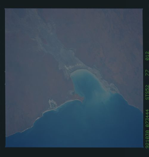
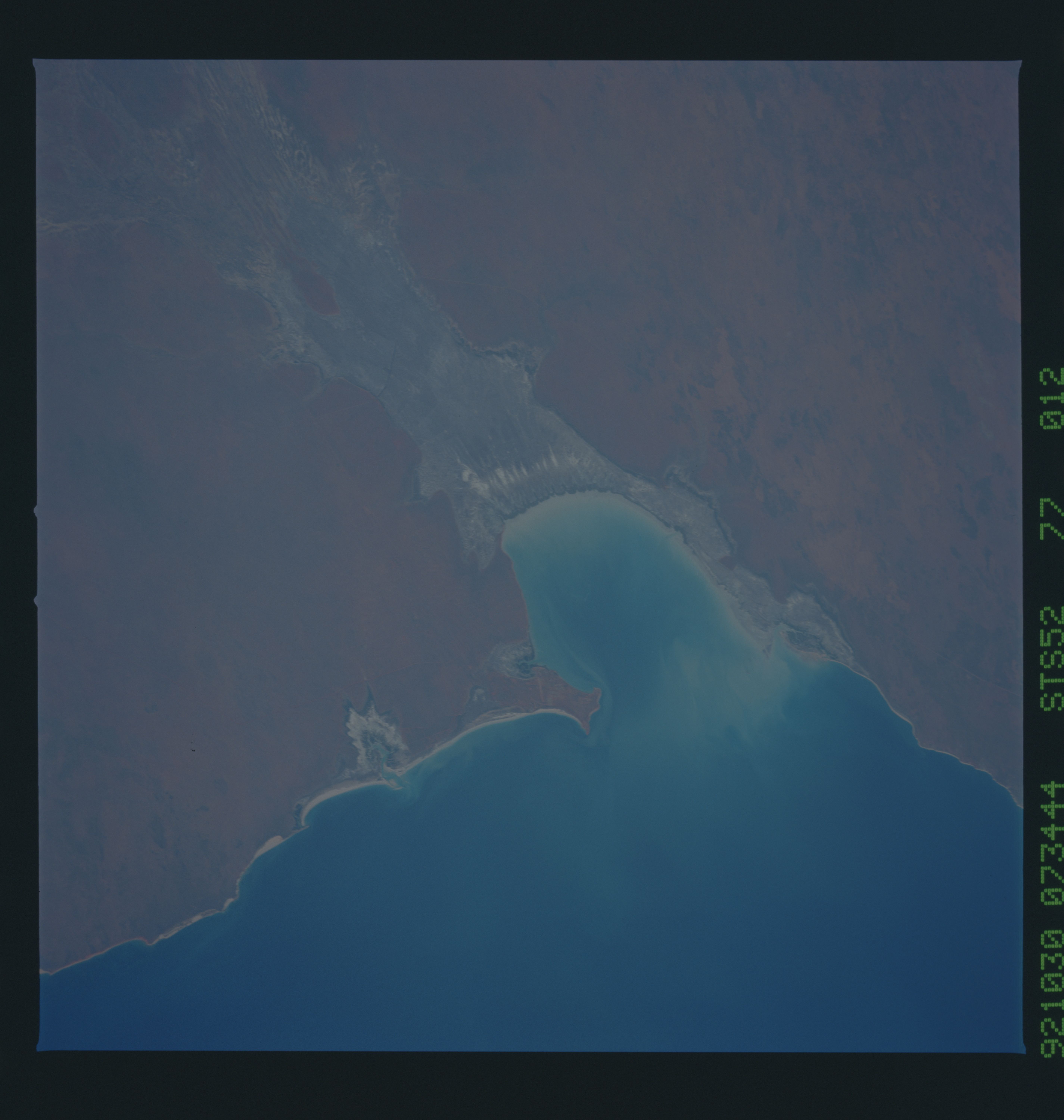
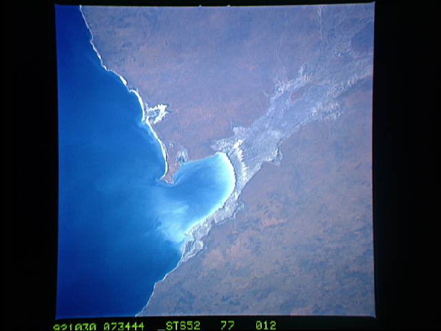
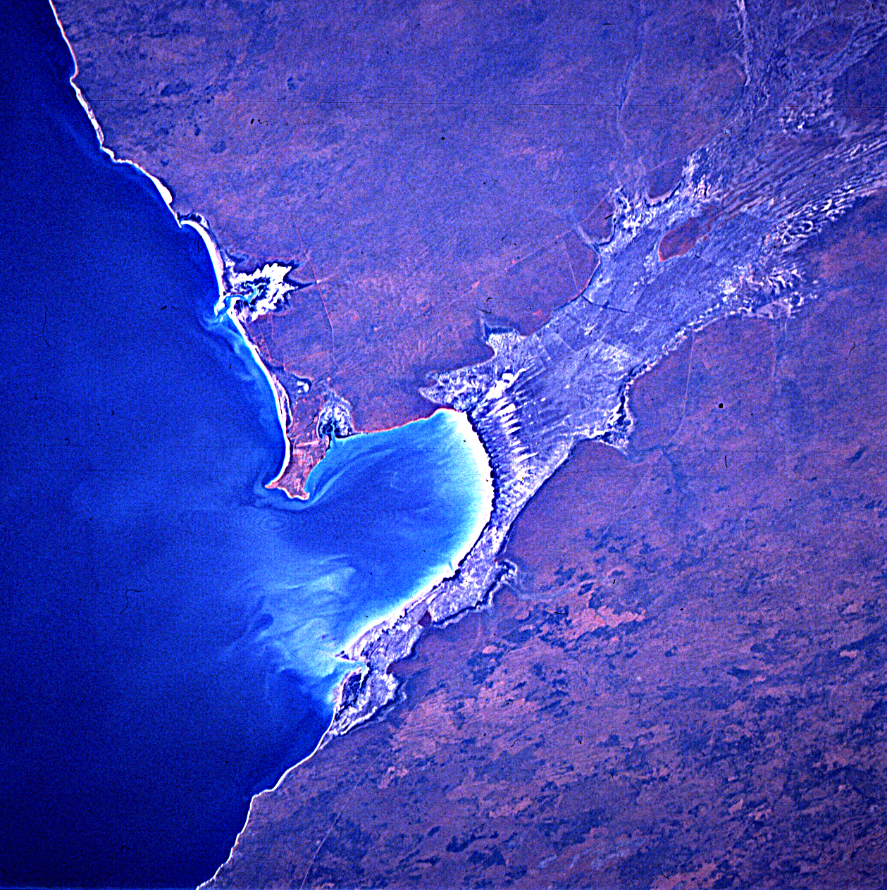
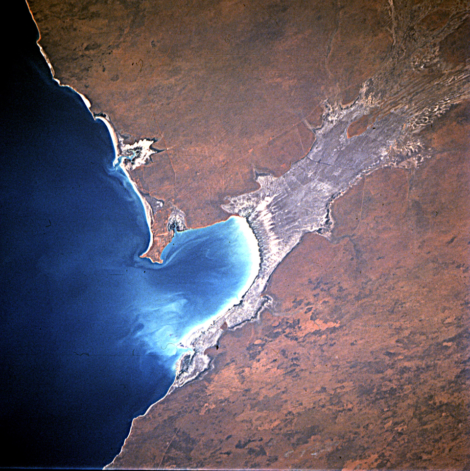
Image Caption: Roebuck Bay, Western Australia. Broome is invisible on the anemone-shaped point. Grooves in the tidal flat, mangrove coast.
Roebuck Bay (18.0S, 122.0E) is a prominent bay on the arid northwest coast of Western Australia and the town of Broome is one of the few prominent towns along this very sparsley settled coast. The large gray area extending back from the shoreline of the bay is the Roebuck Plains slowly being filled with sediment by local streams draining the Great Sandy Desert. The irregular bare patches on the desert to the south are burn scars from brush fires.
Roebuck Bay (18.0S, 122.0E) is a prominent bay on the arid northwest coast of Western Australia and the town of Broome is one of the few prominent towns along this very sparsley settled coast. The large gray area extending back from the shoreline of the bay is the Roebuck Plains slowly being filled with sediment by local streams draining the Great Sandy Desert. The irregular bare patches on the desert to the south are burn scars from brush fires.
