STS052-76-81
| NASA Photo ID | STS052-76-81 |
| Focal Length | 250mm |
| Date taken | 1992.10.29 |
| Time taken | 21:06:56 GMT |

Cloud masks available for this image:
Spacecraft nadir point: 20.3° S, 65.4° W
Photo center point: 19.5° S, 68.0° W
Photo center point by machine learning:
Photo center point: 19.5° S, 68.0° W
Photo center point by machine learning:
Nadir to Photo Center: West
Spacecraft Altitude: 159 nautical miles (294km)
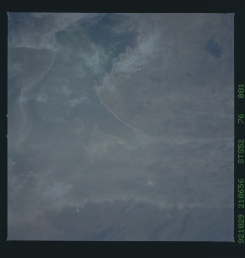
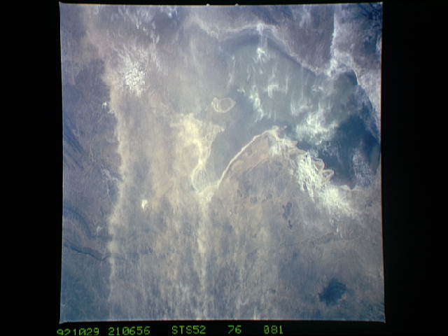
Country or Geographic Name: | BOLIVIA |
Features: | COIPASA LAKE AREA |
| Features Found Using Machine Learning: | |
Cloud Cover Percentage: | 5 (1-10)% |
Sun Elevation Angle: | 18° |
Sun Azimuth: | 262° |
Camera: | Hasselblad |
Focal Length: | 250mm |
Camera Tilt: | 46 degrees |
Format: | 5017: Kodak, natural color positive, Ektachrome, X Professional, ASA 64, standard base |
Film Exposure: | Normal |
| Additional Information | |
| Width | Height | Annotated | Cropped | Purpose | Links |
|---|---|---|---|---|---|
| 5700 pixels | 6000 pixels | No | No | Download Image | |
| 500 pixels | 526 pixels | No | No | Download Image | |
| 640 pixels | 480 pixels | No | No | Download Image |
Download Packaged File
Download a Google Earth KML for this Image
View photo footprint information
Download a GeoTIFF for this photo
Image Caption: Simultaneous color and infra-red views
Dust rises on the plains due west of Bolivia's Lago Poopo in the central Andes. It is thick enough to be detected even on CIR film which tends to "see through" thin dust haze. These plumes merge into a wide pall which then banks up against a topographic barrier (right, CIR photo, over). The trajectory of this pall (050deg.) is directly towards Rondonia, the region of intensive deforestation in Brazil
Dust rises on the plains due west of Bolivia's Lago Poopo in the central Andes. It is thick enough to be detected even on CIR film which tends to "see through" thin dust haze. These plumes merge into a wide pall which then banks up against a topographic barrier (right, CIR photo, over). The trajectory of this pall (050deg.) is directly towards Rondonia, the region of intensive deforestation in Brazil
