STS052-153-104
| NASA Photo ID | STS052-153-104 |
| Focal Length | 90mm |
| Date taken | 1992.10.26 |
| Time taken | 17:35:32 GMT |

Cloud masks available for this image:
Spacecraft nadir point: 23.0° N, 79.8° W
Photo center point: 25.0° N, 78.0° W
Photo center point by machine learning:
Photo center point: 25.0° N, 78.0° W
Photo center point by machine learning:
Nadir to Photo Center: Northeast
Spacecraft Altitude: 158 nautical miles (293km)
Country or Geographic Name: | BAHAMAS |
Features: | CENTERED ON ANDROS I. |
| Features Found Using Machine Learning: | |
Cloud Cover Percentage: | 50 (26-50)% |
Sun Elevation Angle: | 53° |
Sun Azimuth: | 193° |
Camera: | Linhof |
Focal Length: | 90mm |
Camera Tilt: | High Oblique |
Format: | QX868: Kodak, natural color positive, Ektachrome QX868(5017 emulsion), ASA 64, thin base |
Film Exposure: | Normal |
| Additional Information | |
| Width | Height | Annotated | Cropped | Purpose | Links |
|---|---|---|---|---|---|
| 640 pixels | 480 pixels | No | No | ISD 1 | Download Image |
| 2996 pixels | 2400 pixels | No | No | Download Image | |
| 574 pixels | 453 pixels | Yes | No | Download Image |
Download Packaged File
Download a Google Earth KML for this Image
View photo footprint information
Download a GeoTIFF for this photo
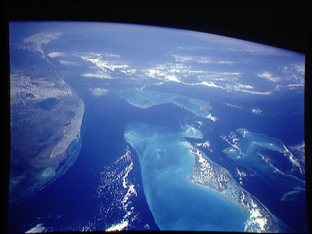
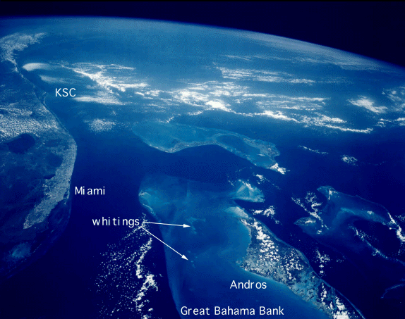
Image Caption: Bahamas
This photograph provides a rare opportunity to observe a
natural chemical laboratory at work. Limestone of a quite
different sort from that forming the Great Barrier Reef is
actually in the process of formation. Many of the Bahama
islands are little more than sandbars rising just a few
meters above sea level but it separates the deep, dark blue
waters of the Atlantic on the fight from the approximately
10-meter (33 feet) shallows of the Great Bahama Bank.
Details of the topography of the bank are visible through
the clear waters.
The shallow waters are warm and become extremely salty.
Crystals of aragonite, a calcium carbonate mineral, are
precipitated and formed into spherical sand-sized oolites as
the tidal currents swirl back and forth. Lithification of
the carbonate sands produces an oolitic limestone. Although
the water is warm and clear, corals do not live in the
shallows, probably because of the elevated salt content.
Although chemically similar, the oolitic limestone forming
the Bahama Islands is very different from coral reef
limestone.
