STS052-151-159
| NASA Photo ID | STS052-151-159 |
| Focal Length | 250mm |
| Date taken | 1992.10.24 |
| Time taken | 11:26:04 GMT |
Cloud masks available for this image:
Spacecraft nadir point: 27.5° N, 9.9° E
Photo center point: 26.5° N, 8.5° E
Photo center point by machine learning:
Photo center point: 26.5° N, 8.5° E
Photo center point by machine learning:
Nadir to Photo Center: Southwest
Spacecraft Altitude: 158 nautical miles (293km)
Country or Geographic Name: | ALGERIA |
Features: | TINRHERT PLAT, DUNES, MTS. |
| Features Found Using Machine Learning: | |
Cloud Cover Percentage: | 0 (no clouds present) |
Sun Elevation Angle: | 50° |
Sun Azimuth: | 188° |
Camera: | Linhof |
Focal Length: | 250mm |
Camera Tilt: | 33 degrees |
Format: | QX868: Kodak, natural color positive, Ektachrome QX868(5017 emulsion), ASA 64, thin base |
Film Exposure: | Normal |
| Additional Information | |
| Width | Height | Annotated | Cropped | Purpose | Links |
|---|---|---|---|---|---|
| 5611 pixels | 4433 pixels | No | No | Earth From Space collection | Download Image |
| 639 pixels | 505 pixels | No | No | Earth From Space collection | Download Image |
| 640 pixels | 480 pixels | No | No | ISD 1 | Download Image |
Download Packaged File
Download a Google Earth KML for this Image
View photo footprint information
Download a GeoTIFF for this photo
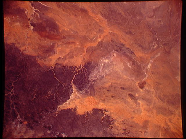
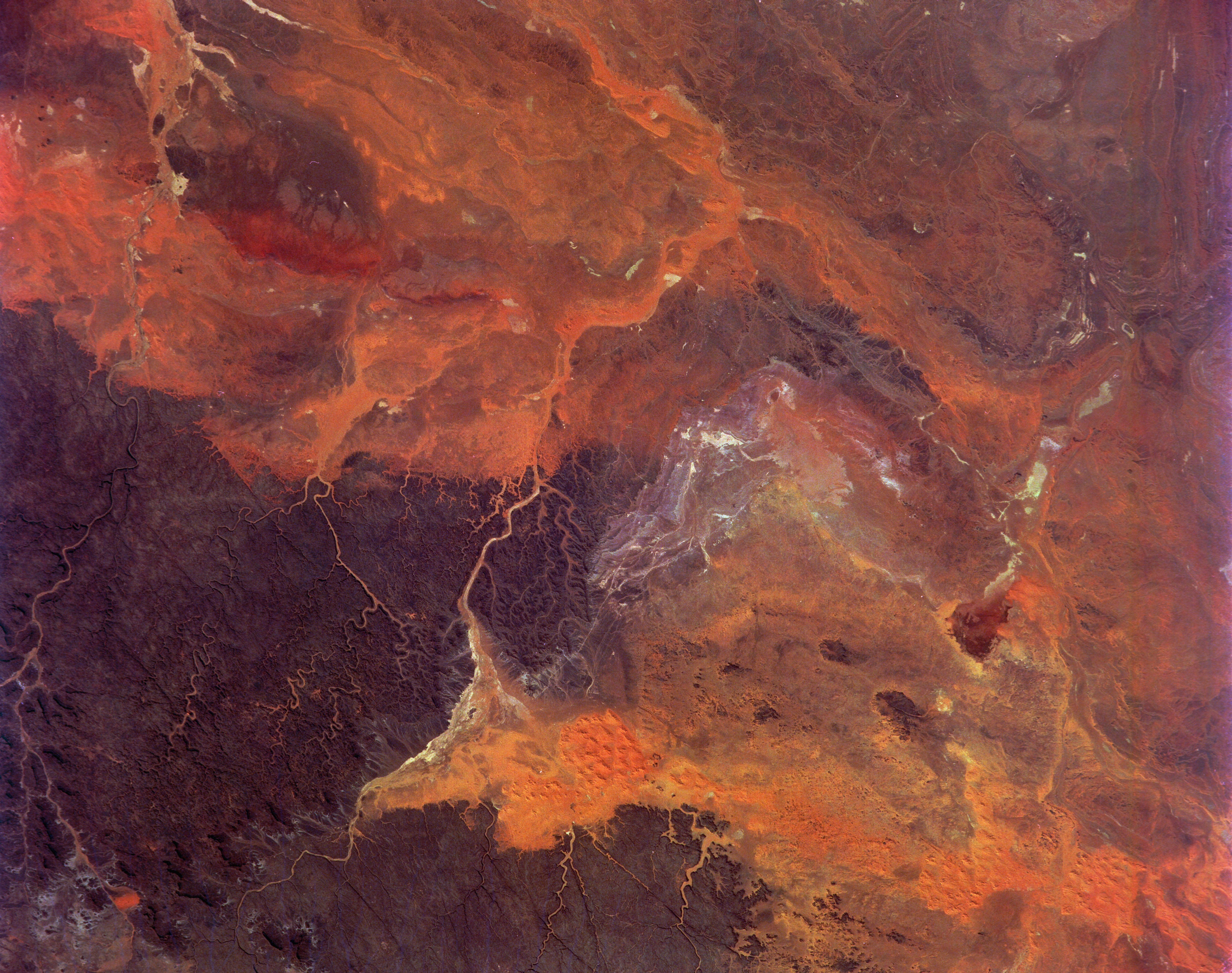
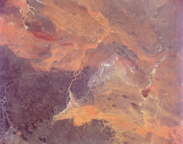
Image Caption: STS052-151-159 Tassili N' Ajjer, Algeria October 1992
The northeastern extension of the Tassili N' Ajjer is an austere, beautiful desert. From the dark, heavily eroded sandstone plateau in the southwestern quadrant of the photograph to the numerous drainage valleys filled with scattered sand sheets and sand dunes, the vivid desert colors range from dull red to black. The wide variety of colors results from desert varnish, which is a thin layer of metallic oxides dissolved from the rocks and deposited on the surface as a stain. This area in southeast Algeria is strategic because it is on the Algeria-Libya border. The border is visible near the center of the photograph in the gray area where very narrow lines could be a roadway, a fence line, or a combination of the two.
The northeastern extension of the Tassili N' Ajjer is an austere, beautiful desert. From the dark, heavily eroded sandstone plateau in the southwestern quadrant of the photograph to the numerous drainage valleys filled with scattered sand sheets and sand dunes, the vivid desert colors range from dull red to black. The wide variety of colors results from desert varnish, which is a thin layer of metallic oxides dissolved from the rocks and deposited on the surface as a stain. This area in southeast Algeria is strategic because it is on the Algeria-Libya border. The border is visible near the center of the photograph in the gray area where very narrow lines could be a roadway, a fence line, or a combination of the two.
