STS052-100-34
| NASA Photo ID | STS052-100-34 |
| Focal Length | 250mm |
| Date taken | 1992.10.28 |
| Time taken | 13:15:27 GMT |
Resolutions offered for this image:
5221 x 5221 pixels 640 x 640 pixels 5700 x 6000 pixels 500 x 526 pixels 640 x 480 pixels
5221 x 5221 pixels 640 x 640 pixels 5700 x 6000 pixels 500 x 526 pixels 640 x 480 pixels
Cloud masks available for this image:
Spacecraft nadir point: 13.5° N, 5.3° W
Photo center point: 14.0° N, 6.0° W
Photo center point by machine learning:
Photo center point: 14.0° N, 6.0° W
Photo center point by machine learning:
Nadir to Photo Center: Northwest
Spacecraft Altitude: 157 nautical miles (291km)
Country or Geographic Name: | MALI |
Features: | NIGER RIVER |
| Features Found Using Machine Learning: | |
Cloud Cover Percentage: | 0 (no clouds present) |
Sun Elevation Angle: | 58° |
Sun Azimuth: | 214° |
Camera: | Hasselblad |
Focal Length: | 250mm |
Camera Tilt: | 18 degrees |
Format: | VELVI: Fuji, natural color positive, Velvia 50, CS 135-36, ASA 32, standard base |
Film Exposure: | Normal |
| Additional Information | |
| Width | Height | Annotated | Cropped | Purpose | Links |
|---|---|---|---|---|---|
| 5221 pixels | 5221 pixels | No | No | Earth From Space collection | Download Image |
| 640 pixels | 640 pixels | No | No | Earth From Space collection | Download Image |
| 5700 pixels | 6000 pixels | No | No | Download Image | |
| 500 pixels | 526 pixels | No | No | Download Image | |
| 640 pixels | 480 pixels | No | No | Download Image |
Download Packaged File
Download a Google Earth KML for this Image
View photo footprint information
Download a GeoTIFF for this photo
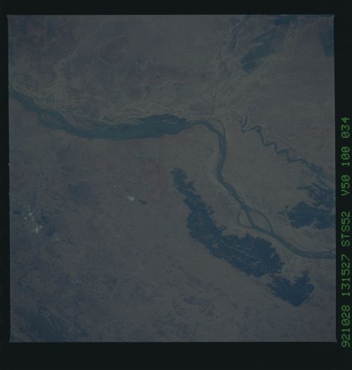
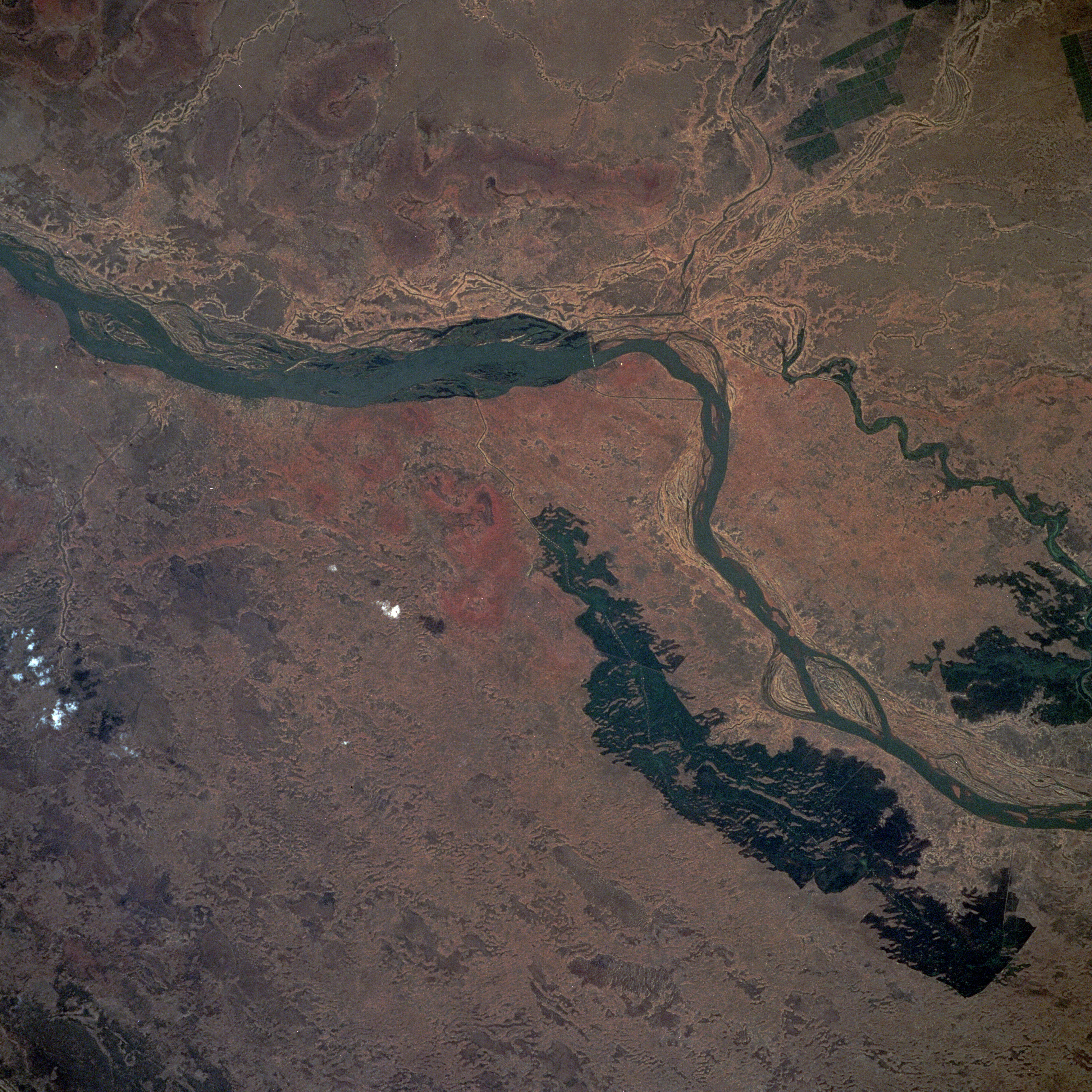
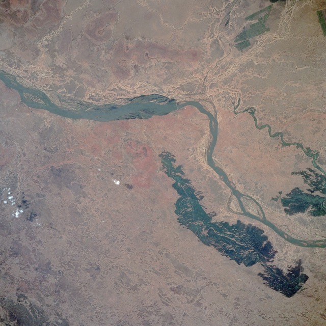
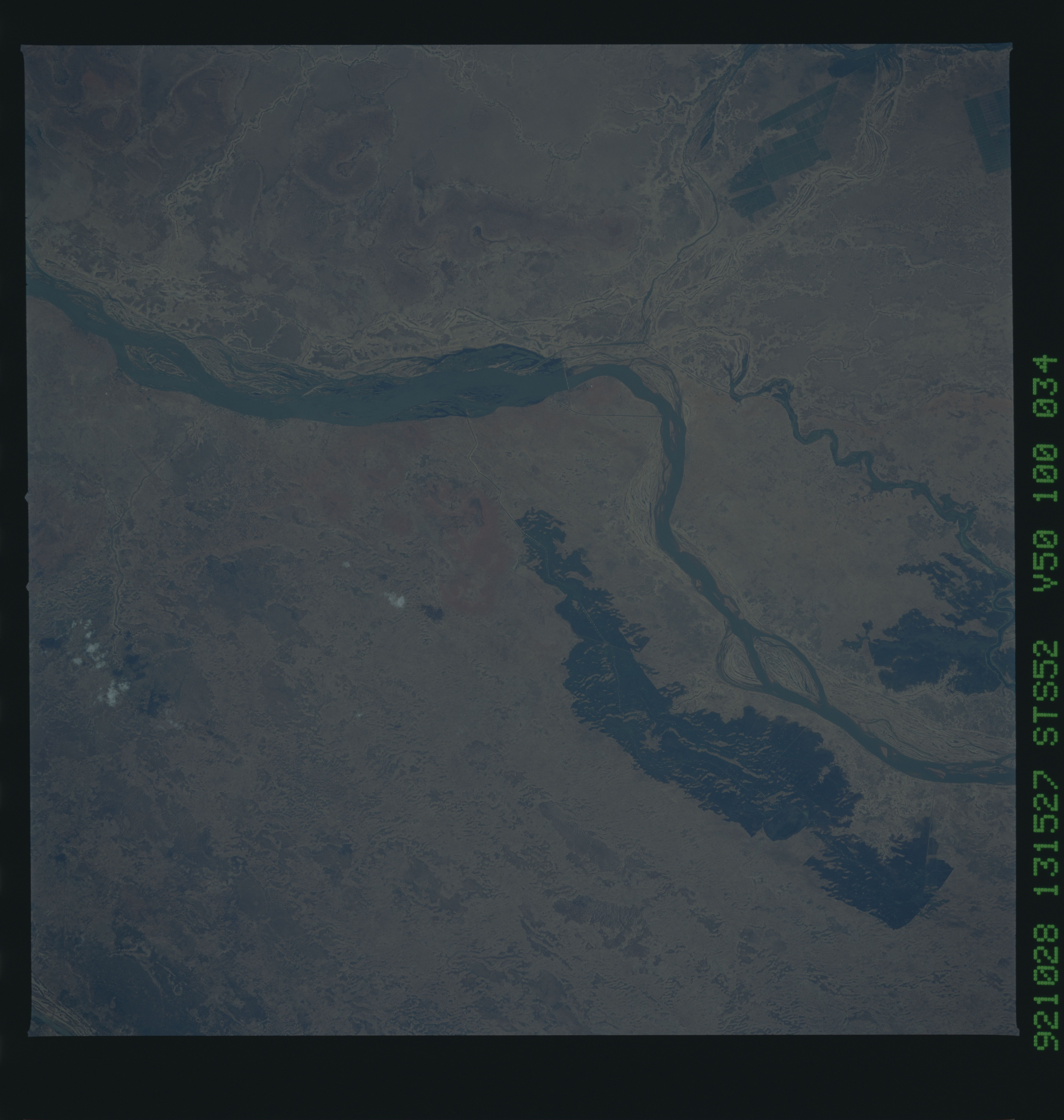
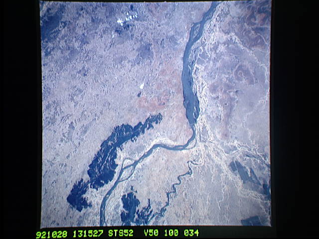
Image Caption: STS052-100-034 Niger River, Mali October 1992
The semiarid, steppe grasslands of central Mali shown in this photograph lie on the southwestern fringe of the inland delta of the Niger River. The small city of Markala is located southeast of the single bridge that spans the northeasterly-flowing Niger. Most of the narrow linear features, which are visible on both the north and south sides of the main river channel, are irrigation ditches. Large dark areas south of the river are irrigated agricultural fields. Large irrigated field patterns are also visible north of the Niger River along the Fala River. This part of Mali is in the center of the Sahel, a transition zone where overgrazing is changing the appearance of the landscape. The area is an environmentally sensitive region where, because of fluctuations and decreasing amounts of rainfall, the grasslands can quickly become a true desert with virtually no vegetation--a process known as desertification. The annual range of precipitation fluctuates between 12 and 20 inches (30 and 50 centimeters).
The semiarid, steppe grasslands of central Mali shown in this photograph lie on the southwestern fringe of the inland delta of the Niger River. The small city of Markala is located southeast of the single bridge that spans the northeasterly-flowing Niger. Most of the narrow linear features, which are visible on both the north and south sides of the main river channel, are irrigation ditches. Large dark areas south of the river are irrigated agricultural fields. Large irrigated field patterns are also visible north of the Niger River along the Fala River. This part of Mali is in the center of the Sahel, a transition zone where overgrazing is changing the appearance of the landscape. The area is an environmentally sensitive region where, because of fluctuations and decreasing amounts of rainfall, the grasslands can quickly become a true desert with virtually no vegetation--a process known as desertification. The annual range of precipitation fluctuates between 12 and 20 inches (30 and 50 centimeters).
