STS051-78-13
| NASA Photo ID | STS051-78-13 |
| Focal Length | 250mm |
| Date taken | 1993.09.17 |
| Time taken | 03:36:44 GMT |
Resolutions offered for this image:
3904 x 3904 pixels 639 x 639 pixels 5700 x 5900 pixels 500 x 518 pixels 640 x 480 pixels
3904 x 3904 pixels 639 x 639 pixels 5700 x 5900 pixels 500 x 518 pixels 640 x 480 pixels
Cloud masks available for this image:
Spacecraft nadir point: 19.5° S, 134.9° E
Photo center point: 19.0° S, 136.0° E
Photo center point by machine learning:
Photo center point: 19.0° S, 136.0° E
Photo center point by machine learning:
Nadir to Photo Center: East
Spacecraft Altitude: 165 nautical miles (306km)
Country or Geographic Name: | AUSTRALIA-NT |
Features: | BRUNETTE DOWNS LAKES |
| Features Found Using Machine Learning: | |
Cloud Cover Percentage: | 0 (no clouds present) |
Sun Elevation Angle: | 66° |
Sun Azimuth: | 334° |
Camera: | Hasselblad |
Focal Length: | 250mm |
Camera Tilt: | 24 degrees |
Format: | 5017: Kodak, natural color positive, Ektachrome, X Professional, ASA 64, standard base |
Film Exposure: | Normal |
| Additional Information | |
| Width | Height | Annotated | Cropped | Purpose | Links |
|---|---|---|---|---|---|
| 3904 pixels | 3904 pixels | No | No | Earth From Space collection | Download Image |
| 639 pixels | 639 pixels | No | No | Earth From Space collection | Download Image |
| 5700 pixels | 5900 pixels | No | No | Download Image | |
| 500 pixels | 518 pixels | No | No | Download Image | |
| 640 pixels | 480 pixels | No | No | Download Image |
Download Packaged File
Download a Google Earth KML for this Image
View photo footprint information
Download a GeoTIFF for this photo
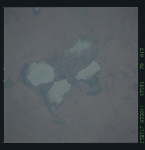
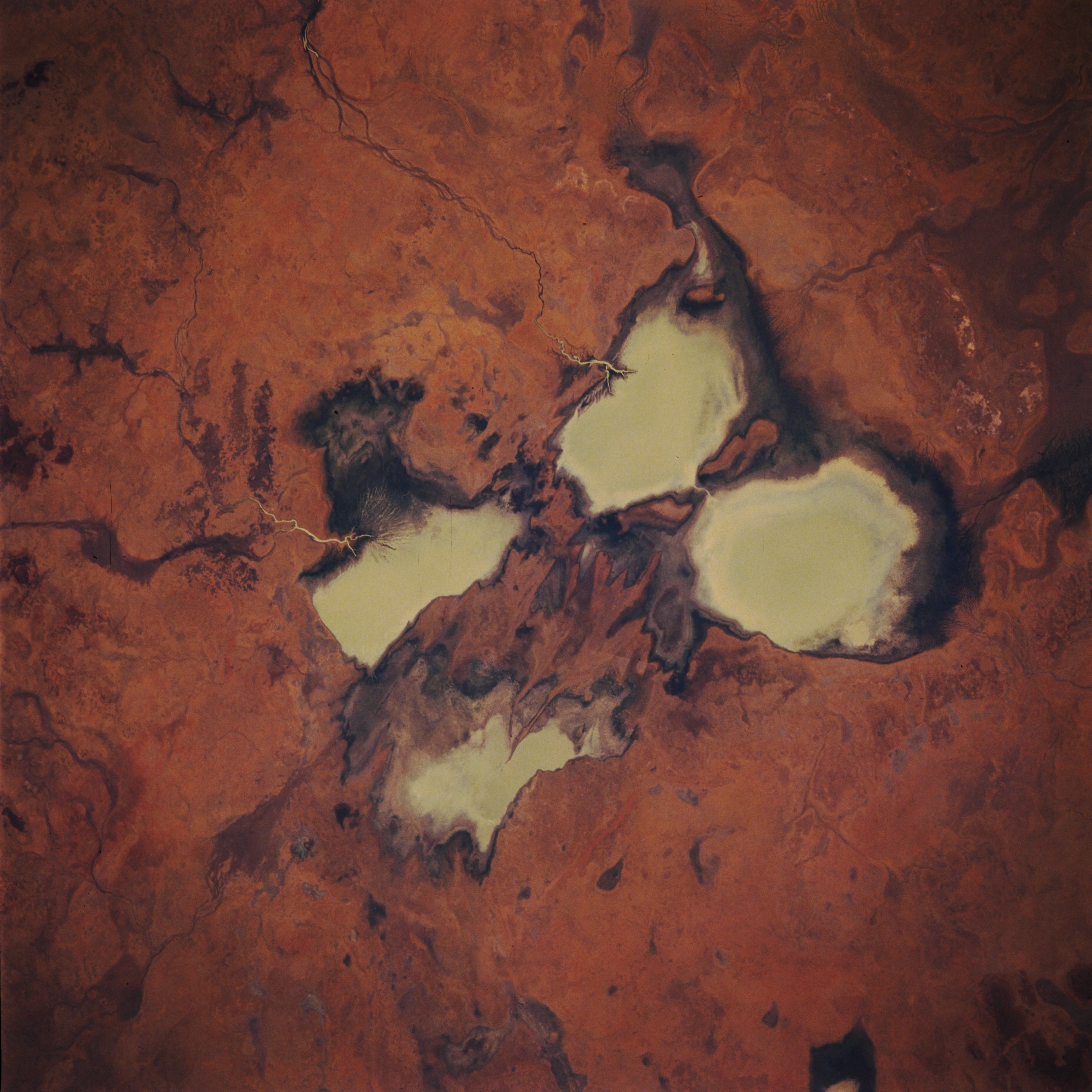
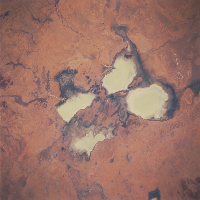
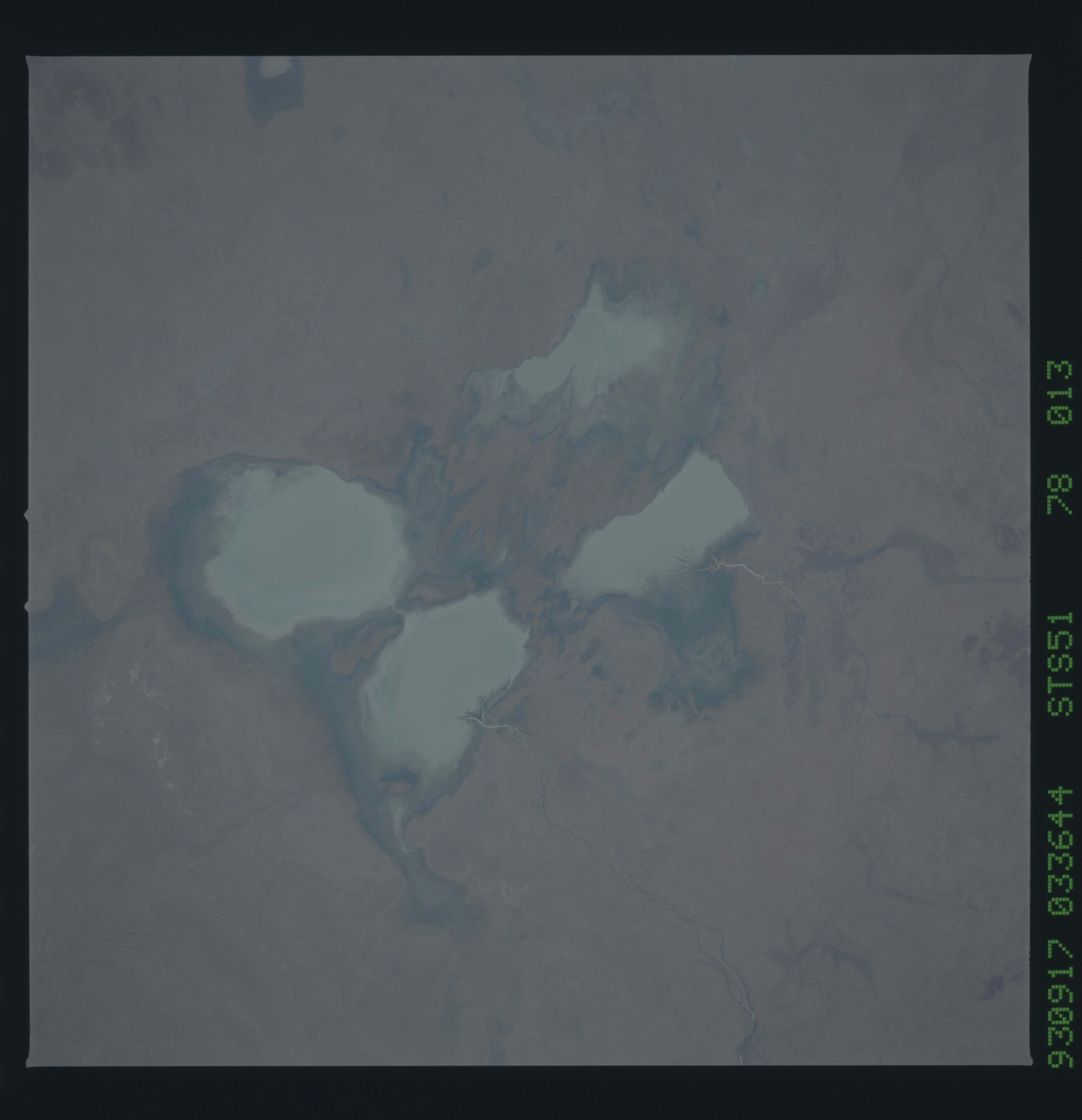
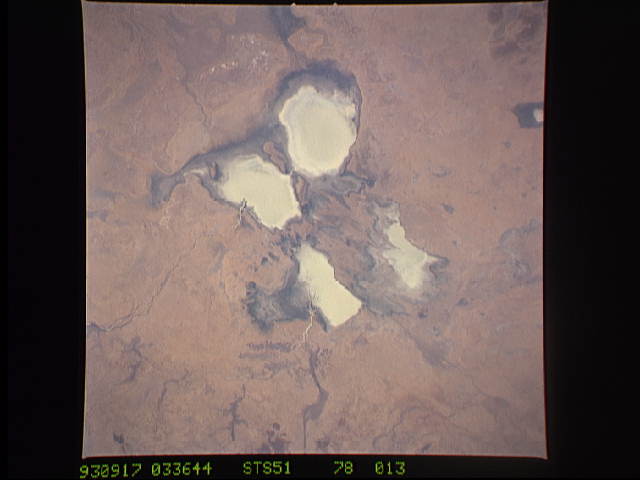
Image Caption: STS051-078-013 Brunette Creek Area, Northern Territory, Australia September 1993
Four sizable, highly reflective surfaces are milky colored freshwater lakes that are located on the Barkly Tablelands. The surface inflow of fresh water is primarily from two different sources. A section of the Corella Creek and its swampy delta (darker landscape) is visible as the water flow enters the northeast side of Corella Lake (rectangular-shaped whitish feature--nearest top of image). The Burnette Creek channel (narrow, dark linear feature) can be traced southwesterly across the grasslands as the creek enters Lake Sylvester (roughly oval-shaped feature nearest right side of the picture). The other two milky colored features (largest and smallest in area) are also shallow lakes that have been created by the overflow from Corella Lake and Lake Sylvester. In wetter years these lakes can be connected by narrow channels. It is interesting to note that the outline of these lakes and their drainage pattern does not directly correlate to existing maps. The grasslands found in this sparsely populated environment support some pastoral grazing.
Four sizable, highly reflective surfaces are milky colored freshwater lakes that are located on the Barkly Tablelands. The surface inflow of fresh water is primarily from two different sources. A section of the Corella Creek and its swampy delta (darker landscape) is visible as the water flow enters the northeast side of Corella Lake (rectangular-shaped whitish feature--nearest top of image). The Burnette Creek channel (narrow, dark linear feature) can be traced southwesterly across the grasslands as the creek enters Lake Sylvester (roughly oval-shaped feature nearest right side of the picture). The other two milky colored features (largest and smallest in area) are also shallow lakes that have been created by the overflow from Corella Lake and Lake Sylvester. In wetter years these lakes can be connected by narrow channels. It is interesting to note that the outline of these lakes and their drainage pattern does not directly correlate to existing maps. The grasslands found in this sparsely populated environment support some pastoral grazing.
