STS051-72-95
| NASA Photo ID | STS051-72-95 |
| Focal Length | 250mm |
| Date taken | 1993.09.14 |
| Time taken | 13:44:28 GMT |
Resolutions offered for this image:
5700 x 5900 pixels 500 x 518 pixels 640 x 480 pixels 4874 x 4464 pixels 2673 x 2731 pixels 6821 x 6668 pixels 5057 x 5039 pixels 540 x 526 pixels 909 x 886 pixels
5700 x 5900 pixels 500 x 518 pixels 640 x 480 pixels 4874 x 4464 pixels 2673 x 2731 pixels 6821 x 6668 pixels 5057 x 5039 pixels 540 x 526 pixels 909 x 886 pixels


Cloud masks available for this image:
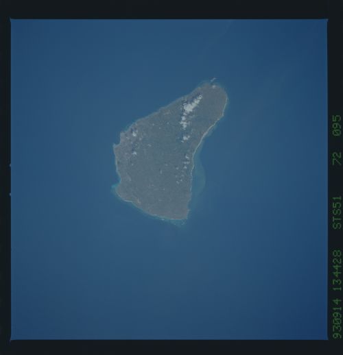
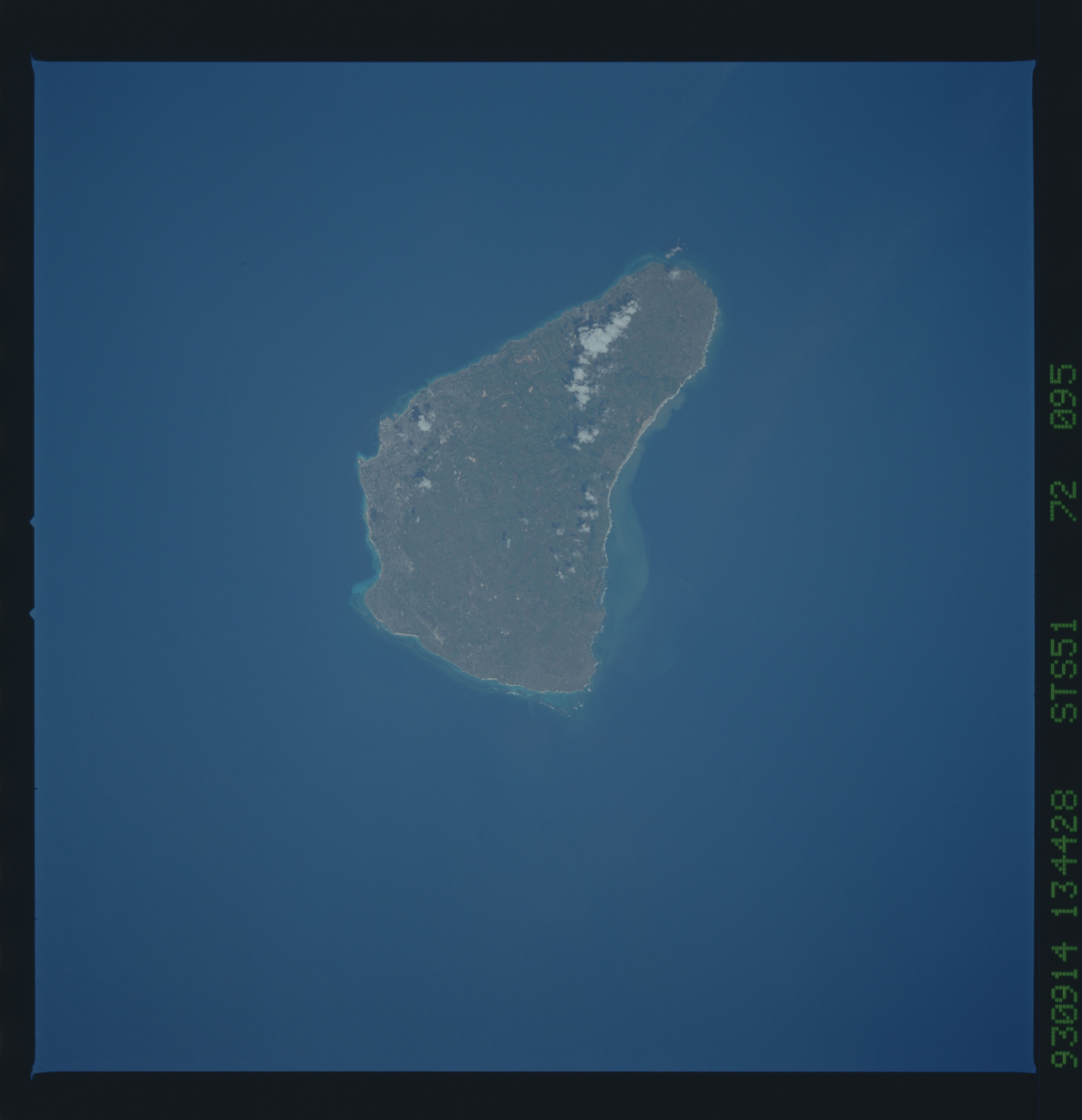
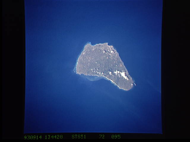
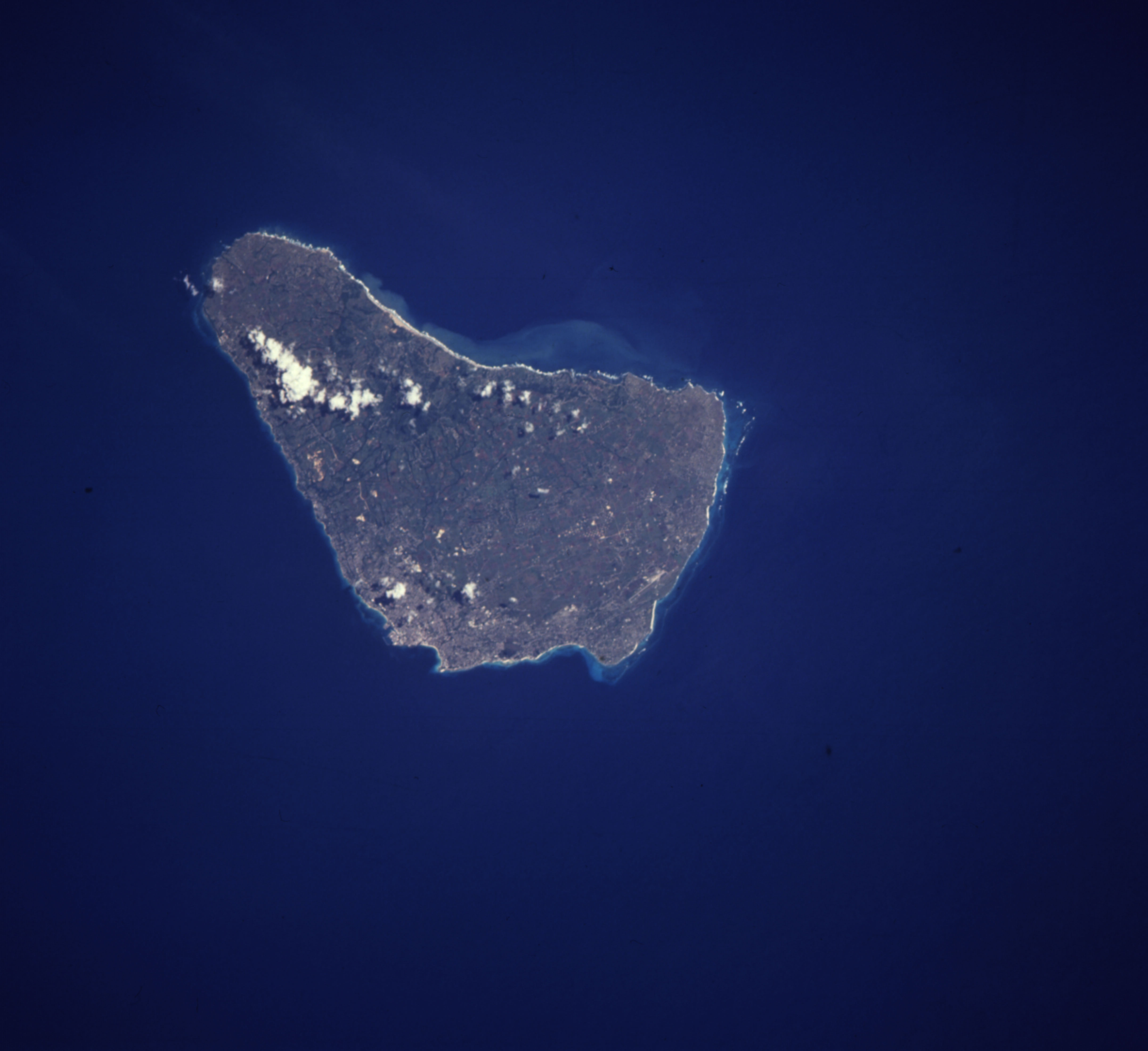
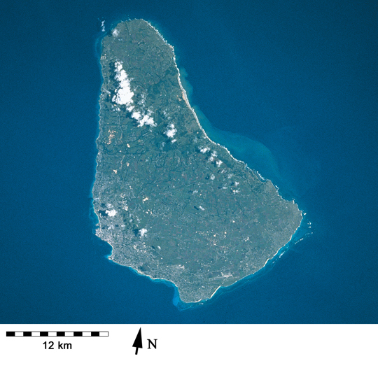
Spacecraft nadir point: 12.4° N, 59.6° W
Photo center point: 13.0° N, 59.5° W
Photo center point by machine learning:
Photo center point: 13.0° N, 59.5° W
Photo center point by machine learning:
Nadir to Photo Center: North
Spacecraft Altitude: 163 nautical miles (302km)
Country or Geographic Name: | LESSER ANTILLES |
Features: | BARBADOS I., AGRICULTURE |
| Features Found Using Machine Learning: | |
Cloud Cover Percentage: | 5 (1-10)% |
Sun Elevation Angle: | 57° |
Sun Azimuth: | 103° |
Camera: | Hasselblad |
Focal Length: | 250mm |
Camera Tilt: | 13 degrees |
Format: | 5017: Kodak, natural color positive, Ektachrome, X Professional, ASA 64, standard base |
Film Exposure: | Normal |
| Additional Information | |
| Width | Height | Annotated | Cropped | Purpose | Links |
|---|---|---|---|---|---|
| 5700 pixels | 5900 pixels | No | No | Download Image | |
| 500 pixels | 518 pixels | No | No | Download Image | |
| 640 pixels | 480 pixels | No | No | Download Image | |
| 4874 pixels | 4464 pixels | ReefBase pilot | Download Image | ||
| 2673 pixels | 2731 pixels | No | ReefBase 1 | Download Image | |
| 6821 pixels | 6668 pixels | No | No | Download Image | |
| 5057 pixels | 5039 pixels | No | No | Download Image | |
| 540 pixels | 526 pixels | Yes | Yes | Publisher Request | Download Image |
| 909 pixels | 886 pixels | Yes | Yes | Publisher Request | Download Image |
Download Packaged File
Download a Google Earth KML for this Image
View photo footprint information
Download a GeoTIFF for this photo
Image Caption: Fringing reefs around Barbados have declined over many decades although there are still submerged reefs off the west and southern coasts [STS051-72-95, 1993].
