STS051-101-54
| NASA Photo ID | STS051-101-54 |
| Focal Length | 100mm |
| Date taken | 1993.09.15 |
| Time taken | 05:07:24 GMT |
Resolutions offered for this image:
3936 x 3872 pixels 639 x 629 pixels 5700 x 5900 pixels 500 x 518 pixels 640 x 480 pixels
3936 x 3872 pixels 639 x 629 pixels 5700 x 5900 pixels 500 x 518 pixels 640 x 480 pixels
Cloud masks available for this image:
Spacecraft nadir point: 24.0° S, 143.0° E
Photo center point: 23.5° S, 140.0° E
Photo center point by machine learning:
Photo center point: 23.5° S, 140.0° E
Photo center point by machine learning:
Nadir to Photo Center: West
Spacecraft Altitude: 161 nautical miles (298km)
Country or Geographic Name: | AUSTRALIA-Q |
Features: | GEORGINA RIVER |
| Features Found Using Machine Learning: | |
Cloud Cover Percentage: | 5 (1-10)% |
Sun Elevation Angle: | 42° |
Sun Azimuth: | 298° |
Camera: | Hasselblad |
Focal Length: | 100mm |
Camera Tilt: | 49 degrees |
Format: | VELVI: Fuji, natural color positive, Velvia 50, CS 135-36, ASA 32, standard base |
Film Exposure: | Normal |
| Additional Information | |
| Width | Height | Annotated | Cropped | Purpose | Links |
|---|---|---|---|---|---|
| 3936 pixels | 3872 pixels | No | No | Earth From Space collection | Download Image |
| 639 pixels | 629 pixels | No | No | Earth From Space collection | Download Image |
| 5700 pixels | 5900 pixels | No | No | Download Image | |
| 500 pixels | 518 pixels | No | No | Download Image | |
| 640 pixels | 480 pixels | No | No | Download Image |
Download Packaged File
Download a Google Earth KML for this Image
View photo footprint information
Download a GeoTIFF for this photo
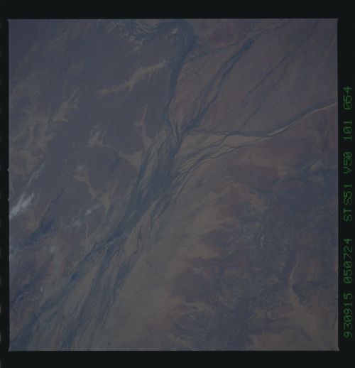
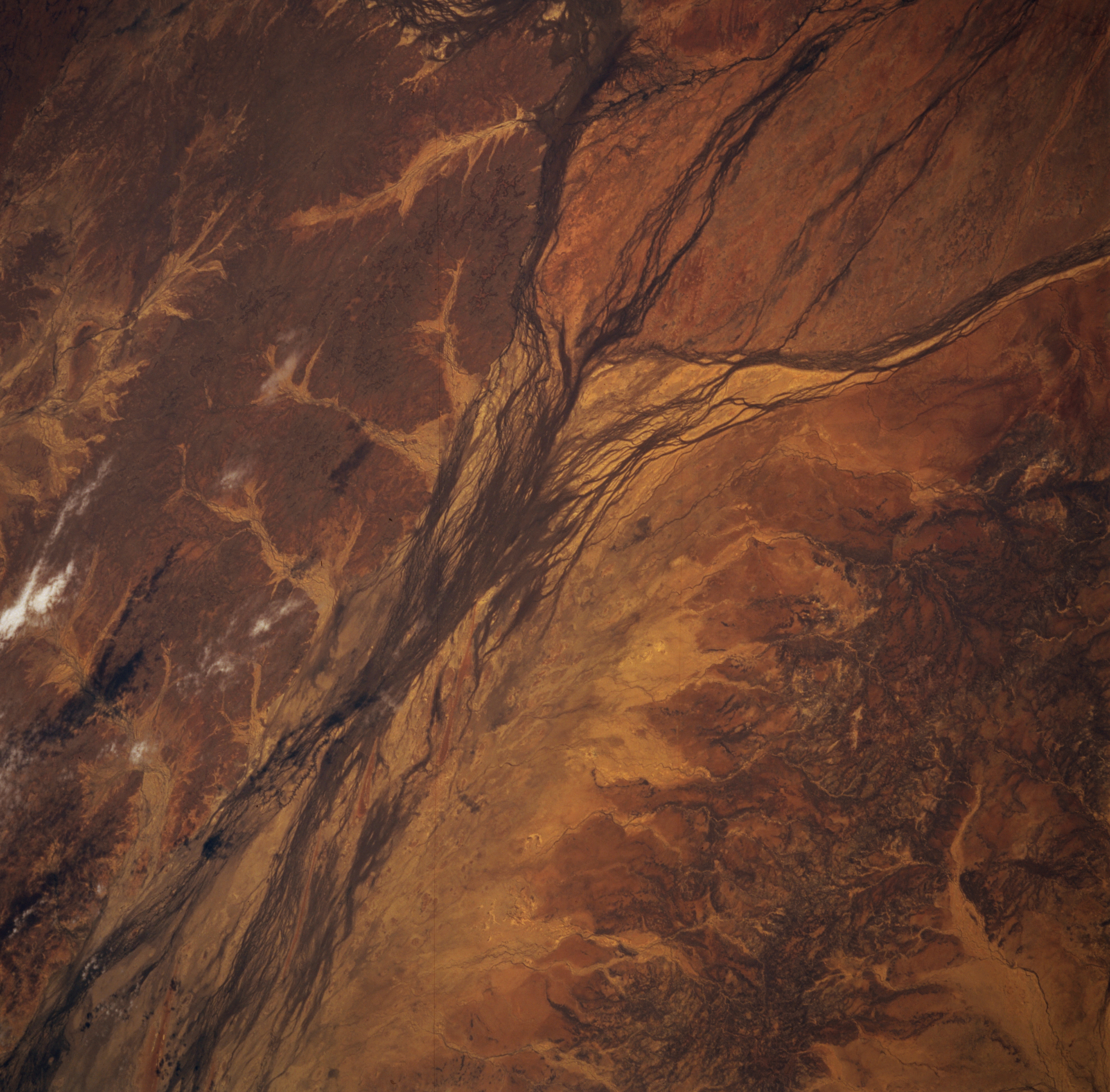
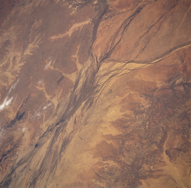
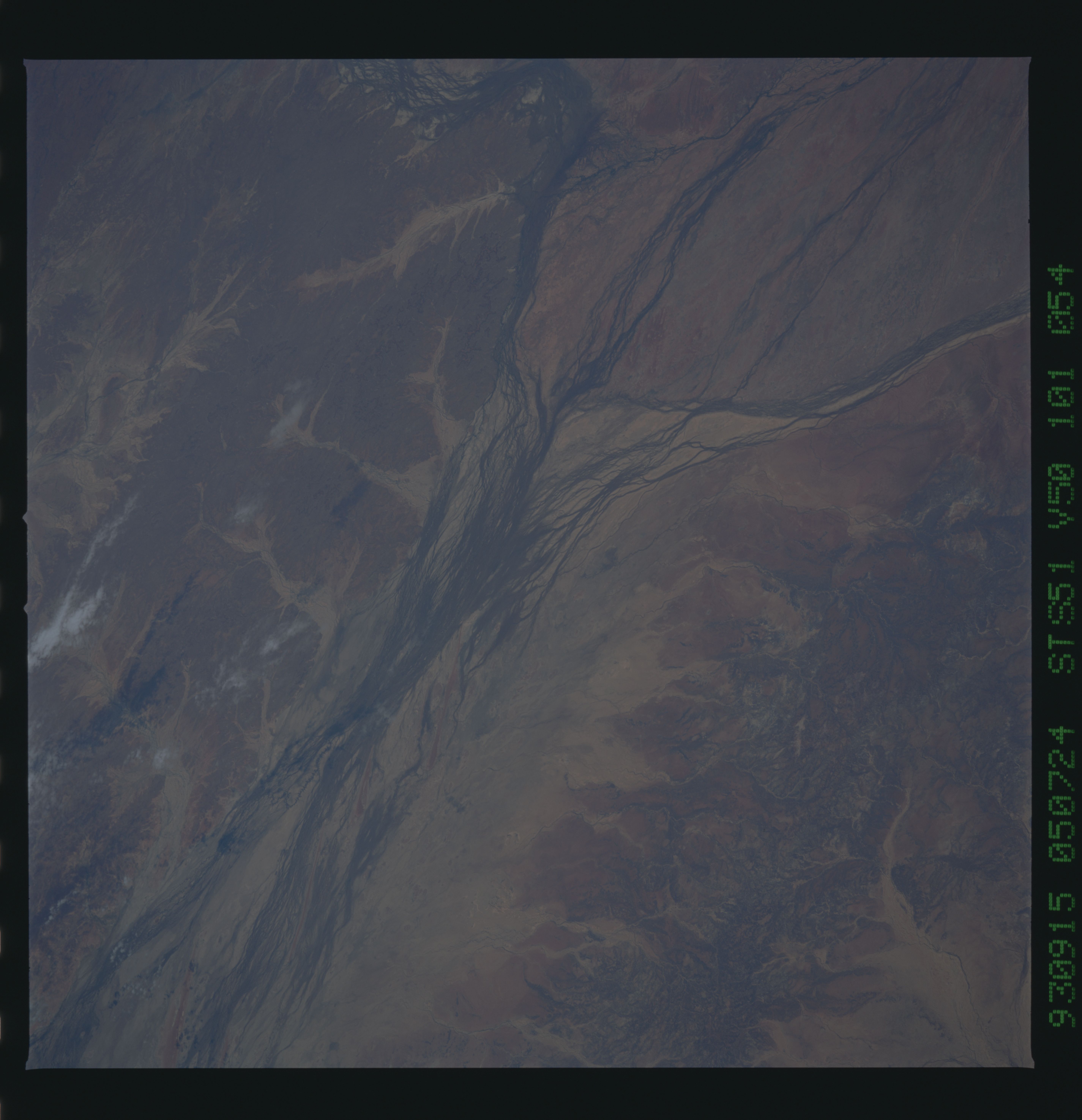
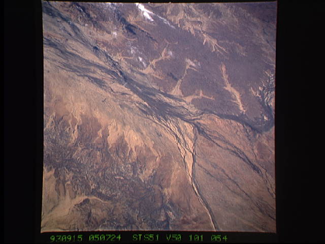
Image Caption: STS051-101-054 Georgina River, Queensland, Australia September 1993
The Georgina River's floodplain widens substantially south of the very small Outback town of Boulia in southwest Queensland. This picture shows the merging area of three of Australia's many ephermal rivers that drain towards the interior of the continent. From the top right (northeast) the Hamilton River and its small delta merges with the Burke River (drains southward from the north) and the Georgina River (from the northwest). Keep in mind that these rivers only have limited water flow when there is sufficient rainfall in the basin areas north of this region. The darker-looking landscape in the lower right quadrant is the slightly elevated terrain that separates the Georgina drainage basin from the Diamantina drainage basin to the east. The darker looking areas in the scene are where more vegetative cover exists, mainly grasslands. The lighter-looking landscape shows areas where erosion is greatest--not permitting vegetation to get established.
The Georgina River's floodplain widens substantially south of the very small Outback town of Boulia in southwest Queensland. This picture shows the merging area of three of Australia's many ephermal rivers that drain towards the interior of the continent. From the top right (northeast) the Hamilton River and its small delta merges with the Burke River (drains southward from the north) and the Georgina River (from the northwest). Keep in mind that these rivers only have limited water flow when there is sufficient rainfall in the basin areas north of this region. The darker-looking landscape in the lower right quadrant is the slightly elevated terrain that separates the Georgina drainage basin from the Diamantina drainage basin to the east. The darker looking areas in the scene are where more vegetative cover exists, mainly grasslands. The lighter-looking landscape shows areas where erosion is greatest--not permitting vegetation to get established.
